

Craignaw
Good walks are even better shared.
NX4683 : Craignaw's Eastern side
Callum Black Photo source
Overview
Craignaw: An Adventurer's Paradise
Craignaw, a Marilyn standing at an elevation of 747 meters, is nestled within the stunning Southern Uplands of Scotland. This mountain, characterised by its rugged sandstone features, is perfect for a day of gentle exertion and breathtaking vistas.
Geology
The rocks of Craignaw date back to the Upper Carboniferous period, forming a rich and diverse habitat that descends into boggy areas and moorland. Keep your eyes peeled for unique flora and fauna as you make your ascent—nature loves to surprise its visitors!
Routes
The most popular route to the summit starts at the Glen Trool car park, winding through beautiful landscapes. This trail is moderately difficult, making it suitable for those with a bit of experience. Expect to navigate some rocky terrain, but it’s all in a day's work for the intrepid hiker!
Summit Features
The summit boasts a commanding stone cairn—ideal for that classic summit selfie. The nearby trig point provides another fine spot to take in the dramatic surroundings and convince your friends on social media that you've been to the 'top of the world.'
Terrain Type
Expect a varied landscape—rocky pathways, grassy patches, and leafy trails, complemented by the stunning heather in bloom during the warmer months. Whatever the terrain, bring along sturdy footwear to tackle the multitude of textures underfoot.
Views
On a clear day, the views from Craignaw are second to none. Gaze out at the rolling hills of the Galloway Forest Park and let your eyes wander toward the majestic peaks of the Merrick and the Rhins of Galloway. Dawn and dusk bring a magical light to the landscape, so plan your trip for one of these times if you can!
Hazards
Despite its allure, always be cautious of loose stones and changing weather conditions up top. Be prepared for everything mother nature throws your way—after all, Scotland does enjoy a good squall! Keep an eye out for local livestock as you navigate the trails.
Access
The Glen Trool car park serves as the nearest parking hub, making your approach suited for day visits. To reach the area via public transport, a bus operates from Newton Stewart, but it is advisable to check schedules since they can be sporadic. After your trek, why not indulge in a fine dinner at one of Newton Stewart's lovely eateries?
Facilities
Once back to civilisation, grab a bite or refresh yourself in Newton Stewart where you can explore various cafes and shops. Facilities at Glen Trool itself are sparse, so come prepared for a self-sufficient adventure.
History
The area around Craignaw is steeped in history, with local legends and folk tales that speak of it as a scenic paradise. The etymology of its name reflects this beauty, making it a spot of cultural significance to the locals.
In summary, Craignaw offers a delightful mix of stunning scenery, engaging trails and a touch of Scottish charm. Pack your bag, lace up your boots, and go explore this gem of the Southern Uplands!
Happy hiking!
Explore routes near Craignaw
Walks starting near this hill. Open a route to check its map, distance and full itinerary.
Loch Trool: Full Loch and Oak Woodland Circuit
View route
Glentrool Water of Trool and Spout Head Trail
View route
Carrick Forest Drive: Stinchar Bridge to Loch Doon
View route
Wood of Cree Waterfalls and Scrubland Circuit
View route
Route planning notes
These notes describe possible approaches. Check a route's map and access information when planning your walk.
Craignaw from the Glen Trool
A popular route starting from Glen Trool, offering stunning views and an enjoyable ascent towards the summit.
Make a day of it, together
Find someone to share the walk with, or organise a day out along a route you like.
Photo Gallery
View all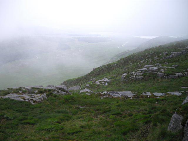 Photo could not load
NX4683 : Craignaw's Eastern side
Callum Black
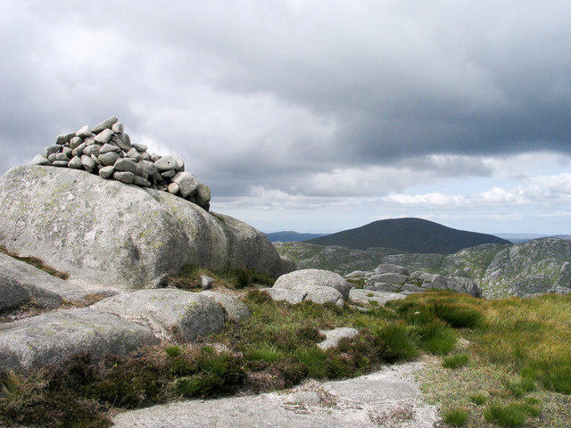 Photo could not load
NX4583 : Summit cairn of Craignaw
Trevor Littlewood
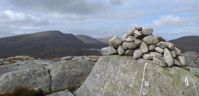 Photo could not load
NX4583 : Craignaw summit cairn
Colin Kinnear
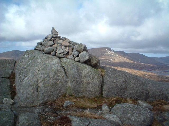 Photo could not load
NX4583 : Craignaw cairn
Chris Wimbush
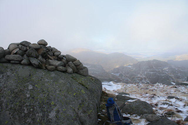 Photo could not load
NX4583 : Craignaw summit cairn
Colin Kinnear
Hill facts and local notes
Classifications
Elevation
646m
2,119 ft
Prominence
151m
Coordinates
55.1204, -4.4176
NX459833
OS Map
77
Explorer: 318
At the Summit
The summit is marked by a substantial stone cairn, providing a great photo opportunity after your climb. Be sure to check for the trig point standing proudly nearby!
Terrain & Geology
Craignaw is primarily composed of sandstone, which dates back to the Upper Carboniferous period. This gives the mountain its distinctive rugged features and contributes to the diverse ecosystems found in the area.
Views & Scenery
From the summit, hikers can enjoy panoramic views of the Galloway Forest Park, as well as distant peaks such as the Merrick and the Rhins of Galloway.
History & Heritage
Name Origin
The name 'Craignaw' derives from the Gaelic 'Creag na h-Aoibhinn,' which translates to 'rock of the pleasantness,' reflecting the scenic beauty of the area.
Historical Significance
The mountain has been a cherished spot for adventurers and nature lovers, and plays a role in local folklore.
Getting There & Facilities
Parking
The nearest parking area is at the Glen Trool car park, which provides a good starting point for your walk.
Public Transport
Public transport options are limited; however, a bus service runs from Newton Stewart to the nearest stop about 5 km from Glen Trool.
Nearby Facilities
There are no facilities directly at Glen Trool, but Newton Stewart has several cafes, restaurants, and public toilets—perfect for pre- or post-hike refreshments.
Safety Information
Known Hazards
- As with many upland routes, watch for loose stones and changing weather conditions. It's advisable to be mindful of livestock that may be grazing in the area.
General Safety Tips
- Check weather conditions before setting out
- Carry appropriate clothing and equipment
- Let someone know your planned route
- Take a map, compass, and GPS device
- Carry emergency supplies: food, water, first aid kit, torch
Hills
Some common questions about the hills answered
Are there group walks up Craignaw?
Many walkers use Walkmates to join or organise walks with others. You can check for group walks around Craignaw through the maps
Are there other walkers around Craignaw?
Activity varies by location and time, but Walkmates lets you see whether others have shared walks or shown interest in this area. Find other people through the walking friends search walking friends for Craignaw search or of course create your own walk for Craignaw
Can I organise a walk to Craignaw?
Yes. If there aren’t any walks listed already, you can create a walk and make it available for others to join.
If you're signed up to Walkmates, you can create a walk to Craignaw.
How do I find a walk up this hill?
There are often multiple ways to walk this hill, depending on experience and route preference. Walkmates helps you explore walks and routes that others have shared.
Can I suggest a new route up Craignaw?
Yes. You can suggest or create routes to share with others. Walkmates focuses on the social side of walking, so routes are used to help people organise walks and explore areas together, rather than as detailed navigation tools or route libraries.
Other uses really appreciate knowledgeable walkers sharing their routes. Share your favourite route to Craignaw here
The is an error or something incorrect about this hill. How do I let you know?
We always strive to keep the information on Walkmates as accurate as possible. If you find an error, please let us know through the contact form and we'll aim to correct it as quickly as possible
Community Discussion
Comments
Location
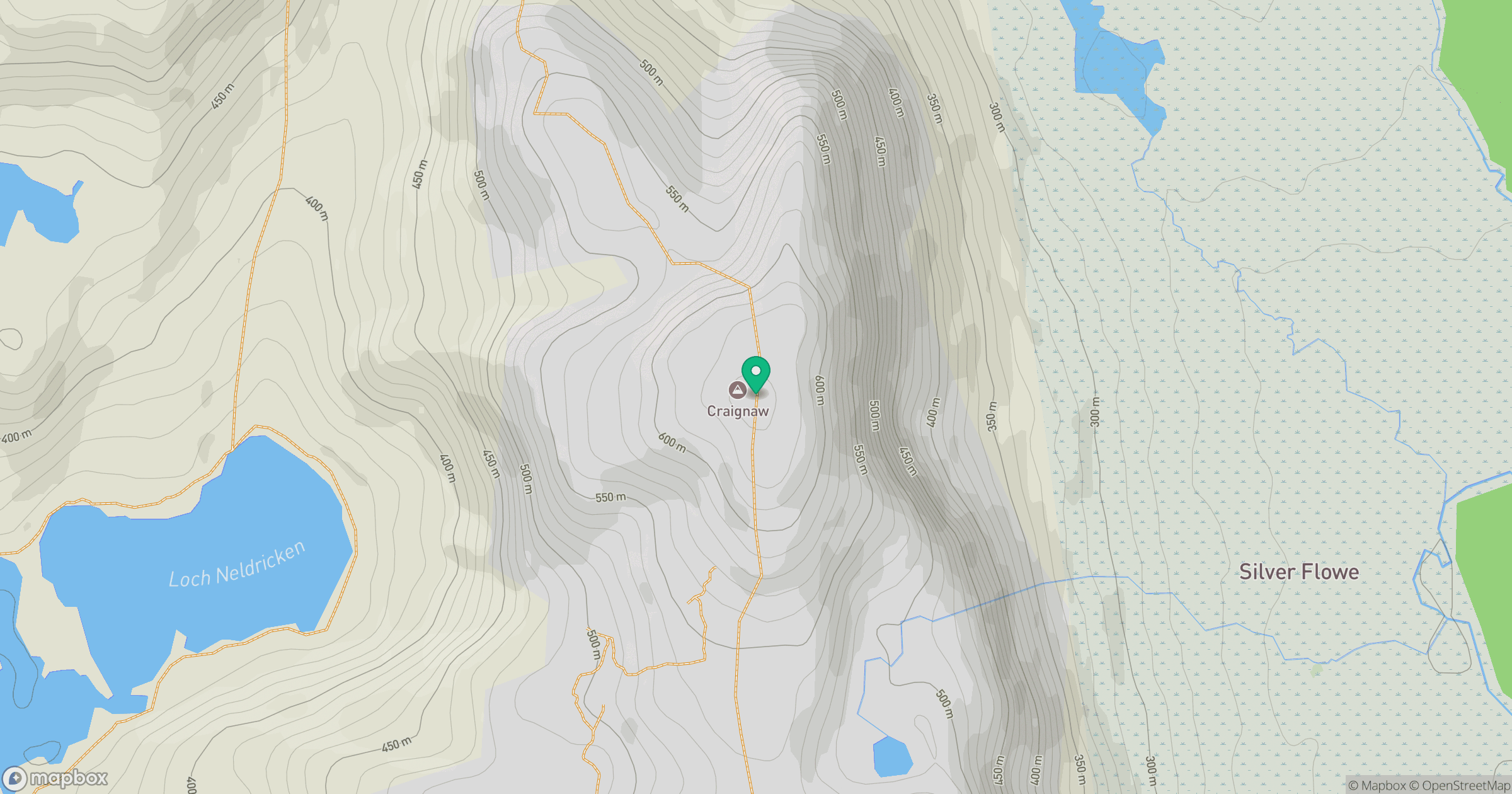
Grid reference: NX459833
View on OpenStreetMapOpens a map in a new tab, centred on the hill.

No comments yet. Be the first.