

Cairnsmore of Carsphairn
Good walks are even better shared.
NX5997 : Trig point at the summit Cairnsmore of Casphairn
Mark Klimek Photo source
Overview
Cairnsmore of Carsphairn
The Cairnsmore of Carsphairn stands proudly at 798 meters, a Corbett that offers outdoor enthusiasts a moderately challenging yet rewarding hike. Nestled within the Southern Uplands, this peak is not just a magnificent natural feature but also a delightful blend of history, geology, and breathtaking views.
Geology
Cairnsmore is primarily composed of Old Red Sandstone. The reddish hues of the rock tell a story that stretches back over 400 million years! Keep your eyes peeled, and you might just spot some stunning quartz veins peeking through the landscape.
Hiking Routes
One of the popular hiking routes to the summit starts at the village of Carsphairn. This 9 km trek, often referred to as the 'Carsphairn to Cairnsmore route', takes about 3.5 hours to complete. The path meanders through heather and grassy terrain, with the occasional rocky outcrop to keep you on your toes. Perfect for those who don’t mind getting their boots a little dirty!
Summit Features
At the top, hikers are greeted by a sturdy trig point and a well-built stone cairn. It’s a great spot to catch your breath and snap some photos to show your friends – because if it isn’t on Instagram, did it even happen?
Terrain and Views
The terrain is grassy with rocky outcrops, punctuated by patches of boggy ground that may test your balance. The rewards, however, are worth every squelchy step. On a clear day, the summit offers panoramic views of the surrounding Galloway Forest Park and the peaks of the Rhinns of Kells. Spring and early summer are the best times to visit to capture the colourful floral displays below.
Hazards
As with any hike, caution is advised. The area can become muddy, making certain sections slippery, especially after rainfall. The weather can be unpredictable; so, hiking gear that includes proper footwear and raingear is crucial.
Access and Facilities
Accessing Cairnsmore is straightforward. Parking is available near the village hall in Carsphairn, and local buses will drop you off there from Dumfries. Once you’ve worked up an appetite, reward yourself at the village shop or cafe – their shortbread is not to be missed!
History
The name 'Cairnsmore' reflects its historical significance, deriving from Gaelic and referring to the many stone structures scattered throughout the area. This region has been shaped by centuries of human connection with its rugged allure.
In summary, Cairnsmore of Carsphairn is more than just a hike; it’s an adventure steeped in natural beauty and rich history.
Happy hiking, and don’t forget to enjoy the fresh air!
Explore routes near Cairnsmore of Carsphairn
Walks starting near this hill. Open a route to check its map, distance and full itinerary.
Carrick Forest Drive: Stinchar Bridge to Loch Doon
View route
Loch Trool: Full Loch and Oak Woodland Circuit
View route
Glentrool Water of Trool and Spout Head Trail
View route
Wood of Cree Waterfalls and Scrubland Circuit
View route
Route planning notes
These notes describe possible approaches. Check a route's map and access information when planning your walk.
Standard Route from Green Well of Scotland
This is the most popular route to Cairnsmore of Carsphairn, starting from the Green Well of Scotland layby. The route follows a clear path that gradually ascends through open moorland before reaching the summit. The terrain is mostly grassy, with some boggy sections, and offers stunning views over the surrounding Galloway hills.
Circular Route via Willieanna and Dunool
This circular route starts from the same layby at the Green Well of Scotland and ascends Cairnsmore of Carsphairn via Willieanna Hill. After reaching the summit, the descent heads over Dunool, providing a great opportunity to explore the wider ridge and enjoy panoramic views. The route is slightly longer and more challenging due to the added undulation.
Southern Approach from Knockgray
This quieter route starts near Knockgray Farm to the south. The path is less distinct and requires good navigation skills, but it provides a more remote-feeling ascent. The route climbs steadily through moorland and joins the main ridge near the summit. It’s a great choice if you want to avoid crowds.
Alternative Route via Craig of Knockgray
This alternative route begins near Knockgray Farm as well, but it takes a more direct ascent via Craig of Knockgray. The route is steep and pathless in sections, making it a more adventurous choice for experienced walkers. The summit views are well worth the effort.
Extended Ridge Walk from Dalmellington
Starting from Dalmellington, this is a long and challenging day walk that follows the ridge line to Cairnsmore of Carsphairn. The route covers multiple summits and offers a true wilderness experience. It requires excellent navigation skills and stamina, but rewards with exceptional views and a sense of accomplishment.
Make a day of it, together
Find someone to share the walk with, or organise a day out along a route you like.
Photo Gallery
View all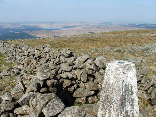 Photo could not load
NX5997 : Trig point at the summit Cairnsmore of Casphairn
Mark Klimek
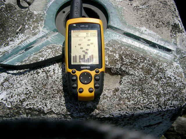 Photo could not load
NX5997 : Should the OS know where their trigs are?
Gordon Brown
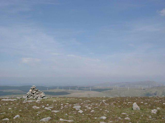 Photo could not load
NX5998 : Cairn at the north end of Cairnsmore of Carsphairn.
Gordon Brown
 Photo could not load
NX5997 : The rugged eastern side of Cairnsmore of Carsphairn
James T M Towill
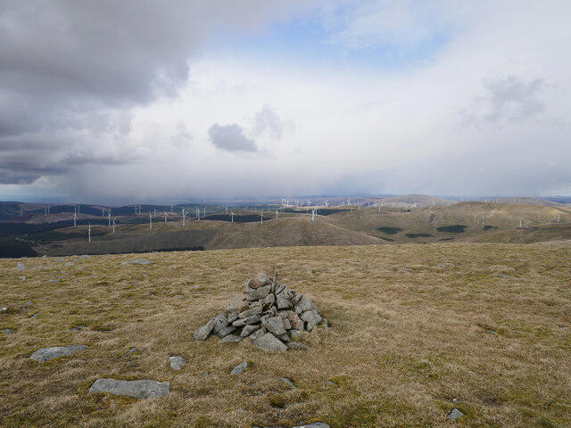 Photo could not load
NX5998 : A modest affair
James T M Towill
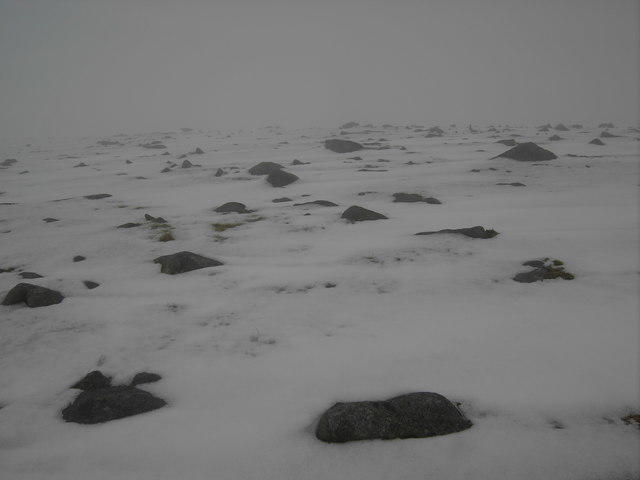 Photo could not load
NX5998 : In the Mist
Colin Kinnear
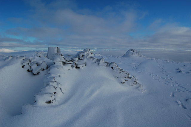 Photo could not load
NX5997 : Cairnsmore of Carsphairn
Alex Mcnaughton
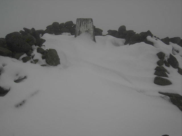 Photo could not load
NX5997 : Summit trig Cairnsmore of Carsphairn.
Colin Kinnear
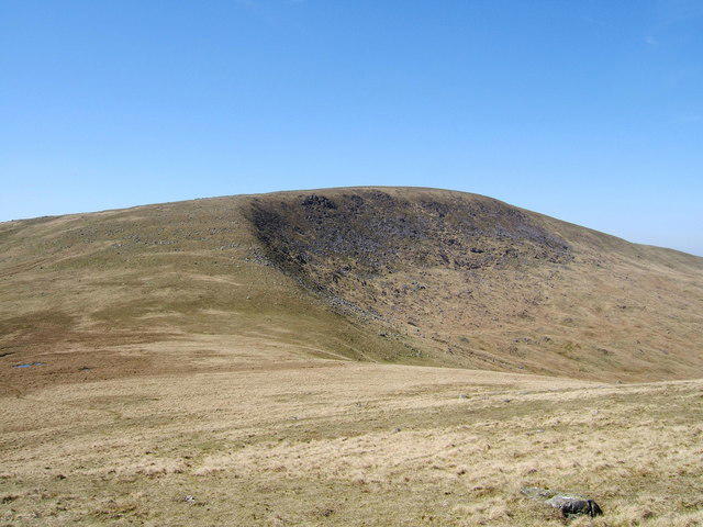 Photo could not load
NX5997 : Cairnsmore of Carsphairn (797 metres) from the slopes of Beninner
Colin McDonald
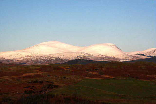
NX5997 : Snow covered Cairnsmore Of Carsphairn
Duncan McNaught
Hill facts and local notes
Classifications
Elevation
797m
2,615 ft
Prominence
582m
Coordinates
55.2561, -4.2131
NX594980
OS Map
77
Explorer: 328S
At the Summit
The summit features a prominent trig point and a well-established stone cairn, giving hikers a sense of accomplishment (and an excellent photo opportunity).
Terrain & Geology
The mountain is primarily composed of Old Red Sandstone, a rock formation known for its reddish hue and sedimentary layers, which tell a geological story dating back over 400 million years. You might even spot some beautiful quartz veins if you’re paying attention!
Views & Scenery
From the summit, one can enjoy panoramic views of the Galloway Forest Park and the distant peaks of the Rhinns of Kells, as well as the scenic rolling hills of Dumfries and Galloway.
History & Heritage
Name Origin
The name 'Cairnsmore' derives from the Gaelic 'Carn mór', meaning ‘big cairn’, referencing the numerous stone structures found in the area.
Historical Significance
The mountain is part of the ancient landscape and has historical significance for local communities, reflecting centuries of human interaction with the rugged terrain.
Getting There & Facilities
Parking
Parking is available at the Carsphairn village hall and along the roadside, which is usually free and provides a convenient starting point for your hike.
Public Transport
Buses run to Carsphairn from major towns such as Dumfries, though service may be infrequent. Check local schedules before planning your visit.
Nearby Facilities
The village has a small shop and a cafe, offering refreshments and supplies for your outdoor adventure. Don’t forget to treat yourself to a slice of shortbread!
Safety Information
Known Hazards
- Muddy and boggy areas can be slippery, particularly after rain. Watch your footing!
- Changing weather conditions can quickly reduce visibility, so be prepared with appropriate gear.
General Safety Tips
- Check weather conditions before setting out
- Carry appropriate clothing and equipment
- Let someone know your planned route
- Take a map, compass, and GPS device
- Carry emergency supplies: food, water, first aid kit, torch
Hills
Some common questions about the hills answered
Are there group walks up Cairnsmore of Carsphairn?
Many walkers use Walkmates to join or organise walks with others. You can check for group walks around Cairnsmore of Carsphairn through the maps
Are there other walkers around Cairnsmore of Carsphairn?
Activity varies by location and time, but Walkmates lets you see whether others have shared walks or shown interest in this area. Find other people through the walking friends search walking friends for Cairnsmore of Carsphairn search or of course create your own walk for Cairnsmore of Carsphairn
Can I organise a walk to Cairnsmore of Carsphairn?
Yes. If there aren’t any walks listed already, you can create a walk and make it available for others to join.
If you're signed up to Walkmates, you can create a walk to Cairnsmore of Carsphairn.
How do I find a walk up this hill?
There are often multiple ways to walk this hill, depending on experience and route preference. Walkmates helps you explore walks and routes that others have shared.
Can I suggest a new route up Cairnsmore of Carsphairn?
Yes. You can suggest or create routes to share with others. Walkmates focuses on the social side of walking, so routes are used to help people organise walks and explore areas together, rather than as detailed navigation tools or route libraries.
Other uses really appreciate knowledgeable walkers sharing their routes. Share your favourite route to Cairnsmore of Carsphairn here
The is an error or something incorrect about this hill. How do I let you know?
We always strive to keep the information on Walkmates as accurate as possible. If you find an error, please let us know through the contact form and we'll aim to correct it as quickly as possible
Community Discussion
Comments
Location
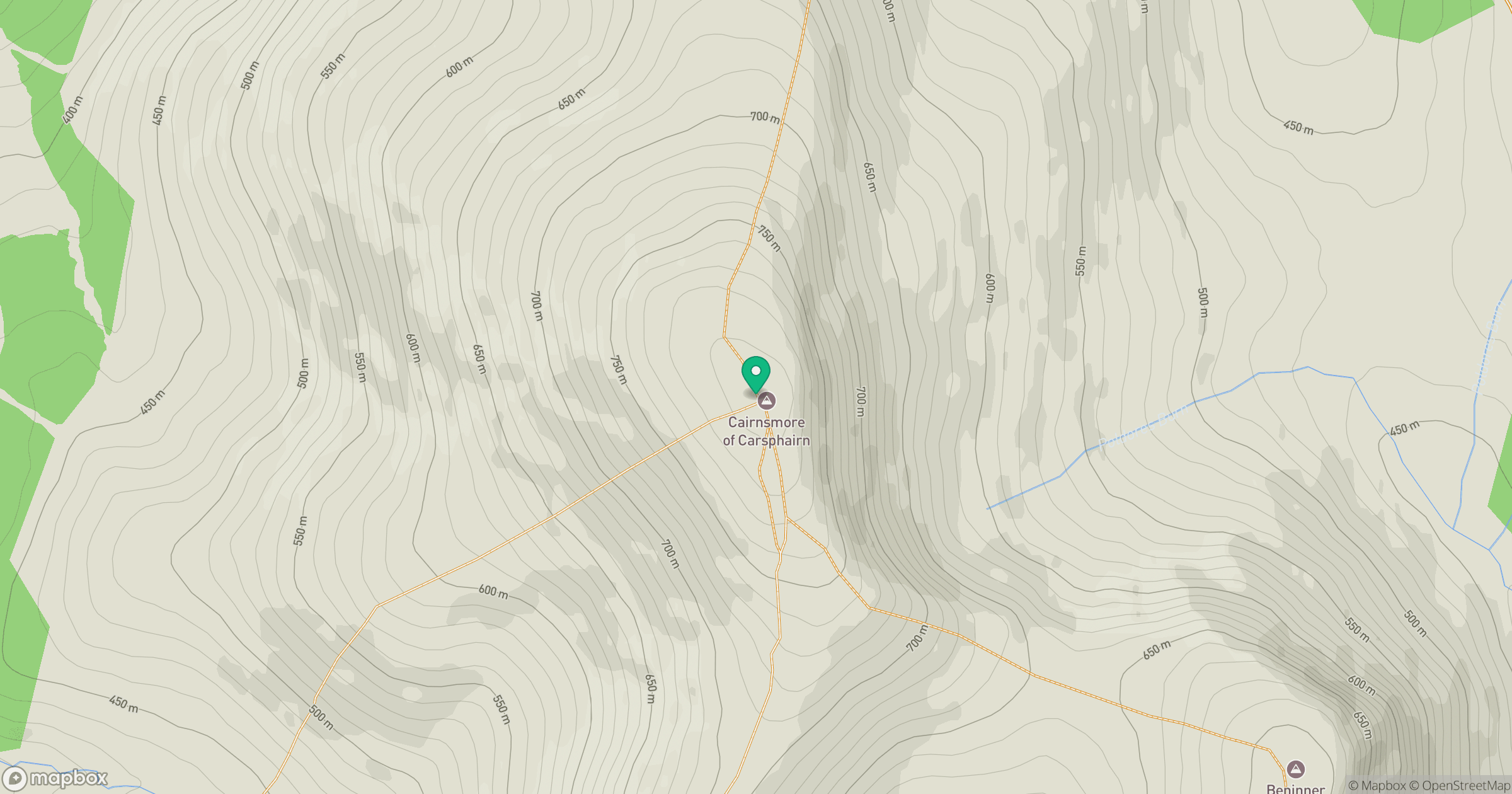
Grid reference: NX594980
View on OpenStreetMapOpens a map in a new tab, centred on the hill.

No comments yet. Be the first.