

Curleywee
Good walks are even better shared.
Overview
Curleywee: A Hiker's Delight
Ever fancied a good old-fashioned hike? Well, you're in for a treat with Curleywee! Standing at an elevation of 576 meters, this Marilyn offers splendid views and a dash of adventure, making it a favourite with hikers and walkers alike.
Geology
Curleywee is part of the beautiful Southern Uplands, primarily composed of sandstone and mudstone. These ancient rocks tell a story of a time long gone and remind us that even mountains have layers—much like ourselves, only rock-hard and a tad less emotional.
Routes
One of the most accessible and enjoyable routes is from Glen Trool. Over a distance of about 6.5 km, this moderate trek up the hill is adorned with heather-clad hills where sheep may just stop to say hello (or more likely, stare judgmentally).
Route Details:
- Distance: 6.5 km
- Time: Approximately 2.5 hours
- Difficulty: Moderate
Summit Features
At the top, a small stone cairn welcomes you like an old friend. The fresh air is invigorating, and after a good trek, there's nothing quite like enjoying a sandwich at the summit (don’t forget the after-hike snack!).
Terrain
Expect grassy slopes with a few rocky outcrops thrown in for good measure. It's a varied terrain that keeps things interesting—don’t you love when nature mixes it up?
Views
Curleywee provides breathtaking views of the Galloway Forest Park and, on a clear day, even the Kintyre Peninsula can be spotted in the distance. The best time to go for these views are during Spring or Autumn when the visibility is at its finest.
Hazards
As with any mountain hike, the weather can be a fickle friend. Be prepared for sudden changes in conditions. The paths can be slippery, particularly when wet. Remember, no one wants their hike to turn into a slide show!
Nearby Summits
If you'd like to extend your adventure, consider adding nearby Mullwharchar (788 m) or Bencairn (623 m) to your itinerary. They make for fine neighbours!
Access
The nearest parking can be found at Glen Trool, which is easily reachable by car. If you're relying on public transport, hop on a bus to New Galloway and enjoy a brisk walk to the trailhead.
Facilities
New Galloway has a quaint cafe and public toilets, perfect for your pre- or post-hike refreshment.
History
The name 'Curleywee' is said to have Scottish roots, with 'wee' translating to small. But don’t let the name fool you; this mountain packs quite a punch in views and experiences!
In conclusion, Curleywee is a delightful destination for any hiking enthusiast. Whether you’re out for a challenging walk or a leisurely stroll, the mountain has something for everyone. Just pack your walking shoes, your favourite snacks, and don't forget the camera!
Explore routes near Curleywee
Public walks starting within 80 km of this hill. Nearby does not mean a route reaches the summit; check its map and access before setting out.
Loch Trool: Full Loch and Oak Woodland Circuit
View route
Glentrool Water of Trool and Spout Head Trail
View route
Wood of Cree Waterfalls and Scrubland Circuit
View route
Knockman Wood Cairn and Woodland Trail
View route
Route planning notes
These notes describe possible approaches, not verified navigable routes or permission to cross land. Check current paths, local access rules and conditions before setting out.
Curleywee from Glen Trool
A scenic route that starts from the picturesque Glen Trool, leading you upward through a mix of paths and heather-clad hills.
Make a day of it, together
Find someone to share the walk with, or organise a day out along a route you like.
Photo Gallery
View all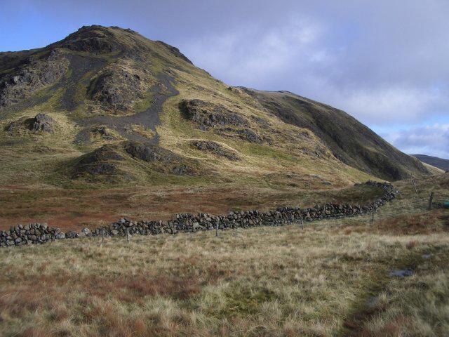 Photo could not load
NX4576 : Curleywee
Callum Black
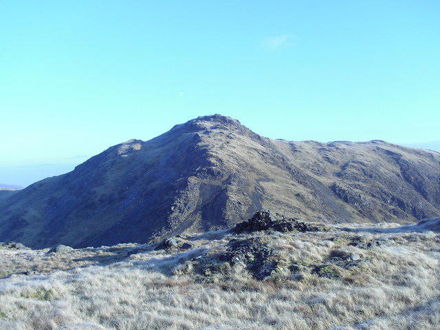 Photo could not load
NX4576 : Curlywee
Mark McKie
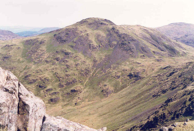 Photo could not load
NX4576 : Curleywee Hill
Billy McCrorie
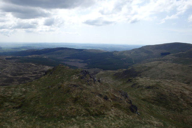 Photo could not load
NX4576 : On Curleywee
Michael Graham
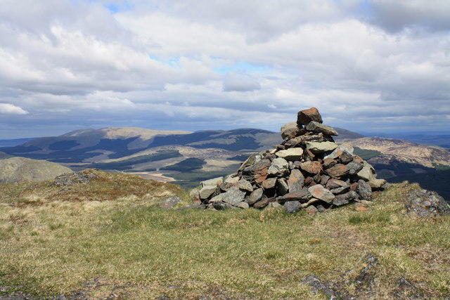 Photo could not load
NX4576 : Curlywee summit cairn
Colin Kinnear
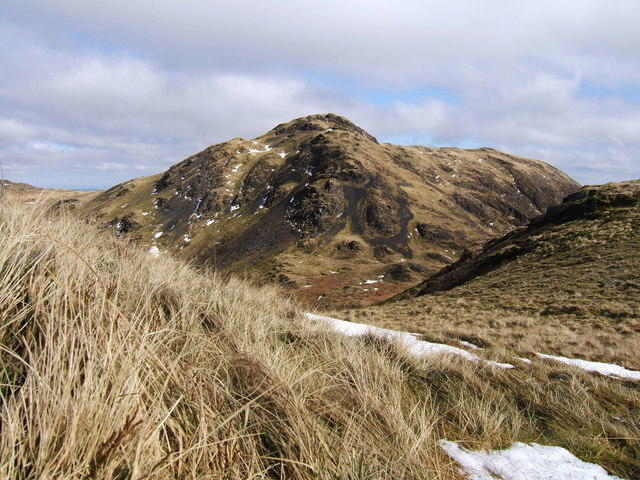 Photo could not load
NX4576 : The summit of Curlywee 674 metres.
Colin McDonald
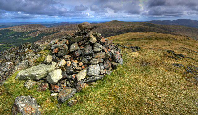 Photo could not load
NX4576 : Cairn On Curlywee Summit
Duncan McNaught
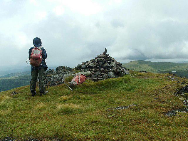 Photo could not load
NX4576 : Curleywee (summit cairn)
Raibeart MacAoidh
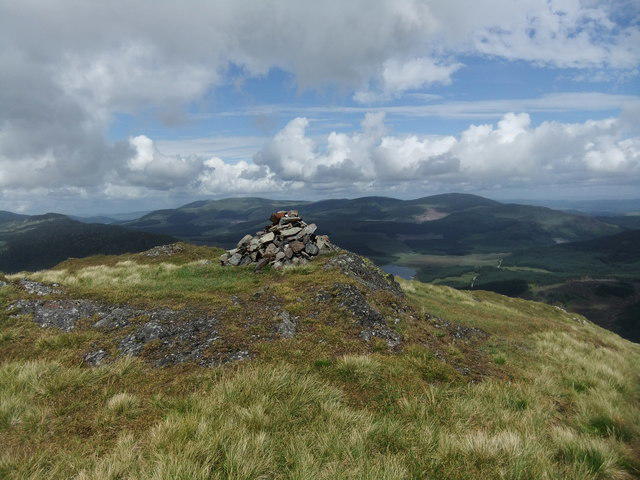 Photo could not load
NX4576 : Summit of Curleywee
David Brown
Hill facts and local notes
Classifications
Elevation
674m
2,213 ft
Prominence
120m
Coordinates
55.0630, -4.4213
NX454769
OS Map
77
Explorer: 319
At the Summit
At the summit, you will find a small stone cairn that serves as a reliable landmark amid the rolling hills. The vast openness around the summit provides ample space for a celebratory sandwich—or a cheeky flask of tea!
Terrain & Geology
Curleywee is primarily composed of sandstone and mudstone, characteristic of the Southern Uplands. The layered sedimentary rocks create a rugged terrain that adds to the mountain's charm, while the erosion has sculpted some fascinating shapes on the cliffs.
Views & Scenery
On a clear day, look out for the expansive views of the Galloway Forest Park and beyond, including the distant peaks of the Kintyre Peninsula.
History & Heritage
Name Origin
The name 'Curleywee' is thought to derive from the Scots word 'wee', meaning small, which is quite ironic given its commanding presence in the region.
Historical Significance
Curleywee and the surrounding hills are of great interest for walking enthusiasts and those fascinated with the area's natural history. They also play a part in local folklore.
Getting There & Facilities
Check current local access restrictions, parking rules and transport timetables before travelling. These notes do not confirm public access to the summit.
Parking
There is a parking area at the entrance to Glen Trool, which accommodates several vehicles. It's a popular spot, so arriving early is advised.
Public Transport
Regular bus services run to nearby towns, with the nearest stop being in New Galloway. From there, it's a moderate walk to the parking area.
Nearby Facilities
Facilities near New Galloway include a cafe and public toilets, perfect for refueling or a last-minute check on the trail conditions.
Safety Information
Known Hazards
- Watch out for sudden weather changes; the Southern Uplands can be temperamental. Slippery paths, especially after rain, can turn your hike into an unintended slip-and-slide experience.
General Safety Tips
- Check weather conditions before setting out
- Carry appropriate clothing and equipment
- Let someone know your planned route
- Take a map, compass, and GPS device
- Carry emergency supplies: food, water, first aid kit, torch
Hills
Some common questions about the hills answered
Are there group walks up Curleywee?
Many walkers use Walkmates to join or organise walks with others. You can check for group walks around Curleywee through the maps
Are there other walkers around Curleywee?
Activity varies by location and time, but Walkmates lets you see whether others have shared walks or shown interest in this area. Find other people through the walking friends search walking friends for Curleywee search or of course create your own walk for Curleywee
Can I organise a walk to Curleywee?
Yes. If there aren’t any walks listed already, you can create a walk and make it available for others to join.
If you're signed up to Walkmates, you can create a walk to Curleywee.
How do I find a walk up this hill?
There are often multiple ways to walk this hill, depending on experience and route preference. Walkmates helps you explore walks and routes that others have shared.
Can I suggest a new route up Curleywee?
Yes. You can suggest or create routes to share with others. Walkmates focuses on the social side of walking, so routes are used to help people organise walks and explore areas together, rather than as detailed navigation tools or route libraries.
Other uses really appreciate knowledgeable walkers sharing their routes. Share your favourite route to Curleywee here
The is an error or something incorrect about this hill. How do I let you know?
We always strive to keep the information on Walkmates as accurate as possible. If you find an error, please let us know through the contact form and we'll aim to correct it as quickly as possible
Community Discussion
Comments
Location
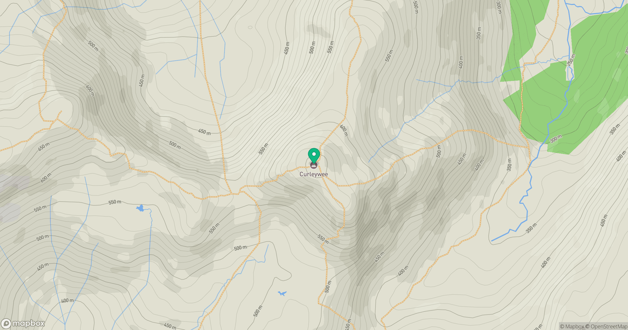
Grid reference: NX454769
View on OpenStreetMapOpens a map in a new tab, centred on the hill.
Hills within 30 km
Straight-line distance, not a walking route or confirmation of access.
No comments yet. Be the first.