
Meall Reamhar
Good walks are even better shared.
Overview
Meall Reamhar
Overview
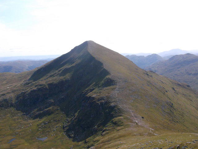
Meall Reamhar is a striking Munro located in the Scottish Highlands, beckoning hikers with its promise of adventure and stunning scenery. Standing at an elevation of 670 meters, this 'fat hill' offers a rewarding ascent and views that will take your breath away – just remember to breathe again!
Geology
The mountain is composed of ancient volcanic rock, making its geology both fascinating and a little rough around the edges. This ancient landscape is home to various flora and fauna, providing a rich tapestry of biodiversity. Perfect for geologists or anyone who appreciates a good rock!
Routes
The route from Glen Dochart is a popular choice among hikers. Stretching about 8 kilometers, it generally takes around 4 hours to complete. The trek provides a good mix of challenge, with plenty of scenic moments to keep your spirits high.
Summit Features
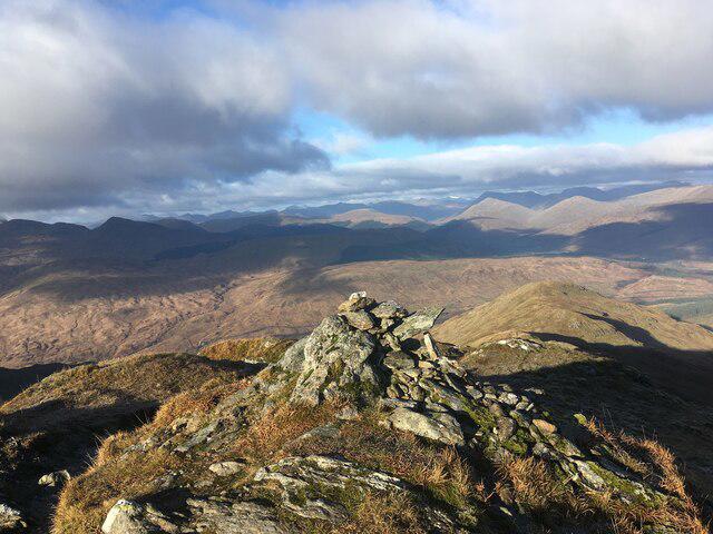
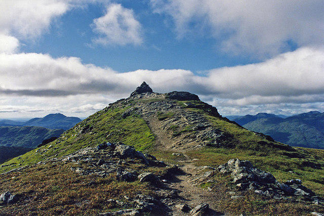
When you reach the summit, you'll be greeted by a stone cairn triumphantly standing guard over the majestic views of the surrounding peaks. Don't forget to snap a selfie; the summit is just made for it!
Terrain
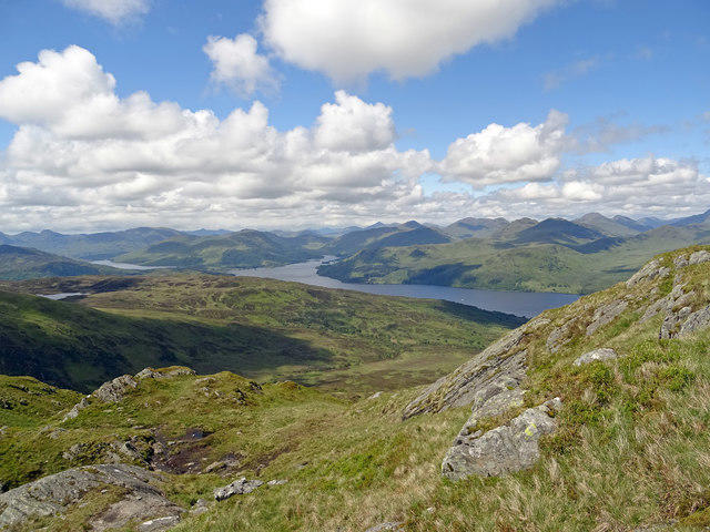
The terrain features a combination of rocky outcrops, grassy expanses, and a few boggy patches that love to surprise unsuspecting hikers. Proper footwear is a must, unless you fancy a dip!
Views
From the summit, you'll be rewarded with stunning panoramic views that include the rugged contours of Ben More and the serene waters of Loch Dochart. To catch the best views, try visiting in late spring or early autumn, keeping that ever-unpredictable Scottish weather in mind!
Hazards
As with any mountain trek in Scotland, watch out for those rapid weather changes. One moment it can be sunny; the next, you might be debating whether you can use your backpack as an umbrella. And of course, keep an eye on your footing – wet rocks and boggy sections can turn a simple walk into a slapstick routine!
Access
Parking is available at Glen Dochart, but arrive early to beat the crowds. For those using public transport, Crianlarich station has bus connections to neighboring regions. It's the perfect jump-off point for your adventure.
Facilities
Crianlarich is close enough to provide all the necessary facilities, including cosy cafes and pubs. Treat yourself to a well-deserved meal after conquering the mountain - you'll have earned it!
History
The meaning of Meall Reamhar, 'the fat hill,' may refer to its gentle contours. This mountain plays a significant role in Scotland’s cultural heritage and is cherished by hikers and nature lovers alike.
In conclusion, Meall Reamhar is more than just a pretty face. From geology enthusiasts to nature lovers and seasoned hikers, there's something for everyone to enjoy at this magnificent Munro. Now, go forth and discover the wonders that await!
Explore routes near Meall Reamhar
Walks starting near this hill. Open a route to check its map, distance and full itinerary.
Loch Katrine: Brenachoile Point Shore Walk from Trossachs Pier
View route
Loch Ard Forest: Sculpture Trail and Little Loch Ard
View route
The Cobbler from Succoth Carpark
View route
Beinn Ime from Succoth
View route
Route planning notes
These notes describe possible approaches. Check a route's map and access information when planning your walk.
From Glen Dochart
This route leads hikers through lush glens and invigorating slopes, perfect for those seeking a good stretch of the legs.
Make a day of it, together
Find someone to share the walk with, or organise a day out along a route you like.
Hill facts and local notes
Classifications
Elevation
844m
2,770 ft
Prominence
97m
Coordinates
56.3060, -4.5476
NN424155
OS Map
56
Explorer: OL46N 365N
At the Summit
At the summit, you will find a substantial cairn indicating the highest point, along with breathtaking panoramic views that will have you feeling like the king or queen of the hill.
Terrain & Geology
Meall Reamhar is primarily composed of ancient volcanic rock, providing a rugged landscape that dates back millions of years. This geology contributes to the rich biodiversity found in the area.
Views & Scenery
From the summit, enjoy sweeping vistas of the surrounding peaks, including the iconic Ben More and the serene Loch Dochart.
History & Heritage
Name Origin
The name Meall Reamhar translates to 'the fat hill' in Scots Gaelic, possibly referring to its rounded summit shape.
Historical Significance
As a Munro, Meall Reamhar is part of Scotland's renowned mountain heritage, attracting hikers from all over the world, drawn by both its challenges and its beauty.
Getting There & Facilities
Parking
There is a small parking area at Glen Dochart, which accommodates several vehicles. Arrive early to secure a spot as it tends to fill up quickly during peak season.
Public Transport
The nearest train station is in Crianlarich, with bus services connecting to various points in the Highlands.
Nearby Facilities
Nearby facilities include various tea rooms and pubs in Crianlarich where weary hikers can refuel. Toilets are also available at the train station.
Safety Information
Known Hazards
- Beware of sudden weather changes, and footing can be tricky on rocky sections, especially when wet. The usual suspects of boggy patches could also provide an unexpected footbath.
General Safety Tips
- Check weather conditions before setting out
- Carry appropriate clothing and equipment
- Let someone know your planned route
- Take a map, compass, and GPS device
- Carry emergency supplies: food, water, first aid kit, torch
Hills
Some common questions about the hills answered
Are there group walks up Meall Reamhar?
Many walkers use Walkmates to join or organise walks with others. You can check for group walks around Meall Reamhar through the maps
Are there other walkers around Meall Reamhar?
Activity varies by location and time, but Walkmates lets you see whether others have shared walks or shown interest in this area. Find other people through the walking friends search walking friends for Meall Reamhar search or of course create your own walk for Meall Reamhar
Can I organise a walk to Meall Reamhar?
Yes. If there aren’t any walks listed already, you can create a walk and make it available for others to join.
If you're signed up to Walkmates, you can create a walk to Meall Reamhar.
How do I find a walk up this hill?
There are often multiple ways to walk this hill, depending on experience and route preference. Walkmates helps you explore walks and routes that others have shared.
Can I suggest a new route up Meall Reamhar?
Yes. You can suggest or create routes to share with others. Walkmates focuses on the social side of walking, so routes are used to help people organise walks and explore areas together, rather than as detailed navigation tools or route libraries.
Other uses really appreciate knowledgeable walkers sharing their routes. Share your favourite route to Meall Reamhar here
The is an error or something incorrect about this hill. How do I let you know?
We always strive to keep the information on Walkmates as accurate as possible. If you find an error, please let us know through the contact form and we'll aim to correct it as quickly as possible
Community Discussion
Comments
Location
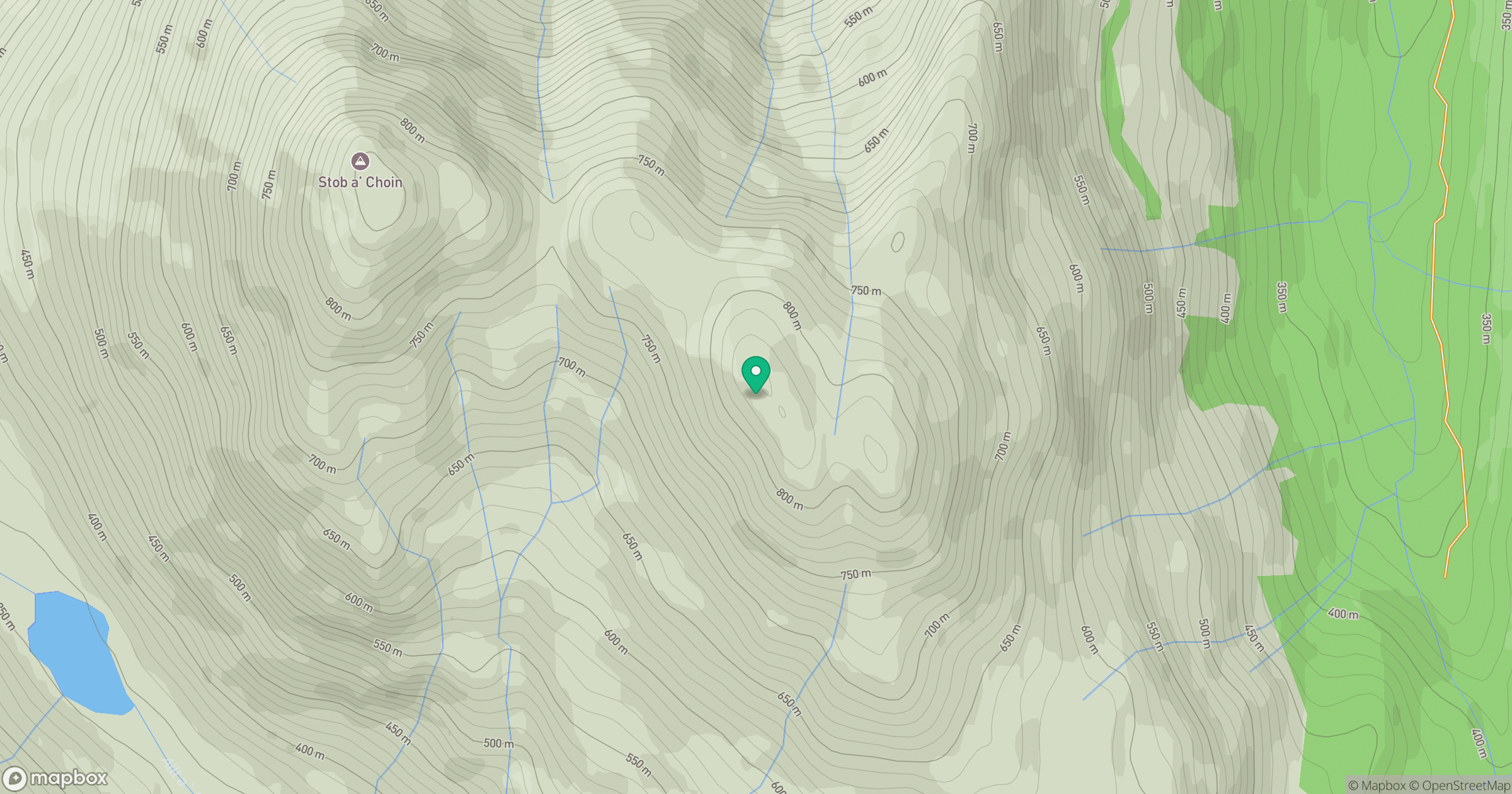
Grid reference: NN424155
View on OpenStreetMapOpens a map in a new tab, centred on the hill.
No comments yet. Be the first.