

Meall nan Saighdearan
Good walks are even better shared.
Overview
Meall nan Saighdearan: Hill of the Archers
Nestled in the breathtaking Scottish Highlands, Meall nan Saighdearan stands proudly at 883 meters, marking its territory as a Munro. Renowned for both its stunning vistas and challenging terrain, it offers outdoor enthusiasts a delightful escape into nature’s wonderland.
Geology
The mountain is primarily composed of schists and gneisses, remnants of ancient geological forces that shaped this rugged landscape. Whether you're a geology enthusiast or just enjoy the sights, the metamorphic rocks here tell a story of time gone by.
Routes
Two popular routes cater to different hiking preferences:
- East Ridge Route (8.5 km, 4.5 hours, Moderate): A gentle ascent that provides hikers with breathtaking views without too many sweat beads.
- West Approach Route (9.2 km, 5 hours, Challenging): A steeper climb for those looking to break a sweat; a great way to test your mettle (and your knees).
Summit Features
Expect to be greeted by a trig point and a hearty cairn at the summit. On a clear day, the world opens up before you, with Loch Awe and the peaks of Ben More and Ben Vorlich stealing the show. Bring your camera!
Terrain
Get ready for a bit of a skip and a jump! The mix of rocky paths and grassy slopes offers variety, though be prepared for some squishy bogs. Wear sturdy footwear, unless you fancy a surprise mud bath.
Views
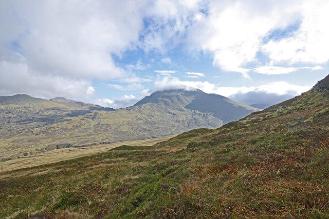
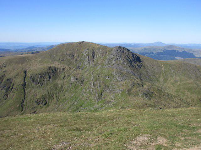
The vistas from the summit are a feast for the eyes. With panoramic views of the Southern Highlands, you'll feel on top of the world, especially during summer when clarity reigns supreme.
Hazards
Keep an eye on Scotland's notorious weather; conditions can change faster than a cheetah on an espresso. Also, be wary of steep drops and boggy patches that might just be waiting for a moment of distraction.
Access
For your convenience, there's a small car park at NN661201. If public transport is your jam, the bus stop in Balquhidder is the way to go, with a moderate walk to the trailhead. Don’t forget to pop into Callander for supplies and the odd bite before heading out!
Facilities
While the mountain doesn't offer any facilities, Callander is mere kilometres away and filled with eateries and necessary pit stops. Stock up on snacks and water before your adventure!
History
No hike is complete without a sprinkle of history! 'Meall nan Saighdearan' translates to 'Hill of the Archers.' Once a hunting ground for local clans, this mountain is steeped in rich stories from times past.
Whether you're after stunning landscapes, a decent workout, or a slice of history, Meall nan Saighdearan is sure to impress, setting the stage for an exceptional Scottish outdoor adventure.
And remember:
The only thing better than reaching the summit is telling everyone about how you did it! Happy hiking!
Explore routes near Meall nan Saighdearan
Public walks starting within 80 km of this hill. Nearby does not mean a route reaches the summit; check its map and access before setting out.
Loch Lubnaig: West Shore Railway Path from Ben Ledi Car Park
View route
Killin: Falls of Dochart, Finlarig and Moirlanich Longhouse
View route
Crieff: Lady Mary's Walk and the River Earn
View route
Loch Katrine: Trossachs Pier to Stronachlachar
View route
Route planning notes
These notes describe possible approaches, not verified navigable routes or permission to cross land. Check current paths, local access rules and conditions before setting out.
East Ridge Route
This route starts from the car park at the base and follows the well-worn East ridge, allowing for a steady ascent with breathtaking views along the way.
West Approach Route
A more challenging yet rewarding route, this approach follows a steeper gradient, often tackling some lush and boggy patches before reaching the summit.
Make a day of it, together
Find someone to share the walk with, or organise a day out along a route you like.
Photo Gallery
View all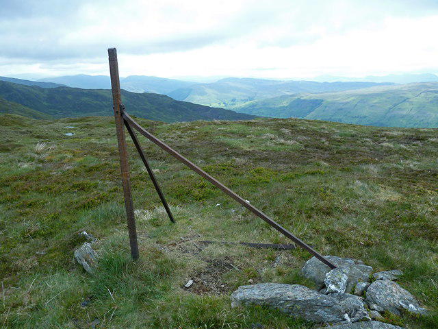 Photo could not load
NN6721 : Remains of fence on Meall nan Saighdearan
Anthony O'Neil
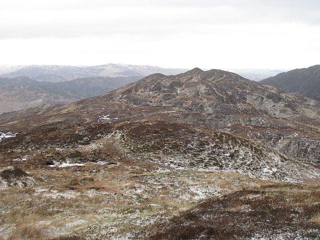 Photo could not load
NN6721 : Bealach Ruadh
Richard Webb
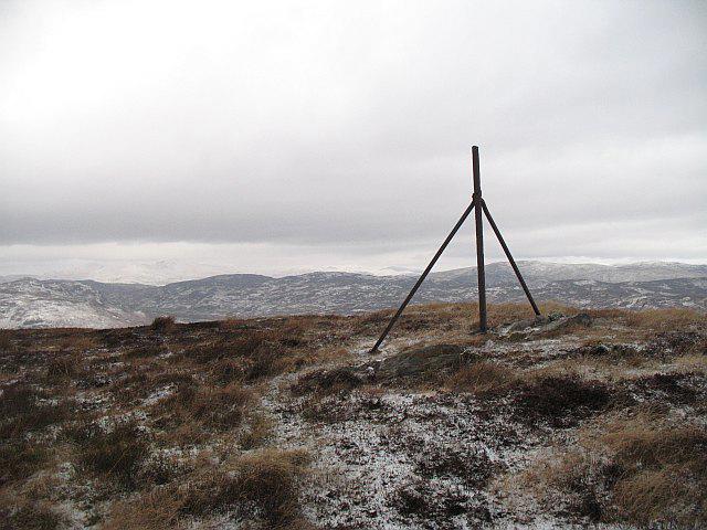 Photo could not load
NN6721 : Summit, Meall an Saighdearan
Richard Webb
Hill facts and local notes
Classifications
Elevation
681m
2,234 ft
Prominence
129m
Coordinates
56.3646, -4.1513
NN672212
OS Map
51 57
Explorer: OL47W 368W
At the Summit
The summit of Meall nan Saighdearan is marked by a prominent trig point and a small, stone-built cairn. Here, hikers can revel in panoramic views of the surrounding Highlands, with Loch Awe and Ben Ledi standing proudly in the distance.
Terrain & Geology
Meall nan Saighdearan is primarily composed of metamorphic rocks, including schists and gneisses, which have been shaped over millennia by glacial activity. The rugged terrain presents a tapestry of geological features that excite rock enthusiasts.
Views & Scenery
From the summit, one can spot Ben More, Ben Vorlich, and on a clear day, the distant peaks of the Southern Highlands.
History & Heritage
Name Origin
The name 'Meall nan Saighdearan' translates as 'Hill of the Archers', hinting at a rich historical connection to hunting and archery in the Highlands.
Historical Significance
The mountain is part of the ancient lands that were significant for local clans and served as a hunting ground, breathing history into every step of your hike.
Getting There & Facilities
Check current local access restrictions, parking rules and transport timetables before travelling. These notes do not confirm public access to the summit.
Parking
A small car park is located at NN661201, suitable for approximately 10 cars, giving direct access to the East Ridge Route.
Public Transport
The nearest bus stop is in the village of Balquhidder, with services from Callander. From there, it's about a 5km walk to the starting point.
Nearby Facilities
While there are no facilities directly on the mountain, the village of Callander offers cafes, shops, and public toilets. It's best to replenish on snacks and drinks before your climb!
Safety Information
Known Hazards
- Be cautious of sudden weather changes, steep drops, and the occasional bog; don't underestimate Scotland's penchant for surprise rain showers!
General Safety Tips
- Check weather conditions before setting out
- Carry appropriate clothing and equipment
- Let someone know your planned route
- Take a map, compass, and GPS device
- Carry emergency supplies: food, water, first aid kit, torch
Hills
Some common questions about the hills answered
Are there group walks up Meall nan Saighdearan?
Many walkers use Walkmates to join or organise walks with others. You can check for group walks around Meall nan Saighdearan through the maps
Are there other walkers around Meall nan Saighdearan?
Activity varies by location and time, but Walkmates lets you see whether others have shared walks or shown interest in this area. Find other people through the walking friends search walking friends for Meall nan Saighdearan search or of course create your own walk for Meall nan Saighdearan
Can I organise a walk to Meall nan Saighdearan?
Yes. If there aren’t any walks listed already, you can create a walk and make it available for others to join.
If you're signed up to Walkmates, you can create a walk to Meall nan Saighdearan.
How do I find a walk up this hill?
There are often multiple ways to walk this hill, depending on experience and route preference. Walkmates helps you explore walks and routes that others have shared.
Can I suggest a new route up Meall nan Saighdearan?
Yes. You can suggest or create routes to share with others. Walkmates focuses on the social side of walking, so routes are used to help people organise walks and explore areas together, rather than as detailed navigation tools or route libraries.
Other uses really appreciate knowledgeable walkers sharing their routes. Share your favourite route to Meall nan Saighdearan here
The is an error or something incorrect about this hill. How do I let you know?
We always strive to keep the information on Walkmates as accurate as possible. If you find an error, please let us know through the contact form and we'll aim to correct it as quickly as possible
Community Discussion
Comments
Location
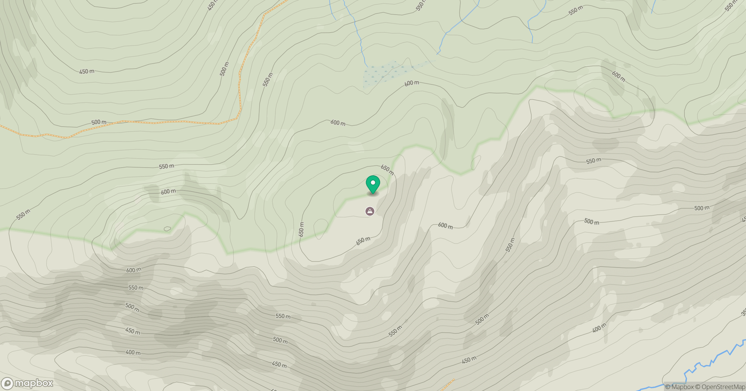
Grid reference: NN672212
View on OpenStreetMapOpens a map in a new tab, centred on the hill.
Hills within 30 km
Straight-line distance, not a walking route or confirmation of access.
No comments yet. Be the first.