
Meall nan Gabhar
Good walks are even better shared.
Overview
Meall nan Gabhar
Overview
Meall nan Gabhar stands proudly at 865 meters, showcasing the stunning Scottish Highlands in all its natural glory. This Munro is a must-visit for serious hikers and casual strollers alike.
Getting There
To tackle this majestic hill, most hikers start at the Balquhidder Upper car park, which sits conveniently near the trailhead. From here, you're treated to a lovely 8.5 km trail that winds its way to the top with moderate challenges along the way.
The Route
The pathway is filled with the sights and sounds of local wildlife, so don't forget your camera! Remember, while the route is well-marked, some sections may challenge your sense of balance, especially if the Highlands decide to give you a bit of rain.
Summit Features
At the summit, you'll find a sizeable stone cairn, which not only serves as a great resting spot but also a prime location for photos that will make your friends green with envy.
Terrain
The terrain mainly consists of a mix of rocky patches and grassy trails, but be prepared for a few boggy sections that could turn your shoes into sponges if you're not careful. But, it’s all part of the adventure!
Views
Once you reach the top, the views are nothing short of spectacular! Look out for Loch Voil sprawling below and the dramatic peaks of Ben More and Stobinian in the distance. Don’t forget, spring and autumn are the best seasons to witness this beauty.
Safety Considerations
Like all good things in life, there can be pitfalls—uneven terrain, sudden weather changes, and boggy patches to navigate, so keep those hiking boots firmly tied!
Nearby Adventures
If you’re still feeling adventurous after conquering Meall nan Gabhar, why not tackle nearby Ben More and Stobinian? They promise a thrilling continuation of your Highland adventure.
In Conclusion
Whether you’re after sweeping panoramas or a wholesome hike, Meall nan Gabhar delivers. Pack your lunch, lace up your boots, and enjoy all that this wonderful Munro has to offer!
Explore routes near Meall nan Gabhar
Walks starting near this hill. Open a route to check its map, distance and full itinerary.
West Highland Way: Tyndrum to Bridge of Orchy
View route
Beinn Ime from Succoth
View route
The Cobbler from Succoth Carpark
View route
Ben Lomond in the trossachs
View route
Route planning notes
These notes describe possible approaches. Check a route's map and access information when planning your walk.
Hill of the Goats Path
A scenic route that starts near the village of Balquhidder, winding gently upwards. Expect to see plenty of wildlife along the way.
Make a day of it, together
Find someone to share the walk with, or organise a day out along a route you like.
Hill facts and local notes
Classifications
Elevation
744m
2,441 ft
Prominence
265m
Coordinates
56.3755, -4.8585
NN235240
OS Map
50
Explorer: OL39N 364N
At the Summit
The summit is marked by a sizeable stone cairn, providing a perfect spot for a rest stop or a dramatic selfie.
Terrain & Geology
The mountain is composed largely of quartzite and schist, which impart a rugged character to the landscape. It's like the mountain dressed up for a fancy occasion, glinting in the sunlight!
Views & Scenery
On a clear day, you can see the stunning Loch Voil and the craggy peaks of the surrounding mountains including Ben More and Stobinian.
History & Heritage
Name Origin
The name 'Meall nan Gabhar' translates to 'Hill of the Goats' in Gaelic, a nod to the local wildlife.
Historical Significance
The area is steeped in history, notably linked to the Highland Clearances and known for its traditional Highland culture.
Getting There & Facilities
Parking
Parking is available at the Balquhidder Upper car park, approximately 2 km from the route start.
Public Transport
The area can be accessed via regular bus services from cities like Stirling, but be sure to check schedules as they can vary.
Nearby Facilities
Public toilets are available in Callander, along with several cafes and shops for pre or post-adventure refreshments.
Safety Information
Known Hazards
- Uneven terrain, potential for sudden weather changes, and some sections can be particularly boggy.
General Safety Tips
- Check weather conditions before setting out
- Carry appropriate clothing and equipment
- Let someone know your planned route
- Take a map, compass, and GPS device
- Carry emergency supplies: food, water, first aid kit, torch
Hills
Some common questions about the hills answered
Are there group walks up Meall nan Gabhar?
Many walkers use Walkmates to join or organise walks with others. You can check for group walks around Meall nan Gabhar through the maps
Are there other walkers around Meall nan Gabhar?
Activity varies by location and time, but Walkmates lets you see whether others have shared walks or shown interest in this area. Find other people through the walking friends search walking friends for Meall nan Gabhar search or of course create your own walk for Meall nan Gabhar
Can I organise a walk to Meall nan Gabhar?
Yes. If there aren’t any walks listed already, you can create a walk and make it available for others to join.
If you're signed up to Walkmates, you can create a walk to Meall nan Gabhar.
How do I find a walk up this hill?
There are often multiple ways to walk this hill, depending on experience and route preference. Walkmates helps you explore walks and routes that others have shared.
Can I suggest a new route up Meall nan Gabhar?
Yes. You can suggest or create routes to share with others. Walkmates focuses on the social side of walking, so routes are used to help people organise walks and explore areas together, rather than as detailed navigation tools or route libraries.
Other uses really appreciate knowledgeable walkers sharing their routes. Share your favourite route to Meall nan Gabhar here
The is an error or something incorrect about this hill. How do I let you know?
We always strive to keep the information on Walkmates as accurate as possible. If you find an error, please let us know through the contact form and we'll aim to correct it as quickly as possible
Community Discussion
Comments
Location
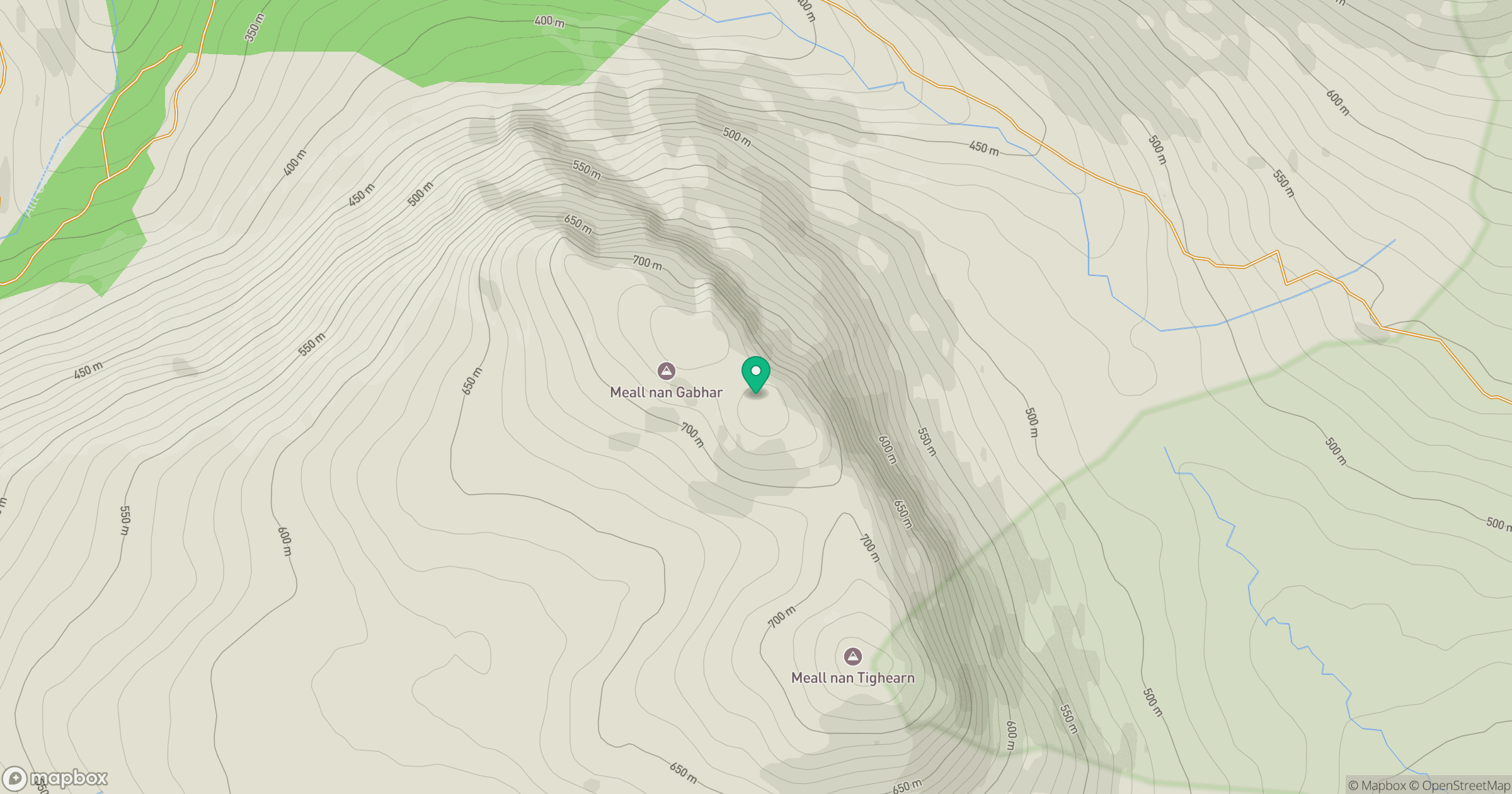
Grid reference: NN235240
View on OpenStreetMapOpens a map in a new tab, centred on the hill.
Nearby Hills
![Ben Lui [Beinn Laoigh]](https://cdn.walkmates.com/gallery-images/20d4da67f4984b329a102d7c3aba012b.jpg)
Ben Lui [Beinn Laoigh]
1,131m
Beinn Ime
1,012m
Ben Vorlich
943m
Beinn Narnain
927m
![The Cobbler [Ben Arthur]](https://cdn.walkmates.com/gallery-images/a1b697040769474a8338b3fb586ebc7a.jpg)
The Cobbler [Ben Arthur]
887m
No comments yet. Be the first.