
Meall nan Eun
Good walks are even better shared.
Overview
Meall nan Eun: A Munro Worth Exploring
Meall nan Eun, standing at a proud 785 meters, is a stout Munro nestled within the picturesque Scottish Highlands. Known as 'Hill of the Birds', this beautiful peak presents a delightful challenge to those keen on experiencing the rugged beauty of Scotland.
Geology
What lies beneath your boots is just as fascinating as the views above! The summit is mainly composed of schist rock, with its rugged edges and glacial features bringing an enchanting charm to the landscape that you won’t soon forget.
Routes
There are a couple of popular routes that can lead you to the summit:
- Inverlochlarig route: A delightful 10-km path takes about 4 hours. This moderate route is quite popular and takes you through moorland that showcases the stunning Highland scenery.
- Balquhidder Glen route: If you feel a bit more adventurous, this challenging 12-km trek will last around 5 hours. The views are absolutely rewarding, provided the legs are ready for climbing.
Summit Features
The summit boasts a significant cairn—a traditional pile of stones built by fellow climbers, which has become a delightful spot for photos and reflection. Don’t forget your camera; the views are as picturesque as a postcard!
Terrain
Expect rocky terrains with a mixture of grassy slopes and the occasional boggy area, especially after a downpour. Ensure your footwear is as sturdy as your resolve!
Views
From the top of Meall nan Eun, treat your eyes to a feast! Loch Voil dazzles to the north while the rolling hills of the Trossachs pour out before you. Clear days may even gift you a glimpse of the distant Southern Highlands. The best time to enjoy these views is during the spring and autumn, when nature wears its finest attire.
Hazards
As with all outdoor adventures, caution should be exercised. First and foremost, keep an eye on the weather; it can change faster than a squirrel on a nut hunt! The boggy sections can be slippery, so take care during your ascent and descent.
Nearby Summits
If the spirit of exploration swells within you, two notable neighbouring Munros are Ben Vorlich and Stuc a' Chroin, both reachable from this majestic peak.
Access
Nearest parking can be found at Inverlochlarig Farm, though it's wise to park considerately. For those relying on public transport, options are rather scarce, but you might get lucky with a bus to nearby settlements followed by a taxi ride. Callander, about 20 km away, is your best bet for amenities.
Facilities
While the mountain itself lacks facilities, Callander offers cafes and shops should you need refreshments post-hike. Toilets are a welcome sight after long walks, so plan accordingly.
History
The name Meall nan Eun hints at its natural beauty and wildlife, with a cultural significance to the Highlanders who have roamed these parts for generations.
Meall nan Eun awaits with open arms (figuratively, of course), promising an unforgettable adventure amidst its scenic splendour.
Happy hiking!
Explore routes near Meall nan Eun
Walks starting near this hill. Open a route to check its map, distance and full itinerary.
Kenmore: Drummond Hill Black Rock Trail above Loch Tay
View route
Aberfeldy: Glassie Woodland and River Tay Circular
View route
Killin: Falls of Dochart, Finlarig and Moirlanich Longhouse
View route
Crieff: Lady Mary's Walk and the River Earn
View route
Route planning notes
These notes describe possible approaches. Check a route's map and access information when planning your walk.
Inverlochlarig route
Starting from the Inverlochlarig Farm, this route offers a well-defined path leading through moorland and up to the summit, with spectacular views along the way.
Balquhidder Glen route
This scenic route involves a mix of woodland trails and open moorland, eventually leading up to a steep but achievable gradient towards the summit.
Make a day of it, together
Find someone to share the walk with, or organise a day out along a route you like.
Hill facts and local notes
Classifications
Elevation
851m
2,791 ft
Prominence
21m
Coordinates
56.7357, -4.1502
NN685625
OS Map
42
Explorer: OL49W 386W
At the Summit
The summit is marked by a substantial stone cairn, providing a perfect spot for a photo op. As one stands at the top, the panoramic views truly reward the effort put into the climb.
Terrain & Geology
Meall nan Eun is primarily composed of schist rock, which gives it a rugged and rocky appearance. The landscape showcases glacial features formed during the last Ice Age, adding both intrigue and artistic beauty to the terrain.
Views & Scenery
From the summit, you can marvel at the breathtaking sight of Loch Voil to the north, the rolling hills of the Trossachs, and on clear days, the distant peaks of the Southern Highlands.
History & Heritage
Name Origin
The name 'Meall nan Eun' translates to 'Hill of the Birds' in Gaelic, suggesting an area rich in avian life.
Historical Significance
This area is steeped in historical significance, linked to local folklore and traditions among the Highland communities.
Getting There & Facilities
Parking
There is limited roadside parking at Inverlochlarig Farm. Be considerate of local residents when parking.
Public Transport
Public transport options are limited; however, bus services to nearby villages can connect with a short taxi ride.
Nearby Facilities
There are no facilities directly on the mountain, but cafes, restrooms, and shops can be found in the nearby town of Callander.
Safety Information
Known Hazards
- Beware of sudden weather changes; high winds and reduced visibility can occur. Boggy patches can be slippery after rain, so sturdy footwear is recommended.
General Safety Tips
- Check weather conditions before setting out
- Carry appropriate clothing and equipment
- Let someone know your planned route
- Take a map, compass, and GPS device
- Carry emergency supplies: food, water, first aid kit, torch
Hills
Some common questions about the hills answered
Are there group walks up Meall nan Eun?
Many walkers use Walkmates to join or organise walks with others. You can check for group walks around Meall nan Eun through the maps
Are there other walkers around Meall nan Eun?
Activity varies by location and time, but Walkmates lets you see whether others have shared walks or shown interest in this area. Find other people through the walking friends search walking friends for Meall nan Eun search or of course create your own walk for Meall nan Eun
Can I organise a walk to Meall nan Eun?
Yes. If there aren’t any walks listed already, you can create a walk and make it available for others to join.
If you're signed up to Walkmates, you can create a walk to Meall nan Eun.
How do I find a walk up this hill?
There are often multiple ways to walk this hill, depending on experience and route preference. Walkmates helps you explore walks and routes that others have shared.
Can I suggest a new route up Meall nan Eun?
Yes. You can suggest or create routes to share with others. Walkmates focuses on the social side of walking, so routes are used to help people organise walks and explore areas together, rather than as detailed navigation tools or route libraries.
Other uses really appreciate knowledgeable walkers sharing their routes. Share your favourite route to Meall nan Eun here
The is an error or something incorrect about this hill. How do I let you know?
We always strive to keep the information on Walkmates as accurate as possible. If you find an error, please let us know through the contact form and we'll aim to correct it as quickly as possible
Community Discussion
Comments
Location
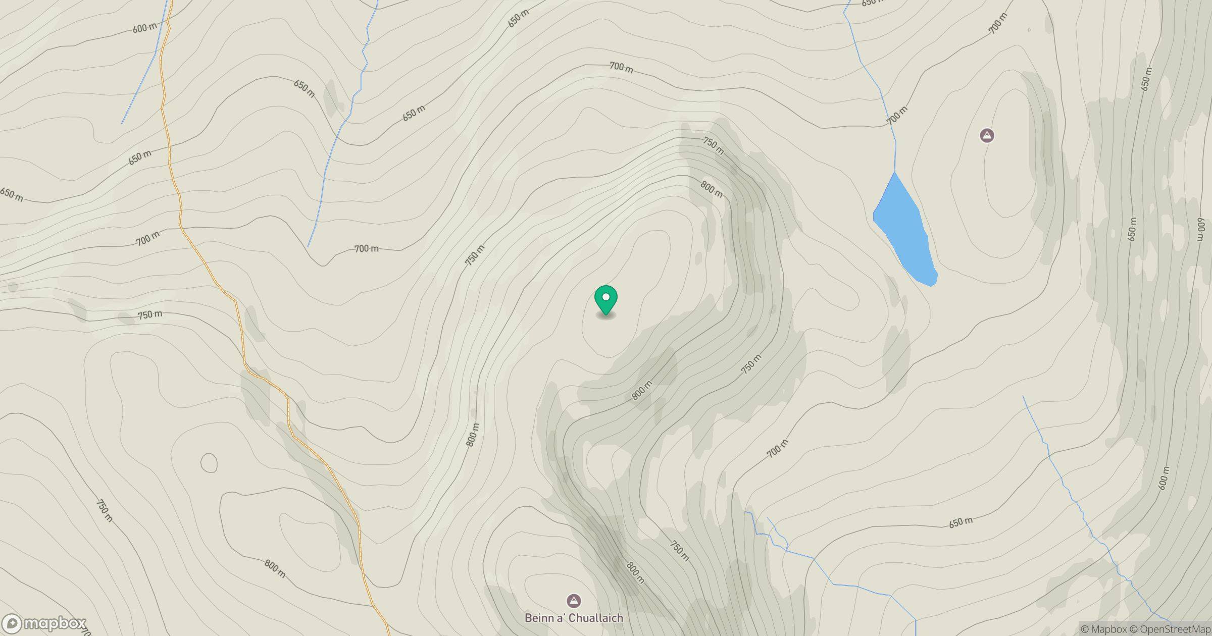
Grid reference: NN685625
View on OpenStreetMapOpens a map in a new tab, centred on the hill.
No comments yet. Be the first.