

Geal Charn
Good walks are even better shared.
Overview
Geal Charn: A Munro Worth Climbing
Overview
Geal Charn is one of the prominent Munros in the stunning Scottish Highlands, standing at an elevation of 987 meters. Its majestic height and the surrounding landscapes make it a favourite among hikers and outdoor enthusiasts.
Geology
This mountain is a fascinating canvas of geological history, with ancient granitic formations unfolding a story that spans eons. Glacial activity has sculpted its features, leaving behind a picturesque mix of rocky and grassy terrains that speak to the majesty of natural forces.
Routes
Two main routes lead to the summit:
- East Ridge Route: A popular choice starting near Loch Laggan, it allows hikers to soak in the scenic beauty whilst walking along a well-defined path.
- North-West Approach: If you fancy a bit of quiet, this challenging route provides solitude and stunning views away from the bustling trails, perfect for those looking to immerse themselves in nature.
Summit Features
Upon reaching the summit, you'll be greeted by a proud stone cairn and a weather station, ensuring you know whether the weather is going to turn you into a human icicle! Perfect for those epic summit selfies!
Terrain
The terrain is vibrant and varied, ranging from rocky outcrops that might challenge your balance to nice grassy patches good for a breather or a snack. Be prepared for some boggy sections, especially after a good Scottish downpour.
Views
From the summit of Geal Charn, the vistas are nothing short of spectacular. You can gaze upon the surrounding Munros, particularly the towering Ben Alder, with Loch Laggan glittering below. The best times to enjoy these heavenly views are in spring or early autumn when the skies clear up to give you jaw-dropping panoramas.
Hazards
As enchanting as it may be, it’s crucial to be mindful of the changing weather conditions. What starts as a sunny day could quickly morph into a soggy mess, so dressing in layers is always a wise choice. Also, watch your step through muddy patches to avoid looking like you've lost a mud wrestling match!
Access and Facilities
Parking is available at Loch Laggan, but come early to snag a spot, especially on the weekends! The nearest town, Laggan, offers quaint cafés and essential supplies. Toilets at the Loch make for an added convenience.
History
Geal Charn’s name, meaning 'white mound', is reflective of its shimmering quartzite landscape. The mountain, and indeed the area, is steeped in a rich tapestry of Highland history, echoing the valour of clan battles and the serene beauty of the Scottish wilderness.
In conclusion, Geal Charn is a magnificent Munro that combines stunning views, intriguing geology, and a slice of Scottish history. Whether you're a seasoned hiker or just dabbling your toes into the world of Munros, this mountain should definitely be on your list!
Happy hiking!
Explore routes near Geal Charn
Public walks starting within 80 km of this hill. Nearby does not mean a route reaches the summit; check its map and access before setting out.
Kenmore: Drummond Hill Black Rock Trail above Loch Tay
View route
Aberfeldy: Glassie Woodland and River Tay Circular
View route
Glen Banvie Trail with the Bruar viewpoint
View route
Killin: Falls of Dochart, Finlarig and Moirlanich Longhouse
View route
Route planning notes
These notes describe possible approaches, not verified navigable routes or permission to cross land. Check current paths, local access rules and conditions before setting out.
East Ridge Route
A well-trodden path starting from the parking area near Loch Laggan, leading hikers along a scenic ridge to the summit.
North-West Approach
A less popular, but rewarding route that offers a bit of solitude and splendid views without the crowds.
Make a day of it, together
Find someone to share the walk with, or organise a day out along a route you like.
Photo Gallery
View all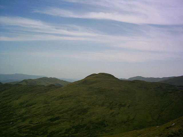 Photo could not load
NN6854 : Geal Charn (792 metres) from the lower western slopes of Schiehallion
Mark Taylor
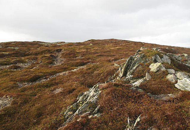 Photo could not load
NN6854 : Geal Charn
Richard Webb
Hill facts and local notes
Classifications
Elevation
794m
2,603 ft
Prominence
128m
Coordinates
56.6634, -4.1528
NN681544
OS Map
42 51
Explorer: OL49W 386W
At the Summit
The summit features a prominent stone cairn, which provides a perfect backdrop for that summit selfie. A weather station can also be found, keeping tabs on the wild Scottish weather.
Terrain & Geology
Geal Charn is primarily composed of ancient granitic rocks which give it a robust and enduring landscape. The area showcases fascinating glacial features and rich deposits of basic igneous rocks contributing to its unique topography.
Views & Scenery
Breathtaking views of the surrounding Munros, including Ben Alder and the expansive Loch Laggan, making it a photographer’s paradise.
History & Heritage
Name Origin
Geal Charn translates to 'white mound' in Gaelic, a nod to the quartzite rock that can shimmer in the sunlight.
Historical Significance
The area is rich in Scottish history, tied to the Highland clans; tales of battles and bravery are woven into the very fabric of these hills.
Getting There & Facilities
Check current local access restrictions, parking rules and transport timetables before travelling. These notes do not confirm public access to the summit.
Parking
There is a parking area at Loch Laggan, which provides a convenient starting point for the hike up Geal Charn. Spaces can be limited during busy weekends.
Public Transport
The nearest bus service runs from Fort William to Dalwhinnie; from there, it is best to arrange a taxi to Loch Laggan.
Nearby Facilities
While facilities near the mountain are limited, Laggan has a small café and shops for supplies. Public toilets are available at the Loch Laggan area.
Safety Information
Known Hazards
- Variable weather conditions are a significant hazard; sudden changes can occur, so be prepared. Slippery paths and boggy areas can also pose challenges, especially after rainfall.
General Safety Tips
- Check weather conditions before setting out
- Carry appropriate clothing and equipment
- Let someone know your planned route
- Take a map, compass, and GPS device
- Carry emergency supplies: food, water, first aid kit, torch
Hills
Some common questions about the hills answered
Are there group walks up Geal Charn?
Many walkers use Walkmates to join or organise walks with others. You can check for group walks around Geal Charn through the maps
Are there other walkers around Geal Charn?
Activity varies by location and time, but Walkmates lets you see whether others have shared walks or shown interest in this area. Find other people through the walking friends search walking friends for Geal Charn search or of course create your own walk for Geal Charn
Can I organise a walk to Geal Charn?
Yes. If there aren’t any walks listed already, you can create a walk and make it available for others to join.
If you're signed up to Walkmates, you can create a walk to Geal Charn.
How do I find a walk up this hill?
There are often multiple ways to walk this hill, depending on experience and route preference. Walkmates helps you explore walks and routes that others have shared.
Can I suggest a new route up Geal Charn?
Yes. You can suggest or create routes to share with others. Walkmates focuses on the social side of walking, so routes are used to help people organise walks and explore areas together, rather than as detailed navigation tools or route libraries.
Other uses really appreciate knowledgeable walkers sharing their routes. Share your favourite route to Geal Charn here
The is an error or something incorrect about this hill. How do I let you know?
We always strive to keep the information on Walkmates as accurate as possible. If you find an error, please let us know through the contact form and we'll aim to correct it as quickly as possible
Community Discussion
Comments
Location
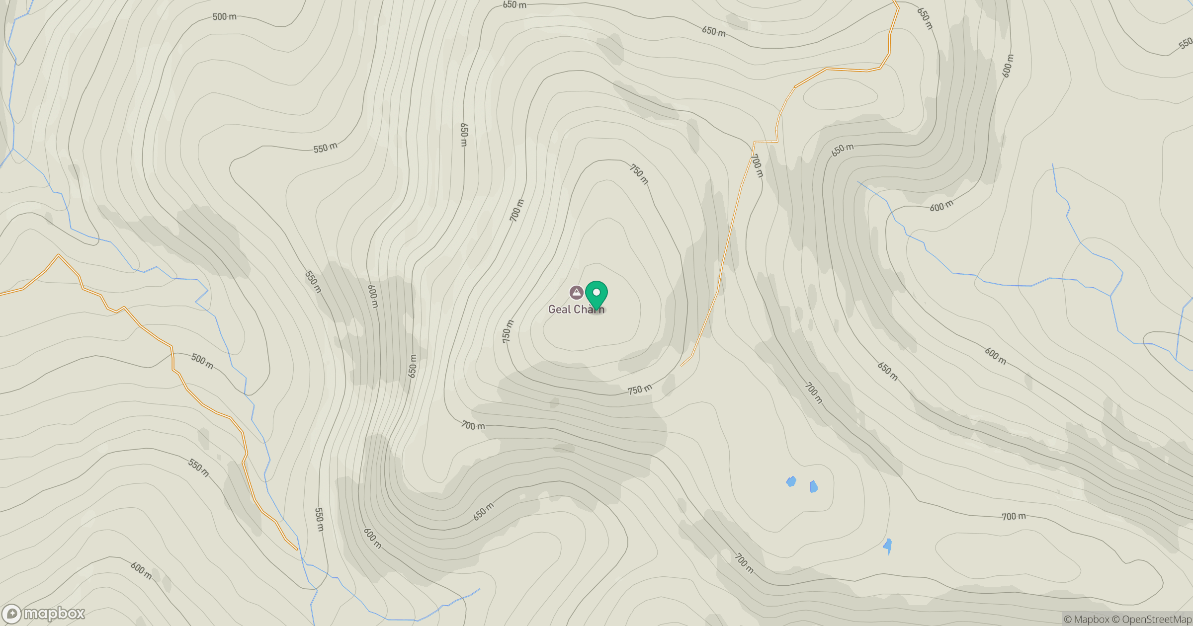
Grid reference: NN681544
View on OpenStreetMapOpens a map in a new tab, centred on the hill.
Hills within 30 km
Straight-line distance, not a walking route or confirmation of access.
Schiehallion
1,083m
An Stuc
1,117m
Ben Lawers
1,214m
Ben Alder
1,148m
Beinn a' Ghlo - Carn Liath
976m
No comments yet. Be the first.