
Sron Chon
Good walks are even better shared.
Overview
Sron Chon: The Hound's Nose
Nestled in the Scottish Highlands, Sron Chon stands proudly at 893 meters, boasting a prominence of 229 meters. Often overshadowed by its taller neighbours, this Marilyn is beloved for its rugged beauty and offers a hike that's as rewarding as it is picturesque.
Geological Wonders
Sron Chon’s rugged terrain primarily consists of schist, a metamorphic rock that adds character to its steep ascents and sharp ridges. As you hike, take a moment to ponder the forces of nature that shaped this landscape. Just mind the loose rocks underfoot — they tend to have a flair for dramatic descents!
Routes Overview
The most popular route, the Sron Chon Circuit, begins at a comfortable parking area along the A82. Covering approximately 12 km in a moderate 4-hour trek, it winds through Glen Etive's stunning scenery, leading you straight to the summit. Along the way, you’ll traverse grassy paths, rocky outcrops, and a few boggy sections that will test your balance and mettle.
Summit Features and Views
Upon reaching the summit, a solid stone cairn awaits you — perfect for a photo op or a quick rest. Prepare for breathtaking panoramic views of Loch Etive and the surrounding Glen Coe mountains. On clear days, you might even spot the distant islands of Mull and Skye — just don’t forget your snacks!
Hazards and Precautions
As any seasoned hiker will tell you, the weather in the Highlands can flip faster than you can say 'Scottish drizzle.' Stay alert for sudden fog, as visibility can drop dramatically. Ensure your footing is secure while navigating the rocky paths, particularly during the descent.
Nearby Summits
If you're up for a challenge, don't miss out on nearby peaks such as Ben Starav (1022 m) and Meall nan Eun (825 m), both of which promise equally jaw-dropping scenery.
Access and Facilities
To tackle Sron Chon, park at a convenient spot on the A82, about 7 km south of Dalness. If you prefer public transport, hop on a bus from Glasgow to Fort William, but a personal vehicle is your best bet for easy access. Facilities in nearby Tyndrum include a café to fuel up before your hike and public toilets for last-minute pit stops.
A Bit of History
The etymology of Sron Chon, translating to 'the nose of the hound', captures the mountain's distinctive profile. Historically, Glen Etive is steeped in tales and has been a haven for hikers and adventurers alike for centuries.
Whether you're a seasoned mountaineer or a meek novice seeking the next great view, Sron Chon offers a taste of Highland beauty that’s second to none.
Get your gear ready, lace up those boots, and embrace the spirit of adventure — just remember, it’s all in good fun until you start talking to the sheep!
Last Updated
2023-10-01
Explore routes near Sron Chon
Public walks starting within 80 km of this hill. Nearby does not mean a route reaches the summit; check its map and access before setting out.
Glen Banvie Trail with the Bruar viewpoint
View route
Kenmore: Drummond Hill Black Rock Trail above Loch Tay
View route
Aberfeldy: Glassie Woodland and River Tay Circular
View route
Coire Ardair lochan from Aberarder and back
View route
Route planning notes
These notes describe possible approaches, not verified navigable routes or permission to cross land. Check current paths, local access rules and conditions before setting out.
Sron Chon Circuit
This loop starts at the car park near the A82 and winds its way through the breathtaking Glen Etive, eventually leading to the summit of Sron Chon.
Make a day of it, together
Find someone to share the walk with, or organise a day out along a route you like.
Hill facts and local notes
Classifications
Elevation
566m
1,857 ft
Prominence
128m
Coordinates
56.7706, -4.1456
NN689663
OS Map
42
Explorer: OL49W 386W
At the Summit
The summit features a substantial stone cairn that serves as a navigational aid as well as a resting point for the weary. The expansive views from the top can have you questioning your life choices, all while enjoying the beauty of the Highlands.
Terrain & Geology
Sron Chon is mainly comprised of schist formations, which give the mountain its distinct rugged texture. The erosion of these rocks has created deep crevices and a unique topography that is appealing to both geologists and hikers alike.
Views & Scenery
From the summit, you can see the stunning vistas over Loch Etive, the surrounding peaks of the Glencoe range, and, on a clear day, even the distant islands of Mull and Skye.
History & Heritage
Name Origin
The name 'Sron Chon' is derived from Gaelic, meaning 'the nose of the hound', possibly referring to the steep, prominent profile of the mountain.
Historical Significance
This mountain, while not the highest, is a local favourite for its dramatic views and the rich history of Glen Etive dating back to prehistoric times.
Getting There & Facilities
Check current local access restrictions, parking rules and transport timetables before travelling. These notes do not confirm public access to the summit.
Parking
There is a car park situated along the A82, approx. 7 km south of the village of Dalness, which provides ample room for several vehicles.
Public Transport
The nearest bus service operates from Glasgow to Fort William, with connections to local transport, but a car will provide the most flexibility.
Nearby Facilities
Your best bet for facilities is Tyndrum, where you can find a café, a shop, and public toilets to prep for your adventure.
Safety Information
Known Hazards
- Be aware of rapid weather changes; fog can descend unexpectedly. Slippery rocks and uneven terrain can make descending tricky.
General Safety Tips
- Check weather conditions before setting out
- Carry appropriate clothing and equipment
- Let someone know your planned route
- Take a map, compass, and GPS device
- Carry emergency supplies: food, water, first aid kit, torch
Hills
Some common questions about the hills answered
Are there group walks up Sron Chon?
Many walkers use Walkmates to join or organise walks with others. You can check for group walks around Sron Chon through the maps
Are there other walkers around Sron Chon?
Activity varies by location and time, but Walkmates lets you see whether others have shared walks or shown interest in this area. Find other people through the walking friends search walking friends for Sron Chon search or of course create your own walk for Sron Chon
Can I organise a walk to Sron Chon?
Yes. If there aren’t any walks listed already, you can create a walk and make it available for others to join.
If you're signed up to Walkmates, you can create a walk to Sron Chon.
How do I find a walk up this hill?
There are often multiple ways to walk this hill, depending on experience and route preference. Walkmates helps you explore walks and routes that others have shared.
Can I suggest a new route up Sron Chon?
Yes. You can suggest or create routes to share with others. Walkmates focuses on the social side of walking, so routes are used to help people organise walks and explore areas together, rather than as detailed navigation tools or route libraries.
Other uses really appreciate knowledgeable walkers sharing their routes. Share your favourite route to Sron Chon here
The is an error or something incorrect about this hill. How do I let you know?
We always strive to keep the information on Walkmates as accurate as possible. If you find an error, please let us know through the contact form and we'll aim to correct it as quickly as possible
Community Discussion
Comments
Location
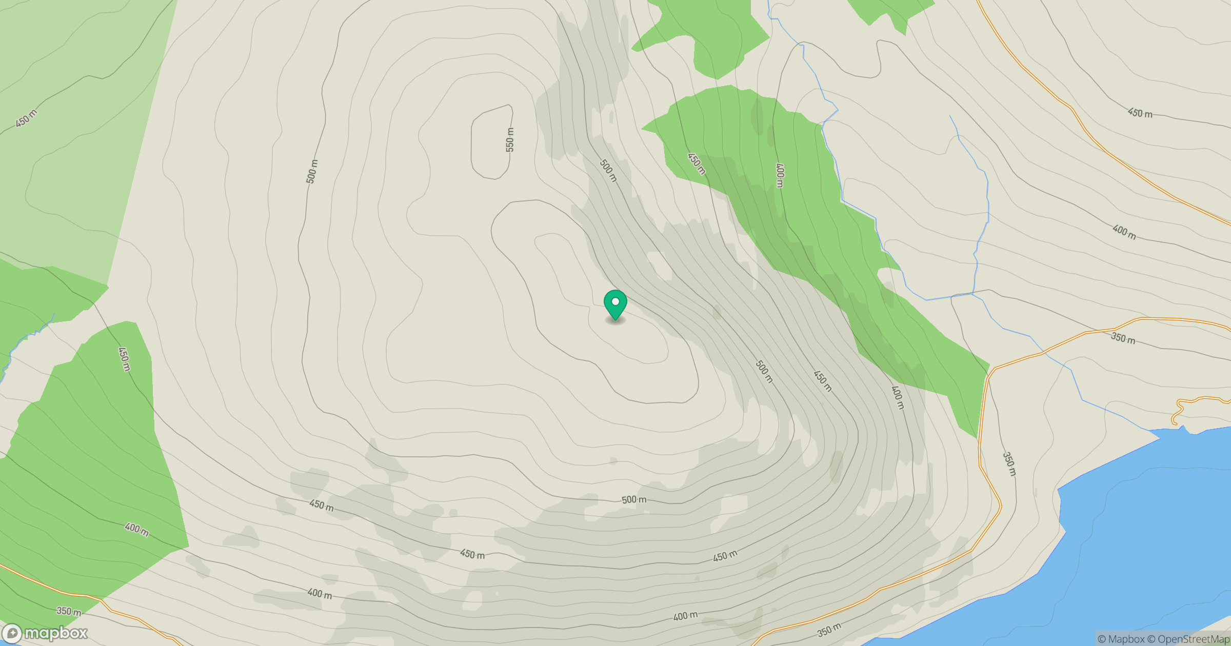
Grid reference: NN689663
View on OpenStreetMapOpens a map in a new tab, centred on the hill.
Hills within 30 km
Straight-line distance, not a walking route or confirmation of access.
No comments yet. Be the first.