

Beinn a' Ghlo - Braigh Coire Chruinn-bhalgain
Good walks are even better shared.
NN9472 : Braigh Coire Chruinn-bhalgain
Euan Nelson Photo source
Overview
Beinn a' Ghlo - Braigh Coire Chruinn-bhalgain
Overview
Beinn a' Ghlo, part of the Scottish Highlands, stands proudly at 1125 meters. Its prominence of 225 meters makes it a notable Munro, attracting both seasoned climbers and enthusiastic day-trippers looking to grab a selfie at the summit.
Geology
The geology of Beinn a' Ghlo is fascinating, dominated by ancient schist which tells the tale of millions of years of geological processes. As you trek, take a moment to admire how the rocks have weathered the storms of time and weather - they could share a story or two!
Routes
One of the most beloved routes is the circular path that begins at the Glen Tilt. At around 14 km in length, it will take about 6 hours to complete with moderate difficulty. Perfect for those who have a good fancy for fresh air but aren't keen on extreme challenges. Plus, it's practically a scenic tour of the stunning, rugged beauty of the Highlands!
Summit Features
Arriving at the summit, you'll find a substantial cairn built by countless fellow adventurers, a testament to the community of hikers who cherish this mountain. Here’s your chance to create your own mini sculpture or simply take a moment to enjoy the view.
Terrain
The terrain can be rocky, grassy, and even a bit boggy in places – so, be prepared for all types of footing! It's a great way to test if your boots live up to their 'waterproof' label.
Views
The view from the top is nothing short of spectacular. You’ll be treated to vistas of the Cairngorms stretching far and wide. Late spring and autumn are prime times for clarity and beauty, but keep in mind the famous unpredictability of Scottish weather – a sunny day can turn into a downpour faster than you can say ‘Pimm's’!
Hazards
While exploring Beinn a' Ghlo, you'll want to watch out for slippery sections, especially when the moors are wet. And don't forget to check the forecast before your adventure to avoid getting soaked!
Nearby Summits
The towering presence of Carn Liath (975m) and the impressive Beinn a' Ghlo (1128m) nearby add further allure to this region, making it a fantastic playground for peak baggers.
Access
Park your car at the Dalmunzie Castle Hotel, where you can also grab some refreshments after the hike. If you're coming by public transport, the best chance is in Blair Atholl – so plan accordingly. The nearest town is a quaint little place full of charm to enjoy before or after your adventure.
Facilities
After all that hiking, you'll want to refuel! Head back to Dalmunzie Castle for some delicious cakes or warming meals.
History
The mountain's name, translating to 'mountain of the hill', speaks to its majestic stature in the landscape of the Highlands. It's been a cherished destination for hikers for centuries, standing as a reminder of the love folks have for the great outdoors.
So, pack your gear, lace up those boots, and set forth on an adventure that captures the spirit of Scotland!
Happy hiking!
Explore routes near Beinn a' Ghlo - Braigh Coire Chruinn-bhalgain
Walks starting near this hill. Open a route to check its map, distance and full itinerary.
Aberfeldy: Glassie Woodland and River Tay Circular
View route
Kenmore: Drummond Hill Black Rock Trail above Loch Tay
View route
Unled club outing: West Drumochter/Beinn Udlamain (coach departure)
View route
Unled club outing: Glenesk (coach departure)
View route
Route planning notes
These notes describe possible approaches. Check a route's map and access information when planning your walk.
Classic Beinn a' Ghlo Traverse
This popular route tackles all three Munros of Beinn a' Ghlo: Carn Liath, Braigh Coire Chruinn-bhalgain, and Carn nan Gabhar. Starting from the car park at Loch Moraig (NN 850 670), the route ascends Carn Liath first before continuing along the ridge to Braigh Coire Chruinn-bhalgain, where you'll enjoy sweeping views of the surrounding hills. The final Munro, Carn nan Gabhar, is reached via a broad ridge. The descent follows a well-trodden path that loops back to Loch Moraig.
Out-and-Back to Braigh Coire Chruinn-bhalgain
For those focusing on Braigh Coire Chruinn-bhalgain alone, this route starts at Loch Moraig (NN 850 670) and bypasses Carn Liath by taking the stalkers' path into the col below Braigh Coire Chruinn-bhalgain. From here, a steeper ascent leads directly to the summit. Retrace your steps to return to the start.
Carn Liath and Braigh Coire Chruinn-bhalgain Loop
This route begins at Loch Moraig (NN 850 670) and follows the steep climb to Carn Liath. From the summit, continue along the ridge to Braigh Coire Chruinn-bhalgain. Instead of heading to Carn nan Gabhar, descend via the stalkers’ path to the glen below, forming a satisfying loop back to the starting point.
Braigh Coire Chruinn-bhalgain via Glen Tilt
A less frequented but scenic approach, this route begins at the car park near Old Blair (NN 867 662) and heads through Glen Tilt. A path ascends towards the col between Carn Liath and Braigh Coire Chruinn-bhalgain. From here, a steady climb takes you to the summit. Retrace your steps or optionally extend the walk to Carn nan Gabhar.
Winter Ascent of Braigh Coire Chruinn-bhalgain
For experienced winter walkers, this route starts at Loch Moraig (NN 850 670) and follows the same path as the out-and-back route, with the added challenges of snow and ice. Proper equipment and knowledge of winter navigation are essential. The summit rewards you with stunning winter panoramas.
Make a day of it, together
Find someone to share the walk with, or organise a day out along a route you like.
Photo Gallery
View all Photo could not load
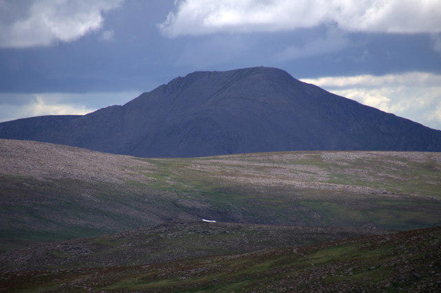
NN9472 : Braigh Coire Chruinn-bhalgain
Euan Nelson
 Photo could not load
NN9472 : Braigh Coire Chruinn-bhalgain
David Brown
 Photo could not load
NN9472 : Bràigh Coire Chruinn-bhalgain, from Carn Liath
Nigel Brown
 Photo could not load
NN9472 : Braigh Coire Chruinn-bhalgain & Beinn a' Ghlo as seen from Carn Liath
Colin Park
 Photo could not load
NN9472 : Bràigh Coire Chruinn-bhalgain Summit
Robert Struthers
 Photo could not load
NN9472 : Summit of Braigh Coire Chruinn bhalgain
Iain Russell
 Photo could not load
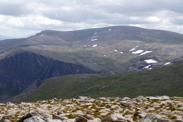
NN9472 : View to Braigh Coire Chruinn-bhalgain from Beinn a' Ghlo
Colin Park
 Photo could not load
NN9472 : Braigh Coire Chruinn-bhalgain
wfmillar
Hill facts and local notes
Classifications
Elevation
1,070m
3,510 ft
Prominence
222m
Coordinates
56.8311, -3.7295
NN945724
OS Map
43
Explorer: OL51E 394E
At the Summit
The summit is marked by a large stone cairn, ideal for those who enjoy channeling their inner mountain goat while celebrating at the peak.
Terrain & Geology
The mountain is primarily composed of ancient metamorphic rocks, notably schist, which give rise to its rugged disposition. You might say the rocks are almost as old as your last hike!
Views & Scenery
From the summit, you can see the expansive views of the Cairngorms, Strathardle, and the ever-mighty Ben Lawers. Bring your binoculars to spot distant landmarks!
History & Heritage
Name Origin
Beinn a' Ghlo translates to 'mountain of the hill', capturing its towering presence amidst the landscape.
Historical Significance
This mountain has been a favourite among hikers and climbers for generations, representing both physical challenge and natural beauty.
Getting There & Facilities
Parking
There is parking available at the Dalmunzie Castle Hotel, about 6 km from the starting point of your hike. It's a lovely spot to kick off your adventure.
Public Transport
The nearest bus stop is in Blair Atholl, which services some local routes, but checking schedules in advance is wise.
Nearby Facilities
Facilities, including toilets, can be found at Dalmunzie Castle Hotel. Be sure to refuel after your hike; they may even have a cake waiting for you!
Safety Information
Known Hazards
- Beware of slippery rocks, particularly in wet conditions, and the occasional unpredictable Scottish weather – pack a little patience along with your waterproofs.
General Safety Tips
- Check weather conditions before setting out
- Carry appropriate clothing and equipment
- Let someone know your planned route
- Take a map, compass, and GPS device
- Carry emergency supplies: food, water, first aid kit, torch
Hills
Some common questions about the hills answered
Are there group walks up Beinn a' Ghlo - Braigh Coire Chruinn-bhalgain?
Many walkers use Walkmates to join or organise walks with others. You can check for group walks around Beinn a' Ghlo - Braigh Coire Chruinn-bhalgain through the maps
Are there other walkers around Beinn a' Ghlo - Braigh Coire Chruinn-bhalgain?
Activity varies by location and time, but Walkmates lets you see whether others have shared walks or shown interest in this area. Find other people through the walking friends search walking friends for Beinn a' Ghlo - Braigh Coire Chruinn-bhalgain search or of course create your own walk for Beinn a' Ghlo - Braigh Coire Chruinn-bhalgain
Can I organise a walk to Beinn a' Ghlo - Braigh Coire Chruinn-bhalgain?
Yes. If there aren’t any walks listed already, you can create a walk and make it available for others to join.
If you're signed up to Walkmates, you can create a walk to Beinn a' Ghlo - Braigh Coire Chruinn-bhalgain.
How do I find a walk up this hill?
There are often multiple ways to walk this hill, depending on experience and route preference. Walkmates helps you explore walks and routes that others have shared.
Can I suggest a new route up Beinn a' Ghlo - Braigh Coire Chruinn-bhalgain?
Yes. You can suggest or create routes to share with others. Walkmates focuses on the social side of walking, so routes are used to help people organise walks and explore areas together, rather than as detailed navigation tools or route libraries.
Other uses really appreciate knowledgeable walkers sharing their routes. Share your favourite route to Beinn a' Ghlo - Braigh Coire Chruinn-bhalgain here
The is an error or something incorrect about this hill. How do I let you know?
We always strive to keep the information on Walkmates as accurate as possible. If you find an error, please let us know through the contact form and we'll aim to correct it as quickly as possible
Community Discussion
Comments
Location
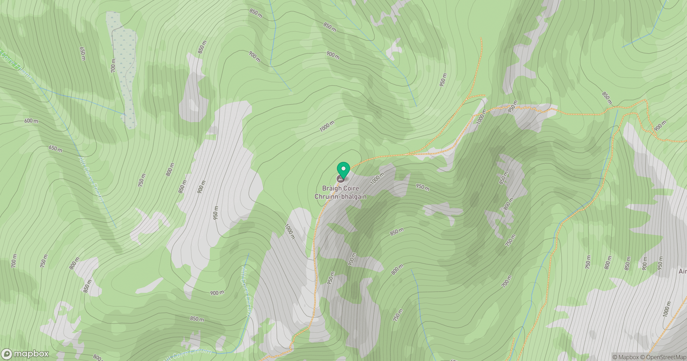
Grid reference: NN945724
View on OpenStreetMapOpens a map in a new tab, centred on the hill.
No comments yet. Be the first.