
Meall Ban
Good walks are even better shared.
Overview
Meall Ban: A Hiker's Delight
Nestled in the heart of the Scottish Highlands, Meall Ban rises to a respectable 896 meters, standing out as a welcoming wonder for anyone looking to blend adventure with stunning scenery.
Geology
Meall Ban is primarily composed of ancient schist and granite formations. The rugged terrain has been shaped over millennia by the forces of glacial movement, creating a landscape that is as beautiful as it is historic.
Routes
The most favoured route to the summit is the East Ridge Route, starting in the quaint village of Strathyre. It’s a moderate 7.5 km hike that will take you approximately 3.5 hours. As you ascend, the views only get better; remember to pace yourself and take plenty of photos, unless you enjoy struggling up the hill back down!
Summit Features
At the top, you’ll find a well-constructed stone cairn, providing a perfect windbreak for a well-deserved snack break while capturing those spectacular views.
Terrain Type
Expect a mix of rocky outcrops and grassy slopes, which can turn boggy underfoot, especially after rain. It’s advisable to wear sturdy hiking boots to avoid any unintended slips or trips.
Views
On a clear day, the views from the summit are nothing short of breathtaking. You can see distant lochs sparkling in the sun, lush glens, and hills rolling away into the horizon. The best seasons for these views are late spring and early summer when the heather is in bloom, casting a vibrant hue across the landscape.
Hazards
As with all mountainous hikes, the weather can be unpredictable. Take care of sudden mist or rain, which can limit visibility. Also, negotiating the rocky and boggy areas requires attentiveness to avoid tumbles.
Access
Parking is readily available in Strathyre, just 1.5 km from the trailhead. Using public transport is also feasible, with bus services connecting from Stirling.
Facilities
While you're at the foot of the mountain, indulge in a slice of cake at the local café or stock up on supplies from small shops in Strathyre before you start your climb. Remember, no one likes a hangry hiker!
History
The name 'Meall Ban' means 'white hill,' reflecting both the ancient snow capping it and the often undulating heather painted across its slopes.
Conclusion
Whether you're an experienced climber or a leisurely walker, Meall Ban offers something for everyone. Just lace up those hiking boots, pack your sense of adventure, and enjoy what nature has to offer. Good luck, and may your next hike be filled with good weather and great views!
Explore routes near Meall Ban
Public walks starting within 80 km of this hill. Nearby does not mean a route reaches the summit; check its map and access before setting out.
Coire Ardair lochan from Aberarder and back
View route
Kenmore: Drummond Hill Black Rock Trail above Loch Tay
View route
Killin: Falls of Dochart, Finlarig and Moirlanich Longhouse
View route
Glen Banvie Trail with the Bruar viewpoint
View route
Route planning notes
These notes describe possible approaches, not verified navigable routes or permission to cross land. Check current paths, local access rules and conditions before setting out.
East Ridge Route
A popular route starting from the small village of Strathyre, offering a steady ascent along the eastern ridge of Meall Ban, with spectacular views along the way.
Make a day of it, together
Find someone to share the walk with, or organise a day out along a route you like.
Hill facts and local notes
Classifications
Elevation
546m
1,791 ft
Prominence
105m
Coordinates
56.7285, -4.3792
NN545621
OS Map
42
Explorer: 385E
At the Summit
At the summit of Meall Ban, you'll find a small stone cairn that provides shelter from the winds and makes for a perfect photo backdrop.
Terrain & Geology
Meall Ban consists predominantly of schist and granite, typical of the Scottish Highlands, which provides a rugged and striking landscape for walkers. The rocks tell tales of geological upheaval and ancient glacial erosion.
Views & Scenery
From the summit, enjoy sweeping vistas of the surrounding glens, the distant Trossachs, and lochs glinting like jewels in the rough.
History & Heritage
Name Origin
The name 'Meall Ban' translates to 'white hill,' which is believed to refer to the often snow-capped peaks or the bright heather that adorns its slopes.
Historical Significance
Meall Ban is notable for its breathtaking natural beauty and is part of the larger protected area of the Trossachs National Park, which attracts hikers and nature lovers alike.
Getting There & Facilities
Check current local access restrictions, parking rules and transport timetables before travelling. These notes do not confirm public access to the summit.
Parking
There is parking available in Strathyre, which is about 1.5 km from the start of the East Ridge Route. Make sure to arrive early during peak times to nab a space.
Public Transport
The best way to get here by public transport is via bus services that connect to the village of Strathyre from cities such as Stirling.
Nearby Facilities
While there are no facilities on the mountain itself, Strathyre offers a few local shops, a café for a well-earned slice of cake, and toilets to refresh oneself after the hike.
Safety Information
Known Hazards
- Be wary of sudden changes in weather, including mist and rain that can reduce visibility quickly. Also, watch out for slippery rocks and bogs, which can be more treacherous than they appear.
General Safety Tips
- Check weather conditions before setting out
- Carry appropriate clothing and equipment
- Let someone know your planned route
- Take a map, compass, and GPS device
- Carry emergency supplies: food, water, first aid kit, torch
Hills
Some common questions about the hills answered
Are there group walks up Meall Ban?
Many walkers use Walkmates to join or organise walks with others. You can check for group walks around Meall Ban through the maps
Are there other walkers around Meall Ban?
Activity varies by location and time, but Walkmates lets you see whether others have shared walks or shown interest in this area. Find other people through the walking friends search walking friends for Meall Ban search or of course create your own walk for Meall Ban
Can I organise a walk to Meall Ban?
Yes. If there aren’t any walks listed already, you can create a walk and make it available for others to join.
If you're signed up to Walkmates, you can create a walk to Meall Ban.
How do I find a walk up this hill?
There are often multiple ways to walk this hill, depending on experience and route preference. Walkmates helps you explore walks and routes that others have shared.
Can I suggest a new route up Meall Ban?
Yes. You can suggest or create routes to share with others. Walkmates focuses on the social side of walking, so routes are used to help people organise walks and explore areas together, rather than as detailed navigation tools or route libraries.
Other uses really appreciate knowledgeable walkers sharing their routes. Share your favourite route to Meall Ban here
The is an error or something incorrect about this hill. How do I let you know?
We always strive to keep the information on Walkmates as accurate as possible. If you find an error, please let us know through the contact form and we'll aim to correct it as quickly as possible
Community Discussion
Comments
Location
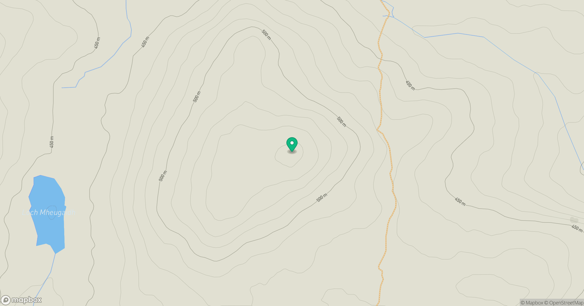
Grid reference: NN545621
View on OpenStreetMapOpens a map in a new tab, centred on the hill.
Hills within 30 km
Straight-line distance, not a walking route or confirmation of access.
No comments yet. Be the first.