
Stob Ban
Good walks are even better shared.
Overview
Stob Ban
Overview
Stob Ban stands proud at 999 meters, making it one of the celebrated Munros of the Scottish Highlands. Its stunning granite crags and rich history make it a popular passion for those in pursuit of wilderness and beauty.
Geology
The mountain is primarily made up of granite, formed during the intense geological processes that shaped the Highlands. This brings a scenic ruggedness to the landscape, attracting climbers and nature enthusiasts alike. It's no wonder that the rocks here are the envy of lesser hills.
Routes
Eastern Route from Loch Leven
Starting at the serene Loch Leven, this moderate trek offers breathtaking views as you wind your way up. The picturesque loch and the fresh Highland air will make you feel alive.
Western Approach from Glen Nevis
If you’re looking for something a bit more challenging, look no further! This approach is steeper but absolutely rewarding. Definitely bring your sturdy boots!
Summit Features
Reaching the summit, hikers are greeted by a tall cairn that not only serves as a marker but also as a fantastic viewpoint. On a clear day, the vistas you can behold are incredible, including the majestic Ben Nevis!
Terrain Type
Expect a blend of rocky outcrops, grassy patches, and a bit of bog here and there. Just a reminder: waterproof footwear could be your best friend after a rainy spell.
Views
From the top, the highlight views include the expansive sights of Ben Nevis and the Mamores. The best time to enjoy this outdoorsy feast for the eyes is between late spring and early autumn – when the sun shines its brightest, and the air is crisp!
Hazards
While Stob Ban offers spectacular scenery, don't dawdle around too carelessly! Watch out for loose rocks and be prepared in case fog rolls in. A map and compass are worth their weight in gold!
Nearby Summits
Don’t miss the chance to also explore nearby gems like Stob Coire a' Chairn and Sgurr a' Mhaim for an extended adventure.
Access
Finding your way to Stob Ban is quite straightforward. Nearest parking can be found at Loch Leven, with Fort William just a stone's throw away offering amenities like cafes and shops.
Facilities
In Fort William, you’ll find everything from cozy cafes to modern toilets, ensuring you’re well prepared before your hike.
History
The mountain gets its name, Stob Ban, from the Gaelic term for 'White Peak'. With its snowy crown in winter, it’s a fitting name. With rich tales of Highland folklore behind it, who knows what stories these stones could tell?
Happy hiking!
Explore routes near Stob Ban
Walks starting near this hill. Open a route to check its map, distance and full itinerary.
Ben Nevis via Mountain Path
View route
Banavie to Glen Loy Aqueduct: Neptune’s Staircase Canal Towpath
View route
Fort Augustus to Kytra Lock: Caledonian Canal Towpath
View route
Killin: Falls of Dochart, Finlarig and Moirlanich Longhouse
View route
Route planning notes
These notes describe possible approaches. Check a route's map and access information when planning your walk.
Classic Stob Ban via Coire a' Mhusgain
This route begins at the car park in Glen Nevis (Grid Ref NN122730) and follows the well-defined path through Coire a' Mhusgain. The trail climbs steadily, offering stunning views of the Mamores range before reaching the summit of Stob Ban. Descend via the same route.
Stob Ban and Mullach nan Coirean Circuit
A popular circular route starting at the same Glen Nevis car park. Ascend Stob Ban via Coire a' Mhusgain, then continue along the ridge to Mullach nan Coirean. The descent follows a path along the Allt Coire a' Mhusgain, completing the circuit back to the start point.
Stob Ban via the West Ridge
Starting from the Achriabhach car park (Grid Ref NN145681), this route takes a more dramatic ascent via the West Ridge. The route is steep and involves some scrambling, but rewards walkers with incredible views over Glen Nevis and beyond. Descend via Coire a' Mhusgain.
Stob Ban from Kinlochleven
An alternative approach, this route begins at Kinlochleven and follows a path through the forest before ascending the northern flanks of Stob Ban. This lesser-used route provides a quieter day out while still offering fantastic views.
Stob Ban and the Ring of Steall
For experienced hillwalkers, this demanding route includes Stob Ban as part of the famous Ring of Steall, a classic ridge walk in the Mamores. Starting from the car park at the Lower Falls in Glen Nevis, the route includes multiple Munros and ridge sections before descending via Coire a' Mhusgain.
Make a day of it, together
Find someone to share the walk with, or organise a day out along a route you like.
Hill facts and local notes
Classifications
Elevation
977m
3,205 ft
Prominence
174m
Coordinates
56.8107, -4.8409
NN266723
OS Map
41
Explorer: 392
At the Summit
The summit is adorned with a substantial cairn offering panoramic views. On clear days, you can even spot the mighty Ben Nevis in the distance, proudly flexing its muscles.
Terrain & Geology
Stob Ban is predominantly composed of granite, which creates a rugged landscape. This resilient rock contributes to the impressive crags and screes that beckon adventurous hikers.
Views & Scenery
You can enjoy views of Ben Nevis, Loch Leven, and the surrounding peaks of the Mamores, making a fine setting for those 'look-at-me-I'm-hiking' selfies.
History & Heritage
Name Origin
The name Stob Ban translates to 'White Peak' in Gaelic, likely referring to the snow-capped summit often seen in winter.
Historical Significance
Stob Ban holds historical significance due to its role in Scottish folklore, where it has been a silent witness to many tales of adventure and intrigue throughout the ages.
Getting There & Facilities
Parking
The main parking area is at the west end of Loch Leven, which accommodates a good number of vehicles, though it can fill up quickly during peak season.
Public Transport
While public transport options are limited, buses from Fort William head towards Kinlochleven, which is the nearest village. You may need to hitch a ride to the starting point.
Nearby Facilities
In Fort William, you’ll find cafes, pubs, and toilets. Don't forget to stop for a hearty breakfast, as you’ll need the fuel!
Safety Information
Known Hazards
- Loose rocks can be treacherous, especially on ascent or descent. Watch your footing! Fog can roll in quickly, so it’s wise to have a map and compass handy.
General Safety Tips
- Check weather conditions before setting out
- Carry appropriate clothing and equipment
- Let someone know your planned route
- Take a map, compass, and GPS device
- Carry emergency supplies: food, water, first aid kit, torch
Hills
Some common questions about the hills answered
Are there group walks up Stob Ban?
Many walkers use Walkmates to join or organise walks with others. You can check for group walks around Stob Ban through the maps
Are there other walkers around Stob Ban?
Activity varies by location and time, but Walkmates lets you see whether others have shared walks or shown interest in this area. Find other people through the walking friends search walking friends for Stob Ban search or of course create your own walk for Stob Ban
Can I organise a walk to Stob Ban?
Yes. If there aren’t any walks listed already, you can create a walk and make it available for others to join.
If you're signed up to Walkmates, you can create a walk to Stob Ban.
How do I find a walk up this hill?
There are often multiple ways to walk this hill, depending on experience and route preference. Walkmates helps you explore walks and routes that others have shared.
Can I suggest a new route up Stob Ban?
Yes. You can suggest or create routes to share with others. Walkmates focuses on the social side of walking, so routes are used to help people organise walks and explore areas together, rather than as detailed navigation tools or route libraries.
Other uses really appreciate knowledgeable walkers sharing their routes. Share your favourite route to Stob Ban here
The is an error or something incorrect about this hill. How do I let you know?
We always strive to keep the information on Walkmates as accurate as possible. If you find an error, please let us know through the contact form and we'll aim to correct it as quickly as possible
Community Discussion
Comments
Location
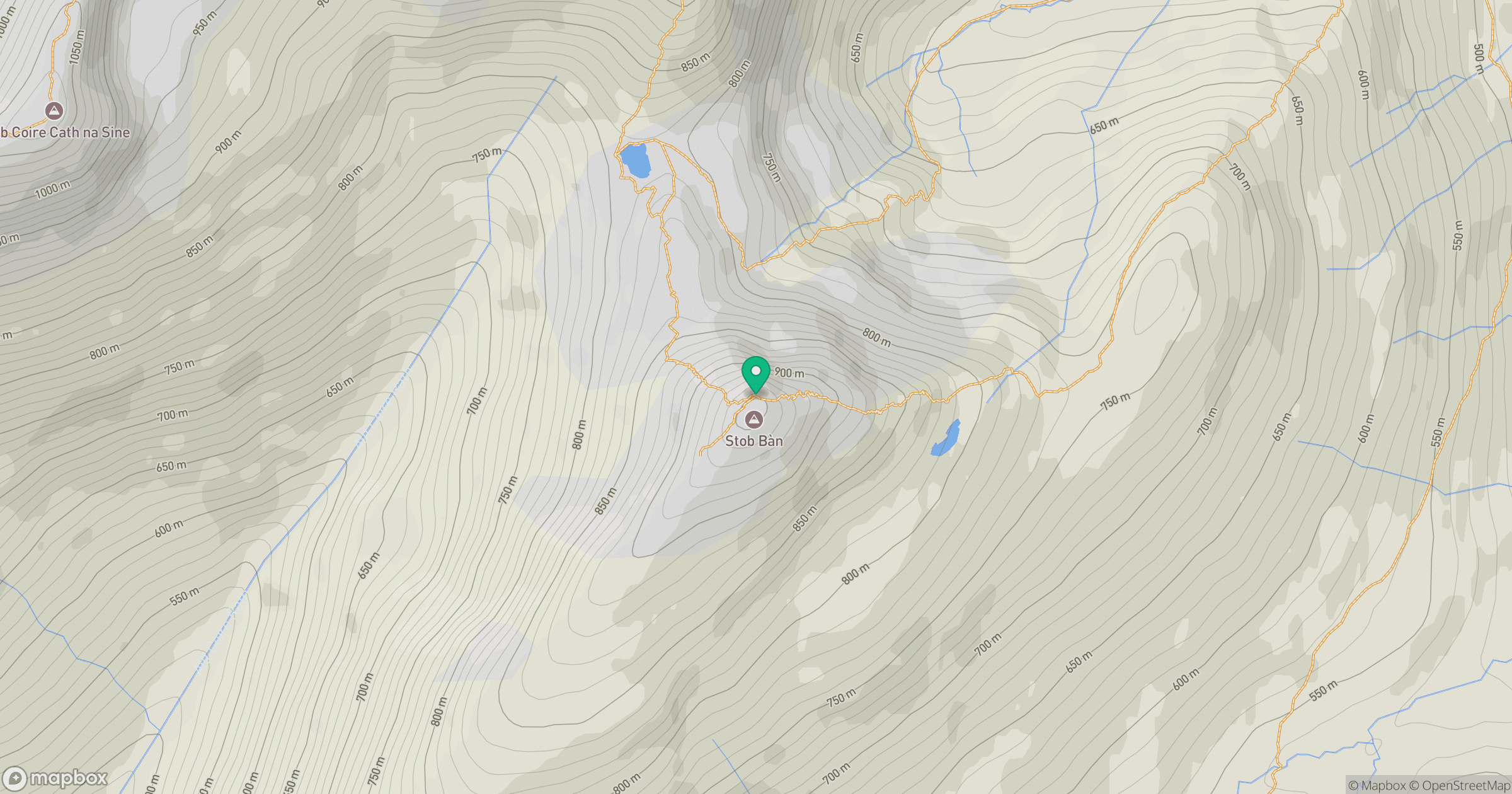
Grid reference: NN266723
View on OpenStreetMapOpens a map in a new tab, centred on the hill.
No comments yet. Be the first.