
Glas Mheall Mor
Good walks are even better shared.
Overview
Glas Mheall Mor
Introduction
Glas Mheall Mor, standing proudly at 1,032 meters, is a spectacular Munro that commands attention in the Scottish Highlands. Nestled in a rugged landscape filled with dramatic peaks and serene lochs, this mountain rewards hikers with breathtaking views and a sense of achievement.
Geology
As you ascend Glas Mheall Mor, take a moment to appreciate its fascinating geology. Composed mainly of schist and granite, the mountain's terrain was sculpted by ancient glaciers, leaving behind rocky outcrops and lush valleys. The unique geological composition not only adds to its beauty but also provides a rich habitat for various flora and fauna.
Routes
Several routes lead to the summit, with the West Glen More Route being a popular choice. Spanning approximately 13.5 km, this path allows for a gradual ascent alongside beautiful scenery. Alternatively, the East Glen More Path offers a more direct but challenging trek at 11 km, perfect for those wanting to get their heart racing.
Summit Features
Upon reaching the summit, you’ll find a rugged rocky outcrop and a small cairn celebrating your accomplishment. It's a fantastic spot to catch your breath and take in the panoramic views that make every step worthwhile.
Terrain
Expect a mix of rocky and grassy sections, interspersed with boggy patches that may test your footing. Essential hiking boots are highly recommended, especially when the weather makes the ground a bit squelchy.
Views
The views from Glas Mheall Mor are simply spectacular. On a clear day, you can relish sights of the majestic Loch Awe to the south and the rolling peaks of the Grampians. The changing light, particularly during sunrise and sunset, creates a picturesque landscape worth every moment spent on the trail.
Hazards
As with many Highland hikes, please take care when navigating rocky terrain and be mindful of unpredictable weather changes. Those pesky midges can also make an appearance during summer – consider bringing insect repellent for peace of mind!
Nearby Summits
Nearby peaks such as Meall Glas and Creag Dhu are excellent for those wanting to extend their adventure. Each offers unique features and stunning perspectives of the region.
Access
Reaching Glas Mheall Mor is straightforward, with a small parking area conveniently located at NN563673. The nearest town, Tyndrum, is filled with friendly locals and several cafes where you can fuel up before setting off.
Facilities
Tyndrum has everything you need post-hike, including cafes for warming up with a hot drink and public toilets to ensure you're comfortable before heading back home.
History
The name Glas Mheall Mor translates to 'Big Green Hill' – a fitting description for the lush slopes that lead up to it. Embracing its status as a Munro, it's steeped in outdoor culture and is part of the broader tapestry of the Scottish Highlands, an area rich in history and natural beauty.
A trek up Glas Mheall Mor is a delightful adventure, offering both challenge and reward in the splendid embrace of the Highlands. So lace up those boots and set off for a day to remember! Happy hiking!
Explore routes near Glas Mheall Mor
Public walks starting within 80 km of this hill. Nearby does not mean a route reaches the summit; check its map and access before setting out.
Coire Ardair lochan from Aberarder and back
View route
Kenmore: Drummond Hill Black Rock Trail above Loch Tay
View route
Glen Banvie Trail with the Bruar viewpoint
View route
Killin: Falls of Dochart, Finlarig and Moirlanich Longhouse
View route
Route planning notes
These notes describe possible approaches, not verified navigable routes or permission to cross land. Check current paths, local access rules and conditions before setting out.
West Glen More Route
A scenic approach from the west, offering gradual ascent along tracks with occasional steep sections.
East Glen More Path
A more direct route utilising clear paths and tracks leading to the summit, perfect for those looking for a faster ascent.
Make a day of it, together
Find someone to share the walk with, or organise a day out along a route you like.
Hill facts and local notes
Classifications
Elevation
829m
2,721 ft
Prominence
147m
Coordinates
56.7751, -4.3526
NN563673
OS Map
42
Explorer: 385E
At the Summit
The summit is marked by a prominent rocky outcrop and features a small cairn, ideal for triumphant photo opportunities.
Terrain & Geology
Glas Mheall Mor is primarily composed of schist and granite, creating a rugged landscape that has been shaped by glacial activity over millennia. This geological history adds to the mountain's dramatic profile.
Views & Scenery
On a clear day, one can see Loch Awe to the south, the peaks of the surrounding Grampians, and stunning glens flooded with the golden light of sunset.
History & Heritage
Name Origin
The name 'Glas Mheall Mor' translates to 'Big Green Hill' from Scots Gaelic, an apt description considering its lush slopes.
Historical Significance
As a Munro, it draws many hikers and climbers, adding to its cultural importance in Scottish outdoor activities.
Getting There & Facilities
Check current local access restrictions, parking rules and transport timetables before travelling. These notes do not confirm public access to the summit.
Parking
There is a small parking area at NN563673, providing a convenient starting point for either of the routes.
Public Transport
The nearest bus service runs from Tyndrum to Inverawe, but it's recommended to have a car for easier access.
Nearby Facilities
Tyndrum has several cafes and shops for re-fuelling before or after your hike, as well as public toilets.
Safety Information
Known Hazards
- Be cautious of rocky terrain and potential for sudden weather changes in the Highlands; also watch out for the occasional grouse who may think it owns the path.
General Safety Tips
- Check weather conditions before setting out
- Carry appropriate clothing and equipment
- Let someone know your planned route
- Take a map, compass, and GPS device
- Carry emergency supplies: food, water, first aid kit, torch
Hills
Some common questions about the hills answered
Are there group walks up Glas Mheall Mor?
Many walkers use Walkmates to join or organise walks with others. You can check for group walks around Glas Mheall Mor through the maps
Are there other walkers around Glas Mheall Mor?
Activity varies by location and time, but Walkmates lets you see whether others have shared walks or shown interest in this area. Find other people through the walking friends search walking friends for Glas Mheall Mor search or of course create your own walk for Glas Mheall Mor
Can I organise a walk to Glas Mheall Mor?
Yes. If there aren’t any walks listed already, you can create a walk and make it available for others to join.
If you're signed up to Walkmates, you can create a walk to Glas Mheall Mor.
How do I find a walk up this hill?
There are often multiple ways to walk this hill, depending on experience and route preference. Walkmates helps you explore walks and routes that others have shared.
Can I suggest a new route up Glas Mheall Mor?
Yes. You can suggest or create routes to share with others. Walkmates focuses on the social side of walking, so routes are used to help people organise walks and explore areas together, rather than as detailed navigation tools or route libraries.
Other uses really appreciate knowledgeable walkers sharing their routes. Share your favourite route to Glas Mheall Mor here
The is an error or something incorrect about this hill. How do I let you know?
We always strive to keep the information on Walkmates as accurate as possible. If you find an error, please let us know through the contact form and we'll aim to correct it as quickly as possible
Community Discussion
Comments
Location
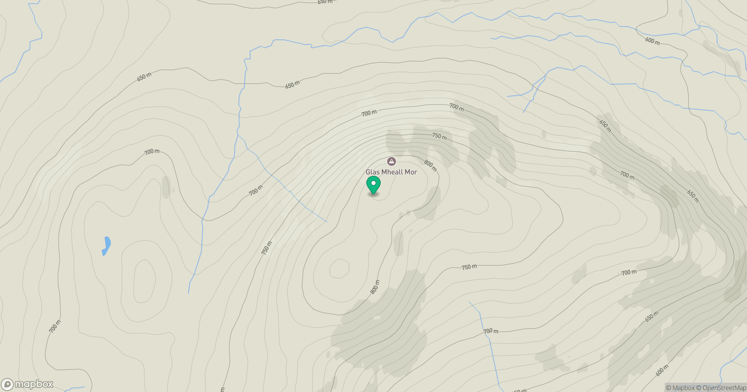
Grid reference: NN563673
View on OpenStreetMapOpens a map in a new tab, centred on the hill.
Hills within 30 km
Straight-line distance, not a walking route or confirmation of access.
No comments yet. Be the first.