

Maol Chean-dearg
Good walks are even better shared.
NG9249 : Down from the summit of Maol Chean-dearg
Penny Goodman Photo source
Overview
Maol Chean-dearg: A Munro with Character
Nestled in the stunning Scottish Highlands, Maol Chean-dearg rises proudly with an elevation of 922 meters, making it a prominent Munro that won't shy away from a challenge. Known for its rugged terrain and spectacular views, this mountain is a favourite among seasoned hikers and aspiring adventurers alike.
Geology
Maol Chean-dearg is primarily composed of Lewisian gneiss, one of the oldest rock formations in the UK. The twisted and rugged nature of this ancient rock tells stories of the Earth's tumultuous past and gives the summit its distinct character.
Routes
The most popular route is the North-West Ridge, which spans approximately 8.5 km and typically takes around 4.5 hours to complete. Be prepared for some steep sections that will make you question your life choices, but rest assured, the views will be worth every puff and pant!
Summit Features
Reaching the summit reveals a large cairn—a timeless monument to all who have made the climb. The 360-degree views showcase the breathtaking landscapes of the Scottish Highlands, rewarding your efforts with sights that seem to stretch into forever.
Terrain Type
Expect rocky trails with plenty of boulders to navigate. Bring your best hiking boots and an adventurous spirit!
Views
From the summit, awe-inspiring views of the Red Cuillin and the Isle of Skye await. On clear days, the Outer Hebrides tease their distant presence, and every glance around reveals another stunning vista. Spring and Autumn are particularly rewarding seasons for views, although summer’s longer daylight hours can’t be beaten.
Hazards
As any seasoned hiker knows, the weather in these parts can shift faster than a Highland coo can chew its cud. Rockfalls are a risk on steeper sections, and planning is essential to ensure a safe and enjoyable experience. Be prepared!
Access
Access to Maol Chean-dearg is relatively straightforward, with the nearest car park situated in Kinloch. For those using public transport, the bus services from Inverness are reliable, ensuring you can get close enough without needing to hike too far before the hike.
Facilities
While Kinloch has limited facilities, you’ll find a few lovely cafes and a public toilet to take care of business before you conquer the Munro.
History
The name Maol Chean-dearg translates to 'Bald Red Head', likely a nod to its rocky summit or the distinctive heather blooms that add a pop of colour to the landscape. The mountain holds a place in local legends and continues to fascinate those who explore its heights.
In conclusion, whether you're driven by thirst for adventure or a hunger for spectacular scenery, Maol Chean-dearg offers a nugget of the Scottish Highlands that won’t disappoint. Lace up those hiking boots, pack a decent snack, and prepare to be enchanted!
Explore routes near Maol Chean-dearg
Walks starting near this hill. Open a route to check its map, distance and full itinerary.
Beinn Eighe Lancaster Wreckage at Coire Mhic Fhearchair
View route
Fairy Lochs Liberator Wreckage Circuit
View route
Glen Affric: Coire Loch Woodland Trail
View route
Fort Augustus to Kytra Lock: Caledonian Canal Towpath
View route
Route planning notes
These notes describe possible approaches. Check a route's map and access information when planning your walk.
North-West Ridge
This route takes you steeply up the north-west ridge, offering stunning views and a bit of a workout.
Make a day of it, together
Find someone to share the walk with, or organise a day out along a route you like.
Photo Gallery
View all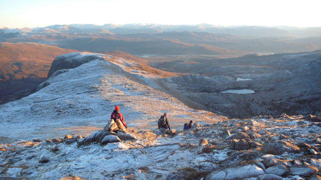 Photo could not load
NG9249 : Down from the summit of Maol Chean-dearg
Penny Goodman
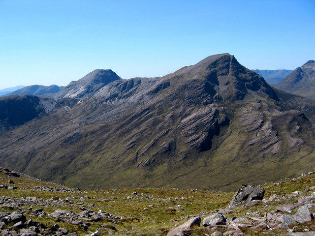 Photo could not load
NG9249 : Maol Chean-dearg from Sgorr Ruadh
Dave Croker
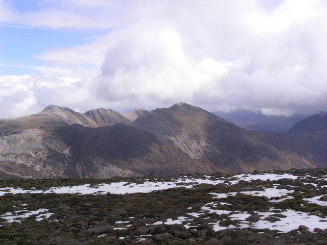 Photo could not load
NG9249 : Summit of Maol Chean-dearg
Russel Wills
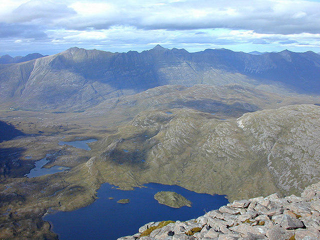 Photo could not load
NG9249 : North from Maol Chean-dearg
Nigel Brown
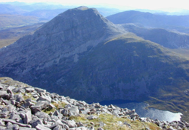 Photo could not load
NG9249 : South from Maol Chean-dearg
Nigel Brown
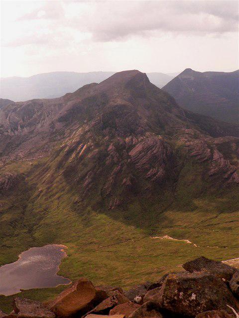 Photo could not load
NG9249 : Maol Chean-dearg from Sgorr Ruadh
AlastairG
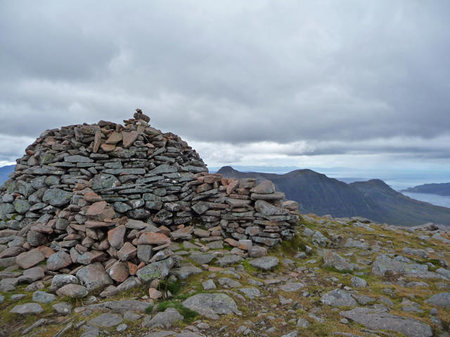 Photo could not load
NG9249 : Summit of Maol Chean-dearg
John Allan
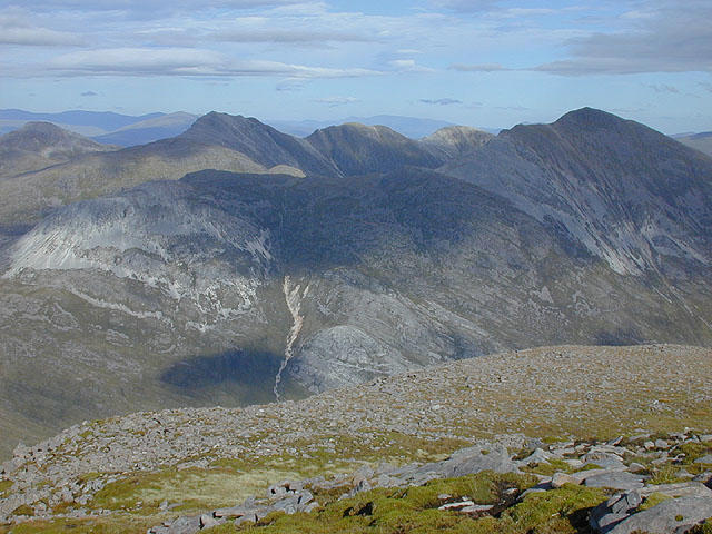 Photo could not load
NG9249 : East northeast from Maol Chean-dearg
Nigel Brown
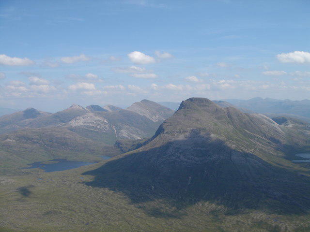 Photo could not load
NG9249 : Maol Chean-Dearg from Beinn Damh
david glass
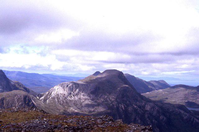
NG9249 : View to Maol Chean-dearg from Fuar Tholl
Colin Park
Hill facts and local notes
Classifications
Elevation
933m
3,061 ft
Prominence
514m
Coordinates
57.4917, -5.4656
NG924499
OS Map
25
Explorer: 429
At the Summit
The summit features a large cairn, adorned with the offerings of many a bagpiper's tune, and exceptional views across the northern Highlands.
Terrain & Geology
The mountain is primarily composed of Lewisian gneiss, one of the oldest rocks in the UK, giving it a rugged texture that has definitely seen a few quarrels with Mother Nature over the aeons.
Views & Scenery
At the summit, admire views of the Red Cuillin, the Isle of Skye, and on clear days, even as far as the Outer Hebrides.
History & Heritage
Name Origin
The name Maol Chean-dearg roughly translates to 'Bald Red Head', possibly due to its rocky summit resembling a shiny head or due to the heather flowers in bloom.
Historical Significance
Part of the local mythology, the mountain is often mentioned in tales of the area, adding to its allure for adventurers.
Getting There & Facilities
Parking
There is a car park at the base of the trail near the hamlet of Kinloch, but be quick, as it fills up faster than a kettle on a stove!
Public Transport
Regular bus services run from Inverness to nearby towns, and a little planning can get you quite close to the starting point.
Nearby Facilities
Limited facilities exist in Kinloch, with a few eateries and a public toilet, perfect for a pre-hike pit-stop!
Safety Information
Known Hazards
- Rockfall is a possibility on the steeper sections, and sudden weather changes can transform a sunny outing into a soggy affair—so pack accordingly!
General Safety Tips
- Check weather conditions before setting out
- Carry appropriate clothing and equipment
- Let someone know your planned route
- Take a map, compass, and GPS device
- Carry emergency supplies: food, water, first aid kit, torch
Hills
Some common questions about the hills answered
Are there group walks up Maol Chean-dearg?
Many walkers use Walkmates to join or organise walks with others. You can check for group walks around Maol Chean-dearg through the maps
Are there other walkers around Maol Chean-dearg?
Activity varies by location and time, but Walkmates lets you see whether others have shared walks or shown interest in this area. Find other people through the walking friends search walking friends for Maol Chean-dearg search or of course create your own walk for Maol Chean-dearg
Can I organise a walk to Maol Chean-dearg?
Yes. If there aren’t any walks listed already, you can create a walk and make it available for others to join.
If you're signed up to Walkmates, you can create a walk to Maol Chean-dearg.
How do I find a walk up this hill?
There are often multiple ways to walk this hill, depending on experience and route preference. Walkmates helps you explore walks and routes that others have shared.
Can I suggest a new route up Maol Chean-dearg?
Yes. You can suggest or create routes to share with others. Walkmates focuses on the social side of walking, so routes are used to help people organise walks and explore areas together, rather than as detailed navigation tools or route libraries.
Other uses really appreciate knowledgeable walkers sharing their routes. Share your favourite route to Maol Chean-dearg here
The is an error or something incorrect about this hill. How do I let you know?
We always strive to keep the information on Walkmates as accurate as possible. If you find an error, please let us know through the contact form and we'll aim to correct it as quickly as possible
Community Discussion
Comments
Location
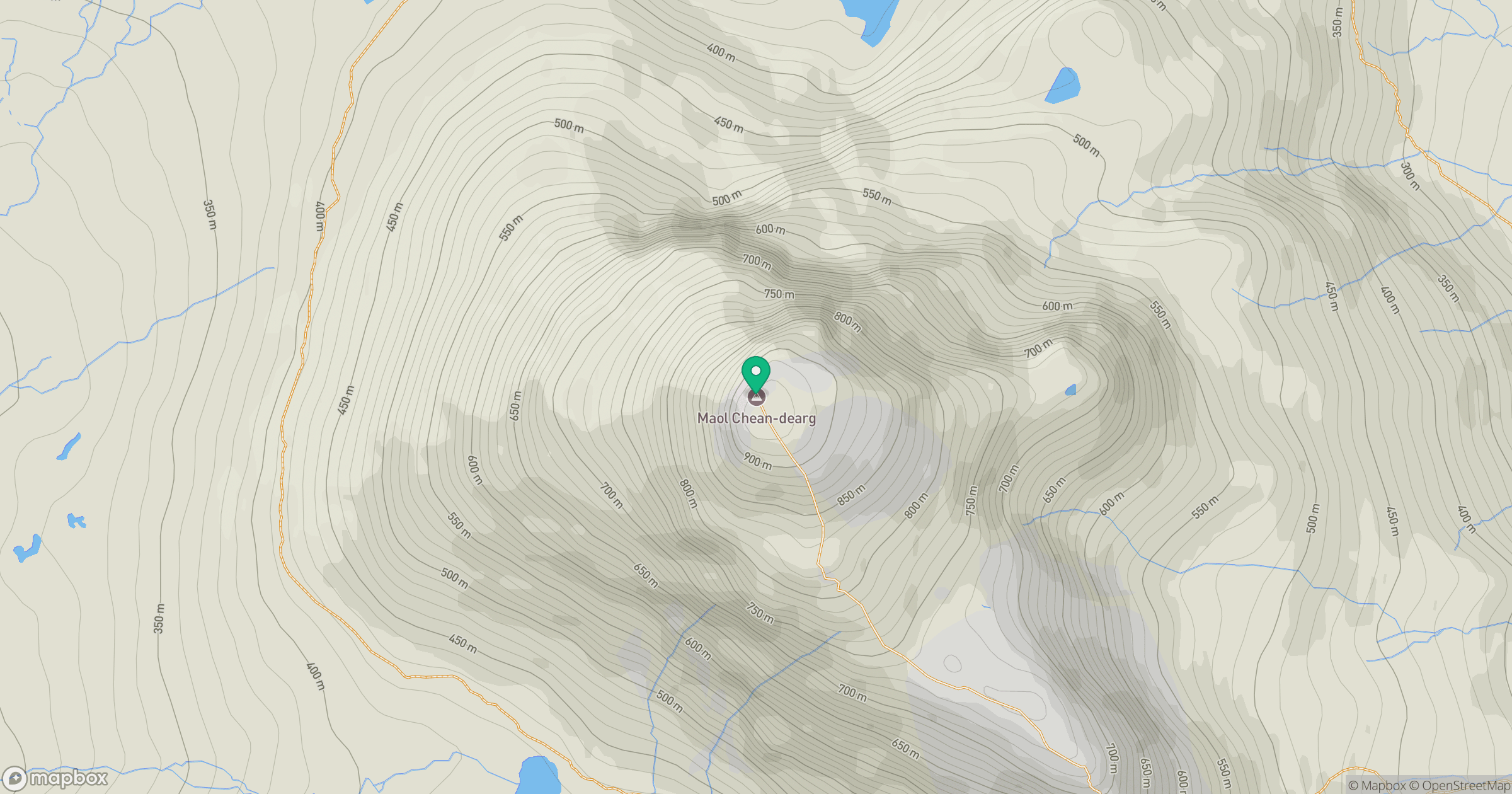
Grid reference: NG924499
View on OpenStreetMapOpens a map in a new tab, centred on the hill.
No comments yet. Be the first.