

Lotus Hill
Good walks are even better shared.
Overview
Lotus Hill: A Hidden Gem for Hikers
Nestled in the scenic North Pennines, Lotus Hill stands at 408 meters. Whether you're an avid hill walker or a casual stroller, a trek to its summit promises splendid views and a chance to experience the joys of the great outdoors.
Geology
The hill is primarily made up of Carboniferous limestone, giving it a unique presence in the landscape. This geological formation hosts various flora and fauna, appealing to botany enthusiasts and nature lovers alike. Just watch your step—those rocks can be slipperier than a politician's promise!
The Route
The most popular route begins at the nature reserve, winding through lush, vibrant woodlands teeming with wildlife. As you ascend, be prepared for a few steeper stretches (a gentle reminder that you might have underestimated that post-hike pastry treat). This moderate route spans 5.1 km and typically takes around 2.5 hours.
Summit Features
Upon reaching the top, hikers are greeted by a well-built stone cairn—perfect for your summit selfies. The panoramic views are nothing short of breathtaking, allowing you to see the rolling hills of the North Pennines unfold beneath you.
Terrain & Hazards
The terrain is primarily grassy with some rocky outcrops, ensuring a variety of ground cover. Always be cautious after rain; those rocks can turn into colourful slip-and-slide challenges. Visibility can also be a challenge in fog, so keep an eye on the weather!
Nearby Summits
If you're keen to extend your adventure, nearby summits include Cross Fell at a towering 893 meters and Cairn Hill at 601 meters.
Access & Facilities
Getting to Lotus Hill is straightforward, with a small car park at the nature reserve accommodating about ten vehicles. For those relying on public transport, buses from Penrith can get you within striking distance. Restroom facilities and a welcoming café can be found in nearby Alston, ideal for catching your breath and sipping a refreshment after your hike.
A Bit of History
The etymology of "Lotus" may not bring to mind a dream-like oasis; rather, it likely refers to plant life once found in abundance. Historically, this area has been a significant drovers’ route, witnessing countless journeys brimming with sheep and stories.
So, lace up those boots, grab your walking poles, and head out to Lotus Hill. Just remember, it’s all about the journey, not just the summit—though we won't blame you for wanting that perfect Instagram shot at the top!
Happy Hiking!
Explore routes near Lotus Hill
Public walks starting within 80 km of this hill. Nearby does not mean a route reaches the summit; check its map and access before setting out.
Mabie Forest Dalshinnie Glen and Loch
View route
Dalbeattie Forest Plantain Loch Trail
View route
Castle Douglas Carlingwark Loch and Lover’s Walk Circuit
View route
Doach Wood Douglas Trail and Solway Viewpoint
View route
Route planning notes
These notes describe possible approaches, not verified navigable routes or permission to cross land. Check current paths, local access rules and conditions before setting out.
From the Nature Reserve
Starting at the nearby nature reserve, this route takes you through lush woodland before revealing stunning views as you ascend.
Make a day of it, together
Find someone to share the walk with, or organise a day out along a route you like.
Photo Gallery
View all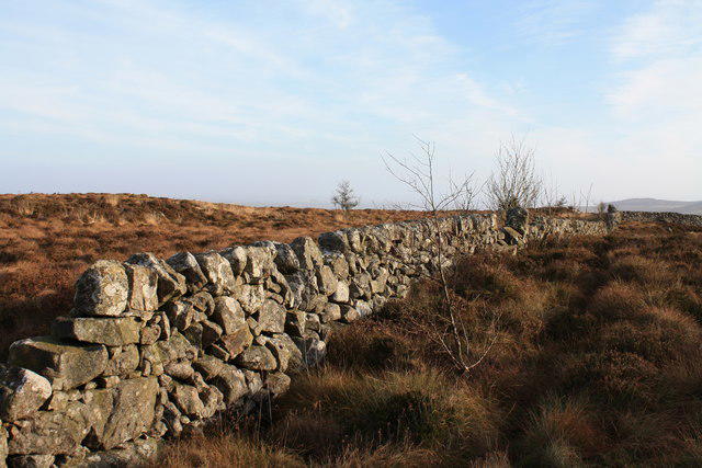 Photo could not load
NX9067 : Dyke on Lotus Hill
Colin Kinnear
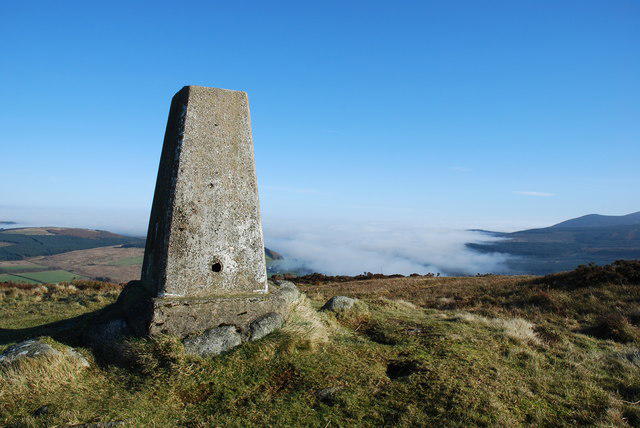 Photo could not load
NX9067 : Lotus Hill
Debbie Turner
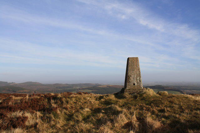 Photo could not load
NX9067 : Summit of Lotus Hill
Colin Kinnear
Hill facts and local notes
Classifications
Elevation
321m
1,053 ft
Prominence
108m
Coordinates
54.9895, -3.7177
NX901674
OS Map
84
Explorer: 313
At the Summit
The summit features a charming stone cairn, which can easily be confused with an oversized mushrooms—only one is edible.
Terrain & Geology
The hill is primarily composed of Carboniferous limestone, which is interesting as it provides a unique habitat for various flora and fauna. The exposed rock can be a delight for geology buffs, though climbing on it without due care can feel like playing hopscotch on a game of chess.
Views & Scenery
From the summit, you can gaze upon the rolling hills of the North Pennines, and on a clear day, you may even spot County Durham and beyond.
History & Heritage
Name Origin
The name 'Lotus' may evoke images of serenity, though it likely derives from 'lotus' plants once thought to be present in the area—no actual lotuses in sight!
Historical Significance
Historically, this area has been a vital route for drovers moving livestock to market, and it has seen generations of foot traffic.
Getting There & Facilities
Check current local access restrictions, parking rules and transport timetables before travelling. These notes do not confirm public access to the summit.
Parking
There is a small car park at the entrance to the nature reserve, suitable for around 10 vehicles.
Public Transport
Buses from Penrith service the area, but having your own transport is recommended for convenience.
Nearby Facilities
The nearest facilities, including restrooms and a café, can be found in Alston. Perfect for a cup of tea to recover from your hike!
Safety Information
Known Hazards
- Possible slippery rocks, particularly after rain; visibility can be poor in misty conditions.
General Safety Tips
- Check weather conditions before setting out
- Carry appropriate clothing and equipment
- Let someone know your planned route
- Take a map, compass, and GPS device
- Carry emergency supplies: food, water, first aid kit, torch
Hills
Some common questions about the hills answered
Are there group walks up Lotus Hill?
Many walkers use Walkmates to join or organise walks with others. You can check for group walks around Lotus Hill through the maps
Are there other walkers around Lotus Hill?
Activity varies by location and time, but Walkmates lets you see whether others have shared walks or shown interest in this area. Find other people through the walking friends search walking friends for Lotus Hill search or of course create your own walk for Lotus Hill
Can I organise a walk to Lotus Hill?
Yes. If there aren’t any walks listed already, you can create a walk and make it available for others to join.
If you're signed up to Walkmates, you can create a walk to Lotus Hill.
How do I find a walk up this hill?
There are often multiple ways to walk this hill, depending on experience and route preference. Walkmates helps you explore walks and routes that others have shared.
Can I suggest a new route up Lotus Hill?
Yes. You can suggest or create routes to share with others. Walkmates focuses on the social side of walking, so routes are used to help people organise walks and explore areas together, rather than as detailed navigation tools or route libraries.
Other uses really appreciate knowledgeable walkers sharing their routes. Share your favourite route to Lotus Hill here
The is an error or something incorrect about this hill. How do I let you know?
We always strive to keep the information on Walkmates as accurate as possible. If you find an error, please let us know through the contact form and we'll aim to correct it as quickly as possible
Community Discussion
Comments
Location
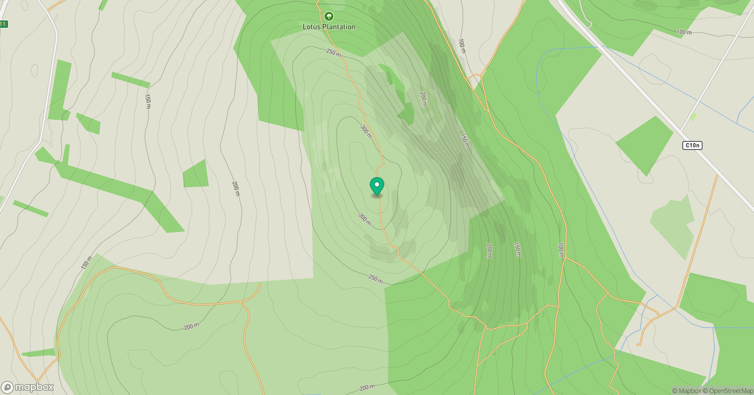
Grid reference: NX901674
View on OpenStreetMapOpens a map in a new tab, centred on the hill.
Hills within 30 km
Straight-line distance, not a walking route or confirmation of access.
No comments yet. Be the first.