

Tod Fell
Good walks are even better shared.
Overview
Tod Fell
Overview
Tod Fell, with its charming stature and enchanting views, stands tall at 474 meters in the heart of the Lake District. A Marilyn in classification, this hill offers a delightful escape for both seasoned hikers and casual walkers alike.
Geology
This summit showcases the unique Skiddaw slate, which can be spotted not just by its dark hue but also by its layered appearance. The volcanic rock outcrops can add a touch of drama to the landscape, making it an excellent spot for both geology enthusiasts and casual explorers.
Routes
One of the most popular routes begins from the A685. It's a moderate trek of about 3.5 km that rewards you with stunning views as you navigate the grassy slopes. Make sure to take a moment to pause and catch your breath while filling your lungs with fresh, crisp air! Expect a round trip of about 1.5 hours; just enough time to work off that hearty breakfast.
Summit Features
Upon reaching the summit, you'll find a traditional stone cairn. It's a testament to the countless walkers who have made the trek before you and, of course, a perfect photo opportunity. Don't forget to celebrate your achievement with a snack – you've earned it!
Terrain
Expect grassy slopes interspersed with rocky outcrops as you near the summit. Good footwear is essential, as those rocks can be a bit tricky when you're trekking down.
Views
The panoramic views from the summit are simply breathtaking. On a clear day, you can spot the Howgill Fells and the stunning Yorkshire Dales. If the weather is just right, even the distant Pennines make an appearance to charm your socks off!
Hazards
Always be on your toes; the weather can be as fickle as a cat in a room full of rockers. Sudden changes can occur, so keep an eye on the sky. Additionally, be careful on the rocky sections, especially when descending after a tiring climb!
Nearby Summits
For those looking to extend their adventure, consider heading towards Nine Standards Rigg or Barbon Fell which are both within a reasonable distance.
Access
Parking is available along the A685. Just be sure to respect the roadside and not take up more space than you need. If you’re hopping on the bus, Kirkby Stephen has service routes that can get you within 5 miles of Tod Fell.
Facilities
Once you've conquered the fell, make your way back to Kirkby Stephen where you can indulge in some local cuisine. Cafes and pubs await, offering a warm meal and perhaps a well-deserved pint of ale. You’ll find toilets at the village square to freshen up before heading home.
History
The name 'Tod' is a nod to the Old Norse word for 'fox'. A fitting name, considering the wildlife that resides in the area! Since its exploration, Tod Fell has become a cherished escape for hikers looking to enjoy the natural splendour of the Lake District.
In conclusion, Tod Fell is the perfect blend of challenge and beauty, making it an ideal destination for a day's excursion or a part of a longer hiking journey. Grab your boots and hit the trail!
Explore routes near Tod Fell
Public walks starting within 80 km of this hill. Nearby does not mean a route reaches the summit; check its map and access before setting out.
Doach Wood Douglas Trail and Solway Viewpoint
View route
Castle Douglas Carlingwark Loch and Lover’s Walk Circuit
View route
Dalbeattie Forest Plantain Loch Trail
View route
Threave Nature Reserve River Dee Circuit
View route
Route planning notes
These notes describe possible approaches, not verified navigable routes or permission to cross land. Check current paths, local access rules and conditions before setting out.
Tod Fell from the A685
A straightforward ascent from the roadside offering beautiful views as you trek upwards.
Make a day of it, together
Find someone to share the walk with, or organise a day out along a route you like.
Photo Gallery
View all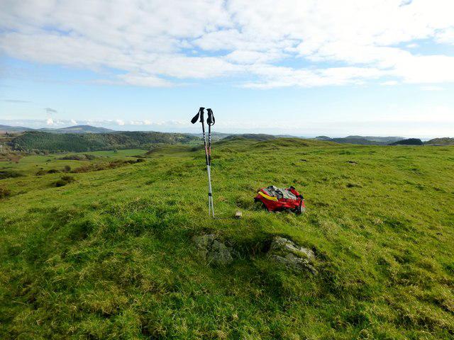 Photo could not load
NX7959 : Tod Fell Summit
Rude Health
Hill facts and local notes
Classifications
Elevation
187m
614 ft
Prominence
135m
Coordinates
54.9161, -3.8821
NX794595
OS Map
84
Explorer: 312
At the Summit
The summit features a stone-built cairn, offering a perfect spot for a celebratory snack (or a cheeky sandwich).
Terrain & Geology
Tod Fell is primarily composed of Skiddaw slate, which is known for its distinct layering and dark coloration. The area also features some interesting outcrops of volcanic rock, giving the terrain a rugged charm.
Views & Scenery
From the summit, one can witness breathtaking views of the Howgill Fells, the majestic Yorkshire Dales, and if you're lucky, a glimpse of the Pennines in the far distance.
History & Heritage
Name Origin
The name 'Tod' is derived from the Old Norse word for 'fox', hinting at the wildlife that roams these hills.
Historical Significance
Tod Fell is a popular walking destination, and its relative solitude makes it a peaceful escape from the busier tourist spots in the Lake District.
Getting There & Facilities
Check current local access restrictions, parking rules and transport timetables before travelling. These notes do not confirm public access to the summit.
Parking
There is parking available at the side of the A685 near the A683 junction, but be sure to park considerately.
Public Transport
The nearest bus stop is in the village of Kirkby Stephen, approximately 5 miles from the start of the walk.
Nearby Facilities
Kirkby Stephen has a few cafes and pubs for a post-hike pint and a proper meal. Toilets are available at the village square.
Safety Information
Known Hazards
- Beware of sudden weather changes, as conditions in the Lake District can turn on a dime. Also, watch your step on those rocky sections!
General Safety Tips
- Check weather conditions before setting out
- Carry appropriate clothing and equipment
- Let someone know your planned route
- Take a map, compass, and GPS device
- Carry emergency supplies: food, water, first aid kit, torch
Hills
Some common questions about the hills answered
Are there group walks up Tod Fell?
Many walkers use Walkmates to join or organise walks with others. You can check for group walks around Tod Fell through the maps
Are there other walkers around Tod Fell?
Activity varies by location and time, but Walkmates lets you see whether others have shared walks or shown interest in this area. Find other people through the walking friends search walking friends for Tod Fell search or of course create your own walk for Tod Fell
Can I organise a walk to Tod Fell?
Yes. If there aren’t any walks listed already, you can create a walk and make it available for others to join.
If you're signed up to Walkmates, you can create a walk to Tod Fell.
How do I find a walk up this hill?
There are often multiple ways to walk this hill, depending on experience and route preference. Walkmates helps you explore walks and routes that others have shared.
Can I suggest a new route up Tod Fell?
Yes. You can suggest or create routes to share with others. Walkmates focuses on the social side of walking, so routes are used to help people organise walks and explore areas together, rather than as detailed navigation tools or route libraries.
Other uses really appreciate knowledgeable walkers sharing their routes. Share your favourite route to Tod Fell here
The is an error or something incorrect about this hill. How do I let you know?
We always strive to keep the information on Walkmates as accurate as possible. If you find an error, please let us know through the contact form and we'll aim to correct it as quickly as possible
Community Discussion
Comments
Location
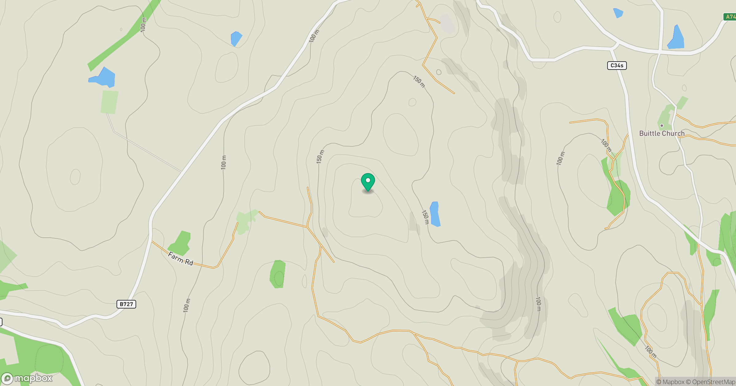
Grid reference: NX794595
View on OpenStreetMapOpens a map in a new tab, centred on the hill.
Hills within 30 km
Straight-line distance, not a walking route or confirmation of access.
No comments yet. Be the first.