
Moyle Hill
Good walks are even better shared.
Overview
Moyle Hill: A Hidden Gem in Dumfries and Galloway
Nestled in the stunning landscape of Dumfries and Galloway, Moyle Hill rises to an elevation of 297 meters, boasting a classification as a Marilyn due to its prominence over the surrounding terrain. For those seeking a gentle adventure in nature, this hill offers not just a hike, but a journey through time and beauty.
Geology
Moyle Hill is predominantly composed of sandstone, which reveals fascinating sedimentary structures. These rocks tell a story of ancient environments and glossy glacial eras. As you trek, have a gander at the textures and colours that bring history to life, albeit without the need for a history book!
Routes
Moyle Hill Circular Route
Starting from the lovely village of Wigtown, this circular route stretches around 6.5 km with a moderate difficulty level. Expect a walk of about two hours, perfect for a refreshing Sunday outing.
Summit Features
Reaching the summit rewards hikers with a humble cairn that begs for a group photo. As you catch your breath, take in the spectacular views that encapsulate the very essence of this region.
Terrain
Expect grassy slopes with the occasional sneaky bog to navigate. Wear sturdy footwear, ideally boots with good grip, or you may find yourself in a comedic ballet with the mud!
Views
Highlights
Standing atop Moyle Hill, you are greeted with sweeping views of the Machars coastline and, on particularly good days, the distant Galloway Hills majesty. It’s truly a sight that bewitches the mind and refreshes the soul.
Best Seasons
Visiting during late spring or early autumn is ideal when likelihood of clear skies and vibrant colours are at their peak.
Hazards
As with most outdoor delights, caution is key. Be mindful of slippery rocks and muddy patches, particularly after a rain shower – a classic reminder of nature’s practical jokes.
Nearby Summits
If you’re feeling ambitious, nearby summits such as Cree Hill (368 meters) and Tinto Hill (707 meters) await the explorer who wants to carry on their adventure.
Access
Nearest Parking
Parking facilities are available at the Wigtown Community Park, only about a kilometre from the trailhead.
Public Transport
Buses from Newton Stewart will whisk you away to Wigtown, providing an easy entry point to your hiking journey.
Nearest Town
Wigtown not only serves as your gateway to the hills but also offers delightful cafes and services for refreshment.
Facilities
Take a break in Wigtown where you can find a friendly café, a toilet, and perhaps a bookshop or two if you fancy a good read.
History
Name Meaning
The name Moyle translates from Gaelic as 'small hill', a charming description fitting for this delightful ascent.
Significance
Rich in local lore, Moyle Hill carries whispers of prehistoric settlements, making it a site of cultural significance as much as a destination for enthusiasts.
In summary, Moyle Hill combines accessibility with stunning views and intriguing history, making it a 'must-visit' for anyone keen on enjoying a slice of Scotland’s beautiful outdoors. So lace up your boots, bring your sense of adventure, and perhaps a sandwich – the hill is waiting!
Explore routes near Moyle Hill
Public walks starting within 80 km of this hill. Nearby does not mean a route reaches the summit; check its map and access before setting out.
Dalbeattie Forest Plantain Loch Trail
View route
Rockcliffe to Kippford Jubilee Path and Waterfront
View route
Doach Wood Douglas Trail and Solway Viewpoint
View route
Castle Douglas Carlingwark Loch and Lover’s Walk Circuit
View route
Route planning notes
These notes describe possible approaches, not verified navigable routes or permission to cross land. Check current paths, local access rules and conditions before setting out.
Moyle Hill Circular Route
A pleasant circular walk starting from the nearby village of Wigtown, it provides a scenic approach to the hill with remarkable views.
Make a day of it, together
Find someone to share the walk with, or organise a day out along a route you like.
Hill facts and local notes
Classifications
Elevation
150m
492 ft
Prominence
102m
Coordinates
54.9003, -3.7977
NX848576
OS Map
84
Explorer: 313
At the Summit
The summit features a modest cairn, which is not only a great place to pause for breath but also for a quick selfie with the dramatic backdrop.
Terrain & Geology
Dominantly composed of sandstone, which is prevalent in the area, Moyle Hill exhibits interesting sedimentary structures that give insights into ancient environments. The rock formation is shaped by glacial erosion, contributing to its scenic beauty.
Views & Scenery
From the summit, one can enjoy panoramic views across the Machars coastline and, on a clear day, the distant peaks of the Galloway Hills.
History & Heritage
Name Origin
The name 'Moyle' is derived from Gaelic, meaning 'small hill', which sums it up quite nicely, don’t you think?
Historical Significance
The hill is steeped in local folklore and offers a glimpse into the prehistoric settlement eras of the region.
Getting There & Facilities
Check current local access restrictions, parking rules and transport timetables before travelling. These notes do not confirm public access to the summit.
Parking
There is parking available at the Wigtown Community Park, about 1 km from the trailhead.
Public Transport
Regular buses operate from Newton Stewart to Wigtown, facilitating easy access.
Nearby Facilities
Wigtown provides a selection of delightful cafes and facilities including public toilets, along with the odd bookshop for literary enthusiasts.
Safety Information
Known Hazards
- Be wary of slippery rocks and muddy patches, especially after rainfall. Also, watch for wildlife crossing the path!
General Safety Tips
- Check weather conditions before setting out
- Carry appropriate clothing and equipment
- Let someone know your planned route
- Take a map, compass, and GPS device
- Carry emergency supplies: food, water, first aid kit, torch
Hills
Some common questions about the hills answered
Are there group walks up Moyle Hill?
Many walkers use Walkmates to join or organise walks with others. You can check for group walks around Moyle Hill through the maps
Are there other walkers around Moyle Hill?
Activity varies by location and time, but Walkmates lets you see whether others have shared walks or shown interest in this area. Find other people through the walking friends search walking friends for Moyle Hill search or of course create your own walk for Moyle Hill
Can I organise a walk to Moyle Hill?
Yes. If there aren’t any walks listed already, you can create a walk and make it available for others to join.
If you're signed up to Walkmates, you can create a walk to Moyle Hill.
How do I find a walk up this hill?
There are often multiple ways to walk this hill, depending on experience and route preference. Walkmates helps you explore walks and routes that others have shared.
Can I suggest a new route up Moyle Hill?
Yes. You can suggest or create routes to share with others. Walkmates focuses on the social side of walking, so routes are used to help people organise walks and explore areas together, rather than as detailed navigation tools or route libraries.
Other uses really appreciate knowledgeable walkers sharing their routes. Share your favourite route to Moyle Hill here
The is an error or something incorrect about this hill. How do I let you know?
We always strive to keep the information on Walkmates as accurate as possible. If you find an error, please let us know through the contact form and we'll aim to correct it as quickly as possible
Community Discussion
Comments
Location
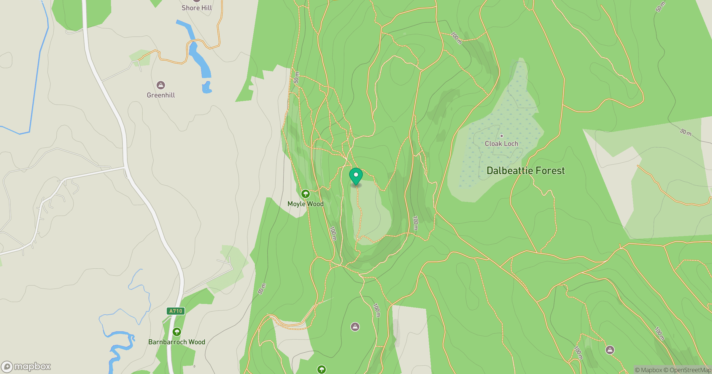
Grid reference: NX848576
View on OpenStreetMapOpens a map in a new tab, centred on the hill.
Hills within 30 km
Straight-line distance, not a walking route or confirmation of access.
No comments yet. Be the first.