

Maidenpap
Good walks are even better shared.
Overview
Maidenpap: An Outdoor Gem in the Lake District
Nestled away in the beautiful Lake District, Maidenpap stands at 372 meters, offering a moderate climb for those looking for a lovely day out amidst stunning landscapes. The path to the summit may make one feel like they’re on a leisurely stroll or an adventure, depending on the weather and company.
Geology
Maidenpap boasts interesting geological features, mainly of volcanic origin. The intricacies of the volcanic terrain offer a glimpse into the earth's fiery past, rounded by schist and sedimentary rocks that further beautify the area. Watch your step—those rocks can be slippery!
Routes
The preferred way to summit is via The Maiden Path, a route that starts conveniently from Gillerthwaite. This pleasant trail allows hikers to meander through lush green forests before tackling the steady incline leading to breathtaking views at the top. It’s about 5.5 km long and should take around 2.5 hours on average.
Summit Features
As one reaches the summit, they are greeted by a charming stone cairn, a useful marker for the wandering soul. With grassy patches inviting you to lay back and take in the views, it’s a fine place for a snack (just keep an eye on the sheep—they can be quite cheeky!).
Terrain and Views
The terrain can be rocky and uneven in places, with the possibility of boggy patches, especially after rain. However, the effort is well worth it; from the top, the panoramic vistas extend to famous peaks like Helvellyn, with Thirlmere sprawling below.
Hazards
Hikers should be mindful of slipping on wet rocks and uneven ground, especially in muddy conditions. Additionally, wildlife—specifically sheep and the occasional bovine—might cross paths with you, adding a bit of rural charm (or chaos, depending on how you look at it).
Access
Getting to Maidenpap is simple. Parking is available at Gillerthwaite, although spaces are limited, so aim to get there early. If you prefer public transport, buses from Keswick will drop you close to the starting point. The quaint town of Keswick near Derwentwater offers all necessary amenities and a delightful atmosphere.
Facilities
In Keswick, you’ll easily find cafes, shops, and even toilets near the bus station, making it a convenient base for your hiking adventure.
History
The name ‘Maidenpap’ harks back to old Norse, suggesting a fascinating historical context, with local legends of maidens wandering the hills adding a sprinkle of magic to your hike.
So strap on those boots and head out for an adventure that promises not just exercise, but an immersion into the rich tapestry of nature and history that Maidenpap has to offer!
Happy hiking, and remember—every hill has its tale!
Explore routes near Maidenpap
Public walks starting within 80 km of this hill. Nearby does not mean a route reaches the summit; check its map and access before setting out.
Dalbeattie Forest Plantain Loch Trail
View route
Rockcliffe to Kippford Jubilee Path and Waterfront
View route
Mabie Forest Dalshinnie Glen and Loch
View route
Doach Wood Douglas Trail and Solway Viewpoint
View route
Route planning notes
These notes describe possible approaches, not verified navigable routes or permission to cross land. Check current paths, local access rules and conditions before setting out.
The Maiden Path
A scenic route starting from the nearby hamlet of Gillerthwaite, winding through lush woodlands before a steady climb to the summit.
Make a day of it, together
Find someone to share the walk with, or organise a day out along a route you like.
Photo Gallery
View all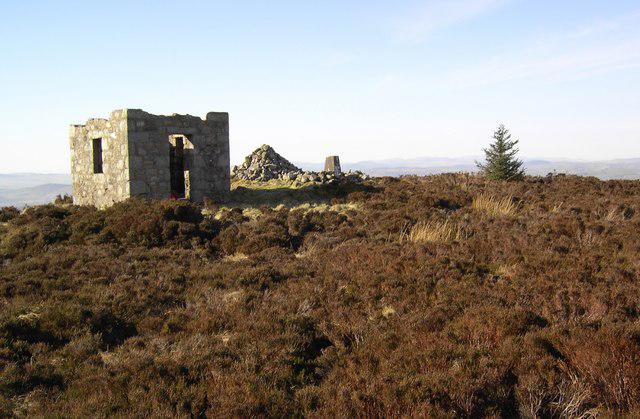 Photo could not load
NX8961 : Shooting Box
Colin Kinnear
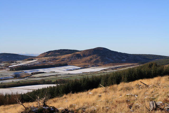 Photo could not load
NX8961 : Maidenpap Hill
Colin Kinnear
Hill facts and local notes
Classifications
Elevation
314m
1,030 ft
Prominence
142m
Coordinates
54.9370, -3.7219
NX897616
OS Map
84
Explorer: 313
At the Summit
The summit features a stone cairn which serves as a prominent landmark, as well as expansive grassland that gives an ideal picnic spot—just mind the midge!
Terrain & Geology
Maidenpap is primarily composed of volcanic rock known for its ruggedness and provides a unique geological history related to the movement of ancient lava flows. The surrounding areas boast sedimentary formations that contrast sharply with the volcanic backdrop.
Views & Scenery
From the summit, one can behold stunning vistas of the surrounding peaks including Helvellyn and the vast expanse of Thirlmere.
History & Heritage
Name Origin
The name 'Maidenpap' is derived from old Norse, meaning 'the maiden's hills', referencing local folklore surrounding the area.
Historical Significance
Historically, Maidenpap is part of local legends pertaining to maiden spirits said to roam the hills, lending the area a mystical air.
Getting There & Facilities
Check current local access restrictions, parking rules and transport timetables before travelling. These notes do not confirm public access to the summit.
Parking
There is a small parking area at Gillerthwaite which can accommodate a few vehicles—arrive early to nab a spot!
Public Transport
Regular buses run from Keswick to Gillerthwaite, with services available throughout the week.
Nearby Facilities
Cafés and shops are plentiful in Keswick, and there are public toilets near the bus station.
Safety Information
Known Hazards
- Slippery rocks, particularly in wet weather; sections of uneven terrain; and possible encounters with livestock on the trails.
General Safety Tips
- Check weather conditions before setting out
- Carry appropriate clothing and equipment
- Let someone know your planned route
- Take a map, compass, and GPS device
- Carry emergency supplies: food, water, first aid kit, torch
Hills
Some common questions about the hills answered
Are there group walks up Maidenpap?
Many walkers use Walkmates to join or organise walks with others. You can check for group walks around Maidenpap through the maps
Are there other walkers around Maidenpap?
Activity varies by location and time, but Walkmates lets you see whether others have shared walks or shown interest in this area. Find other people through the walking friends search walking friends for Maidenpap search or of course create your own walk for Maidenpap
Can I organise a walk to Maidenpap?
Yes. If there aren’t any walks listed already, you can create a walk and make it available for others to join.
If you're signed up to Walkmates, you can create a walk to Maidenpap.
How do I find a walk up this hill?
There are often multiple ways to walk this hill, depending on experience and route preference. Walkmates helps you explore walks and routes that others have shared.
Can I suggest a new route up Maidenpap?
Yes. You can suggest or create routes to share with others. Walkmates focuses on the social side of walking, so routes are used to help people organise walks and explore areas together, rather than as detailed navigation tools or route libraries.
Other uses really appreciate knowledgeable walkers sharing their routes. Share your favourite route to Maidenpap here
The is an error or something incorrect about this hill. How do I let you know?
We always strive to keep the information on Walkmates as accurate as possible. If you find an error, please let us know through the contact form and we'll aim to correct it as quickly as possible
Community Discussion
Comments
Location
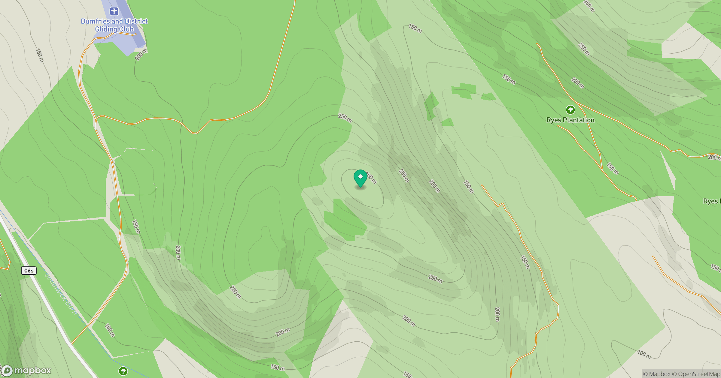
Grid reference: NX897616
View on OpenStreetMapOpens a map in a new tab, centred on the hill.
Hills within 30 km
Straight-line distance, not a walking route or confirmation of access.
No comments yet. Be the first.