
Cuil Hill
Good walks are even better shared.
Overview
Cuil Hill
Cuil Hill, a charming Marilyn nestled in the Southern Uplands of Scotland, stands at 320 meters high, offering spectacular views and a manageable hike for all types of adventurers. Its rounded summit, adorned with a small stone cairn, is a favourite among walkers looking to escape the hustle and bustle of daily life.
Geology
Cuil Hill's geological composition is primarily sandstone, a remnant of ancient river systems that carved out the landscape you see today. The varied geological features tell a story of glacial movements and dynamic shifts in the earth’s crust over millions of years. You might even stumble upon some interesting rock formations if you keep your eyes peeled!
Route Information
Cuil Hill Circular Route
For those wanting to experience the beauty without breaking a sweat, the Cuil Hill Circular Route is perfect. This easy route is about 4.5 km long and usually takes around 2 hours to complete. You'll enjoy a variety of terrains, from grassy knolls to rocky outcrops, all while being reminded just how magnificent nature can be.
Summit Features
At the summit, the small cairn provides a resting place for weary hikers and a great photo opportunity against a stunning backdrop. Bring your camera; the views from the top deserve to be captured!
Terrain Type
Hikers will find the terrain predominantly grassy, with some rocky spots that add an element of charm. While it’s not exactly a walk in the park, you won’t need a degree in mountaineering to enjoy this trip.
Views
The summit rewards your efforts with breathtaking views over the Southern Uplands, with the serene coastlines and the majestic Lake District peaks visible on a clear day. For the best scenic views, visit during spring or early summer when the whole area is lush and vibrant.
Hazards
As with any outdoor adventure, a few hazards exist. Watch out for muddy patches after rain; your boots will thank you later! Also, be cautious during winter months, as icy conditions can sneak up on you, especially in the mornings.
Nearby Summits
Cuil Hill’s proximity to other summits like Cairnsmore of Carsphairn and Saddle Hill provides additional hiking opportunities for those looking to extend their adventure.
Access
The nearest parking area is a small layby on the A713 road, which can fill up quickly on sunny days, so arrive early! If you're relying on public transport, hop on a bus from Newton Stewart, followed by a short taxi ride to the start of your hike. The charming village of New Galloway is the closest town, offering quaint cafes and shop.
Facilities
Post-hike, you can reward yourself at one of the local cafes in New Galloway. Before you know it, you’ll be sat back, sipping tea and swapping tales of your adventures!
History
The name 'Cuil' means 'narrow' in Gaelic, hinting at the stunning landforms in the area and adding a sprinkle of poetic charm to your hike. Historically, this hill has been significant for local shepherds, being a notable landmark and a subject of local folklore.
Conclusion
Whether you’re a local or just passing through, Cuil Hill offers a delightful getaway into nature. So grab your boots, pack your lunch, and get ready for an unforgettable day out in the fresh Scottish air!
Explore routes near Cuil Hill
Public walks starting within 80 km of this hill. Nearby does not mean a route reaches the summit; check its map and access before setting out.
Dalbeattie Forest Plantain Loch Trail
View route
Mabie Forest Dalshinnie Glen and Loch
View route
Rockcliffe to Kippford Jubilee Path and Waterfront
View route
Doach Wood Douglas Trail and Solway Viewpoint
View route
Route planning notes
These notes describe possible approaches, not verified navigable routes or permission to cross land. Check current paths, local access rules and conditions before setting out.
Cuil Hill Circular Route
A well-marked path that offers a leisurely ascent to the summit and returns via a different route, showcasing a variety of landscapes.
Make a day of it, together
Find someone to share the walk with, or organise a day out along a route you like.
Hill facts and local notes
Classifications
Elevation
420m
1,378 ft
Prominence
113m
Coordinates
54.9507, -3.7006
NX911631
OS Map
84
Explorer: 313
At the Summit
The summit features a small stone cairn, offering a place to rest and catch your breath, along with panoramic views that are nothing short of spectacular.
Terrain & Geology
Cuil Hill is primarily composed of sandstone, shaped over millennia by glacial and fluvial processes that have left the landscape dotted with small rocky outcrops. Its geological history provides insight into the ancient environments that once prevailed.
Views & Scenery
From the summit, one can see the rolling hills of the Southern Uplands, the distant coastline, and the outline of the Lake District.
History & Heritage
Name Origin
The name 'Cuil' is derived from the Gaelic word 'caol', meaning narrow or strait, possibly referring to the landforms around the hill.
Historical Significance
Historically, Cuil Hill has been a landmark for local shepherds and has featured in local folklore as a gathering place.
Getting There & Facilities
Check current local access restrictions, parking rules and transport timetables before travelling. These notes do not confirm public access to the summit.
Parking
Parking can be found at the small layby on the A713 road, just to the north of the hill. Spaces are limited, so arrive early if you can!
Public Transport
The nearest public transport is via bus services from Newton Stewart. From there, it's a short taxi ride to the starting point.
Nearby Facilities
While facilities are sparse on the hill itself, New Galloway boasts a couple of cafes for a well-deserved cuppa post-hike, as well as public toilets.
Safety Information
Known Hazards
- Watch out for the odd muddy patch after rain and, during winter months, be prepared for icy conditions early in the morning.
General Safety Tips
- Check weather conditions before setting out
- Carry appropriate clothing and equipment
- Let someone know your planned route
- Take a map, compass, and GPS device
- Carry emergency supplies: food, water, first aid kit, torch
Hills
Some common questions about the hills answered
Are there group walks up Cuil Hill?
Many walkers use Walkmates to join or organise walks with others. You can check for group walks around Cuil Hill through the maps
Are there other walkers around Cuil Hill?
Activity varies by location and time, but Walkmates lets you see whether others have shared walks or shown interest in this area. Find other people through the walking friends search walking friends for Cuil Hill search or of course create your own walk for Cuil Hill
Can I organise a walk to Cuil Hill?
Yes. If there aren’t any walks listed already, you can create a walk and make it available for others to join.
If you're signed up to Walkmates, you can create a walk to Cuil Hill.
How do I find a walk up this hill?
There are often multiple ways to walk this hill, depending on experience and route preference. Walkmates helps you explore walks and routes that others have shared.
Can I suggest a new route up Cuil Hill?
Yes. You can suggest or create routes to share with others. Walkmates focuses on the social side of walking, so routes are used to help people organise walks and explore areas together, rather than as detailed navigation tools or route libraries.
Other uses really appreciate knowledgeable walkers sharing their routes. Share your favourite route to Cuil Hill here
The is an error or something incorrect about this hill. How do I let you know?
We always strive to keep the information on Walkmates as accurate as possible. If you find an error, please let us know through the contact form and we'll aim to correct it as quickly as possible
Community Discussion
Comments
Location
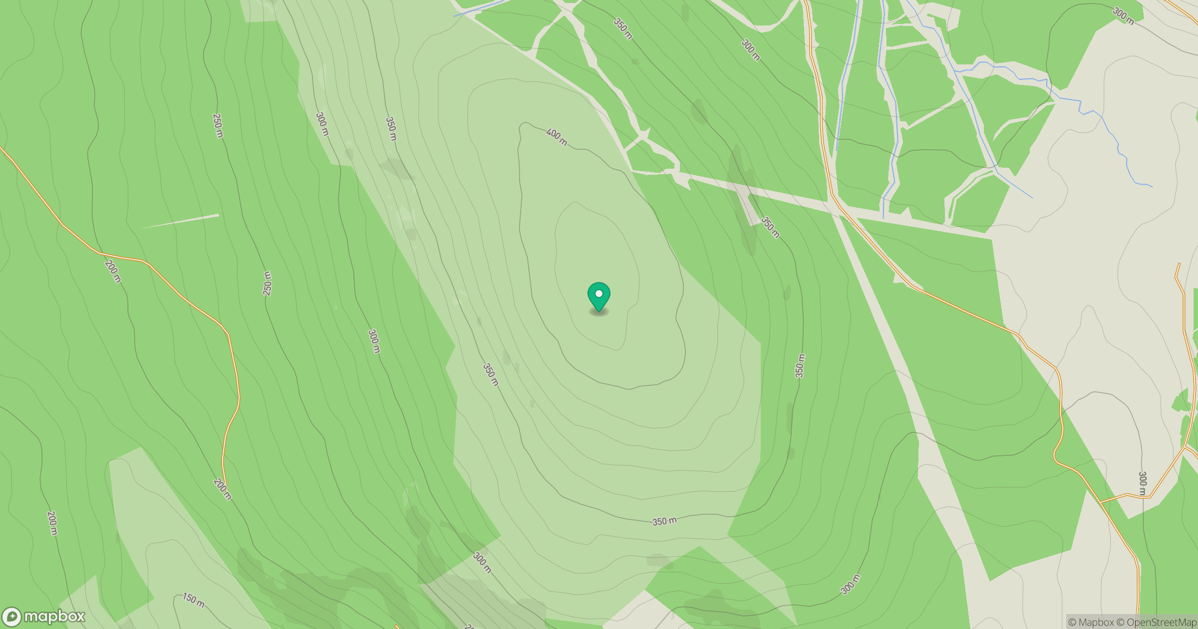
Grid reference: NX911631
View on OpenStreetMapOpens a map in a new tab, centred on the hill.
Hills within 30 km
Straight-line distance, not a walking route or confirmation of access.
No comments yet. Be the first.