
Linton Hill
Good walks are even better shared.
Overview
Linton Hill: A Hidden Gem in the Southern Uplands
Linton Hill, standing proudly at 380 meters, may not be the tallest peak in the area, but it certainly knows how to charm hikers and nature enthusiasts alike. Nestled in the picturesque Southern Uplands, it offers both a delightful trek and stunning panoramic views that could make even the most jaded traveller stop in their tracks.
Geology
The hill is predominantly composed of Old Red Sandstone, characterised by its rich, reddish hues. This sedimentary rock formation not only paints the landscape in gorgeous colours but also forms the basis for the area’s unique flora and fauna.
Routes
The main route to the summit starts at Linton Burn, winding its way through beautiful greenery. With a distance of 4.5 km and an estimated time of 1.5 hours, it's an easy walk that welcomes everyone, from seasoned hikers to families out for a leisurely stroll.
Summit Features
The summit is modestly adorned with a cairn and includes a quaint bench, perfect for those wishing to pause and soak in the serene ambience.
Terrain
Expect to traverse grassy and heather-laden hillsides, interspersed with rocky outcrops. Just enough to keep you on your toes without feeling like you're preparing for an expedition.
Views
Once atop, take a moment to enjoy the sweeping vistas of the Borders and Southern Uplands. Ideal viewing times are during spring and early autumn when the colours are at their most vibrant.
Hazards
While mostly welcoming, do keep an eye out for loose stones and the occasional boggy stretch of trail, especially after a good rain. Just remember, mud comes with great stories!
Nearby Summits
Linton Hill is quite social! It’s located near Windy Hill (399 m) and Wheatley Hill (360 m), both of which are worth a visit if you’re feeling adventurous.
Access
Driving to Linton Hill is straightforward, with parking available at a layby on the A699, just a short jaunt from the trailhead. Public transport options exist via infrequent bus services from Peebles, making it accessible if you’re relying on public transport.
Facilities
While the immediate area is tranquil and somewhat wild, the nearby town of Peebles boasts several cafes and shops, providing the perfect pit stop for post-hike snacks or refreshments.
History
The name Linton is rooted in Old English, hinting at its historical significance when fields of flax once blanketed the area. It also weaves a tapestry of local folklore, with tales of guardians who are believed to protect this beloved hill.
In summary, Linton Hill represents the charm of the Southern Uplands - a joyful exploration that invites all trekkers and nature lovers to experience the great outdoors. So pack your sandwiches and a flask of tea, and go enjoy a slice of this tranquil British countryside!
Happy hiking!
Explore routes near Linton Hill
Walks starting near this hill. Open a route to check its map, distance and full itinerary.
Morebattle to Kirk Yetholm: St Cuthbert's Way over Wideopen Hill
View route
Kirk Yetholm to the Border Gate: St Cuthbert’s Way return
View route
Kirk Yetholm to Burnhead footbridge: Halter Burn valley return
View route
Kelso Two Bridges: Tweed and Bridgend Park
View route
Route planning notes
These notes describe possible approaches. Check a route's map and access information when planning your walk.
Linton Burn Path
A scenic path starting from Linton Burn, winding through lush greenery and offering gentle gradients, perfect for walkers of all abilities.
Make a day of it, together
Find someone to share the walk with, or organise a day out along a route you like.
Hill facts and local notes
Classifications
Elevation
282m
925 ft
Prominence
176m
Coordinates
55.5448, -2.3385
NT787279
OS Map
74
Explorer: OL16W
At the Summit
The summit is marked by a humble cairn and features a small bench for weary travellers to rest and take in the views.
Terrain & Geology
Linton Hill is primarily composed of Old Red Sandstone, which is rich in iron oxide, giving it a distinctive reddish hue. The underlying geology contributes to the stunning views and diverse vegetation found in the region.
Views & Scenery
From the summit, one can see the rolling hills of the Southern Uplands, as well as the distant sight of the Border hills and the Scottish Borders region.
History & Heritage
Name Origin
The name 'Linton' is derived from the Old English 'lint', referring to the flax plant that once flourished in the area.
Historical Significance
Linton Hill holds an important place in the local folklore, with tales of ancient spirits said to guard the hills.
Getting There & Facilities
Parking
There is ample free parking at the small layby on the A699, approximately 1 km from the Linton Burn path junction.
Public Transport
Nearest bus service operates from Peebles, with occasional services connecting to nearby villages. A short walk from the bus stop leads to the trailhead.
Nearby Facilities
Facilities are limited in the immediate area; however, Peebles offers a variety of cafes, shops, and public toilets.
Safety Information
Known Hazards
- Though Linton Hill is friendly for most, be cautious of loose stones on the path and the occasional boggy section, especially after heavy rain.
General Safety Tips
- Check weather conditions before setting out
- Carry appropriate clothing and equipment
- Let someone know your planned route
- Take a map, compass, and GPS device
- Carry emergency supplies: food, water, first aid kit, torch
Hills
Some common questions about the hills answered
Are there group walks up Linton Hill?
Many walkers use Walkmates to join or organise walks with others. You can check for group walks around Linton Hill through the maps
Are there other walkers around Linton Hill?
Activity varies by location and time, but Walkmates lets you see whether others have shared walks or shown interest in this area. Find other people through the walking friends search walking friends for Linton Hill search or of course create your own walk for Linton Hill
Can I organise a walk to Linton Hill?
Yes. If there aren’t any walks listed already, you can create a walk and make it available for others to join.
If you're signed up to Walkmates, you can create a walk to Linton Hill.
How do I find a walk up this hill?
There are often multiple ways to walk this hill, depending on experience and route preference. Walkmates helps you explore walks and routes that others have shared.
Can I suggest a new route up Linton Hill?
Yes. You can suggest or create routes to share with others. Walkmates focuses on the social side of walking, so routes are used to help people organise walks and explore areas together, rather than as detailed navigation tools or route libraries.
Other uses really appreciate knowledgeable walkers sharing their routes. Share your favourite route to Linton Hill here
The is an error or something incorrect about this hill. How do I let you know?
We always strive to keep the information on Walkmates as accurate as possible. If you find an error, please let us know through the contact form and we'll aim to correct it as quickly as possible
Community Discussion
Comments
Location
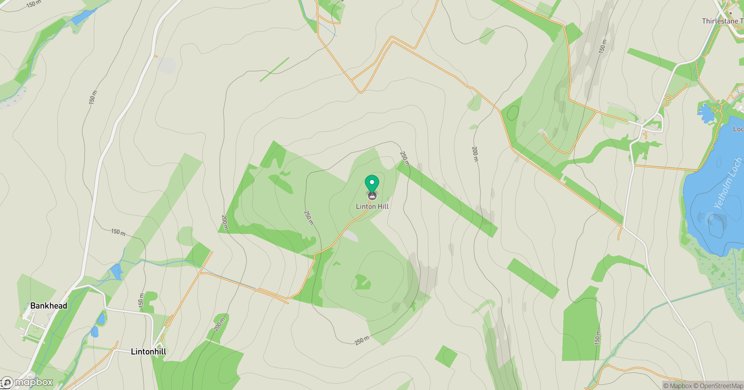
Grid reference: NT787279
View on OpenStreetMapOpens a map in a new tab, centred on the hill.





No comments yet. Be the first.