

Peniel Heugh
Good walks are even better shared.
Overview
Peniel Heugh: The Friendly Giant of the Scottish Borders
Peniel Heugh, standing at 396 meters, is a Marilyn classification that beckons hikers and outdoor enthusiasts with its inviting slopes and stunning panoramic views. Nestled in the heart of the Scottish Borders, it's the perfect place for a gentler hike without sacrificing the majesty of nature.
Geology
This hill’s rocky foundation primarily consists of volcanic rock, a remnant of ancient geological activity. The fascinating formations are a testament to the turbulent history of this landscape, allowing eager enthusiasts to ponder the forces that shaped it.
Routes
Two popular routes offer varied experiences. The route from the A697 provides a quaint pastoral backdrop, while the Pennymuir route presents a longer trek through charming countryside. Be ready to embrace both the challenge and the beauty!
Summit Features
Upon reaching the summit, you'll be greeted by a sturdy stone cairn and a trig point, beckoning you to stop for a well-deserved rest and those all-important summit selfies. With scenic views and a gentle breeze, it’s hard not to feel on top of the world!
Terrain Type
The well-trodden paths will lead you through lush, grassy hills with a few rocky outcrops. While you may encounter the odd potato-sized rock, the journey is generally friendly for all experience levels. Just mind your step in the wetter months!
Views
From the top, the vistas are nothing short of breathtaking. With sprawling views of the Cheviot Hills to the south and the charming town of Synton below, it’s best enjoyed during spring and autumn, when nature truly puts on its finest attire.
Hazards
As with all outdoor adventures, it's wise to be cautious. Slippery conditions can arise from rain, and visibility can drop swiftly. A comprehensive review of your map and compass skills is recommended, especially if you're planning an epic adventure!
Access
For parking, a convenient lay-by along the A697 offers safe spots for vehicles. Duns, the nearest town, is a treasure trove of cafes, pubs, and amenities to refuel after your excursion. While public transport is limited, a bus to Grantshouse can set you on your way.
Facilities
While the great outdoors offers little in terms of creature comforts, Duns provides a few delightful spots to satisfy your hunger and thirst. Remember, you won't find facilities on the hill, so bring along what you need to sustain you!
History
The name Peniel means 'hill of the head', reflecting its prominence in the local landscape. Its historical significance is enriched by folklore, imbuing the hill with stories of the past as a lookout for livestock and neighbouring tribes.
In conclusion, Peniel Heugh is like the friendly neighbour of hills: approachable, beautiful, and always ready to put a smile on your face. What more could a hiker ask for?
Happy hiking!
Explore routes near Peniel Heugh
Public walks starting within 80 km of this hill. Nearby does not mean a route reaches the summit; check its map and access before setting out.
Harestanes Peniel Heugh and Waterloo Monument
View route
Kelso Two Bridges: Tweed and Bridgend Park
View route
Morebattle to Kirk Yetholm: St Cuthbert's Way over Wideopen Hill
View route
Melrose and Gattonside Circular: Tweed and Village Views
View route
Route planning notes
These notes describe possible approaches, not verified navigable routes or permission to cross land. Check current paths, local access rules and conditions before setting out.
From the A697
A popular route starting from a minor road off the A697. The path leads through rolling hills and heather-clad moorland, providing an excellent warm-up before the ascent.
Via Pennymuir
Starting from the village of Pennymuir, this route takes you through pastoral scenes and gently rising hills before reaching the summit of Peniel Heugh.
Make a day of it, together
Find someone to share the walk with, or organise a day out along a route you like.
Photo Gallery
View all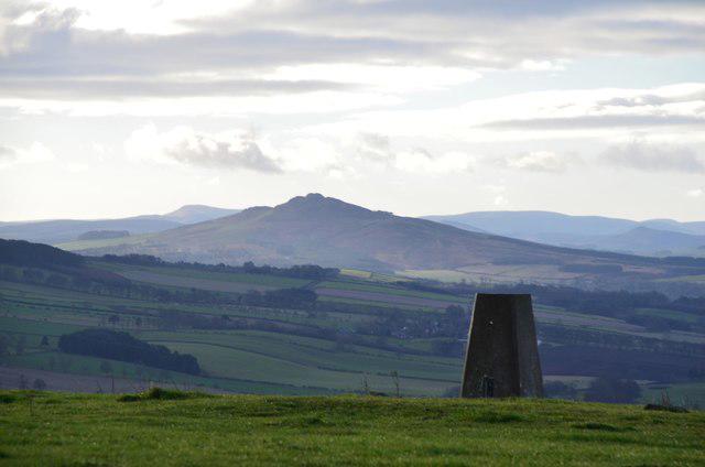 Photo could not load
NT6526 : Southwest from Peniel Heugh
Jim Barton
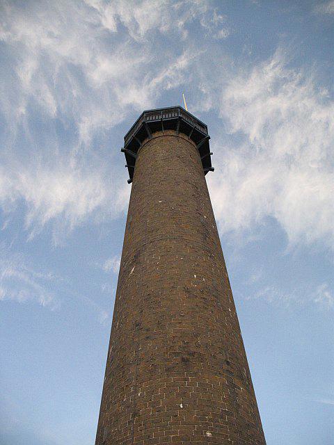 Photo could not load
NT6526 : Waterloo Monument
Richard Webb
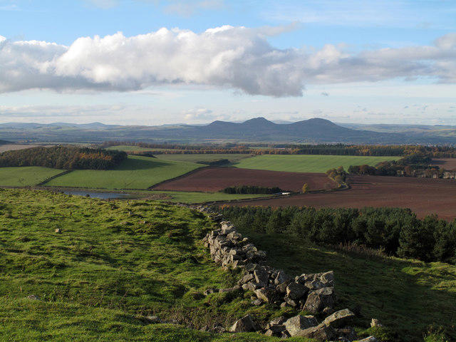 Photo could not load
NT6526 : Dry stone wall on Peniel Heugh
Trevor Littlewood
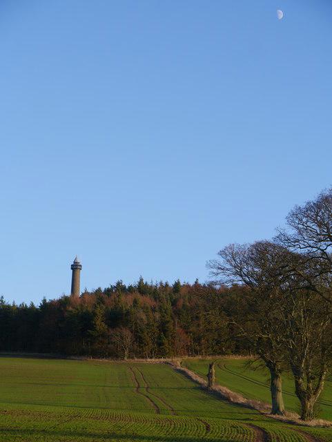 Photo could not load
NT6526 : Waterloo Monument On Peniel Heugh
James T M Towill
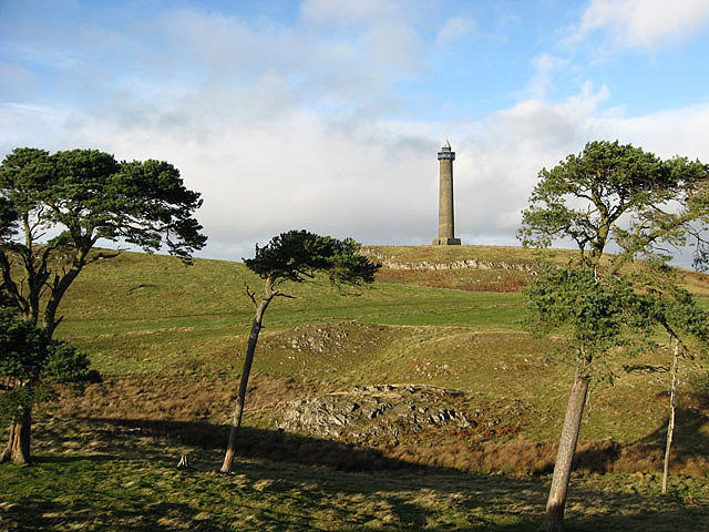 Photo could not load
NT6526 : The Waterloo Monument on Peniel Heugh
Walter Baxter
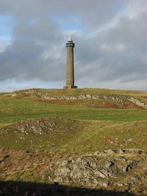 Photo could not load
NT6526 : The Waterloo Monument
Walter Baxter
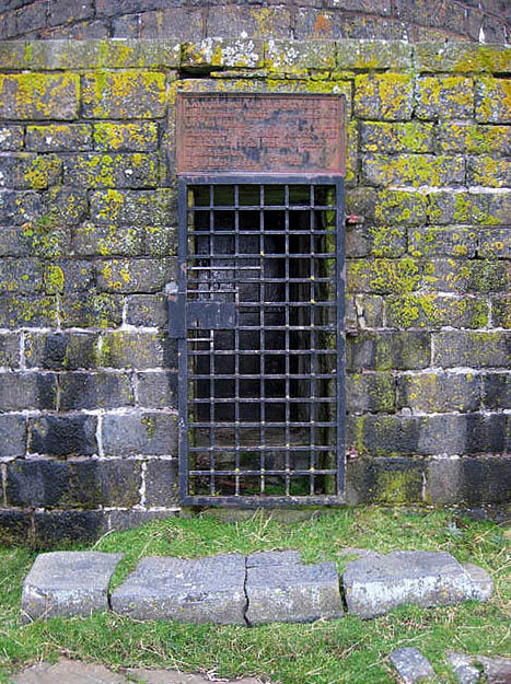 Photo could not load
NT6526 : The entrance to the Waterloo Monument
Walter Baxter
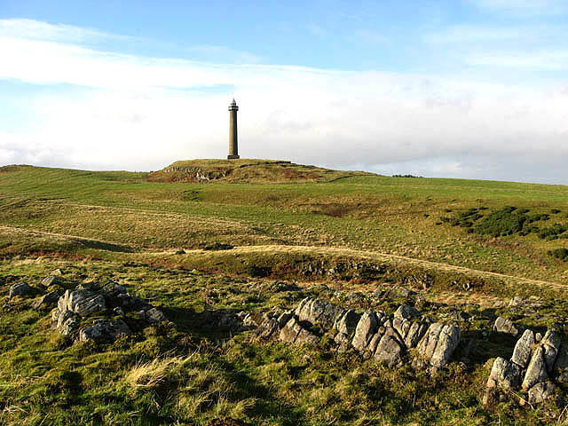 Photo could not load
NT6526 : The Waterloo Monument on Peniel Heugh
Walter Baxter
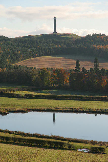 Photo could not load
NT6526 : The Waterloo Monument on Peniel Heugh
Walter Baxter
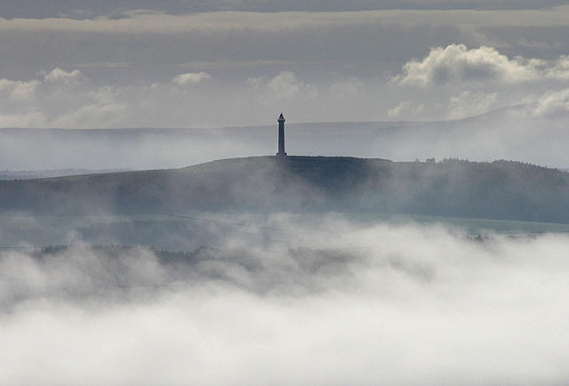
NT6526 : The Waterloo Monument on Peniel Heugh
Walter Baxter
Hill facts and local notes
Classifications
Elevation
237m
778 ft
Prominence
109m
Coordinates
55.5292, -2.5503
NT653263
OS Map
74
Explorer: OL16W
At the Summit
The summit is marked by a small, well-maintained stone cairn, which offers a perfect spot for a picnic or a chance to bask in the glory of your achievement. A trig point is also present, serving as an excellent photo opportunity - because who doesn't like a good photo at the top of a hill?
Terrain & Geology
Primarily composed of volcanic rock, Peniel Heugh showcases the rugged beauty typical of the landscape formed from ancient lava flows. The rocky outcrops give a glimpse into the geological past of the area, telling tales of violent eruptions and the subsequent erosion by wind and water.
Views & Scenery
From the summit, you can enjoy breathtaking views of the Cheviot Hills to the south and the rolling landscapes of the Scottish Borders. Keep an eye out for the picturesque village of Synton!
History & Heritage
Name Origin
The name 'Peniel' is believed to derive from the old British word meaning 'hill of the head' or 'hill of the point', fitting for a peak that certainly stands out in the landscape.
Historical Significance
The hill has historical significance as a site where local folklore suggests it was a lookout point for observing the movements of livestock and neighbouring tribes.
Getting There & Facilities
Check current local access restrictions, parking rules and transport timetables before travelling. These notes do not confirm public access to the summit.
Parking
There is a lay-by along the A697 where you can safely park your vehicle. Be sure to arrive early during weekends as it can fill up quickly.
Public Transport
Although public transport options are limited, you can take a bus to the nearby village of Grantshouse and then walk to the starting point from there.
Nearby Facilities
While there are no facilities directly at the mountain, Duns offers several cafes and pubs where you can grab a bite to eat before or after your hike. Don't expect toilets on the mountain, so plan accordingly.
Safety Information
Known Hazards
- The terrain may be slippery when wet, and visibility can deteriorate rapidly in poor weather conditions. It is advisable to have a map and compass.
General Safety Tips
- Check weather conditions before setting out
- Carry appropriate clothing and equipment
- Let someone know your planned route
- Take a map, compass, and GPS device
- Carry emergency supplies: food, water, first aid kit, torch
Hills
Some common questions about the hills answered
Are there group walks up Peniel Heugh?
Many walkers use Walkmates to join or organise walks with others. You can check for group walks around Peniel Heugh through the maps
Are there other walkers around Peniel Heugh?
Activity varies by location and time, but Walkmates lets you see whether others have shared walks or shown interest in this area. Find other people through the walking friends search walking friends for Peniel Heugh search or of course create your own walk for Peniel Heugh
Can I organise a walk to Peniel Heugh?
Yes. If there aren’t any walks listed already, you can create a walk and make it available for others to join.
If you're signed up to Walkmates, you can create a walk to Peniel Heugh.
How do I find a walk up this hill?
There are often multiple ways to walk this hill, depending on experience and route preference. Walkmates helps you explore walks and routes that others have shared.
Can I suggest a new route up Peniel Heugh?
Yes. You can suggest or create routes to share with others. Walkmates focuses on the social side of walking, so routes are used to help people organise walks and explore areas together, rather than as detailed navigation tools or route libraries.
Other uses really appreciate knowledgeable walkers sharing their routes. Share your favourite route to Peniel Heugh here
The is an error or something incorrect about this hill. How do I let you know?
We always strive to keep the information on Walkmates as accurate as possible. If you find an error, please let us know through the contact form and we'll aim to correct it as quickly as possible
Community Discussion
Comments
Location
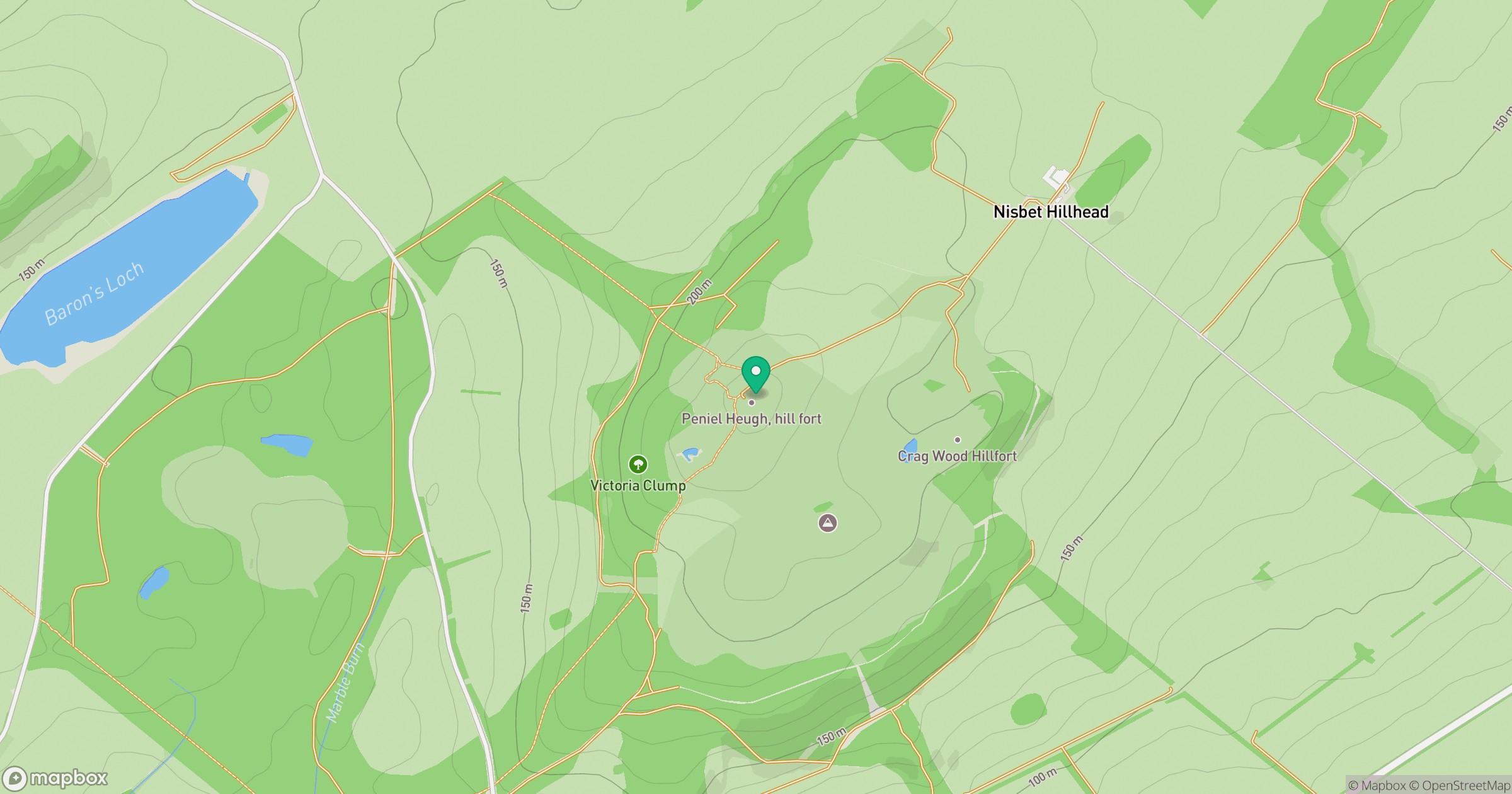
Grid reference: NT653263
View on OpenStreetMapOpens a map in a new tab, centred on the hill.
Hills within 30 km
Straight-line distance, not a walking route or confirmation of access.
No comments yet. Be the first.