

High Tor
Good walks are even better shared.
SK2958 : Cliff edge at High Tor
David Lally Photo source
Overview
High Tor
High Tor stands proudly in the Peak District National Park, a Marilyn that captures the hearts of hikers and casual walkers alike. At 152 meters, it may not reach the heights of some of its taller neighbours, but what it lacks in elevation, it makes up for in breathtaking views and dramatic geology.
Geology
The hill is predominantly limestone, showcasing spectacular karst features that tell a story of erosion over millennia. Rugged cliffs and bizarre rock formations are abundant, making it a favourite for both climbers and photographers. The striking landscape offers insight into the geological processes that shaped this region.
Routes
The most popular route to the summit is the High Tor Circular Walk. This moderate trek begins in the charming village of Matlock Bath, winding through picturesque landscapes that seem straight from a postcard. The total distance is approximately 4.6 km, with a round trip taking about two hours. Perfect for those who fancy a quick jaunt while still soaking up the sights!
Summit Features
Upon reaching the summit, you'll find a large rocky outcrop that serves as an erstwhile sitting area for hikers looking to enjoy a well-deserved snack. A small cairn marks the highest point, reminding visitors of the many adventurers who have paused here to take in the sweeping views.
Views
From the summit of High Tor, the views are simply splendid! Gaze down into the River Derwent Valley, observe the Heights of Abraham, or just revel in the sprawling limestone hills that surround this gem of a mountain. For the best experience, aim for spring and early autumn—when the skies are at their clearest, and the landscape is alive with colour. Don't forget your camera; you might swing by Matlock Bath too for a cheeky ice cream!
Hazards
As with many outdoor adventures, caution is key. Keep an eye out for uneven ground and loose rocks, especially when the path is wet. Familiarise yourself with your surroundings—getting lost is only fun in a maze!
Nearby Summits
Just a stone's throw away is Cromford Hill (150 meters), another scenic spot offering options for a larger walking adventure. Dive into exploring more of the Peak District whilst you’re in the area!
Access
To reach High Tor, you can park in Matlock Bath, where there are ample parking options available. If you'd rather leave the car at home, public transport is widely accessible, with trains and buses regularly making the trip.
Facilities
No outdoor adventure is complete without a bite to eat! Once you're back from your hike, treat yourself to one of the many cafés in Matlock Bath, some of which also provide public toilets. Comfort and convenience, all in one!
History
The name 'High Tor' highlights its identity as a towering rocky outcrop, with the term 'tor' being prevalent in British geography. Historically, it’s seen visitors for centuries, linking nature with culture. It's a place where the past meets the present, beckoning adventurers to carve their own stories upon its rugged terrain.
In summary, whether you're an experienced hiker or just looking for a weekend stroll with spectacular views, High Tor is a must-visit destination that won't disappoint. So lace up your boots, grab your walking stick, and prepare for an extraordinary day out in one of the UK’s crowning jewels of nature!
Explore routes near High Tor
Walks starting near this hill. Open a route to check its map, distance and full itinerary.
Cromford Canal to Whatstandwell: towpath return
View route
Cromford Canal guided walk
View route
Cromford Canal guided walk
View route
Cromford Canal guided walk
View route
Route planning notes
These notes describe possible approaches. Check a route's map and access information when planning your walk.
High Tor Circular Walk
A scenic circular route starting from the village of Matlock Bath, offering stunning views of the surrounding valleys and limestone formations.
Make a day of it, together
Find someone to share the walk with, or organise a day out along a route you like.
Photo Gallery
View all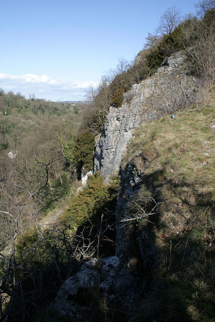 Photo could not load
SK2958 : Cliff edge at High Tor
David Lally
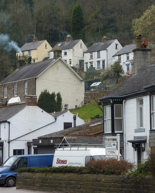 Photo could not load
SK2958 : Houses, Matlock Dale
Andrew Hill
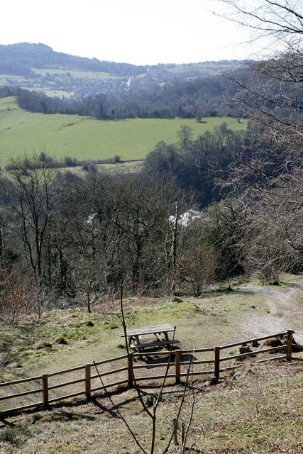 Photo could not load
SK2958 : Picnic area, High Tor
David Lally
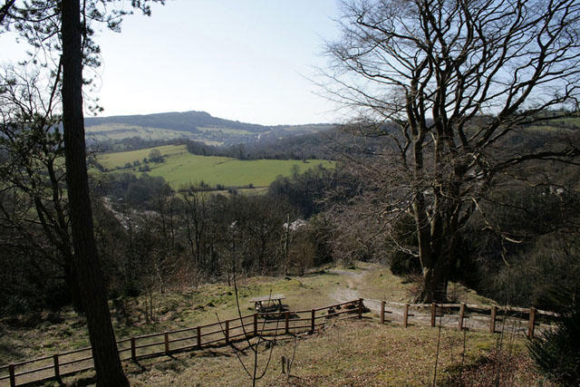 Photo could not load
SK2958 : Picnic area, High Tor
David Lally
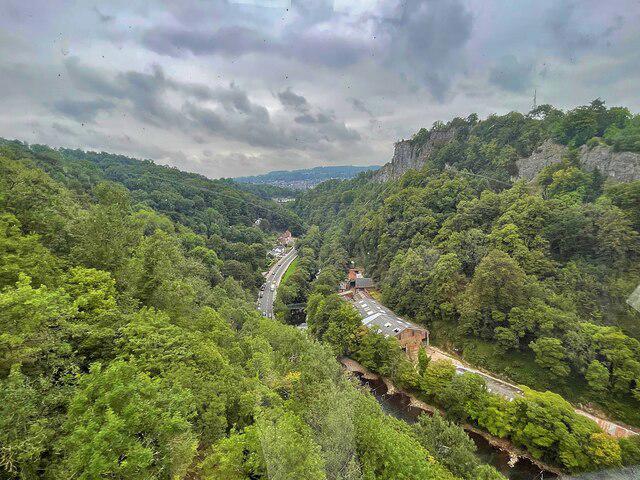 Photo could not load
SK2958 : View over the Derwent Valley
Graham Hogg
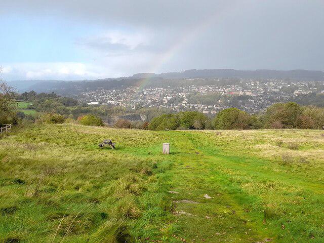 Photo could not load
SK2959 : A picnic bench by a path junction above rainy Matlock
Ian Calderwood
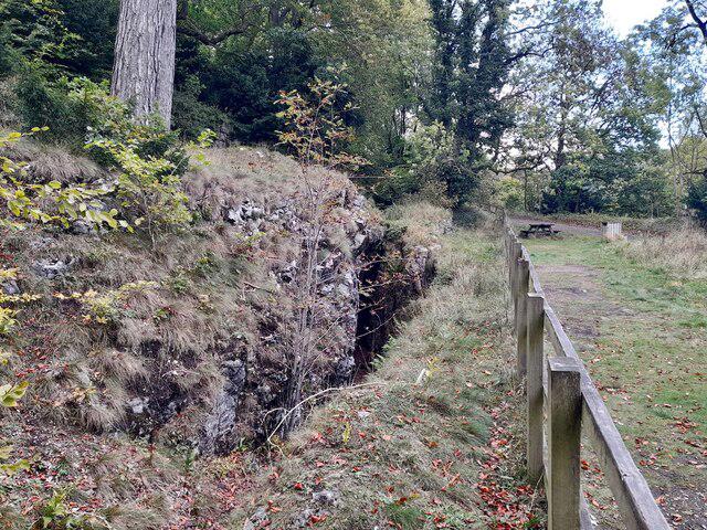 Photo could not load
SK2958 : A fenced-off cleft in the rock by a picnic area
Ian Calderwood
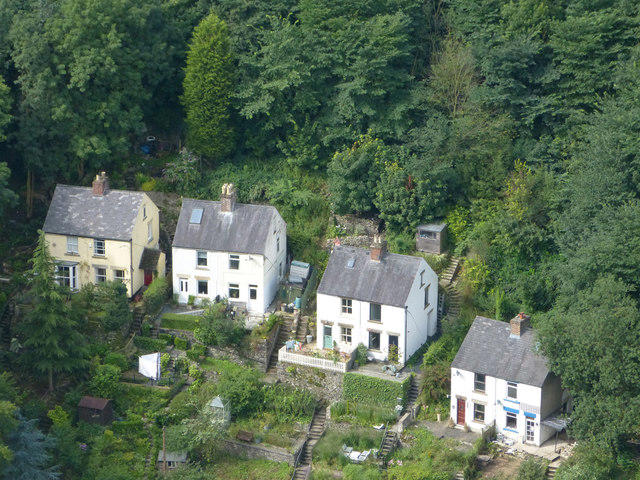 Photo could not load
SK2959 : Valley bottom cottages
Malcolm Neal
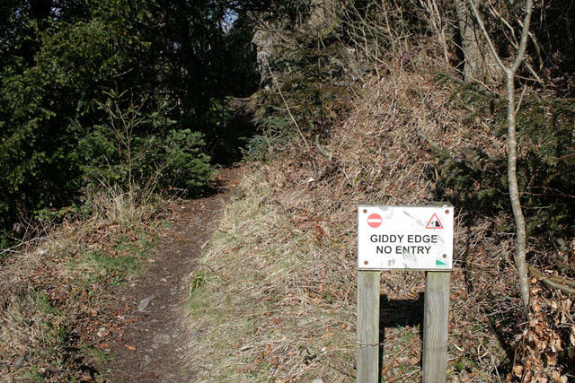 Photo could not load
SK2958 : The south end of the Giddy Edge path
David Lally
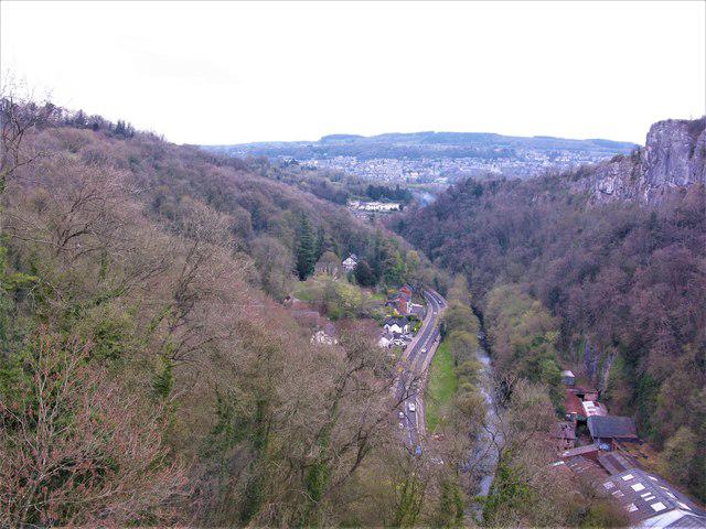
SK2958 : A6 and River Derwent, Derwent Valley
G Laird
Hill facts and local notes
Classifications
Elevation
205m
673 ft
Prominence
47m
Coordinates
53.1270, -1.5577
SK296589
OS Map
119
Explorer: OL24E
At the Summit
The summit is marked by a prominent rocky outcrop, providing a fantastic spot for photographs. There's a small cairn and a few benches for weary legs.
Terrain & Geology
Predominantly limestone with interesting karst features, including cliffs and rocky outcrops, which are a hallmark of the area.
Views & Scenery
Dramatic views of the River Derwent Valley, the Heights of Abraham, and the surrounding limestone hills.
History & Heritage
Name Origin
The name 'High Tor' reflects its status as a prominent cliff or rocky outcrop in the landscape. 'Tor' is a term commonly used in the UK for a high rock or pile of rocks.
Historical Significance
High Tor has long been a popular site for walkers and climbers, featuring in various historical accounts and attracting tourists to the picturesque Peak District.
Getting There & Facilities
Parking
There is parking available at Matlock Bath, just a short walk from the trailhead.
Public Transport
Matlock Bath is served by trains from major cities, with frequent bus services connecting it to nearby towns.
Nearby Facilities
Cafés and public toilets are available in Matlock Bath, perfect for a post-hike treat.
Safety Information
Known Hazards
- Uneven ground may pose a trip hazard; be wary of loose rocks, especially when wet.
General Safety Tips
- Check weather conditions before setting out
- Carry appropriate clothing and equipment
- Let someone know your planned route
- Take a map, compass, and GPS device
- Carry emergency supplies: food, water, first aid kit, torch
Hills
Some common questions about the hills answered
Are there group walks up High Tor?
Many walkers use Walkmates to join or organise walks with others. You can check for group walks around High Tor through the maps
Are there other walkers around High Tor?
Activity varies by location and time, but Walkmates lets you see whether others have shared walks or shown interest in this area. Find other people through the walking friends search walking friends for High Tor search or of course create your own walk for High Tor
Can I organise a walk to High Tor?
Yes. If there aren’t any walks listed already, you can create a walk and make it available for others to join.
If you're signed up to Walkmates, you can create a walk to High Tor.
How do I find a walk up this hill?
There are often multiple ways to walk this hill, depending on experience and route preference. Walkmates helps you explore walks and routes that others have shared.
Can I suggest a new route up High Tor?
Yes. You can suggest or create routes to share with others. Walkmates focuses on the social side of walking, so routes are used to help people organise walks and explore areas together, rather than as detailed navigation tools or route libraries.
Other uses really appreciate knowledgeable walkers sharing their routes. Share your favourite route to High Tor here
The is an error or something incorrect about this hill. How do I let you know?
We always strive to keep the information on Walkmates as accurate as possible. If you find an error, please let us know through the contact form and we'll aim to correct it as quickly as possible
Community Discussion
Comments
Location
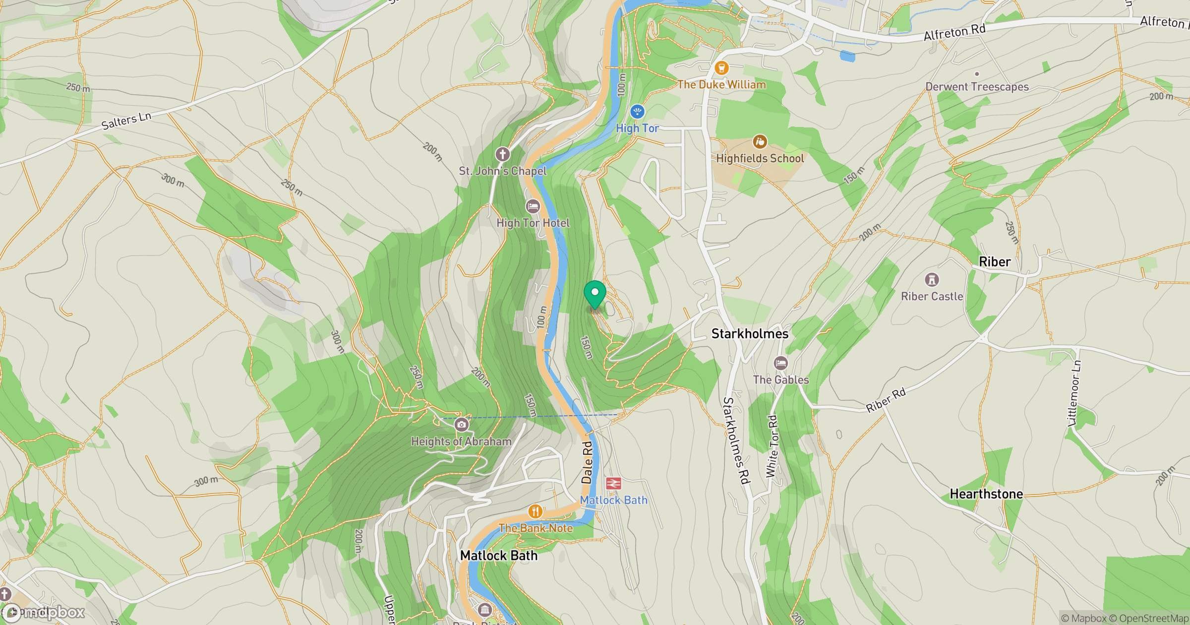
Grid reference: SK296589
View on OpenStreetMapOpens a map in a new tab, centred on the hill.
Nearby Hills

Kinder Scout
636m
The Roaches
505m
Rombalds Moor [Ilkley Moor]
402m

Pendle Hill
557m
Winter Hill
456m
No comments yet. Be the first.