

High Neb
Good walks are even better shared.
Overview
High Neb
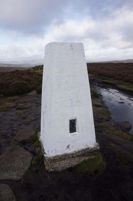
High Neb is the 458 m high point of Stanage Edge above Hathersage. Its exact summit is an outcrop at SK 22782 85368, 40 m WNW of the trig point. DoBIH records a 108 m drop and an Abney-level observation placing the outcrop 25 cm above the trig’s flush bracket. Reaching the pillar alone does not identify the precise summit.
A complete circuit from Hollin Bank
The Peak District Kids circuit starts and finishes at Hollin Bank car park, SK23808368. It climbs through the plantation, follows the upper edge past High Neb’s trig to Stanage End, and returns beneath the cliffs before rejoining the outward path. The publisher gives 7.7 km, 217 m total ascent and about 2.5 hours without children, advising at least 4 hours with young children. These are full-circuit figures.
The guide does not identify the exact outcrop summit. A summit diversion changes the published metrics. Stanedge Pole, the separate 444.1 m DoBIH hill to the south-east, and Robin Hood’s Cave are not part of this circuit. The retained route is not a Pennine Way section.
Rock and landscape
Stanage’s Rivelin or Chatsworth Grit is coarse Carboniferous sandstone deposited by an ancient river-delta system. Millstones left below the crags reflect its industrial use. The edge overlooks Hathersage and the Hope Valley, with Win Hill, Mam Tor and Kinder in the wider outlook. “Neb” is a northern English word for a projecting peak or rock feature; its precise local naming history is uncertain.
Getting there
Use the signed pay-and-display Hollin Bank car park. Dennis Knoll is an alternative official approach to High Neb, but requires a different route plan. Toilets are on The Dale road east of Hollin Bank; carry food and water. Hathersage has further services, rail access and buses, with an additional uphill approach to the estate.
At the 18 October 2026 check, the National Park’s closures page displayed a Hooks Carr car-park restriction from 6 October for four weeks, without a year in that notice. Check before travelling. It is not a stated High Neb summit closure.
Safety and conservation
Stay back from cliff edges and take care on uneven rocks, wet paths and the ladder stile. Wind and low cloud can make this exposed walk more demanding. Keep dogs on short leads on the National Park estate. Before taking a dog west of High Neb, check current access information: the BMC listing flags dog exclusions on some access land, while rights of way and concessionary paths remain open. The precise boundary along this circuit has not been verified. Respect signed nesting-bird restrictions and do not bring fires or barbecues. Park only in designated bays.
Explore routes near High Neb
Public walks starting within 80 km of this hill. Nearby does not mean a route reaches the summit; check its map and access before setting out.
Hathersage festive guided walk
View route
White Edge, Curbar Edge, Froggatt Edge loop.
View route
Derwent and Howden: Slippery Stones reservoir circuit
View route
Ladybower Reservoir: Lost Villages Circuit from Fairholmes
View route
Route planning notes
These notes describe possible approaches, not verified navigable routes or permission to cross land. Check current paths, local access rules and conditions before setting out.
Hollin Bank, High Neb trig point and Stanage End circuit
Start and finish at Hollin Bank car park, SK23808368 (called Hollins Bank by the route author). Climb through the plantation, turn left along the edge, pass High Neb’s trig point and continue to Stanage End. Descend left to the path beneath the edge, follow it back past millstones, cross the ladder stile and rejoin the outward path to the car park. Peak District Kids gives 7.7 km, 217 m total ascent and about 2.5 hours without children; it advises at least 4 hours with young children. These figures apply only to the full published circuit. The exact summit outcrop 40 m WNW of the trig is not explicitly identified by that guide; a diversion to it is not included in the certified route metrics. Stanedge Pole and Robin Hood’s Cave are excluded. https://peakdistrictkids.co.uk/stanage-edge-walk/
Make a day of it, together
Find someone to share the walk with, or organise a day out along a route you like.
Photo Gallery
View all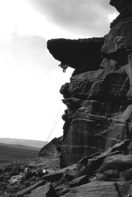 Photo could not load
SK2285 : Quietus, High Neb
Richard Webb
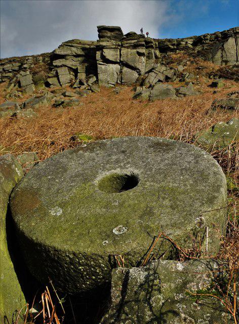 Photo could not load
SK2285 : Abandoned millstone below Stanage Edge
Neil Theasby
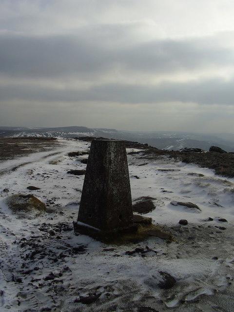 Photo could not load
SK2285 : High Neb
steven ruffles
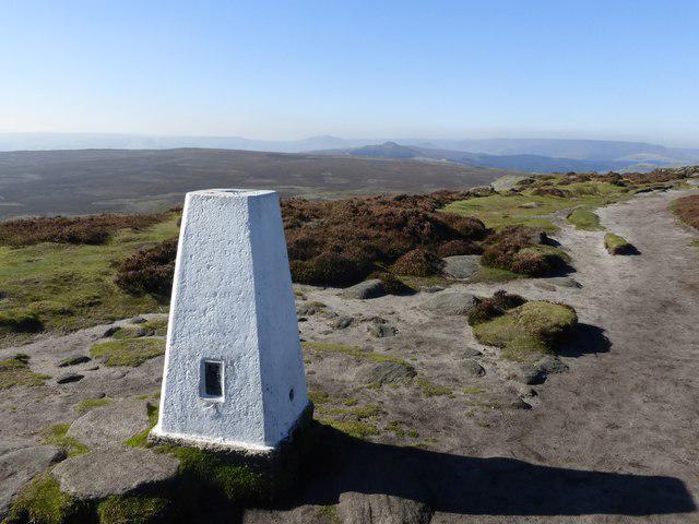 Photo could not load
SK2285 : High Neb trig point
Graham Hogg
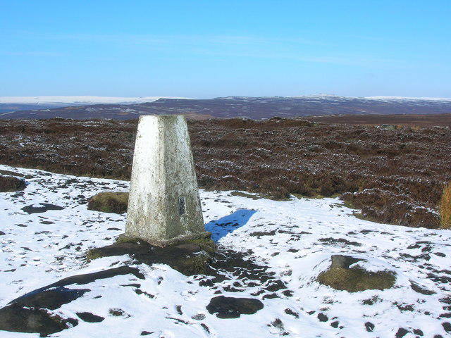 Photo could not load
SK2285 : High Neb Trig Point, Stanage Edge
John H Darch
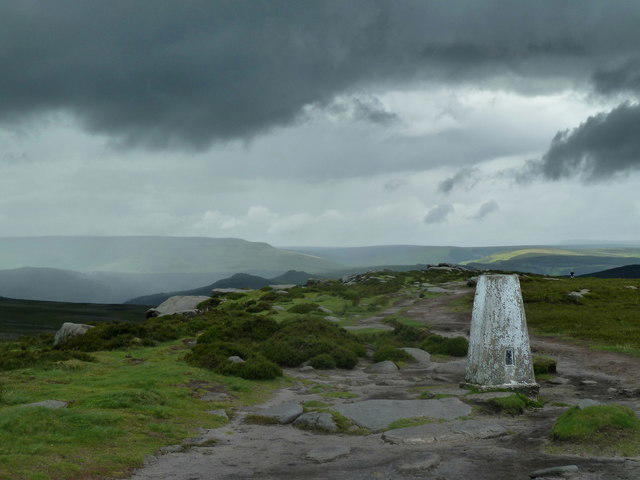 Photo could not load
SK2285 : High Neb trig point
Andrew Hill
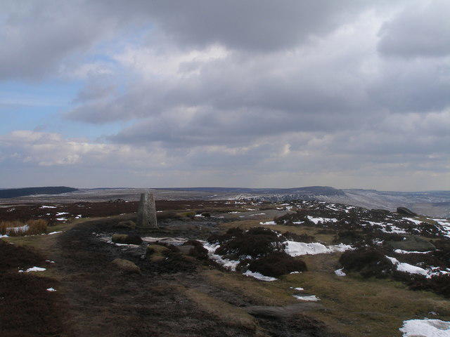 Photo could not load
SK2285 : High Neb trig point
John Slater
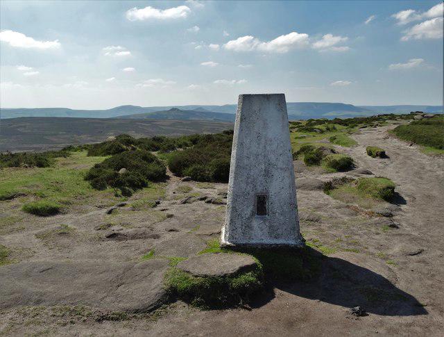 Photo could not load
SK2285 : High Neb - the triangulation pillar
Neil Theasby
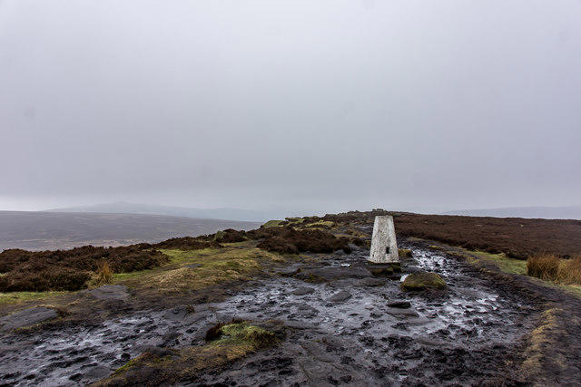 Photo could not load
SK2285 : High Neb Trigpoint, Stanage Edge
Brian Deegan
SK2285 : Trig point OSBM S2157, High Neb, Stanage Edge
Ian S
Hill facts and local notes
Classifications
Elevation
458m
1,503 ft
Prominence
108m
Coordinates
53.3647, -1.6591
SK227853
OS Map
110
Explorer: OL1E
At the Summit
The exact 458 m summit is an outcrop 40 m WNW of the trig point, at SK 22782 85368. DoBIH’s Abney-level observation puts it above nearby contenders and 25 cm above the trig flush bracket. The trig itself is a landmark rather than the exact summit.
Terrain & Geology
High Neb is part of the Stanage gritstone escarpment. Its Rivelin, or Chatsworth, Grit is a coarse Carboniferous sandstone in the Millstone Grit succession, deposited by rivers in an advancing delta system. Cross-bedding and pebbly layers are characteristic.
Views & Scenery
The Stanage escarpment overlooks the Hope Valley and Hathersage, with views towards Win Hill, Mam Tor, Kinder Scout and, on the circuit, Ladybower Reservoir. Distant views depend on visibility.
History & Heritage
Name Origin
In northern English usage, “neb” can mean a peak or projecting gritstone feature. Collins traces the word to Old English nebb, related to Old Norse nef. A specific historical derivation of High Neb’s place-name has not been established here.
Historical Significance
Abandoned millstones below Stanage Edge record its former quarrying industry. The wider North Lees estate also contains prehistoric and later archaeological sites; Stanedge Pole is a separate boundary landmark along Long Causeway.
Getting There & Facilities
Check current local access restrictions, parking rules and transport timetables before travelling. These notes do not confirm public access to the summit.
Parking
Hollin Bank car park, SK23808368, is the start of the described circuit. Dennis Knoll is another official access car park for High Neb, but starting there changes the route. The National Park says its estate car parks are pay-and-display, including card payment. Check the current Hooks Carr closure notice and do not use roadside verges.
Public Transport
The National Park recommends Hathersage station on the Hope Valley Line or bus 272 to Hathersage, followed by roughly two miles of uphill walking to the estate. Neither directly reaches the edge. Check current rail and bus timetables; these approach miles are additional to the Hollin Bank circuit.
Nearby Facilities
Public toilets are on The Dale road about 250 m east of Hollin Bank car park, according to the National Park. There are no summit facilities or permanent refreshments at the estate car parks; Hathersage has shops, cafes and pubs. Bring food and water.
Safety Information
Known Hazards
- Keep well back from the cliff edge and supervise children: a slip or gust can have serious consequences.
- Uneven gritstone, wet rocks, boggy paths and the ladder stile require care. Carry a map, weather protection and suitable footwear.
- Keep dogs on short leads on the National Park estate. Check access restrictions before taking a dog west of High Neb: the BMC access listing flags dog exclusions on some access land, while public rights of way and concessionary paths remain open. The precise restricted-land boundary along this circuit has not been verified. Obey signed nesting-bird restrictions.
- No fires or barbecues on the estate. Use designated parking and do not block verges, gates or emergency access.
- Checked 18 October 2026: the National Park’s current closures page says Hooks Carr car park is partially or fully closed from 6 October for four weeks. That notice does not specify a year. Check current notices; this is a car-park restriction, not a declared closure of High Neb.
General Safety Tips
- Check weather conditions before setting out
- Carry appropriate clothing and equipment
- Let someone know your planned route
- Take a map, compass, and GPS device
- Carry emergency supplies: food, water, first aid kit, torch
Hills
Some common questions about the hills answered
Are there group walks up High Neb?
Many walkers use Walkmates to join or organise walks with others. You can check for group walks around High Neb through the maps
Are there other walkers around High Neb?
Activity varies by location and time, but Walkmates lets you see whether others have shared walks or shown interest in this area. Find other people through the walking friends search walking friends for High Neb search or of course create your own walk for High Neb
Can I organise a walk to High Neb?
Yes. If there aren’t any walks listed already, you can create a walk and make it available for others to join.
If you're signed up to Walkmates, you can create a walk to High Neb.
How do I find a walk up this hill?
There are often multiple ways to walk this hill, depending on experience and route preference. Walkmates helps you explore walks and routes that others have shared.
Can I suggest a new route up High Neb?
Yes. You can suggest or create routes to share with others. Walkmates focuses on the social side of walking, so routes are used to help people organise walks and explore areas together, rather than as detailed navigation tools or route libraries.
Other uses really appreciate knowledgeable walkers sharing their routes. Share your favourite route to High Neb here
The is an error or something incorrect about this hill. How do I let you know?
We always strive to keep the information on Walkmates as accurate as possible. If you find an error, please let us know through the contact form and we'll aim to correct it as quickly as possible
Community Discussion
Comments
Location
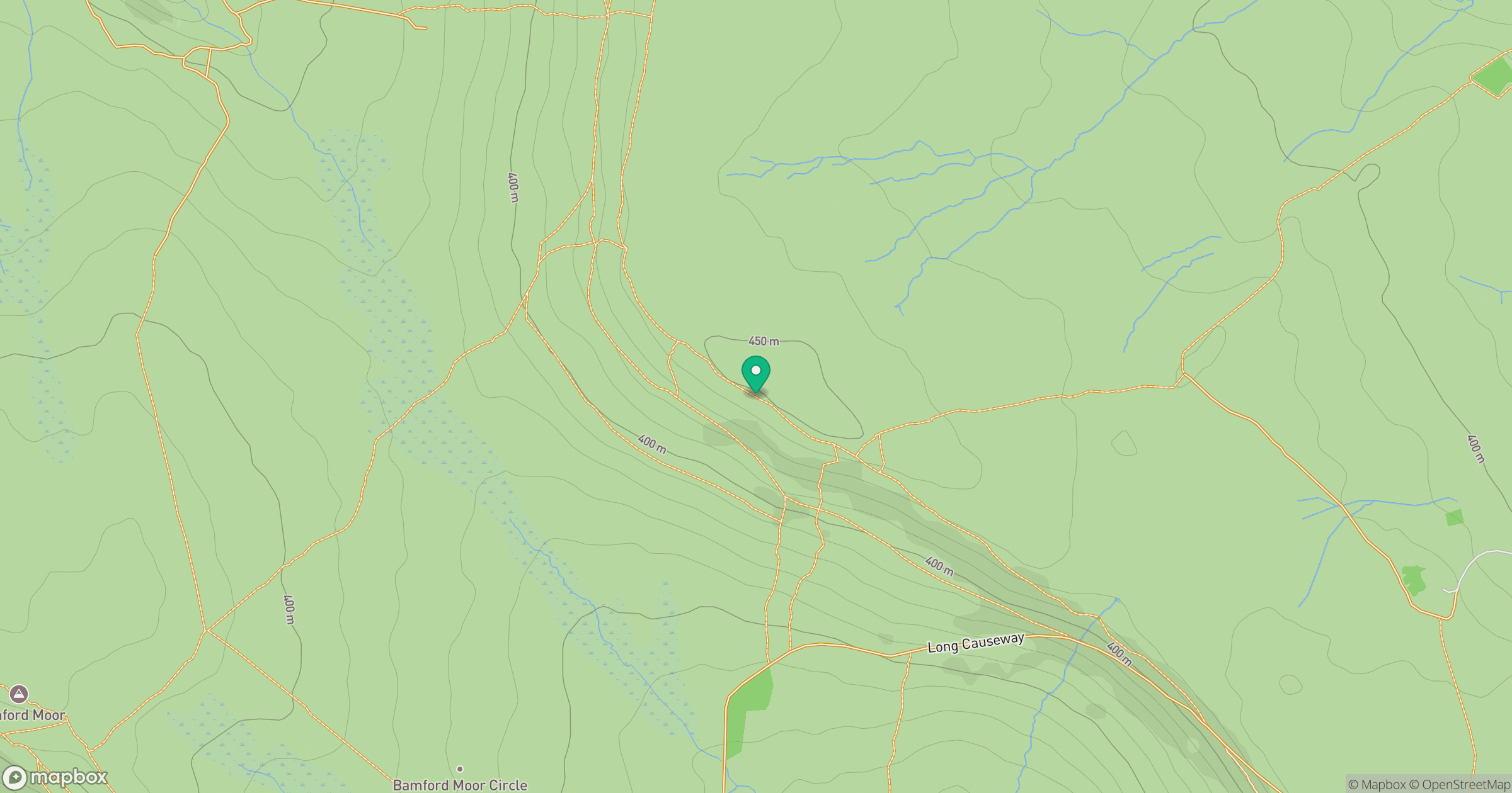
Grid reference: SK227853
View on OpenStreetMapOpens a map in a new tab, centred on the hill.
Hills within 30 km
Straight-line distance, not a walking route or confirmation of access.
No comments yet. Be the first.