

Healey Nab
Good walks are even better shared.
SD6018 : The cairn on Healey Nab
Raymond Knapman Photo source
Overview
Healey Nab
Nestled in the heart of the West Pennine Moors, Healey Nab stands tall at an elevation of 338 meters. As a designated Marilyn, this hill not only offers stunning views but also a rewarding hike for enthusiasts of all ages.
Geology
The ungainly geology of Healey Nab primarily comprises Millstone Grit, ensuring that even after centuries of wear, the rocks remain steadfast against the elements. The rugged terrain hosts a variety of resilient plants, painting a picturesque landscape that will make any photographer drool.
Parking and Access
Getting to Healey Nab is as easy as pie – if pie was a winding road through the countryside. The nearest car park can be found at SD606181, located merely a stone's throw from the trailhead. If you prefer public transport over a car, regular buses from Chorley and Bolton will leave you within a 30-minute walk of the start. Once you arrive, your nearest town is Chorley, a friendly locale ready with refreshments.
The Routes
The Healey Nab Circular Walk is the highlight, offering a 4.5 km journey that loops back around to your starting point. Expect a moderate difficulty level that will get the blood pumping, and you'll thank yourself afterwards for that slice of cake from the cafe.
Summit Features
At the apex, you’ll find a classic stone trig point, perfect for showcasing your hiking triumphs on social media! Ensure your compass is in working order; it’s the only way to avoid that classic ‘lost tourist’ look.
Terrain and Hazards
Prepare for a rocky yet grassy adventure where patches of heather might play hide and seek underfoot. Be advised, slippery stones could make you reconsider that daring dance move, especially after rain. Cattle may be spotted grazing, adding a charming pastoral touch but also a need for caution.
Views and Best Seasons
From the summit, gaze upon Rivington Pike and Winter Hill while the Manchester skyline winks in the distance. Spring and Autumn are the crème de la crème of the seasons to visit, granting your eyes the colours and vistas deserving of the effort.
Nearby Summits
Don’t miss Rivington Pike just up the road; at 343 meters, it’s not only a great neighbour but offers even more splendid views.
Facilities
Post-hike, head back to Chorley for a well-deserved treat. Cafes are aplenty, not to mention public toilets for that essential pit stop.
History
The mountain's name, derived from Old English, hints at its historical significance as a clearing atop a hill. It bears witness to the village’s past of mining and agriculture, with remnants still scattered across the landscape.
So, lace up those hiking boots and take a jaunt up Healey Nab – where every step offers both a challenge and a laughter-filled adventure!
Explore routes near Healey Nab
Walks starting near this hill. Open a route to check its map, distance and full itinerary.
Brockholes Reserve Tour
View route
Brockholes Wildflower Year guided walk
View route
Brockholes Reserve Tour
View route
History of Christmas guided walk
View route
Route planning notes
These notes describe possible approaches. Check a route's map and access information when planning your walk.
Healey Nab Circular Walk
A scenic circular walk starting from the car park and providing sweeping views of the surrounding moors.
Make a day of it, together
Find someone to share the walk with, or organise a day out along a route you like.
Photo Gallery
View all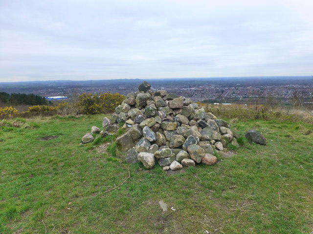 Photo could not load
SD6018 : The cairn on Healey Nab
Raymond Knapman
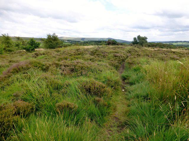 Photo could not load
SD6018 : Healey Nab
Rude Health
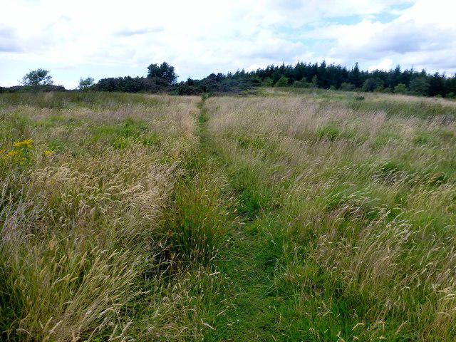 Photo could not load
SD6017 : Healey Nab
Rude Health
Hill facts and local notes
Classifications
Elevation
208m
682 ft
Prominence
64m
Coordinates
53.6570, -2.5957
SD607179
OS Map
109
Explorer: 285E 287
At the Summit
The summit features a stone trig point, providing a perfect photo opportunity. Just don’t forget to check the compass first!
Terrain & Geology
The area primarily consists of Millstone Grit, a tough sandstone which has weathered into steep cliffs and crags. You'll find some incredibly resilient flora thriving in the rocky terrain.
Views & Scenery
From the summit, hikers can catch glimpses of Rivington Pike, Winter Hill, and the distant bow of the Manchester skyline.
History & Heritage
Name Origin
The name 'Healey' is derived from Old English meaning 'clearing on a hill', which seems fitting for a hilltop you won’t forget.
Historical Significance
This area has a rich history of mining and agriculture, with remnants of ancient practices still visible.
Getting There & Facilities
Parking
There is a small car park at SD606181, just a short walk from the trailhead.
Public Transport
Buses run regularly from Chorley and Bolton to nearby towns with a 30-minute walk to the start of the trail.
Nearby Facilities
There are a few cafes in Chorley for coffee and cake after your hike, plus public toilets available in the town centre.
Safety Information
Known Hazards
- Watch out for slippery rocks, especially after rain. Also, be mindful of cattle grazing in the area.
General Safety Tips
- Check weather conditions before setting out
- Carry appropriate clothing and equipment
- Let someone know your planned route
- Take a map, compass, and GPS device
- Carry emergency supplies: food, water, first aid kit, torch
Hills
Some common questions about the hills answered
Are there group walks up Healey Nab?
Many walkers use Walkmates to join or organise walks with others. You can check for group walks around Healey Nab through the maps
Are there other walkers around Healey Nab?
Activity varies by location and time, but Walkmates lets you see whether others have shared walks or shown interest in this area. Find other people through the walking friends search walking friends for Healey Nab search or of course create your own walk for Healey Nab
Can I organise a walk to Healey Nab?
Yes. If there aren’t any walks listed already, you can create a walk and make it available for others to join.
If you're signed up to Walkmates, you can create a walk to Healey Nab.
How do I find a walk up this hill?
There are often multiple ways to walk this hill, depending on experience and route preference. Walkmates helps you explore walks and routes that others have shared.
Can I suggest a new route up Healey Nab?
Yes. You can suggest or create routes to share with others. Walkmates focuses on the social side of walking, so routes are used to help people organise walks and explore areas together, rather than as detailed navigation tools or route libraries.
Other uses really appreciate knowledgeable walkers sharing their routes. Share your favourite route to Healey Nab here
The is an error or something incorrect about this hill. How do I let you know?
We always strive to keep the information on Walkmates as accurate as possible. If you find an error, please let us know through the contact form and we'll aim to correct it as quickly as possible
Community Discussion
Comments
Location
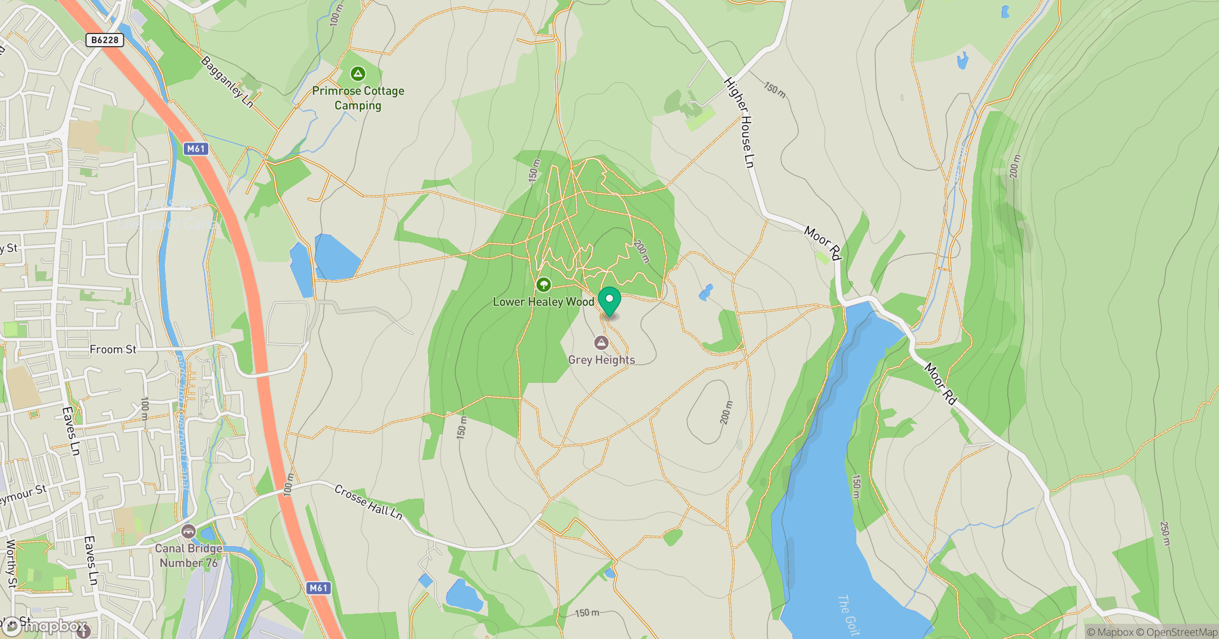
Grid reference: SD607179
View on OpenStreetMapOpens a map in a new tab, centred on the hill.




No comments yet. Be the first.