

Gors Lydan
Good walks are even better shared.
Overview
Gors Lydan
Gors Lydan is a charming hill nestled in the Brecon Beacons National Park, reaching an elevation of 400 meters. This Marilyn, with a prominence of 60 meters, provides an easy-going adventure suitable for families or experienced hikers looking for a leisurely day out.
Geology
The geological underpinnings of Gors Lydan offer insights into the ancient history of the area. Primarily composed of Old Red Sandstone, this mountain has fascinating fossilised remnants hidden among its rocks, hinting at a time when this area was covered by a vast sea. The striking red stone juxtaposed against vivid green valleys creates an ever-changing canvas that captures the heart.
Routes
One of the most popular routes is the Gors Lydan Circuit, which meanders through stunning landscapes for approximately 8.5 km and takes around 2.5 hours to complete. This loop begins in Llangynidr, guiding hikers through breathtaking views and charming scenery, making it a favourite for both locals and visitors alike.
Summit Features
At the summit, you’ll find a durable stone cairn, which visitors often adorn with stones from their journey—a tradition that shows both respect for nature and a touch of playfulness. Close by stands the sturdy trig point, offering the perfect vantage point for those seeking breathtaking photos.
Terrain and Views
Expect a mix of grassy slopes and rockier patches as you traverse Gors Lydan. Keep your eyes peeled for boggy areas that might surprise you! Once at the top, enjoy expansive panoramic views of the Brecon Beacons; if you happen to hit it right, the sunrise or sunset from up here will make your heart skip a beat. The best seasons to appreciate the sights are late spring or early autumn.
Hazards
As delightful as Gors Lydan may be, it's essential to be mindful of the unpredictable weather typical of Wales. Conditions can change quicker than you can say 'Where's my hat?', so pack accordingly and always check the forecast before heading out.
Access
Access to Gors Lydan is straightforward. The nearest parking area is conveniently located at the village hall in Llangynidr. Should you prefer public transport, Abergavenny's bus services can drop you off right in the village.
Facilities
Llangynidr isn't just a pit stop; it offers a local shop for last-minute treats and The Red Lion pub—a great spot to grab a pint after conquering the mountain. There are toilets available at the village hall to freshen up before your trek.
History
The mountain's name, Gors Lydan, reflects its moorland identity, invoking images of a landscape interwoven with stories and folklore. Local legends speak of mythical creatures that once roamed these hills, adding a mystical quality that captivates the imagination.
In conclusion, Gors Lydan may be lesser-known in the grand tales of larger peaks, yet it possesses its own charm and ample beauty. As the saying goes, 'it's not the size of the dog in the fight, but the size of the fight in the dog.' Lace up those boots, grab your walking sticks, and set off for a memorable adventure on Gors Lydan!
Explore routes near Gors Lydan
Public walks starting within 80 km of this hill. Nearby does not mean a route reaches the summit; check its map and access before setting out.
Elan Valley: Reservoir Trail to Pen y Garreg Dam
View route
Hafren Forest: full Source of the Severn Trail
View route
Welshpool to Sweeps Bridge: Montgomery Canal and Belan Locks
View route
Croft Castle: Fishpool Valley and the Gothic pumphouse
View route
Route planning notes
These notes describe possible approaches, not verified navigable routes or permission to cross land. Check current paths, local access rules and conditions before setting out.
Gors Lydan Circuit
A scenic loop starting from the village of Llangynidr, looping around to summit and providing wonderful views over the surrounding valleys.
Make a day of it, together
Find someone to share the walk with, or organise a day out along a route you like.
Photo Gallery
View all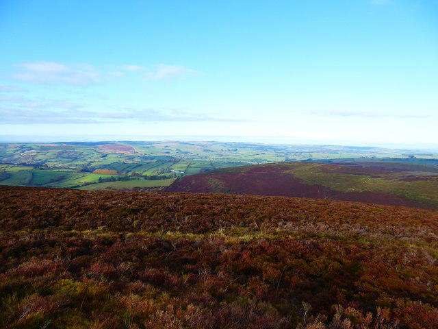 Photo could not load
SO1277 : View north-westward from a burial mound on Gors Lydan
Jeremy Bolwell
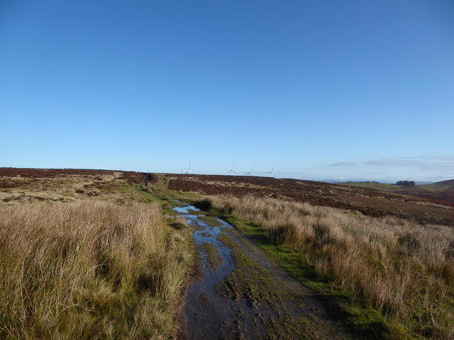 Photo could not load
SO1276 : On Gors Lydan
Jeremy Bolwell
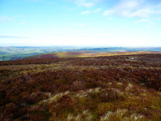 Photo could not load
SO1276 : View from Gors Lydan
Jeremy Bolwell
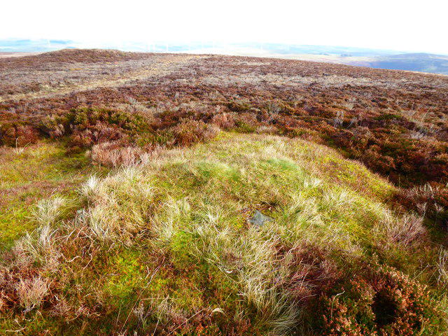 Photo could not load
SO1276 : Burial mounds on Gors Lydan
Jeremy Bolwell
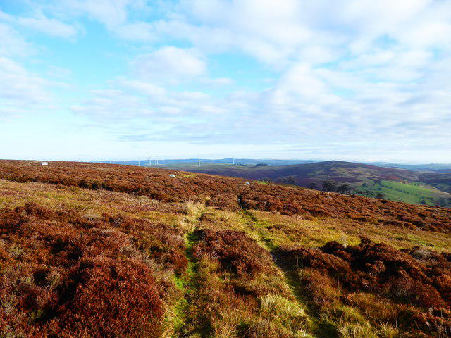 Photo could not load
SO1276 : On Gors Lydan
Jeremy Bolwell
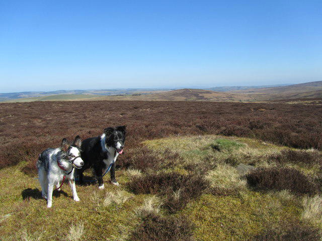 Photo could not load
SO1276 : Dewey bagging
John Horner
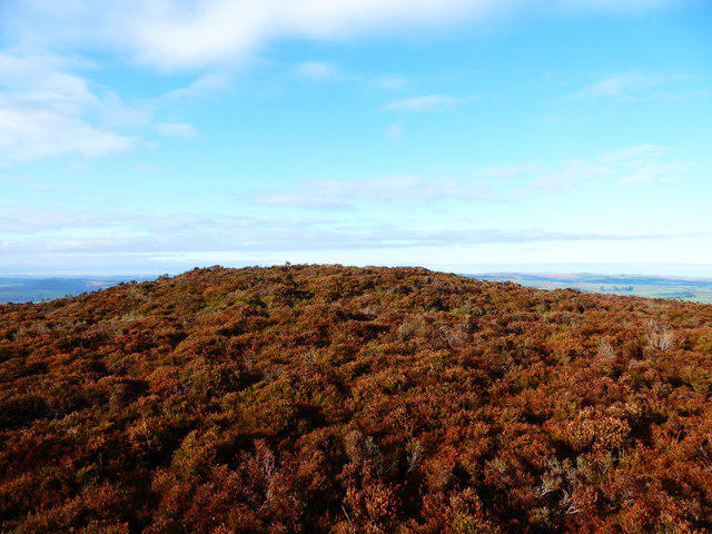 Photo could not load
SO1276 : A burial mound on Gors Lydan
Jeremy Bolwell
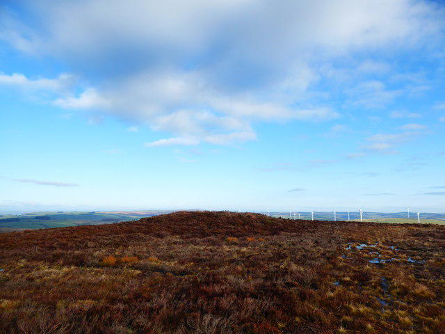 Photo could not load
SO1276 : Burial mound on Gors Lydan
Jeremy Bolwell
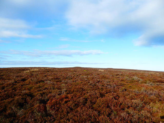 Photo could not load
SO1276 : Tumuli on Gors Lydan
Jeremy Bolwell
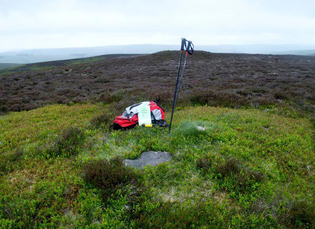 Photo could not load
SO1276 : Gors Lydan
Rude Health
Hill facts and local notes
Classifications
Elevation
529m
1,737 ft
Prominence
125m
Coordinates
52.3828, -3.2853
SO126768
OS Map
136 148
Explorer: 214E
At the Summit
The summit features a well-built stone cairn and a small, weather-beaten trig point that has stood the test of time—much like the views it offers.
Terrain & Geology
Gors Lydan is primarily composed of Old Red Sandstone, with fascinating fossilised remnants that whisper tales of ancient marine environments. The distinctive reddish hue of the rocks provides a lovely contrast to the green hillsides.
Views & Scenery
From the summit, you can gaze upon the majestic peaks of the Brecon Beacons, the lush rural landscape, and on clear days, even the distant Severn Estuary.
History & Heritage
Name Origin
The name 'Gors Lydan' is thought to derive from the Welsh, meaning 'moorland of the swamp', a fitting description given the area’s numerous wet areas.
Historical Significance
Historically, Gors Lydan served as an important landmark for local navigation, and it is entwined with local folklore involving the mythical creatures said to roam its paths.
Getting There & Facilities
Check current local access restrictions, parking rules and transport timetables before travelling. These notes do not confirm public access to the summit.
Parking
Free parking is available at the Llangynidr village hall, which serves as a great starting point for your adventure.
Public Transport
The nearest bus service from Abergavenny stops in Llangynidr, making it a convenient option for reaching the mountain without driving.
Nearby Facilities
The village offers a local shop and a welcoming pub, The Red Lion, where you can fuel up before or celebrate after your hike. Facilities such as toilets are available at the village hall.
Safety Information
Known Hazards
- Watch out for sudden weather changes, especially in spring and autumn, as the conditions can shift faster than a cat on a hot tin roof.
General Safety Tips
- Check weather conditions before setting out
- Carry appropriate clothing and equipment
- Let someone know your planned route
- Take a map, compass, and GPS device
- Carry emergency supplies: food, water, first aid kit, torch
Hills
Some common questions about the hills answered
Are there group walks up Gors Lydan?
Many walkers use Walkmates to join or organise walks with others. You can check for group walks around Gors Lydan through the maps
Are there other walkers around Gors Lydan?
Activity varies by location and time, but Walkmates lets you see whether others have shared walks or shown interest in this area. Find other people through the walking friends search walking friends for Gors Lydan search or of course create your own walk for Gors Lydan
Can I organise a walk to Gors Lydan?
Yes. If there aren’t any walks listed already, you can create a walk and make it available for others to join.
If you're signed up to Walkmates, you can create a walk to Gors Lydan.
How do I find a walk up this hill?
There are often multiple ways to walk this hill, depending on experience and route preference. Walkmates helps you explore walks and routes that others have shared.
Can I suggest a new route up Gors Lydan?
Yes. You can suggest or create routes to share with others. Walkmates focuses on the social side of walking, so routes are used to help people organise walks and explore areas together, rather than as detailed navigation tools or route libraries.
Other uses really appreciate knowledgeable walkers sharing their routes. Share your favourite route to Gors Lydan here
The is an error or something incorrect about this hill. How do I let you know?
We always strive to keep the information on Walkmates as accurate as possible. If you find an error, please let us know through the contact form and we'll aim to correct it as quickly as possible
Community Discussion
Comments
Location
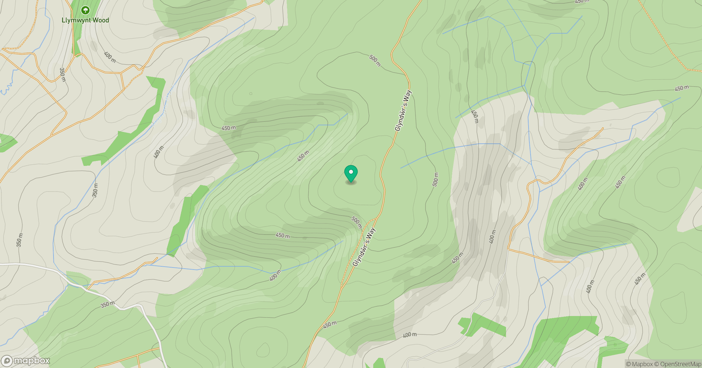
Grid reference: SO126768
View on OpenStreetMapOpens a map in a new tab, centred on the hill.
Hills within 30 km
Straight-line distance, not a walking route or confirmation of access.
No comments yet. Be the first.