
Y Foel
Good walks are even better shared.
Overview
Y Foel
Introduction
Nestled in the picturesque Brecon Beacons National Park, Y Foel stands as a prominent Marilyn featuring stunning landscapes and breathtaking views. At an elevation of 452 meters, it's the kind of hill that makes you feel alive while also gently reminding you to appreciate the little things in life—like a good pair of walking boots!
Geology
Y Foel’s geology is intriguing, primarily composed of Carboniferous limestone. This limestone creates a unique blend of rocky outcrops and grassy slopes, resulting in an ecosystem rich with wildflowers and wildlife, perfect for both amateur naturalists and seasoned hikers alike. And let’s not forget—rocks always make for a great story!
Routes
A couple of routes lead you to Y Foel’s summit:
- Cwm Gledry Route: A delightful 7.5 km hike that weaves through enchanting valleys and open moorlands. Expect to be captivated by its beauty.
- Abercraf Route: This direct route is a steeper ascent of about 6 km, challenging those looking for a good workout. Rewarding views await at the top!
Summit Features
Upon reaching the summit, you’re greeted by a small stone cairn and a wooden post that proudly declares you’ve made it to the top! The expansive views are like the cherry on top of the cake—truly spectacular!
Terrain
The terrain ranges from grassy paths to rocky outcrops with occasional boggy spots. Watch your step though, the damp patches can be a bit slippery!
Views
At the top, you can see impressive sights including the Sugar Loaf and the Black Mountains stretching out before you. Spring and autumn are your best bets for clear views, as the landscape transforms with vibrant colours. Don’t forget to pack a camera for those social media snaps!
Hazards
Keep an eye on the weather; swift changes can catch you off guard! The uneven terrain can also be a tricky customer, so ensure your boots are up to the task. Slips happen!
Nearby Summits
For those who feel the need to conquer more peaks, nearby summits include:
- Pen y Fan: At 886 meters, it’s the highest peak in South Wales.
- Cribyn: A delightful climb at 795 meters that can form part of a longer ridge walk.
Access
Finding your way to Y Foel is straightforward. The nearest parking is at Cwm Gledry with space for around 20 vehicles, plus more in Abercraf. Public transport from towns like Brecon is also available, making this gem accessible to all.
Facilities
Once you’ve returned from your hiking adventure, head to Abercraf for a well-deserved meal. There’s a selection of cafes and pubs to recharge and reflect on your day among the hills!
History
The name Y Foel translates literally to 'The Hill' in Welsh, illustrating its humble yet significant stature. It holds a cherished place in local folklore and continues to draw hikers eager to connect with nature.
So there you have it! Y Foel awaits your footsteps and perhaps a bit of laughter along the way. Happy hiking!
Explore routes near Y Foel
Public walks starting within 80 km of this hill. Nearby does not mean a route reaches the summit; check its map and access before setting out.
Hafren Forest: full Source of the Severn Trail
View route
Elan Valley: Reservoir Trail to Pen y Garreg Dam
View route
Welshpool to Sweeps Bridge: Montgomery Canal and Belan Locks
View route
Waun-oer, Maesglase and Cribin Fawr guided mountain walk
View route
Route planning notes
These notes describe possible approaches, not verified navigable routes or permission to cross land. Check current paths, local access rules and conditions before setting out.
Cwm Gledry Route
A scenic ascent starting from Cwm Gledry, leading through lush valleys and open moorlands.
Abercraf Route
A direct route from Abercraf, offering a steep climb with rewarding views at the summit.
Make a day of it, together
Find someone to share the walk with, or organise a day out along a route you like.
Hill facts and local notes
Classifications
Elevation
435m
1,427 ft
Prominence
116m
Coordinates
52.4457, -3.4453
SO018840
OS Map
136
Explorer: 214E
At the Summit
At the summit, hikers can find a small stone cairn and a wooden post marking the highest point. The expansive views from here are well worth the trek.
Terrain & Geology
Y Foel is primarily composed of Carboniferous limestone, providing a diverse landscape of rocky outcrops and grassy slopes. Its geology also contributes to the rich flora and fauna found in the area.
Views & Scenery
From the summit, enjoy sweeping views of the surrounding hills, including the Sugar Loaf and the Black Mountains. On clear days, the Bristol Channel may also be visible.
History & Heritage
Name Origin
Y Foel translates to 'The Hill' in Welsh, a fitting name for its stature within the landscape.
Historical Significance
Y Foel has notable significance in local folklore and is a popular attraction for both casual walkers and seasoned hikers.
Getting There & Facilities
Check current local access restrictions, parking rules and transport timetables before travelling. These notes do not confirm public access to the summit.
Parking
There is a small car park at Cwm Gledry, which can accommodate around 20 cars. Additional parking is available in Abercraf.
Public Transport
Regular bus services operate from larger towns like Brecon, with the nearest bus stop located in Abercraf.
Nearby Facilities
The nearest facilities are located in Abercraf, which has a few cafes, pubs, and public toilets. Make sure to recharge your energy before or after your hike!
Safety Information
Known Hazards
- Beware of sudden weather changes common in the Brecon Beacons, as well as uneven terrain that can cause slips. Make sure your boots have good grip!
General Safety Tips
- Check weather conditions before setting out
- Carry appropriate clothing and equipment
- Let someone know your planned route
- Take a map, compass, and GPS device
- Carry emergency supplies: food, water, first aid kit, torch
Hills
Some common questions about the hills answered
Are there group walks up Y Foel?
Many walkers use Walkmates to join or organise walks with others. You can check for group walks around Y Foel through the maps
Are there other walkers around Y Foel?
Activity varies by location and time, but Walkmates lets you see whether others have shared walks or shown interest in this area. Find other people through the walking friends search walking friends for Y Foel search or of course create your own walk for Y Foel
Can I organise a walk to Y Foel?
Yes. If there aren’t any walks listed already, you can create a walk and make it available for others to join.
If you're signed up to Walkmates, you can create a walk to Y Foel.
How do I find a walk up this hill?
There are often multiple ways to walk this hill, depending on experience and route preference. Walkmates helps you explore walks and routes that others have shared.
Can I suggest a new route up Y Foel?
Yes. You can suggest or create routes to share with others. Walkmates focuses on the social side of walking, so routes are used to help people organise walks and explore areas together, rather than as detailed navigation tools or route libraries.
Other uses really appreciate knowledgeable walkers sharing their routes. Share your favourite route to Y Foel here
The is an error or something incorrect about this hill. How do I let you know?
We always strive to keep the information on Walkmates as accurate as possible. If you find an error, please let us know through the contact form and we'll aim to correct it as quickly as possible
Community Discussion
Comments
Location
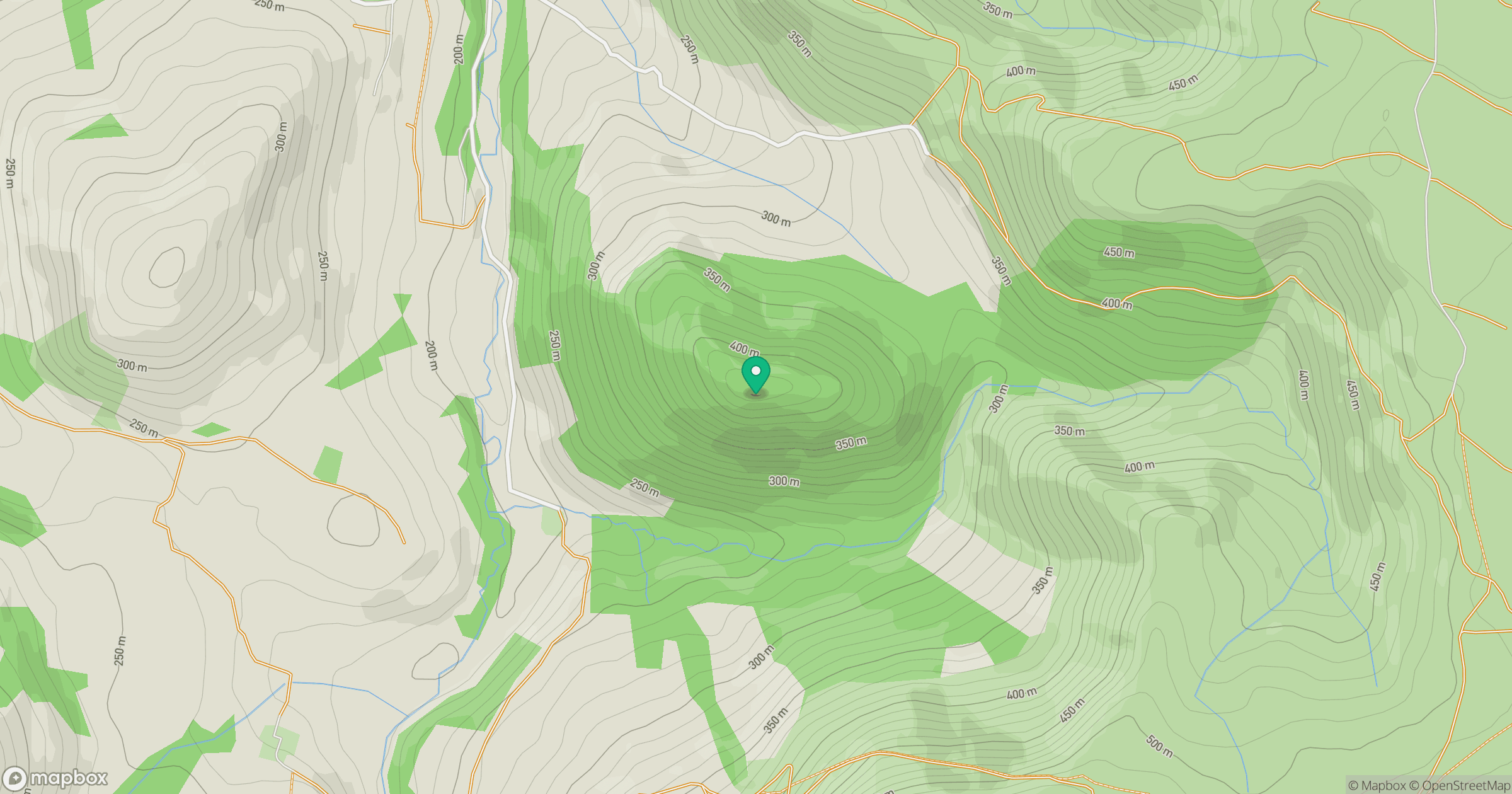
Grid reference: SO018840
View on OpenStreetMapOpens a map in a new tab, centred on the hill.
Hills within 30 km
Straight-line distance, not a walking route or confirmation of access.
No comments yet. Be the first.