

Gaer
Good walks are even better shared.
Overview
Gaer Mountain: An Outdoor Adventure
Nestled in the scenic Black Mountains of Wales, Gaer stands proud at an elevation of 610 meters, offering both seasoned hikers and lazy adventurers a fantastic day's outing. With its peculiar geological features and historical significance, Gaer is a must-visit for anyone looking to immerse themselves in the beauty of the Welsh countryside.
Geology
The mountain is primarily comprised of Old Red Sandstone, formed during the Devonian period, which, with a bit of imagination, could be mistaken for the finest Italian marble in the right light! As you roam the rocky outcrops, you'll be greeted by evidence of ancient glacial activity that has meticulously carved the region into its current form.
Routes
One of the most popular routes is The Gaer Loop, a moderate circular walk of approximately 8.5 km starting from the village of Glaisdale. This delightful trek combines both rocky and grassy terrains, ensuring you get a workout while taking in breathtaking views. Allow around 3.5 hours for this excursion, but don’t forget to spend some extra time enjoying the scenery—nature won't rush you, after all!
Summit Features
As you approach the summit of Gaer, you’ll encounter a large stone cairn—perfect for offering a hearty cheer to your hiking buddies or for playing a game of ‘who can stack the highest rock tower!’ This high point is also ideal for a scenic picnic, where you can enjoy some top-notch views with a packed lunch.
Terrain
The terrain offers a challenging mixture of rocky outcrops and grassy slopes. Keep an eye out for patches of bog; they can be an unexpected suprise!
Views
From the top, you'll unveil stunning vistas of the surrounding Black Mountains, notably the sharp outline of Table Mountain, and the soft curves of the Sugar Loaf. The best views arrive in Autumn when the trees adorn their finest outfits, though Spring brings its lively palette of wildflowers to the scene.
Hazards
Be careful of boggy patches, especially after rain. It’s all fun and games until someone ends up with a wet sock! Always tread cautiously.
Nearby Summits
For the adventure enthusiasts, nearby summits include Mynydd Troed at 654 meters and Crug Mawr at 600 meters. These peaks present further delightful hiking opportunities for those wanting extra adventure.
Access
Accessing Gaer is a breeze; there's ample parking at a layby off the A465, just a short walk from the trailhead. If you prefer public transport, hop on a bus to the village of Pandy and walk the 2 miles to the start.
Facilities
Post-hike, Abergavenny is a stone's throw away, providing cafes, pubs, and all the creature comforts. Public toilets are also available to freshen up before you indulge in a well-earned treat.
History
The name 'Gaer,' meaning 'fort' in Welsh, points to its historical significance as an ancient settlement and lookout tower. This rich history adds a layer of intrigue to your hike, reminding us that folks have been appreciating this spot long before we embarked on our outdoor adventures.
In conclusion, whether you're tackling the summit for the views, the geology, or just to work off that last slice of cake you had at the café, Gaer is sure to provide a rewarding experience. Pack your boots, grab some friends, and get ready for an adventure that could rival a walk in the park... if the park was on a mountain!
Happy Hiking!
Explore routes near Gaer
Public walks starting within 80 km of this hill. Nearby does not mean a route reaches the summit; check its map and access before setting out.
Elan Valley: Reservoir Trail to Pen y Garreg Dam
View route
Hafren Forest: full Source of the Severn Trail
View route
Croft Castle: Fishpool Valley and the Gothic pumphouse
View route
Mortimer Forest Lower Evens Circuit
View route
Route planning notes
These notes describe possible approaches, not verified navigable routes or permission to cross land. Check current paths, local access rules and conditions before setting out.
The Gaer Loop
A circular route starting from the village of Glaisdale, taking in the stunning landscapes around Gaer.
Make a day of it, together
Find someone to share the walk with, or organise a day out along a route you like.
Photo Gallery
View all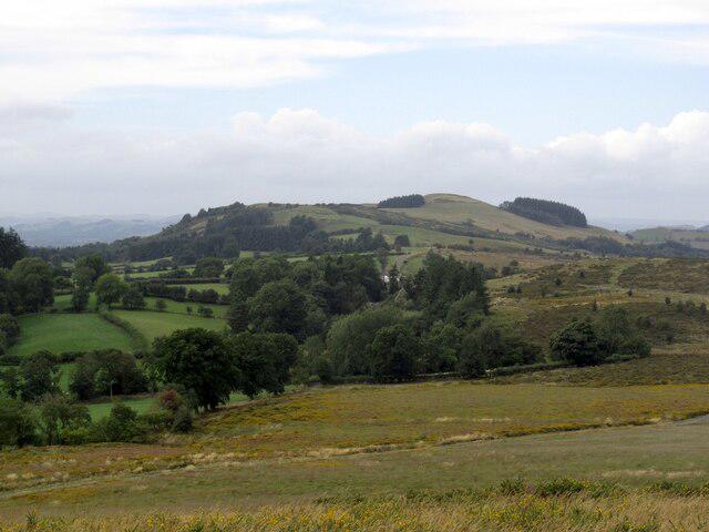 Photo could not load
SO1169 : Gaer
Richard Webb
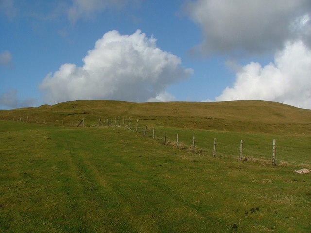 Photo could not load
SO1169 : Gaer Hill Fort
toby everard
Hill facts and local notes
Classifications
Elevation
417m
1,369 ft
Prominence
108m
Coordinates
52.3191, -3.3008
SO114697
OS Map
136 148
Explorer: 200E
At the Summit
At the summit of Gaer, you'll find a large stone cairn marking the high point, offering a perfect spot for a well-deserved rest and a picnic.
Terrain & Geology
Gaer is primarily composed of Old Red Sandstone, creating a unique rocky landscape that has been shaped by glacial processes. The area's distinctive ridges and valleys provide excellent insights into geological history.
Views & Scenery
Incredible panoramas of the surrounding Black Mountains, including the iconic Table Mountain and the distinctive silhouette of the Sugar Loaf.
History & Heritage
Name Origin
The name 'Gaer' derives from the Welsh word for 'fort,' hinting at the area's ancient settlements.
Historical Significance
In historical times, Gaer may have been an important lookout point and part of a defensive structure.
Getting There & Facilities
Check current local access restrictions, parking rules and transport timetables before travelling. These notes do not confirm public access to the summit.
Parking
Parking is available at the small layby off the A465, just a short walk from the starting point of the trail.
Public Transport
The nearest bus stop is in the village of Pandy, which is a 2-mile walk to the trailhead.
Nearby Facilities
There are no facilities directly on the mountain, but Abergavenny has cafes, pubs, and public toilets for pre- and post-hike refreshments.
Safety Information
Known Hazards
- Boggy areas can be slippery, especially after rain. Watch your step and keep an eye out for hidden holes!
General Safety Tips
- Check weather conditions before setting out
- Carry appropriate clothing and equipment
- Let someone know your planned route
- Take a map, compass, and GPS device
- Carry emergency supplies: food, water, first aid kit, torch
Hills
Some common questions about the hills answered
Are there group walks up Gaer?
Many walkers use Walkmates to join or organise walks with others. You can check for group walks around Gaer through the maps
Are there other walkers around Gaer?
Activity varies by location and time, but Walkmates lets you see whether others have shared walks or shown interest in this area. Find other people through the walking friends search walking friends for Gaer search or of course create your own walk for Gaer
Can I organise a walk to Gaer?
Yes. If there aren’t any walks listed already, you can create a walk and make it available for others to join.
If you're signed up to Walkmates, you can create a walk to Gaer.
How do I find a walk up this hill?
There are often multiple ways to walk this hill, depending on experience and route preference. Walkmates helps you explore walks and routes that others have shared.
Can I suggest a new route up Gaer?
Yes. You can suggest or create routes to share with others. Walkmates focuses on the social side of walking, so routes are used to help people organise walks and explore areas together, rather than as detailed navigation tools or route libraries.
Other uses really appreciate knowledgeable walkers sharing their routes. Share your favourite route to Gaer here
The is an error or something incorrect about this hill. How do I let you know?
We always strive to keep the information on Walkmates as accurate as possible. If you find an error, please let us know through the contact form and we'll aim to correct it as quickly as possible
Community Discussion
Comments
Location
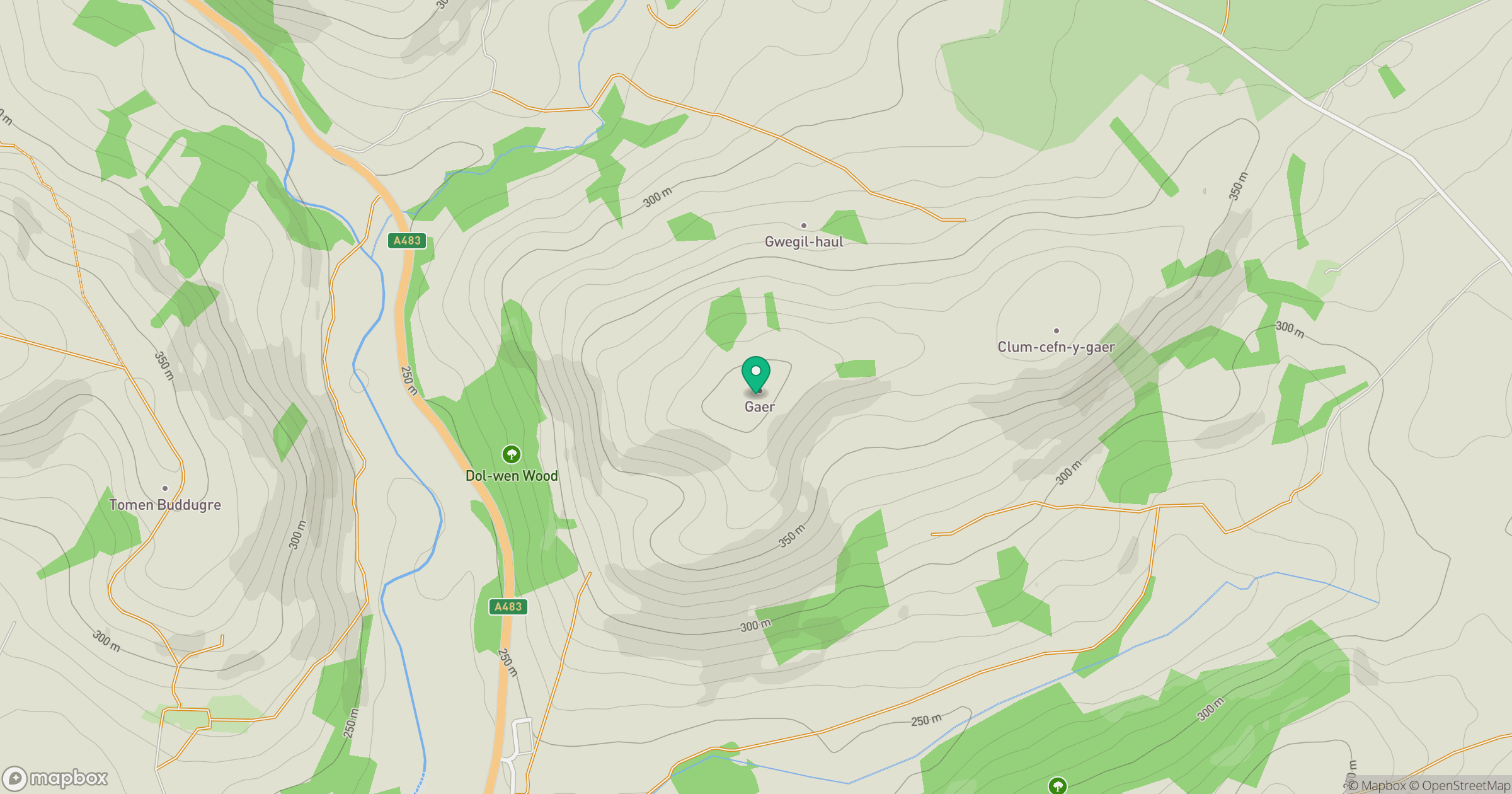
Grid reference: SO114697
View on OpenStreetMapOpens a map in a new tab, centred on the hill.
Hills within 30 km
Straight-line distance, not a walking route or confirmation of access.
No comments yet. Be the first.