

Great Rhos
Good walks are even better shared.
SO1863 : One of the highest trees in Wales (650m)
Richard Webb Photo source
Overview
Great Rhos: A Hidden Gem of the Cambrian Mountains
Nestled in the heart of the Cambrian Mountains, Great Rhos stands as a delightful delight for hikers and adventurers alike. Reaching an elevation of 644 meters, this Marilyn might not be the tallest peak in Wales, but it boasts ample charm and offers a plethora of routes for all skill levels.
Geology
Great Rhos is primarily composed of Old Red Sandstone, and while it may not be as famous as its granite counterparts, it has its own beauty. The sedimentary rock formations speak volumes of the ancient river systems that once flowed across this landscape, and keen-eyed explorers may even spot fossils, remnants of a time long gone.
Routes
Pen y Garn Route
- Distance: 6.5 km
- Time: Approx. 2.5 hours
- Difficulty: Moderate
Starting from Pen y Garn, this route features a steady ascent along a well-trodden path, meandering along the ridge and offering stunning views throughout your journey.
Llanfair Waterdine Approach
- Distance: 8.0 km
- Time: Approx. 3.0 hours
- Difficulty: Challenging
This approach is a bit more off the beaten track but rewards the persistent hiker with breathtaking scenery and a sense of adventure.
Summit Features
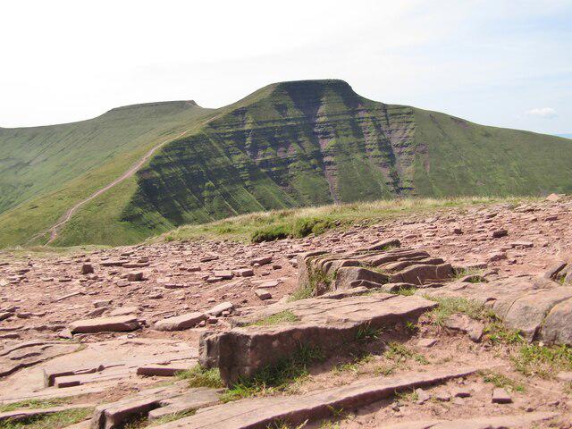
At the summit, you'll be greeted by a rocky outcrop and a charming cairn. On clear days, the views from the trig point can be simply jaw-dropping, as the surroundings unfold before you in an intoxicating panorama.
Terrain
Expect a mix of grassy slopes interspersed with rocky outcrops, and be prepared to navigate some boggy areas after periods of rain. A little hop and skip over the muddy patches adds a touch of fun to your adventure!
Views
From Great Rhos's summit, the views are a feast for the eyes. The Brecon Beacons lie to the south, while the expansive Cambrian hills unfurl like a green blanket. On exceptionally clear days, these spectacular vistas could even include a glimpse of Snowdonia.
Hazards
As always in the mountains, be aware of the ever-changing weather conditions. Expect the delightful unpredictability typical of this terrain, and remember to tread carefully; the occasional bog or slippery rock might try your patience. But worry not—should you run into sheep, they're more than happy to be unhelpfully adorable!
Access
Nearest Parking
A small, free car park can be found just south of the mountain near the start of the Pen y Garn Route. Remember that this is a popular spot, so arrive early to secure a space.
Public Transport
Local bus services connect from surrounding towns to Llanfair Waterdine, but for greater flexibility, having your own transport is highly recommended.
Nearest Town
The quaint village of Llanfair Waterdine serves as the closest point for facilities and a good starting place for your adventure.
Facilities
While Great Rhos provides a wild experience, facilities in the nearby village offer a hot cup of tea and some snacks to refuel after a hearty trek. Public toilets can be found in Llanfair Waterdine, so plan ahead to keep hydrated and comfortable.
History
The name 'Great Rhos' derives from the Welsh word for 'moor', which perfectly captures the essence of this picturesque landscape. The region holds local folklore too, with tales of mythical creatures roaming these hills—though I suspect they were just sheep in disguise, ready for a nomadic adventure!
Conclusion
Great Rhos might not steal the limelight, but it offers a welcoming embrace for hikers seeking less-travelled paths within stunning natural beauty. Whether it’s a spirited ascent or the tranquillity at its summit, this mountain is a jewel waiting to be discovered.
Last Updated: 2023-10-15
Explore routes near Great Rhos
Walks starting near this hill. Open a route to check its map, distance and full itinerary.
Elan Valley: Reservoir Trail to Pen y Garreg Dam
View route
Croft Castle: Fishpool Valley and the Gothic pumphouse
View route
Berrington Hall: woodland, lake and Windmill Hill
View route
Mortimer Forest Lower Evens Circuit
View route
Route planning notes
These notes describe possible approaches. Check a route's map and access information when planning your walk.
Pen y Garn Route
Starting from the nearby Pen y Garn, this route offers a steady ascent and a beautiful traverse along the ridge before reaching the summit of Great Rhos.
Llanfair Waterdine Approach
A less trodden path that meanders through lovely countryside before tackling the slopes of Great Rhos.
Make a day of it, together
Find someone to share the walk with, or organise a day out along a route you like.
Photo Gallery
View all Photo could not load
SO1863 : One of the highest trees in Wales (650m)
Richard Webb
 Photo could not load
SO1863 : Summit of Great Rhos
Graham Horn
 Photo could not load
SO1863 : Great Rhos
Richard Webb
 Photo could not load
SO1863 : Boggy ground on Great Rhos
David Medcalf
 Photo could not load
SO1863 : Trig point on Great Rhos
Jonathan Billinger
 Photo could not load
SO1863 : Trig point on Great Rhos
Philip Halling
 Photo could not load
SO1863 : Trig point on Great Rhos in Radnor Forest
Jeremy Bolwell
 Photo could not load
SO1863 : Great Rhos
Rude Health
 Photo could not load
SO1863 : Summit area of Great Rhos
Trevor Littlewood

SO1863 : Rhos Fawr
Fabian Musto
Hill facts and local notes
Classifications
Elevation
660m
2,165 ft
Prominence
379m
Coordinates
52.2671, -3.1998
SO182638
OS Map
148
Explorer: 200E
At the Summit
At the summit, you'll find a rocky outcrop adorned with a solitary cairn. A trig point stands proud, like a very confused lighthouse keeper guiding you into the skies.
Terrain & Geology
Made up of Old Red Sandstone, the Great Rhos features interesting sedimentary rock formations which tell a tale of ancient river systems and shifting landscapes. Look closely, and you might spot fossilised remnants of the life that once thrived here.
Views & Scenery
From the summit, gaze upon the Brecon Beacons to the south and the rolling hills of the Cambrian Mountains. On clear days, you might even glimpse Snowdonia in the distance.
History & Heritage
Name Origin
The name 'Rhos' translates to 'moor' in Welsh, signifying the mountain's natural habitat. Great Rhos indeed drips with character and history.
Historical Significance
This mountain has been a place of local folklore, and it's said that once upon a time, a dragon roamed these hills—though a more plausible explanation might be an overzealous sheep!
Getting There & Facilities
Parking
There is a small car park along the minor road south of Great Rhos, close to the start of the Pen y Garn Route. Space is limited, but it's free!
Public Transport
Bus services run from nearby towns to the village of Llanfair Waterdine, although a car is recommended for ultimate access.
Nearby Facilities
Facilities are limited. The nearest cafe is in Llanfair Waterdine, offering hot drinks and light snacks, and there are public toilets in the village.
Safety Information
Known Hazards
- Beware of sudden weather changes typical of the area, and boggy ground after rainfall. Also, keep an eye out for sheep—lovely creatures but they tend to leave 'evidence' behind.
General Safety Tips
- Check weather conditions before setting out
- Carry appropriate clothing and equipment
- Let someone know your planned route
- Take a map, compass, and GPS device
- Carry emergency supplies: food, water, first aid kit, torch
Hills
Some common questions about the hills answered
Are there group walks up Great Rhos?
Many walkers use Walkmates to join or organise walks with others. You can check for group walks around Great Rhos through the maps
Are there other walkers around Great Rhos?
Activity varies by location and time, but Walkmates lets you see whether others have shared walks or shown interest in this area. Find other people through the walking friends search walking friends for Great Rhos search or of course create your own walk for Great Rhos
Can I organise a walk to Great Rhos?
Yes. If there aren’t any walks listed already, you can create a walk and make it available for others to join.
If you're signed up to Walkmates, you can create a walk to Great Rhos.
How do I find a walk up this hill?
There are often multiple ways to walk this hill, depending on experience and route preference. Walkmates helps you explore walks and routes that others have shared.
Can I suggest a new route up Great Rhos?
Yes. You can suggest or create routes to share with others. Walkmates focuses on the social side of walking, so routes are used to help people organise walks and explore areas together, rather than as detailed navigation tools or route libraries.
Other uses really appreciate knowledgeable walkers sharing their routes. Share your favourite route to Great Rhos here
The is an error or something incorrect about this hill. How do I let you know?
We always strive to keep the information on Walkmates as accurate as possible. If you find an error, please let us know through the contact form and we'll aim to correct it as quickly as possible
Community Discussion
Comments
Location
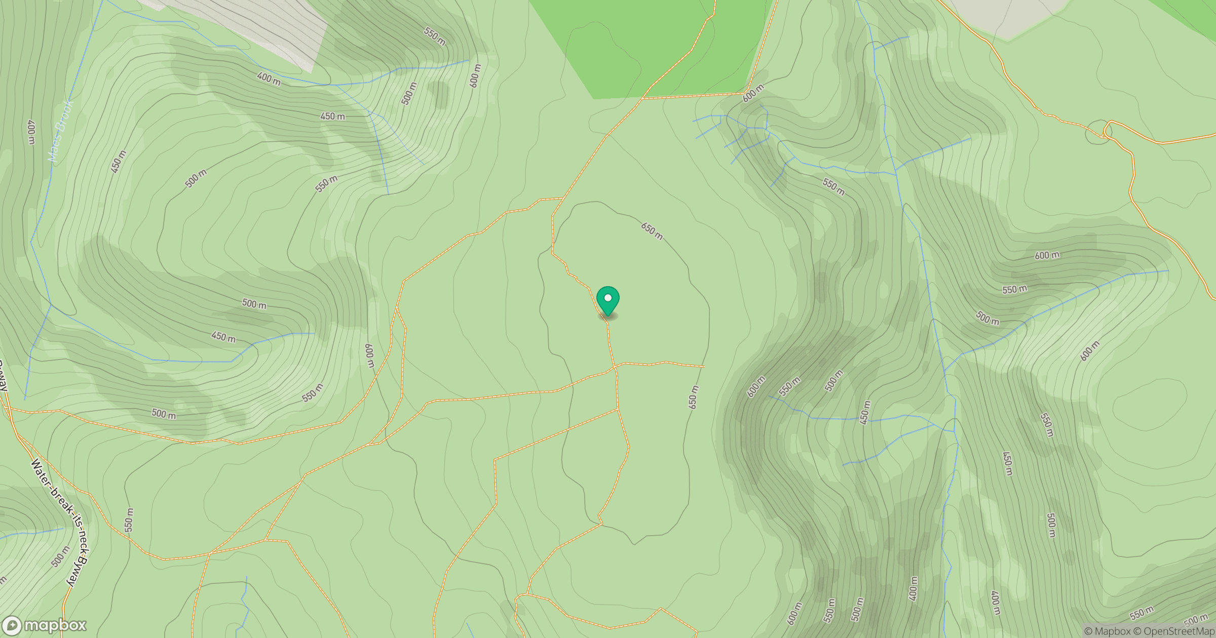
Grid reference: SO182638
View on OpenStreetMapOpens a map in a new tab, centred on the hill.
No comments yet. Be the first.