

Gilwern Hill
Good walks are even better shared.
SO0958 : Steep slopes of Gilwern Hill
Philip Halling Photo source
Overview
Gilwern Hill
Gilwern Hill, standing proud at 436 meters, is nestled in the scenic Brecon Beacons National Park, offering outdoor enthusiasts a delightful escape into nature. Despite its modest height, it is classified as a Marilyn due to its prominence, which adds to its charm.
Geology
The hill is primarily composed of sandstone with interesting limestone outcrops. Geology nerds will appreciate the visibility of geological features from the Carboniferous period, giving insight into the Earth's history. Just don’t start fossil hunting, or you might end up with a reputation!
Route
A popular choice for hikers is the Gilwern Hill Circular Walk. Spanning approximately 6.5 km, this moderate route starts in the village of Gilwern and takes about two and a half hours to complete, depending on your pace (and how many selfies you take at the summit).
Summit Features
The summit is marked by a prominent trig point and a stone cairn, giving hikers a perfect viewpoint to bask in the panoramic scenery of the Brecon Beacons. A great place to reflect on life or just marvel at the landscape – just don’t get too carried away and try to climb the cairn!
Terrain
Expect mixed terrain, with grassy slopes that beg for a picnic on sunny days, rocky outcrops, and some boggy patches that might find their way into your boots. Wear sturdy footwear to avoid the sinking feeling of mud!
Views
From the top, you can spot the rolling Black Mountains, with a clear view of the mighty Sugar Loaf to the east. Best visited in Spring or Autumn for optimal scenic vistas, when the landscape is alive with colour and the weather tends to be more forgiving.
Hazards
Watch your step! The route can become slippery, especially after rain, so be prepared for a bit of a squeaky bum time on some of the slopes. Also, be cautious of steep sections near the summit.
Nearby Summits
Gilwern Hill is conveniently located near several other fabulous hills, including Sugar Loaf at 596 meters and Skirrid Fawr at 486 meters, which can be combined into a fabulous day of hiking.
Access
Access is straightforward, with limited on-street parking available in Gilwern. Public transport is also an option, with bus services connecting to Abergavenny, just a short journey away.
Facilities
After your trek, reward yourself with a treat from the local café that serves fantastic coffee and cake – you’ve earned it! Public toilets can also be found near the village hall.
History
The name Gilwern translates to 'the glen of the fern', adding a whimsical touch to this beautiful spot. Historically, the hill is linked with ancient settlements and local folklore—stories abound of the spirits of yesteryears enjoying a stroll along these paths!
So pack your gear, lace up those boots, and take a trip to Gilwern Hill. It's not just a hill; it's an experience!
Explore routes near Gilwern Hill
Walks starting near this hill. Open a route to check its map, distance and full itinerary.
Elan Valley: Reservoir Trail to Pen y Garreg Dam
View route
Brecon Basin to Brynich Aqueduct: Canal Towpath Walk
View route
Croft Castle: Fishpool Valley and the Gothic pumphouse
View route
Hafren Forest: full Source of the Severn Trail
View route
Route planning notes
These notes describe possible approaches. Check a route's map and access information when planning your walk.
Gilwern Hill Circular Walk
A delightful circular route starting from the village of Gilwern, offering panoramic views as you ascend
Make a day of it, together
Find someone to share the walk with, or organise a day out along a route you like.
Photo Gallery
View all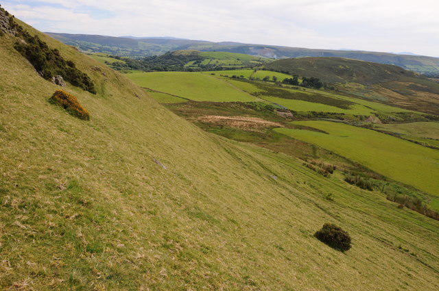 Photo could not load
SO0958 : Steep slopes of Gilwern Hill
Philip Halling
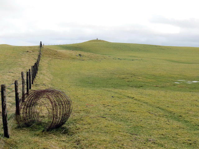 Photo could not load
SO0958 : Bryn Gelli / Gelli Hill
Alan Richards
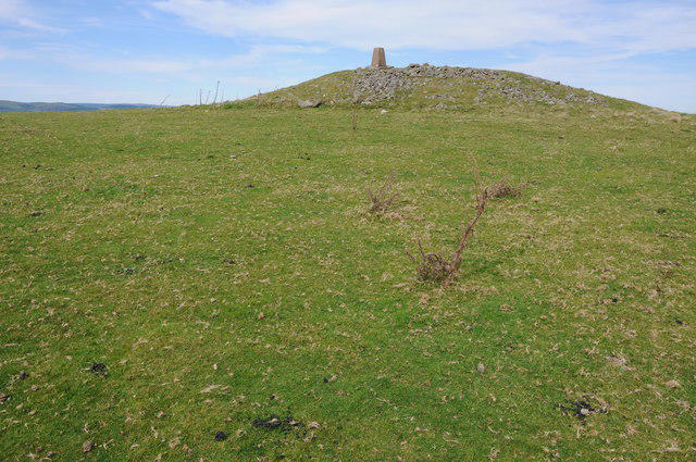 Photo could not load
SO0958 : Trig point on Gilwern Hill
Philip Halling
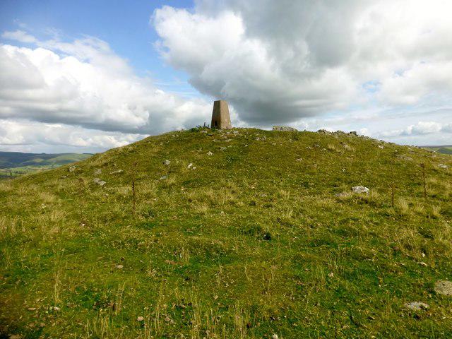 Photo could not load
SO0958 : Gilwern Hill
Rude Health
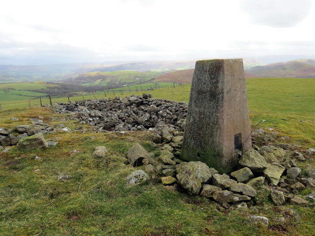 Photo could not load
SO0958 : Piler Triongli Bryn Gelli / Gelli Hill Trig Point
Alan Richards
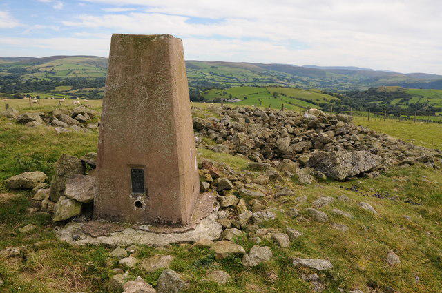 Photo could not load
SO0958 : Trig point on Gilwern Hill
Philip Halling
Hill facts and local notes
Classifications
Elevation
441m
1,446 ft
Prominence
147m
Coordinates
52.2154, -3.3203
SO098582
OS Map
147
Explorer: 200E
At the Summit
The summit boasts a prominent trig point and a small stone cairn, perfect for a photo opportunity to impress your friends. Just be sure not to stand on it – climbing on cairns is frowned upon!
Terrain & Geology
Predominantly composed of sandstone, with scattered limestone outcrops. The exposed rock offers a glimpse into the area's geological history, dating back to the Carboniferous period.
Views & Scenery
From the summit, enjoy breathtaking views of the surrounding Black Mountains, and on a clear day, you can even spot the distant Skirrid Fawr looming in the horizon.
History & Heritage
Name Origin
The name 'Gilwern' originates from the Welsh 'Gilwern', meaning 'the glen of the fern'.
Historical Significance
The hill has historical links to ancient settlements and is a place of interest for local folklore. It's even said that the spirits of the past enjoy an occasional wander about the hills!
Getting There & Facilities
Parking
Gilwern village has limited on-street parking, with spaces available near the local pub and village hall. Arrive early to snag a spot!
Public Transport
Gilwern is served by local bus services from Abergavenny. Check Timetables for up-to-date information.
Nearby Facilities
Amenities include a local café in Gilwern serving excellent coffee and a selection of cakes, as well as public toilets near the village hall.
Safety Information
Known Hazards
- The path can be muddy and slippery, particularly after heavy rain, so sturdy footwear is advised. Be wary of steep sections near the summit.
General Safety Tips
- Check weather conditions before setting out
- Carry appropriate clothing and equipment
- Let someone know your planned route
- Take a map, compass, and GPS device
- Carry emergency supplies: food, water, first aid kit, torch
Hills
Some common questions about the hills answered
Are there group walks up Gilwern Hill?
Many walkers use Walkmates to join or organise walks with others. You can check for group walks around Gilwern Hill through the maps
Are there other walkers around Gilwern Hill?
Activity varies by location and time, but Walkmates lets you see whether others have shared walks or shown interest in this area. Find other people through the walking friends search walking friends for Gilwern Hill search or of course create your own walk for Gilwern Hill
Can I organise a walk to Gilwern Hill?
Yes. If there aren’t any walks listed already, you can create a walk and make it available for others to join.
If you're signed up to Walkmates, you can create a walk to Gilwern Hill.
How do I find a walk up this hill?
There are often multiple ways to walk this hill, depending on experience and route preference. Walkmates helps you explore walks and routes that others have shared.
Can I suggest a new route up Gilwern Hill?
Yes. You can suggest or create routes to share with others. Walkmates focuses on the social side of walking, so routes are used to help people organise walks and explore areas together, rather than as detailed navigation tools or route libraries.
Other uses really appreciate knowledgeable walkers sharing their routes. Share your favourite route to Gilwern Hill here
The is an error or something incorrect about this hill. How do I let you know?
We always strive to keep the information on Walkmates as accurate as possible. If you find an error, please let us know through the contact form and we'll aim to correct it as quickly as possible
Community Discussion
Comments
Location
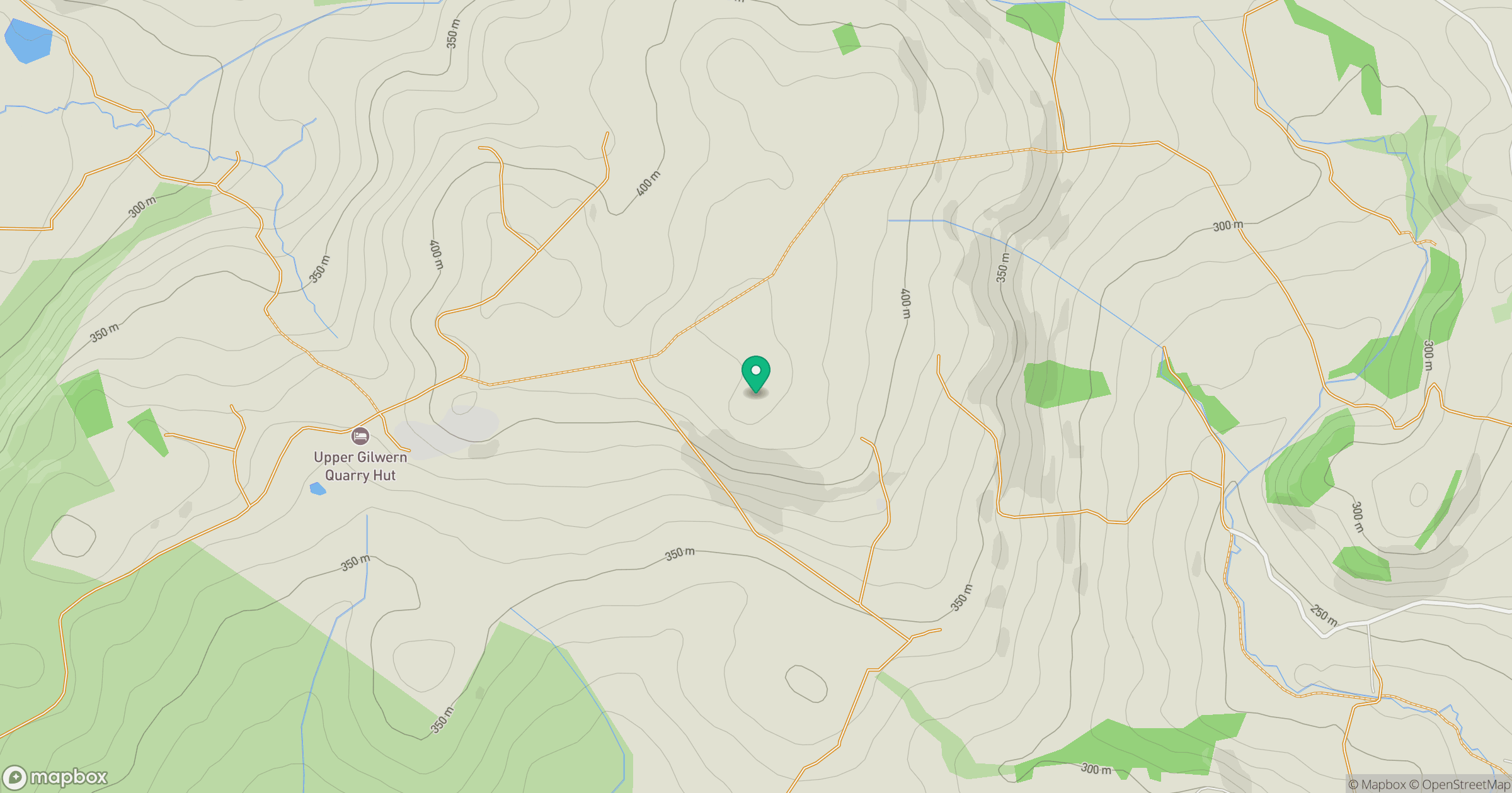
Grid reference: SO098582
View on OpenStreetMapOpens a map in a new tab, centred on the hill.


No comments yet. Be the first.