

Pegwn Mawr
Good walks are even better shared.
SO0281 : Approaching Pegwn Mawr summit cairn
Jeremy Bolwell Photo source
Overview
Pegwn Mawr
Pegwn Mawr stands proudly within the scenic realm of the Brecon Beacons National Park, boasting an elevation of 565 meters and a prominence of 50 meters. Nestled at coordinates 52.5014 latitude and -3.4742 longitude, this Marilyn is a popular choice among walkers seeking a moderate trek.
Geology
The mountain's composition of Old Red Sandstone gives Pegwn Mawr its rugged character. Over eons, the elements have chiselled away at this ancient seabed, leading to its unique rock formations and breathtaking vistas, a true testament to nature's artistry.
Routes
Cwm Cadlan Route: A delightful journey through heather-clad moors that will lead you onto the summit, this 7.5 km trek generally takes about 3.5 hours and is rated as moderate.
Penyfan Route: This more strenuous option extends to 9 km, pushing the legs a bit harder for approximately 4 hours, but rewarding you with some of the best views in the area. Perfect for those who fancy a more challenging day out.
Summit Features
At the pinnacle of Pegwn Mawr, climbers are greeted by a robust rocky outcrop, complete with a stone cairn serving as a monument to fellow adventurers. Be cautious of rocky ledges up there—no one wants to join the cairn by accident!
Terrain
Expect a mix of rocky patches and grassy slopes, with the occasional bog to keep you on your toes. Ideal for hikers equipped with sturdy boots that can handle all terrain.
Views
The summit offers impressive panoramas; on a clear day, you can soak in the sights of the Brecon Beacons and even the Black Mountains off in the distance. Autumn splendors and spring blooms make for the best photographic opportunities.
Hazards
It's vital to stay alert; weather in the Brecon Beacons can turn on a dime. Keep an eye on those slippery rocks—especially after rain, as they might surprise the unsuspecting hiker!
Nearby Summits
Nearby peaks such as Pen y Fan (886 m) and Cribyn (795 m) provide excellent opportunities for extending your hiking adventures.
Access
Parking available at the Cwm Cadlan car park is convenient, but space can be limited. Tredegar is your closest town for basic amenities.
Facilities
The local café in Tredegar is a marvelous spot to grab a hot drink post-hike. Remember, last-minute hot dogs may be in short supply!
History
With a name that simply means 'Big Hill', Pegwn Mawr paints a straightforward but delightful picture of its stature amongst fellow peaks. It holds a significant place in local culture, enriching the Brecon Beacons' lore.
So, gather your gear and head out to Pegwn Mawr for a day filled with breathtaking views, gentle slopes, and a taste of Welsh history. Remember: if the weather's bad, it just adds to the adventure!
Explore routes near Pegwn Mawr
Walks starting near this hill. Open a route to check its map, distance and full itinerary.
Hafren Forest: full Source of the Severn Trail
View route
Elan Valley: Reservoir Trail to Pen y Garreg Dam
View route
Welshpool to Sweeps Bridge: Montgomery Canal and Belan Locks
View route
Ystwyth Trail: Black Covert to Llanilar and back
View route
Route planning notes
These notes describe possible approaches. Check a route's map and access information when planning your walk.
Cwm Cadlan Route
This route starts from the charming Cwm Cadlan valley, leading you through heather-covered moors and steep grassy slopes to the summit.
Penyfan Route
A more challenging ascent that takes you along the ridge from Penyfan, offering breathtaking views and a bit of a workout.
Make a day of it, together
Find someone to share the walk with, or organise a day out along a route you like.
Photo Gallery
View all Photo could not load
SO0281 : Approaching Pegwn Mawr summit cairn
Jeremy Bolwell
 Photo could not load
SO0281 : View from the summit ridge on Pegwn Mawr
Jeremy Bolwell
 Photo could not load
SO0281 : Turbines
Hywel Williams
 Photo could not load
SO0281 : The summit of Pegwn Mawr
Jeremy Bolwell
 Photo could not load
SO0281 : Pegwn Mawr
Rude Health
 Photo could not load
SO0281 : Pegwn Mawr, summit
Richard Webb
 Photo could not load
SO0281 : Pegwn Mawr
Anton Ciritis
 Photo could not load
SO0281 : Pegwn Mawr summit cairn
Jeremy Bolwell
 Photo could not load
SO0281 : Pegwn Mawr
Richard Webb
Hill facts and local notes
Classifications
Elevation
586m
1,923 ft
Prominence
300m
Coordinates
52.4204, -3.4367
SO023812
OS Map
136
Explorer: 214E
At the Summit
The summit of Pegwn Mawr features a sizable rocky outcrop, offering panoramic views with a small stone cairn marking the peak. Watch where you step, as it can be a bit wobbly up there!
Terrain & Geology
Pegwn Mawr is primarily composed of Old Red Sandstone, a sedimentary rock that has been worn down over millennia, creating its distinctive rugged terrain. The striking cliffs and valleys showcase the geological history of the area, representing an ancient sea bed.
Views & Scenery
From the summit, you can gaze upon the majestic peaks of the Brecon Beacons, and on a clear day, even spot the distant Black Mountains and the rolling hills of South Wales.
History & Heritage
Name Origin
The name 'Pegwn Mawr' translates to 'Big Hill' in Welsh, which is rather straightforward - a no-frills naming if you will!
Historical Significance
Pegwn Mawr is part of the cultural tapestry of the Brecon Beacons, with its rich local folklore and stunning landscape attracting both storytellers and hikers alike.
Getting There & Facilities
Parking
Parking is available at Cwm Cadlan car park, located just 2 km from the trailhead. It's a small space, so arrive early on busy days!
Public Transport
Buses run from Merthyr Tydfil to nearby villages; however, a car is recommended to access the starting points conveniently.
Nearby Facilities
There is a café in Tredegar that serves a good cuppa, along with public toilets. Bring your own hot dogs, though; they might not have those!
Safety Information
Known Hazards
- Variable weather conditions can change quickly in the Brecon Beacons. Be prepared for everything from sunshine to sudden downpours. Also, watch out for slippery rocks, especially after rain.
General Safety Tips
- Check weather conditions before setting out
- Carry appropriate clothing and equipment
- Let someone know your planned route
- Take a map, compass, and GPS device
- Carry emergency supplies: food, water, first aid kit, torch
Hills
Some common questions about the hills answered
Are there group walks up Pegwn Mawr?
Many walkers use Walkmates to join or organise walks with others. You can check for group walks around Pegwn Mawr through the maps
Are there other walkers around Pegwn Mawr?
Activity varies by location and time, but Walkmates lets you see whether others have shared walks or shown interest in this area. Find other people through the walking friends search walking friends for Pegwn Mawr search or of course create your own walk for Pegwn Mawr
Can I organise a walk to Pegwn Mawr?
Yes. If there aren’t any walks listed already, you can create a walk and make it available for others to join.
If you're signed up to Walkmates, you can create a walk to Pegwn Mawr.
How do I find a walk up this hill?
There are often multiple ways to walk this hill, depending on experience and route preference. Walkmates helps you explore walks and routes that others have shared.
Can I suggest a new route up Pegwn Mawr?
Yes. You can suggest or create routes to share with others. Walkmates focuses on the social side of walking, so routes are used to help people organise walks and explore areas together, rather than as detailed navigation tools or route libraries.
Other uses really appreciate knowledgeable walkers sharing their routes. Share your favourite route to Pegwn Mawr here
The is an error or something incorrect about this hill. How do I let you know?
We always strive to keep the information on Walkmates as accurate as possible. If you find an error, please let us know through the contact form and we'll aim to correct it as quickly as possible
Community Discussion
Comments
Location
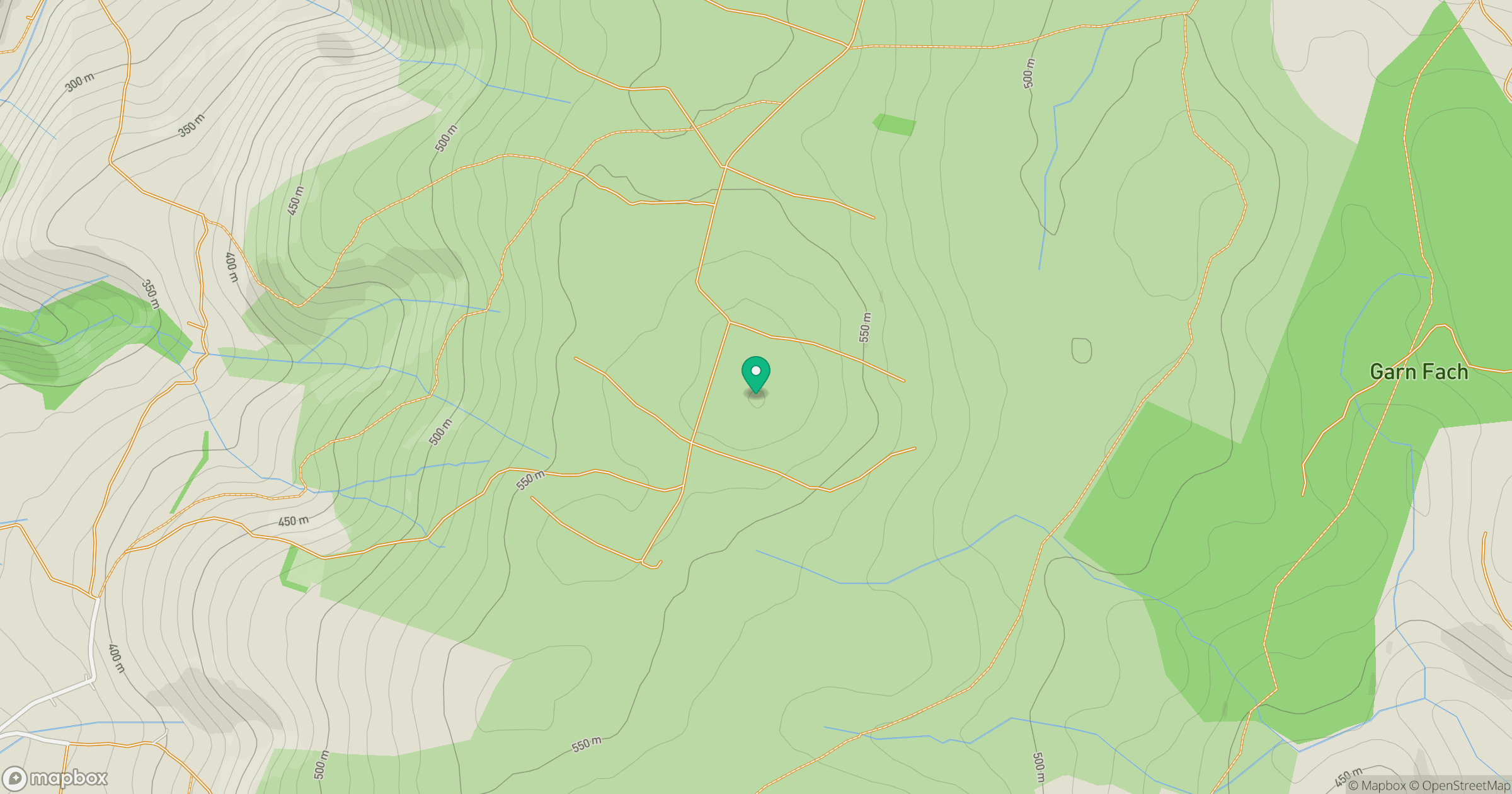
Grid reference: SO023812
View on OpenStreetMapOpens a map in a new tab, centred on the hill.
Nearby Hills
Carneddau
445m
Pumlumon Fawr [Plynlimon]
753m
Aran Fawddwy
906m
Cadair Berwyn
832m
Stiperstones
537m
No comments yet. Be the first.