

Moel Hywel
Good walks are even better shared.
Overview
Moel Hywel
Moel Hywel, standing proudly at 609 meters in height, is a delightful Marilyn nestled in the stunning Brecon Beacons National Park. Offering an accessible yet rewarding hike, it attracts both seasoned walkers and enthusiastic beginners alike.
Geology
This charming hill is mainly composed of Old Red Sandstone. As you ascend, you'll notice the distinct reddish colouration that adds a touch of uniqueness to the landscape. The fascinating sandstone formations are testament to the geological history of this region, dating back millions of years!
Routes
There are a couple of popular routes to consider when visiting Moel Hywel:
- From Talybont Reservoir: This 6.5 km route is well-loved for its stunning woodland paths and gently ascending slopes. Expect to spend around 2.5 hours enjoying the journey and the lovely views of the reservoir.
- From Tor y Foel: For those seeking a more extended expedition, this 8 km route leads through scenic valleys and hillsides, taking approximately 3 hours to complete.
Summit Features
As you reach the summit, you'll be greeted by a triumphant cairn that stands proud as witness to the countless hikers who’ve made the journey. Don't forget to take a moment at the trig point; it’s a fantastic spot for a breather and some pictures to show off to your mates!
Terrain
Moel Hywel's terrain is a delightful mix of grassy slopes and rocky sections. Keep your wits about you in boggy areas, where foot placements are crucial to avoid a soggy sock disaster. It’s all part of the adventure, innit?
Views
The views from Moel Hywel are nothing short of breathtaking. On a clear day, you'll revel in panoramas that stretch towards Pen y Fan and over Llangorse Lake. The best times to soak in these scenes are during spring and autumn when nature dresses the landscape in vibrant colours. And let’s be honest, winter's snow-capped beauty is a sight to behold, too!
Hazards
Be cautious: wet conditions can turn the paths into slippery slides, making good footwear a must. As always, prepare yourself for any sudden weather changes—after all, the mountains have a way of keeping you on your toes!
Access
- Nearest Parking: Talybont-on-Usk offers a convenient car park for access to the trails.
- Public Transport: Easy bus access from Brecon with regular services to Talybont-on-Usk.
- Nearest Town: Talybont-on-Usk provides a charming gateway to your hike.
Facilities
After a satisfying hike, why not pop into one of the local cafes or pubs in Talybont-on-Usk for a hearty meal or a refreshing drink? Toilets are also available nearby.
History
The name Moel Hywel translates to 'Hywel's Hill,' possibly honouring a historical figure from Welsh heritage. The mountain is imbued with cultural significance and adds to the enchanting fabric of the Brecon Beacons—an area rich in both natural beauty and Welsh folklore.
Whether you’re in it for the views, the challenge, or the fresh air, Moel Hywel is sure to leave you with fond memories and perhaps a little mud on your boots! Don’t forget your camera, and most importantly, enjoy the journey!
Explore routes near Moel Hywel
Public walks starting within 80 km of this hill. Nearby does not mean a route reaches the summit; check its map and access before setting out.
Elan Valley: Reservoir Trail to Pen y Garreg Dam
View route
Hafren Forest: full Source of the Severn Trail
View route
Ystwyth Trail: Black Covert to Llanilar and back
View route
Welshpool to Sweeps Bridge: Montgomery Canal and Belan Locks
View route
Route planning notes
These notes describe possible approaches, not verified navigable routes or permission to cross land. Check current paths, local access rules and conditions before setting out.
From Talybont Reservoir
A popular route starting from the Talybont Reservoir which takes you through picturesque woodlands before ascending towards the summit.
From Tor y Foel
A slightly longer route that leads from Tor y Foel, offering stunning views over the surrounding valleys before reaching the summit of Moel Hywel.
Make a day of it, together
Find someone to share the walk with, or organise a day out along a route you like.
Photo Gallery
View all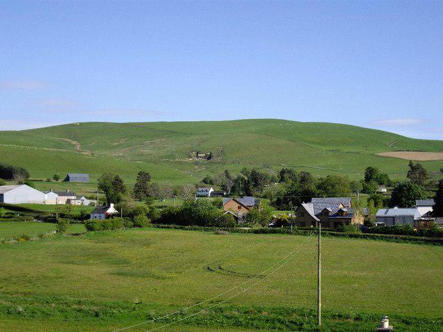 Photo could not load
SO0071 : Moel Hywel in spring sunshine
Brian Beckworth
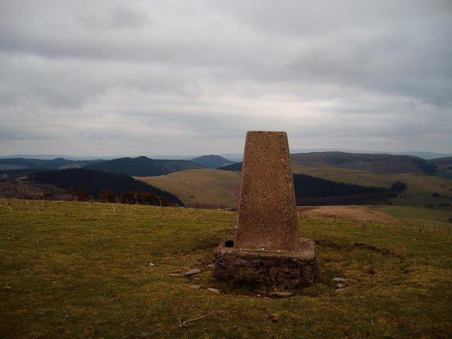 Photo could not load
SO0071 : Moel Hywel
Anton Ciritis
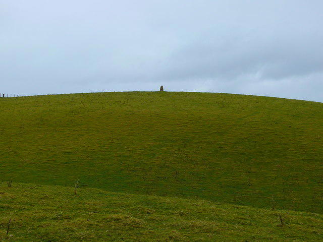 Photo could not load
SO0071 : Moel Hywel
Ian Medcalf
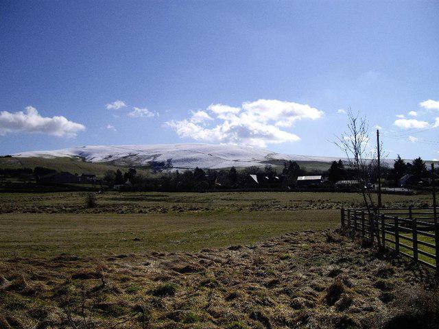 Photo could not load
SO0071 : A dusting of snow on Moel Hywel
Brian Beckworth
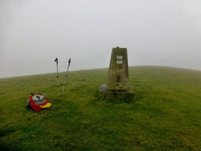 Photo could not load
SO0071 : Moel Hywel
Rude Health
Hill facts and local notes
Classifications
Elevation
505m
1,657 ft
Prominence
133m
Coordinates
52.3305, -3.4647
SO002712
OS Map
136 147
Explorer: 200E 214E
At the Summit
The summit features a well-built cairn, perfect for those summit selfies, along with a trig point providing a great spot for resting and enjoying the views.
Terrain & Geology
Predominantly composed of Old Red Sandstone, giving the mountain its distinctive reddish hue. The summit features interesting sandstone formations that are millions of years old.
Views & Scenery
From the summit, you can enjoy breathtaking views of the Brecon Beacons, Pen y Fan, and Llangorse Lake.
History & Heritage
Name Origin
The name Moel Hywel translates to 'Hywel's Hill', with Hywel possibly referring to a historical figure from Welsh history.
Historical Significance
The mountain has cultural significance in Welsh folklore and is part of the majestic Brecon Beacons, a region steeped in natural beauty.
Getting There & Facilities
Check current local access restrictions, parking rules and transport timetables before travelling. These notes do not confirm public access to the summit.
Parking
The nearest car park is at Talybont-on-Usk, where you can easily access the trails leading to Moel Hywel.
Public Transport
Buses regularly run from Brecon to Talybont-on-Usk. Check local schedules for timings.
Nearby Facilities
There are local cafes and pubs in Talybont-on-Usk, providing refreshments and toilet facilities after your hike.
Safety Information
Known Hazards
- Care should be taken in wet conditions as paths can become muddy and slippery. Always be prepared for sudden weather changes!
General Safety Tips
- Check weather conditions before setting out
- Carry appropriate clothing and equipment
- Let someone know your planned route
- Take a map, compass, and GPS device
- Carry emergency supplies: food, water, first aid kit, torch
Hills
Some common questions about the hills answered
Are there group walks up Moel Hywel?
Many walkers use Walkmates to join or organise walks with others. You can check for group walks around Moel Hywel through the maps
Are there other walkers around Moel Hywel?
Activity varies by location and time, but Walkmates lets you see whether others have shared walks or shown interest in this area. Find other people through the walking friends search walking friends for Moel Hywel search or of course create your own walk for Moel Hywel
Can I organise a walk to Moel Hywel?
Yes. If there aren’t any walks listed already, you can create a walk and make it available for others to join.
If you're signed up to Walkmates, you can create a walk to Moel Hywel.
How do I find a walk up this hill?
There are often multiple ways to walk this hill, depending on experience and route preference. Walkmates helps you explore walks and routes that others have shared.
Can I suggest a new route up Moel Hywel?
Yes. You can suggest or create routes to share with others. Walkmates focuses on the social side of walking, so routes are used to help people organise walks and explore areas together, rather than as detailed navigation tools or route libraries.
Other uses really appreciate knowledgeable walkers sharing their routes. Share your favourite route to Moel Hywel here
The is an error or something incorrect about this hill. How do I let you know?
We always strive to keep the information on Walkmates as accurate as possible. If you find an error, please let us know through the contact form and we'll aim to correct it as quickly as possible
Community Discussion
Comments
Location
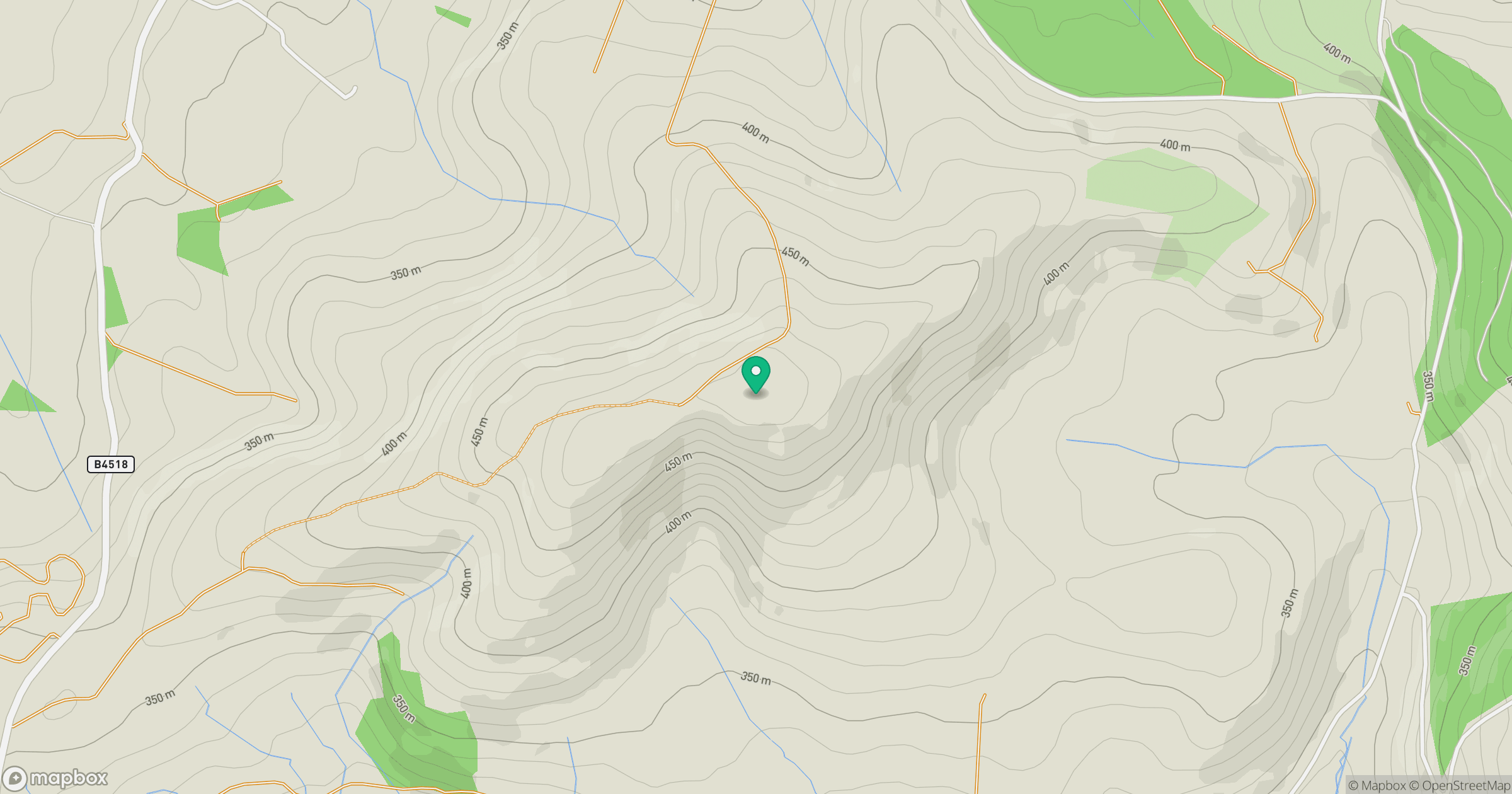
Grid reference: SO002712
View on OpenStreetMapOpens a map in a new tab, centred on the hill.
Hills within 30 km
Straight-line distance, not a walking route or confirmation of access.
No comments yet. Be the first.