
Garth Hill
Good walks are even better shared.
Overview
Garth Hill: A Hiker's Delight
Garth Hill, standing proudly at 209 meters, is a charming summit nestled within the beautiful Mendip Hills. With its limestone geology and scenic vistas, it's a popular choice for walkers and nature lovers alike. Whether you're a seasoned hiker or just looking for a pleasant stroll on a sunny Sunday, Garth Hill will not disappoint.
Geology
Garth Hill is a treasure trove of geological wonders. Composed primarily of Carboniferous limestone, this area showcases remarkable karst features, including fascinating sinkholes and rugged limestone pavements. Perfect for a ramble with geological discovery in mind!
Route Information
For those looking to explore, the Garth Hill Circuit is a delightful option. Starting from Garsington, this circuit is approximately 6.5 kilometers and takes about 2.5 hours to complete. It’s rated as moderate, making it suitable for most walkers. Lush landscapes and a well-marked path make this an enjoyable trek.
Summit Features
At the summit, you will find a sturdy stone cairn and a trig point that provides a great photo opportunity. Consider it a trophy for your trekking achievements!
Terrain and Hazards
The terrain around Garth Hill is predominantly grassy, with a few rocky outcrops that can add a bit of character to your walk. Watch your step, especially after rain, as some areas can be quite slippery. As always, keep an eye on the weather as it can change faster than you can say 'Garth Hill'.
Stunning Views
One of the highlights of reaching the summit is the breathtaking views. On clear days, you can gaze across the picturesque Mendip landscape, spotting the Bristol Channel and even the distant peaks of Wales. Autumn and spring are the best times for those perfect panoramic photographs.
Nearby Attractions
If you feel like making a day of it, consider visiting other nearby summits like Beacon Batch and Crook Peak. They are both fantastic in their own right and easy to access from Garth Hill.
Access and Facilities
For those driving, parking at Garsington Village Hall provides easy access to the trailhead. Public transport is also available, with buses from Bristol making it a breeze for those without wheels. Don’t forget to reward yourself after your walk at one of the local cafes in Cheddar.
A Bit of History
The name Garth refers to an enclosed piece of land, which hints at its agricultural roots. Historically, this hill has served as a lookout and communication point. Today, it remains a beloved spot for outdoor enthusiasts.
So lace up your boots, grab your walking stick, and explore the hidden gems that Garth Hill has to offer. Happy hiking!
Explore routes near Garth Hill
Walks starting near this hill. Open a route to check its map, distance and full itinerary.
Aberdare Walk with Men Walking & Talking
View route
Swansea Canal: Coed Gwilym Park to Pontardawe Aqueduct
View route
Merthyr Tydfil with Men Walking & Talking
View route
Swansea Clyne Valley Railway Walk: Blackpill to Dunvant
View route
Route planning notes
These notes describe possible approaches. Check a route's map and access information when planning your walk.
The Garth Hill Circuit
A pleasant loop starting from the village of Garsington, offering scenic views and a gentle climb to the summit of Garth Hill.
Make a day of it, together
Find someone to share the walk with, or organise a day out along a route you like.
Hill facts and local notes
Classifications
Elevation
257m
844 ft
Prominence
99m
Coordinates
51.6004, -3.6288
SS872903
OS Map
170
Explorer: 166W
At the Summit
The summit boasts a stone cairn marking the high point, with a small trig point nearby for those who enjoy a little extra geological flair.
Terrain & Geology
Garth Hill is primarily composed of limestone from the Carboniferous Period. The karst landscape features a mix of intricate geological formations, including sinkholes and limestone pavements, making it a captivating area for geological study.
Views & Scenery
From the summit, one can see across the rolling Mendip landscape, with glimpses of the Bristol Channel and, on clear days, as far as Wales. The iconic Cheddar Gorge is also visible in the distance.
History & Heritage
Name Origin
The name 'Garth' derives from Old English, meaning an enclosed field or garden, hinting at the area's agricultural past.
Historical Significance
Garth Hill has been a landmark for centuries, with its strategic vantage point historically used for communication and observation.
Getting There & Facilities
Parking
Parking is available at the Garsington Village Hall, a short distance from the trailhead.
Public Transport
There are bus services from Bristol to Garsington, making it fairly accessible for those travelling without a car.
Nearby Facilities
There are a few cafes and pubs in Cheddar, as well as public toilets near the village hall.
Safety Information
Known Hazards
- Beware of sudden weather changes typical of the area; also, watch out for slippery rocks after rain.
General Safety Tips
- Check weather conditions before setting out
- Carry appropriate clothing and equipment
- Let someone know your planned route
- Take a map, compass, and GPS device
- Carry emergency supplies: food, water, first aid kit, torch
Hills
Some common questions about the hills answered
Are there group walks up Garth Hill?
Many walkers use Walkmates to join or organise walks with others. You can check for group walks around Garth Hill through the maps
Are there other walkers around Garth Hill?
Activity varies by location and time, but Walkmates lets you see whether others have shared walks or shown interest in this area. Find other people through the walking friends search walking friends for Garth Hill search or of course create your own walk for Garth Hill
Can I organise a walk to Garth Hill?
Yes. If there aren’t any walks listed already, you can create a walk and make it available for others to join.
If you're signed up to Walkmates, you can create a walk to Garth Hill.
How do I find a walk up this hill?
There are often multiple ways to walk this hill, depending on experience and route preference. Walkmates helps you explore walks and routes that others have shared.
Can I suggest a new route up Garth Hill?
Yes. You can suggest or create routes to share with others. Walkmates focuses on the social side of walking, so routes are used to help people organise walks and explore areas together, rather than as detailed navigation tools or route libraries.
Other uses really appreciate knowledgeable walkers sharing their routes. Share your favourite route to Garth Hill here
The is an error or something incorrect about this hill. How do I let you know?
We always strive to keep the information on Walkmates as accurate as possible. If you find an error, please let us know through the contact form and we'll aim to correct it as quickly as possible
Community Discussion
Comments
Location
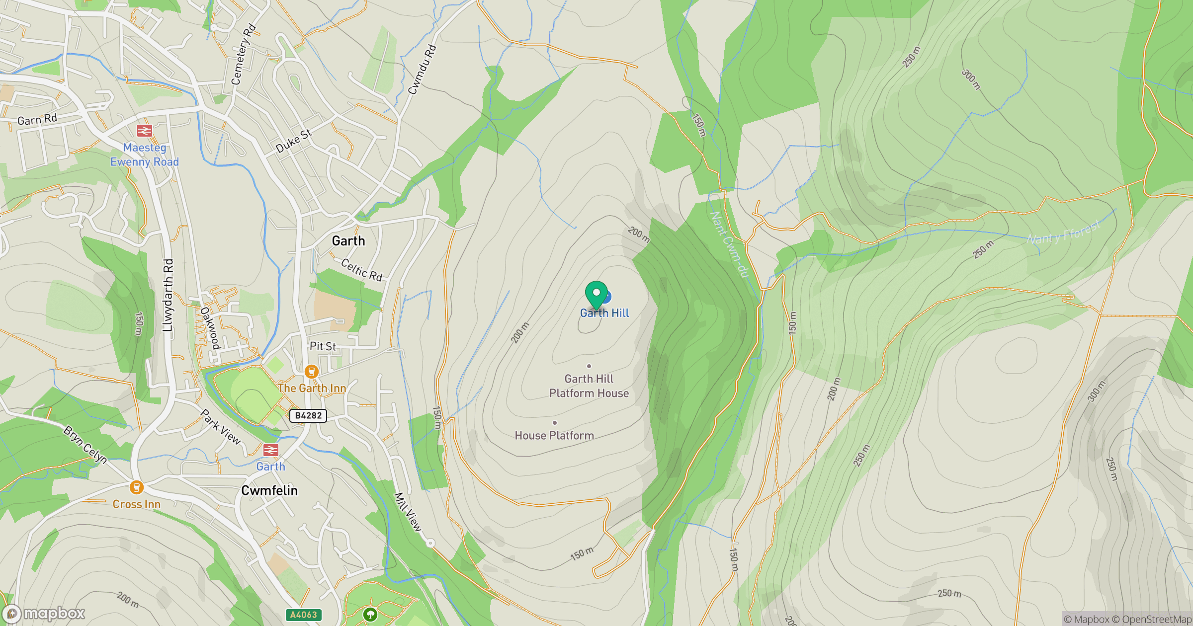
Grid reference: SS872903
View on OpenStreetMapOpens a map in a new tab, centred on the hill.



No comments yet. Be the first.