

Mynydd y Glyn
Good walks are even better shared.
Overview
Mynydd y Glyn
Overview
Mynydd y Glyn stands proudly at an elevation of 396 meters, making it a prominent feature of the Welsh landscape. Nestled within the Brecon Beacons National Park, this Marilyn offers several routes that cater to different levels of experience and provides jaw-dropping views of its surroundings.
Geology
The mountain is primarily composed of sandstone and shale, remnants of ancient seabeds. Its rough edges and gentle slopes are a testament to millions of years of geological changes shaped by glacial activity. Perfect for the geology enthusiast, if Mother Nature was an artist, Mynydd y Glyn would be one of her masterpieces!
Routes
There are a couple of popular routes that hikers can explore:
- Mynydd y Glyn Loop: A scenic trek of about 7.5 km that loops around the mountain, delivering breathtaking landscapes along the way. It's moderate in difficulty, making it accessible for many.
- Direct Ascent from Llangynidr: For those looking for a strenuous challenge, this steep climb is about 4 km long and may take approximately 1.5 hours. Just don’t forget to stretch those legs!
Summit Features
At the peak, you will find a friendly trig point and a small cairn that beckons adventurous spirits for a photo opportunity! Aspiring mountaineers and casual wanderers alike will appreciate the sense of accomplishment this summit provides.
Terrain Type
Expect a mix of grassy tracks, rocky outcrops, and areas that might just try to swallow your boots whole after the rain. Good hiking shoes are a necessity, so keep those sturdy soles ready.
Views
Once you reach the top, the reward is well worth the climb! Witness expansive views including the Black Mountains and the Usk Valley. If you time it right, the sunset offers hues that even the best Instagram filters can't capture.
Hazards
Do keep an eye on the unpredictable Welsh weather. Clear skies can become foggy in the blink of an eye. The trails can be slippery post-rain, so it’s prudent to tread carefully.
Nearby Summits
If adventurous spirits seek more, nearby summits such as Crug Mawr (528 meters) and Glyntaf (469 meters) offer additional challenges and stunning vistas.
Access
Llangynidr is your starting point. The village features parking near the community hall, and bus services from Brecon and Abergavenny make getting there a breeze.
Facilities
While the village has a shop and a welcoming pub, remember to take care of business before hitting the trails, as there are no facilities on the mountain.
History
The name Mynydd y Glyn provides a fascinating glimpse into local history—it's like the mountain is whispering stories of old! Its paths have been trodden for generations, making this not just a hike, but a walk through time.
In conclusion, Mynydd y Glyn is both a breathtaking adventure and a piece of history waiting for you to explore. So lace up those boots, grab a dandy walking stick, and get ready to conquer this marvelous mountain!
Explore routes near Mynydd y Glyn
Public walks starting within 80 km of this hill. Nearby does not mean a route reaches the summit; check its map and access before setting out.
Cardiff: Hailey Park to Blackweir Bridge on the Taff Trail
View route
Merthyr Tydfil with Men Walking & Talking
View route
Newport Fourteen Locks to Risca: Monmouthshire Canal Return
View route
Pen y Fan via Corn Du from Storey Arms
View route
Route planning notes
These notes describe possible approaches, not verified navigable routes or permission to cross land. Check current paths, local access rules and conditions before setting out.
Mynydd y Glyn Loop
A scenic loop that provides an excellent overview of the surrounding countryside, often starting from the nearby village of Llangynidr.
Direct Ascent from Llangynidr
A straightforward ascent that leads directly to the summit. Be prepared for some steep sections.
Make a day of it, together
Find someone to share the walk with, or organise a day out along a route you like.
Photo Gallery
View all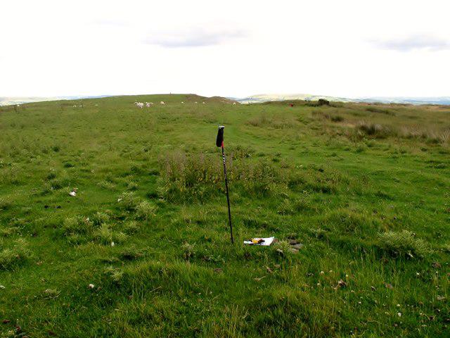 Photo could not load
ST0389 : Mynydd y Glyn
Rude Health
Hill facts and local notes
Classifications
Elevation
377m
1,237 ft
Prominence
189m
Coordinates
51.5973, -3.3991
ST031896
OS Map
170
Explorer: 166E
At the Summit
The summit features a distinctive trig point which serves as a navigational marker, along with scenic views that reward the uphill trek. A small cairn marks the spot for photo opportunities.
Terrain & Geology
Mynydd y Glyn predominantly features sedimentary rock formations, predominantly sandstone and shale. The mountainous terrain was shaped by glacial activity during the last Ice Age, resulting in the distinctive valleys and ridges characteristic of the area.
Views & Scenery
From the summit, hikers can enjoy panoramic views of the Black Mountains, the Usk Valley, and across to the Welsh coastline on clear days. Look out for the imposing silhouette of Pen y Fan to the north.
History & Heritage
Name Origin
Mynydd y Glyn translates to 'Hill of the Glen' in English, indicating its geographical features and historical significance.
Historical Significance
The area around Mynydd y Glyn has historical significance due to ancient tracks and greenways utilized by communities long ago, showcasing its long-held importance as a route through the Brecon Beacons.
Getting There & Facilities
Check current local access restrictions, parking rules and transport timetables before travelling. These notes do not confirm public access to the summit.
Parking
Parking is available at Llangynidr village, with several spaces at the community hall and on-street parking. Aim to arrive early to secure a spot, especially on weekends.
Public Transport
Bus services from Brecon and Abergavenny provide access to Llangynidr; check local schedules for the best times.
Nearby Facilities
While Llangynidr offers basic amenities such as a village shop and a pub, there are no toilets directly on the mountain. Be sure to stop in the village to refresh and gather supplies before your trek.
Safety Information
Known Hazards
- Watch out for sudden weather changes which can occur; fog can roll in quickly. Some paths may be uneven or slippery, particularly after rain.
General Safety Tips
- Check weather conditions before setting out
- Carry appropriate clothing and equipment
- Let someone know your planned route
- Take a map, compass, and GPS device
- Carry emergency supplies: food, water, first aid kit, torch
Hills
Some common questions about the hills answered
Are there group walks up Mynydd y Glyn?
Many walkers use Walkmates to join or organise walks with others. You can check for group walks around Mynydd y Glyn through the maps
Are there other walkers around Mynydd y Glyn?
Activity varies by location and time, but Walkmates lets you see whether others have shared walks or shown interest in this area. Find other people through the walking friends search walking friends for Mynydd y Glyn search or of course create your own walk for Mynydd y Glyn
Can I organise a walk to Mynydd y Glyn?
Yes. If there aren’t any walks listed already, you can create a walk and make it available for others to join.
If you're signed up to Walkmates, you can create a walk to Mynydd y Glyn.
How do I find a walk up this hill?
There are often multiple ways to walk this hill, depending on experience and route preference. Walkmates helps you explore walks and routes that others have shared.
Can I suggest a new route up Mynydd y Glyn?
Yes. You can suggest or create routes to share with others. Walkmates focuses on the social side of walking, so routes are used to help people organise walks and explore areas together, rather than as detailed navigation tools or route libraries.
Other uses really appreciate knowledgeable walkers sharing their routes. Share your favourite route to Mynydd y Glyn here
The is an error or something incorrect about this hill. How do I let you know?
We always strive to keep the information on Walkmates as accurate as possible. If you find an error, please let us know through the contact form and we'll aim to correct it as quickly as possible
Community Discussion
Comments
Location
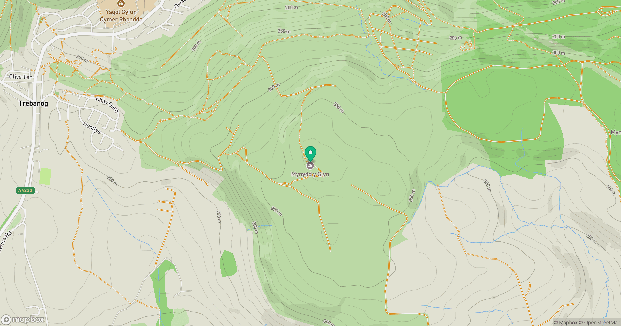
Grid reference: ST031896
View on OpenStreetMapOpens a map in a new tab, centred on the hill.
Hills within 30 km
Straight-line distance, not a walking route or confirmation of access.
No comments yet. Be the first.