

Foel-y-Mwnt
Good walks are even better shared.
SN1952 : North face of Foel y Mwnt
Bob Jones Photo source
Overview
Foel-y-Mwnt
Introduction
Nestled in the stunning Pembrokeshire Coast National Park, Foel-y-Mwnt is a delightful Marilyn that offers both scenic beauty and a dash of history. Standing at an impressive 490 meters, this hill's rounded summit provides excellent views of Cardigan Bay and beyond.
Geology
Foel-y-Mwnt is primarily formed from Ordovician volcanic rock, an excellent reminder of the area's geological past. The terrain features a mix of slate and sandstone, allowing for some interesting rock formations along the paths. Evidence of ancient volcanic activity can be seen throughout the region, contributing to its rich geological tapestry.
Routes
The most popular route to the summit is the Coastal Path Approach, starting from the picturesque Mwnt beach. This path covers approximately 3.5 km and takes about 1.5 hours to complete. It is described as moderate in difficulty, with a few steep sections that provide a bit of a workout. Just remember, steep isn't a warning; it’s an invitation to challenge yourself!
Summit Features
Reaching the summit rewards you with a remarkable cairn and breathtaking views over the rugged coastline. If you're lucky, you might even catch dolphins frolicking in the shimmering seas below. Just don’t forget to bring your binoculars!
Terrain Type
Expect grassy landscapes intermingled with rocky outcrops. While the terrain is generally manageable, it can be slippery when wet—forewarned is forearmed!
Views
The panoramic views from the summit are nothing short of spectacular. Key highlights include the stunning Cardigan Bay and the dense greenery of the Pembrokeshire landscape, especially vivid during spring when wildflowers bloom. The best times to enjoy these vistas are undoubtedly during spring and early summer, when the visibility tends to be clearer.
Hazards
Be mindful of the terrain conditions, especially after rain. The paths can become slippery, particularly in steeper parts, so the trusty hiking boots are a must!
Nearby Summits
Don’t miss out on exploring Moel y Cribau, which stands slightly lower at 462 meters. It provides a fantastic complement to your adventures around Foel-y-Mwnt.
Access
Getting to Foel-y-Mwnt is straightforward. The nearest car park is located at Mwnt, about a mile from the hiking paths. Local buses service the area from Cardigan, making it easily accessible for those relying on public transport. The nearest town, Cardigan, offers plenty of amenities before and after your trek.
Facilities
While the hill itself lacks facilities, the nearby village of Mwnt hosts a charming café and public restrooms. A perfect post-hike treat!
History
The name Foel-y-Mwnt, translating to 'hill of the knoll' in Welsh, hints at the hill's distinctive shape. Historically, the area is significant for its ancient church, St. Mary’s, which dates back to the sixth century. It’s ideal for a quick visit before or after your hike, allowing you to soak up some local heritage.
Conclusion
Foel-y-Mwnt, with its blend of nature, history, and geological intrigue, is a wonderful destination for hikers of all ages. So lace up your boots, grab your walking sticks, and set off for an adventure filled with breathtaking views and a touch of history!
Explore routes near Foel-y-Mwnt
Walks starting near this hill. Open a route to check its map, distance and full itinerary.
Llanerchaeron: Lanlas, Aberaeron and Aeron Valley circular
View route
Abergwili to Nantgaredig: Tywi Valley Path out and back
View route
Dolaucothi Estate: Cothi Valley and Red Waymarked Circuit
View route
Neyland to Johnston: Brunel and Westfield Railway Trail
View route
Route planning notes
These notes describe possible approaches. Check a route's map and access information when planning your walk.
Coastal Path Approach
Starting from the coastal path near Mwnt beach, this stunning route winds up the hill providing spectacular sea views.
Make a day of it, together
Find someone to share the walk with, or organise a day out along a route you like.
Photo Gallery
View all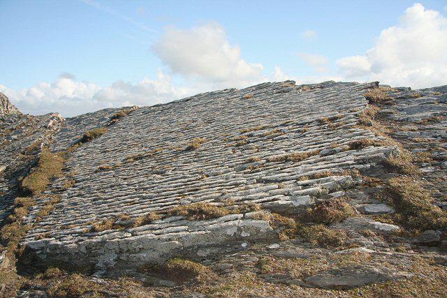 Photo could not load
SN1952 : North face of Foel y Mwnt
Bob Jones
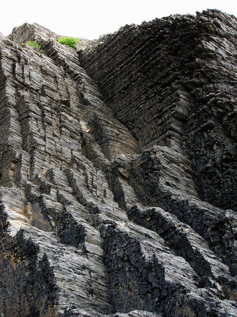 Photo could not load
SN1951 : Traeth y Mwnt, cliffs north of beach
Chris Gunns
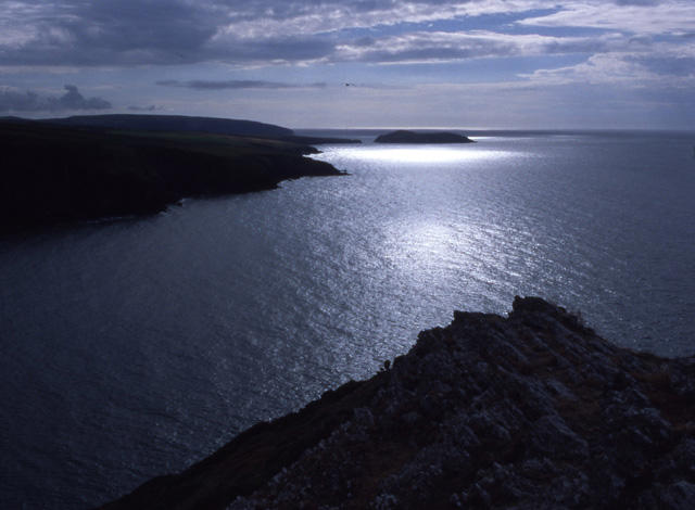 Photo could not load
SN1952 : Foel y Mwnt
Ian Taylor
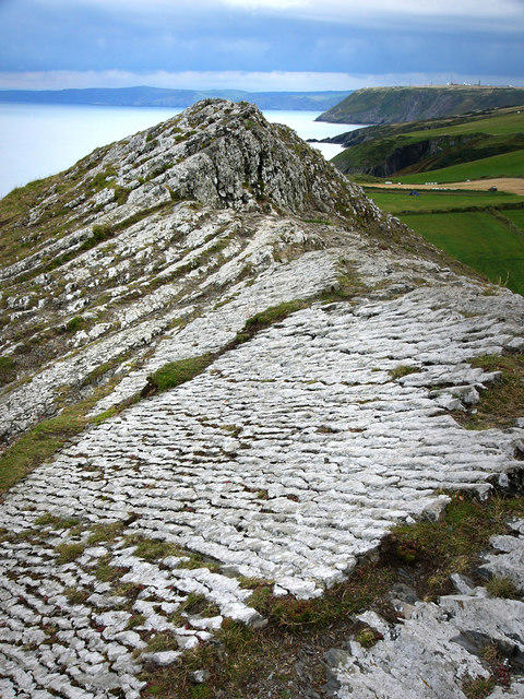 Photo could not load
SN1952 : Summit of Foel y Mwnt, looking east
Chris Gunns
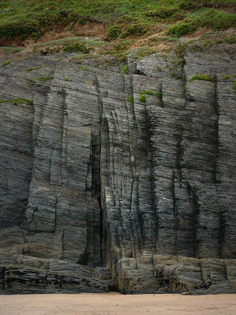 Photo could not load
SN1951 : Traeth y Mwnt, cliffs north of beach
Chris Gunns
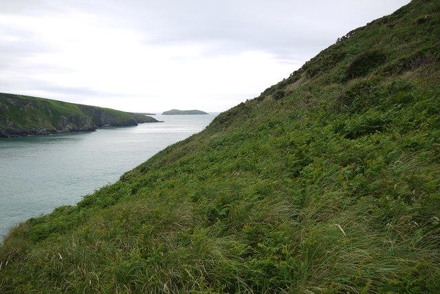 Photo could not load
SN1952 : Foel-y-Mwnt
Nigel Mykura
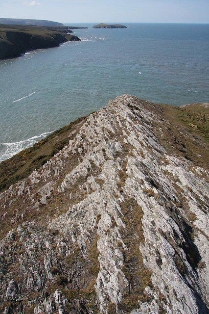 Photo could not load
SN1952 : Summit of Foel y Mwnt
Bob Jones
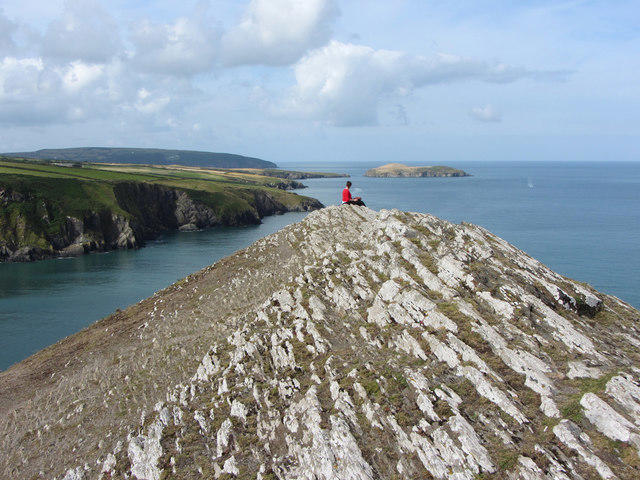 Photo could not load
SN1952 : On Foel y Mwnt
Gareth James
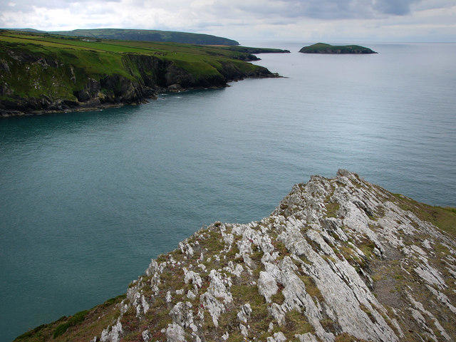 Photo could not load
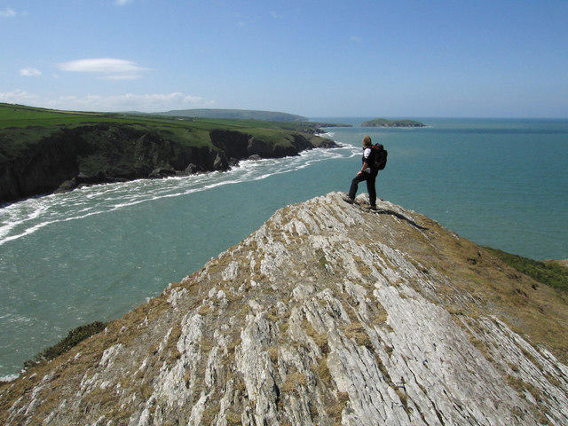
SN1952 : Summit of Foel y Mwnt, looking west
Chris Gunns
SN1952 : Summit of Foel y Mwnt
Dave Croker
Hill facts and local notes
Classifications
Elevation
76m
249 ft
Prominence
43m
Coordinates
52.1374, -4.6412
SN193520
OS Map
145
Explorer: OL35E 198W
At the Summit
At the summit, you’ll find a prominent cairn and a stunning view extending over Cardigan Bay. On a clear day, you may even spot dolphins playing in the surf below.
Terrain & Geology
Foel-y-Mwnt is primarily composed of Ordovician volcanic rock, presenting a fascinating example of ancient geological activity. The hillside features slate and sandstone, remnants of its turbulent geological past.
Views & Scenery
Looking out over the picturesque Cardigan Bay and the rugged coastline, including the distinctive cliffs of the Pembrokeshire Coast.
History & Heritage
Name Origin
The name Foel-y-Mwnt translates to 'hill of the knoll' in Welsh, which is rather apt for the prominent round shape of the summit.
Historical Significance
The hill is known for its ancient church, St. Mary's, located nearby, which is said to date back to the sixth century.
Getting There & Facilities
Parking
There is a car park at Mwnt, approximately 1 mile from the footpath leading up to Foel-y-Mwnt.
Public Transport
The closest bus stop is in the village of Mwnt, which is serviced by local buses from Cardigan.
Nearby Facilities
There are no facilities directly on the hill, but Mwnt offers a lovely café and public toilets nearby.
Safety Information
Known Hazards
- Steep sections may pose a challenge in wet weather; slippery rocks and mud can be an issue.
General Safety Tips
- Check weather conditions before setting out
- Carry appropriate clothing and equipment
- Let someone know your planned route
- Take a map, compass, and GPS device
- Carry emergency supplies: food, water, first aid kit, torch
Hills
Some common questions about the hills answered
Are there group walks up Foel-y-Mwnt?
Many walkers use Walkmates to join or organise walks with others. You can check for group walks around Foel-y-Mwnt through the maps
Are there other walkers around Foel-y-Mwnt?
Activity varies by location and time, but Walkmates lets you see whether others have shared walks or shown interest in this area. Find other people through the walking friends search walking friends for Foel-y-Mwnt search or of course create your own walk for Foel-y-Mwnt
Can I organise a walk to Foel-y-Mwnt?
Yes. If there aren’t any walks listed already, you can create a walk and make it available for others to join.
If you're signed up to Walkmates, you can create a walk to Foel-y-Mwnt.
How do I find a walk up this hill?
There are often multiple ways to walk this hill, depending on experience and route preference. Walkmates helps you explore walks and routes that others have shared.
Can I suggest a new route up Foel-y-Mwnt?
Yes. You can suggest or create routes to share with others. Walkmates focuses on the social side of walking, so routes are used to help people organise walks and explore areas together, rather than as detailed navigation tools or route libraries.
Other uses really appreciate knowledgeable walkers sharing their routes. Share your favourite route to Foel-y-Mwnt here
The is an error or something incorrect about this hill. How do I let you know?
We always strive to keep the information on Walkmates as accurate as possible. If you find an error, please let us know through the contact form and we'll aim to correct it as quickly as possible
Community Discussion
Comments
Location
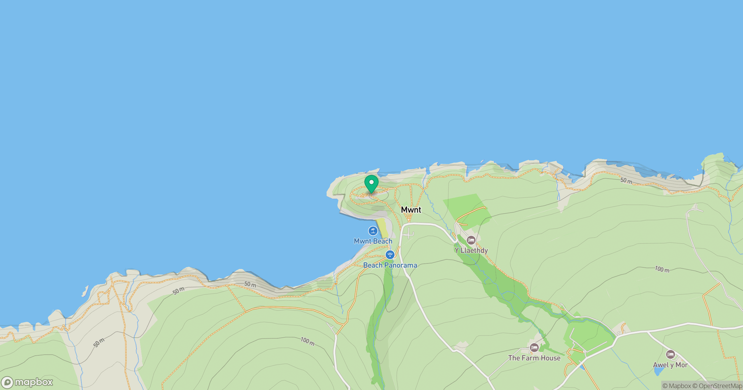
Grid reference: SN193520
View on OpenStreetMapOpens a map in a new tab, centred on the hill.
No comments yet. Be the first.