
Foel Goch
Good walks are even better shared.
Overview
Foel Goch: An Accessible Marvel of Snowdonia
Foel Goch, standing at 703 meters, may not have the height to challenge the giants of Snowdonia, but it sure has its charm! This moderate hike offers a delightful experience with stunning views and a friendly atmosphere.
Geology
With volcanic roots, the geology of Foel Goch is a treat for enthusiasts. Composed of ancient volcanic rocks, the area reflects a tumultuous geological past that is intriguing to explore. Nothing like a bit of rock gazing while catching your breath!
Access and Parking
Getting to Foel Goch is a walk in the park—well, sort of! The nearest parking area at Bwlch y Gwynt is well-known, but it does fill up fast, especially on sunny weekends. Arrive bright and early, and you might just snag a spot. Alternatively, public transport is available via a bus from Betws-y-Coed, making it quite accessible.
Routes
Bwlch y Gwynt Route
The route from Bwlch y Gwynt spans approximately 5.5 km and takes about 2.5 hours to ascend. This path is well-trodden and offers stunning views with every step. A great option for a family hike!
Cwm y Glo Route
A slightly longer alternative at 6.2 km, the Cwm y Glo route provides additional scenic beauty and a few more challenges for those looking for a bit of adventure.
Terrain and Hazards
Expect grassy paths interspersed with rocky patches. Keep an eye out for any slippery stones—wet weather can turn this delightful hike into a mini slip 'n slide! And don’t forget, the weather can change faster than you can say 'raincoat', so pack accordingly.
Summit Features and Views
When you reach the summit, you'll be greeted by a stone cairn and breathtaking views of the surrounding peaks, including Snowdon itself. There’s nothing quite like the feeling of standing on top of the world, so don’t forget to snap a pic! The best times for a clearer view are from late spring to early autumn.
Nearby Summits
While you’re there, take a peek at Carnedd Gwynedd and Mynydd Lluest y Beddau, both of which are mere stones throw away and invite additional exploration.
Conclusion
Foel Goch is more than just a hill; it’s a gateway to the stunning landscape and rich culture of Snowdonia. Whether you’re a seasoned hiker or a curious wanderer, this mountain's accessible routes and scenic views are sure to leave you enchanted. Just remember, the views are free, but the memories are priceless!
Explore routes near Foel Goch
Walks starting near this hill. Open a route to check its map, distance and full itinerary.
Arenig Fach guided mountain walk
View route
Aran Benllyn and Aran Fawddwy from LLanuwchllyn
View route
Llangollen to Horseshoe Falls: Canal Towpath from Market Street
View route
World’s End and back
View route
Route planning notes
These notes describe possible approaches. Check a route's map and access information when planning your walk.
Bwlch y Gwynt Route
A popular ascent starting from the Bwlch y Gwynt, this route offers both stunning views and a manageable climb for most hikers.
Cwm y Glo Route
Starting from Cwm y Glo, this path provides a scenic route with varied terrain and beautiful landscapes along the way.
Make a day of it, together
Find someone to share the walk with, or organise a day out along a route you like.
Hill facts and local notes
Classifications
Elevation
611m
2,005 ft
Prominence
274m
Coordinates
52.9678, -3.5592
SH953422
OS Map
125
Explorer: OL18E
At the Summit
At the summit, hikers will find a small rocky outcrop and a stone cairn, perfect for a quick photo op to show the folks back home that you really did reach the top!
Terrain & Geology
Foel Goch is primarily composed of old volcanic rocks, which are a result of its fiery past. The summit features a unique mix of slate and volcanic tuff, providing a fascinating insight into the geological history of the area.
Views & Scenery
From the summit, you can enjoy panoramic views of the renowned Snowdon range and, on a clear day, even catch a glimpse of the distant North Welsh coastline.
History & Heritage
Name Origin
The name 'Foel Goch' translates to 'Red Hill', likely referencing the reddish hues seen in the earth of the area.
Historical Significance
Foel Goch is part of the rich cultural tapestry of Snowdonia, with connections to local folklore and the history of the region's mining industries.
Getting There & Facilities
Parking
There is a small parking area at Bwlch y Gwynt which can accommodate a few cars. Be sure to arrive early during peak seasons!
Public Transport
The nearest train station is in Betws-y-Coed, from which you can take a local bus service to Bwlch y Gwynt.
Nearby Facilities
There are no facilities at the summit, but Capel Curig and Betws-y-Coed offer plenty of cafes and small shops. Be sure to stock up on snacks before heading up!
Safety Information
Known Hazards
- Watch out for sudden weather changes; Snowdonia can be unpredictable. Also, be cautious of slippery rocks, especially after rain.
General Safety Tips
- Check weather conditions before setting out
- Carry appropriate clothing and equipment
- Let someone know your planned route
- Take a map, compass, and GPS device
- Carry emergency supplies: food, water, first aid kit, torch
Hills
Some common questions about the hills answered
Are there group walks up Foel Goch?
Many walkers use Walkmates to join or organise walks with others. You can check for group walks around Foel Goch through the maps
Are there other walkers around Foel Goch?
Activity varies by location and time, but Walkmates lets you see whether others have shared walks or shown interest in this area. Find other people through the walking friends search walking friends for Foel Goch search or of course create your own walk for Foel Goch
Can I organise a walk to Foel Goch?
Yes. If there aren’t any walks listed already, you can create a walk and make it available for others to join.
If you're signed up to Walkmates, you can create a walk to Foel Goch.
How do I find a walk up this hill?
There are often multiple ways to walk this hill, depending on experience and route preference. Walkmates helps you explore walks and routes that others have shared.
Can I suggest a new route up Foel Goch?
Yes. You can suggest or create routes to share with others. Walkmates focuses on the social side of walking, so routes are used to help people organise walks and explore areas together, rather than as detailed navigation tools or route libraries.
Other uses really appreciate knowledgeable walkers sharing their routes. Share your favourite route to Foel Goch here
The is an error or something incorrect about this hill. How do I let you know?
We always strive to keep the information on Walkmates as accurate as possible. If you find an error, please let us know through the contact form and we'll aim to correct it as quickly as possible
Community Discussion
Comments
Location
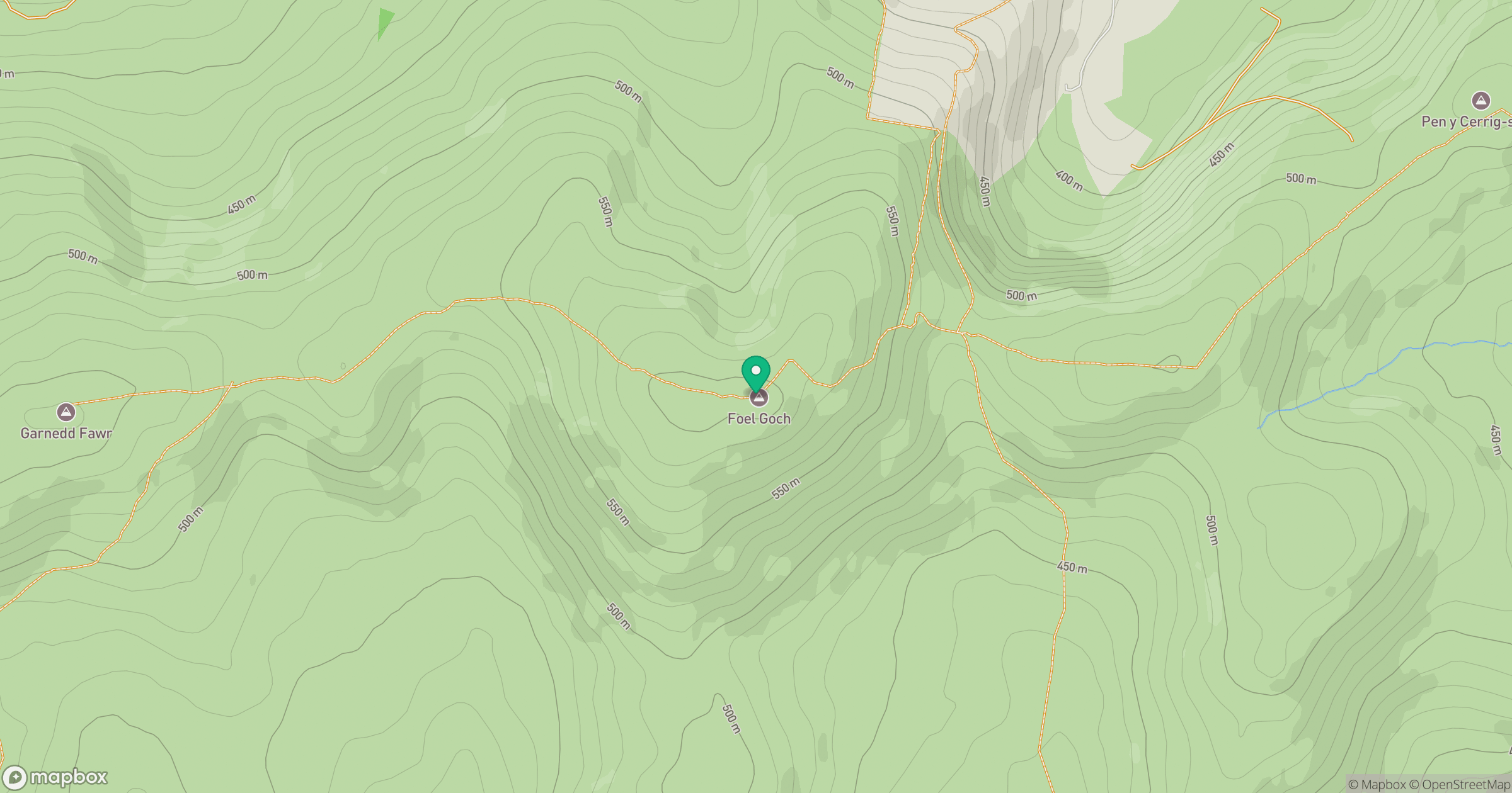
Grid reference: SH953422
View on OpenStreetMapOpens a map in a new tab, centred on the hill.
No comments yet. Be the first.