

Aran Fawddwy
Good walks are even better shared.
SH8622 : On Aran Fawddwy
Michael Graham Photo source
Overview
Aran Fawddwy (905.6 m) is the highest summit in the Arans, in southern Eryri, Gwynedd. Its rocky summit and trig point overlook Creiglyn Dyfi below steep eastern crags. Walkers approach from Cwm Cywarch in the south or follow the long northern ridge from Llanuwchllyn over Aran Benllyn and Erw y Ddafad-ddu.
Aran Fawddwy
Summit and setting
Aran Fawddwy is the highest summit of the Arans in southern Eryri, Gwynedd. DoBIH records 905.6 m and 672.8 m of prominence. The summit is marked by a trig point on a large cairn, overlooking the steep eastern face and Creiglyn Dyfi. Aran Benllyn and Erw y Ddafad-ddu are separate summits on the ridge to the north.
Walking routes
- From Cwm Cywarch, an out-and-back can follow the Hengwm hillside path, Drysgol and Drws Bach to the summit and return the same way.
- The Cwm Cywarch circuit combines the western ascent below Glasgwm with a descent over Drysgol: Walking Britain gives 12.2 km and 6 hours. It does not climb Glasgwm or Pen yr Allt Uchaf.
- The northern out-and-back starts in Llanuwchllyn and crosses Aran Benllyn and Erw y Ddafad-ddu. Walking Britain gives 16.3 km and 7 hours 50 minutes for the complete return walk.
- A north-to-south traverse continues from Aran Fawddwy via Drysgol to Cwm Cywarch. Arrange transport at both ends; a road extension to Dinas Mawddwy is a longer itinerary.
Terrain and safety
Expect bogs, rocky ground and incomplete waymarking. Map-and-compass navigation is essential in cloud. Wet planking and rock can be slippery. Stay away from the eastern cliff edges: Creiglyn Dyfi is below steep crags, not a short, easy summit approach. Snow or ice demands winter skills and appropriate equipment.
Access
The southern walks begin at Cwm Cywarch car park, SH852188; the northern ridge begins beside the Afon Twrch in Llanuwchllyn, SH879297. Dinas Mawddwy is a separate valley base, not the Cwm Cywarch trailhead. Follow signed paths through farms, leave gates as found and keep dogs on leads around livestock. Check local notices and the mountain forecast before setting out.
Landscape and heritage
The rocks include Ordovician welded volcanic ash deposits. Clear-weather views take in the ridge towards Llyn Tegid, the Berwyns, Arenigs and Cadair Idris. The name relates to Mawddwy. Mining remains and old peat routes survive around Cwm Cywarch.
Sources
Explore routes near Aran Fawddwy
Walks starting near this hill. Open a route to check its map, distance and full itinerary.
Waun-oer, Maesglase and Cribin Fawr guided mountain walk
View route
Aran Benllyn and Aran Fawddwy from LLanuwchllyn
View route
Mawddach Trail: Dolgellau to Barmouth
View route
Coed y Brenin: Pont Ty'n-y-groes and Mawddach Forest Trail
View route
Route planning notes
These notes describe possible approaches. Check a route's map and access information when planning your walk.
Southern out-and-back via Drysgol and Drws Bach
From Cwm Cywarch car park (SH852188), take the hillside path above Hengwm to the col below Waun Goch, then climb over Drysgol and Drws Bach to Aran Fawddwy. Return by the same route. This is a strenuous mountain walk with boggy and rocky ground; keep to signed paths through farmland.
Northern ridge from Llanuwchllyn (out-and-back)
Start beside the Afon Twrch at Llanuwchllyn (SH879297). Follow the ridge over Aran Benllyn and Erw y Ddafad-ddu to Aran Fawddwy, then retrace the ridge to the village. Expect bogs and rocky steps, with steep drops to the east. Walking Britain gives 7 hr 50 min for the full return walk. Its grade is Moderate/hard.
Cwm Cywarch circuit via Drysgol
From Cwm Cywarch car park (SH852188), climb past Blaencywarch to the col below Glasgwm, then follow the boggy fence-line approach to Aran Fawddwy. Return via Drws Bach and Drysgol, turning down the Hengwm hillside path before Waun Goch to the same car park. Glasgwm and Pen yr Allt Uchaf are not included. Walking Britain gives 12.2 km, 6 hours and Moderate/hard for the full circuit.
Aran traverse: Llanuwchllyn to Cwm Cywarch
A one-way walk from Llanuwchllyn (SH879297), over Aran Benllyn, Erw y Ddafad-ddu and Aran Fawddwy, then down via Drws Bach, Drysgol and the Hengwm hillside path to Cwm Cywarch car park (SH852188). Arrange transport between the two ends. This finishes in Cwm Cywarch; continuing by road to Dinas Mawddwy adds distance.
Make a day of it, together
Find someone to share the walk with, or organise a day out along a route you like.
Photo Gallery
View all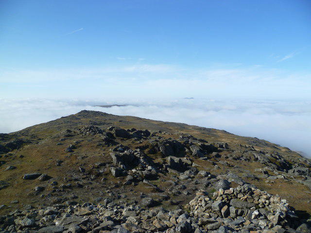 Photo could not load
SH8622 : On Aran Fawddwy
Michael Graham
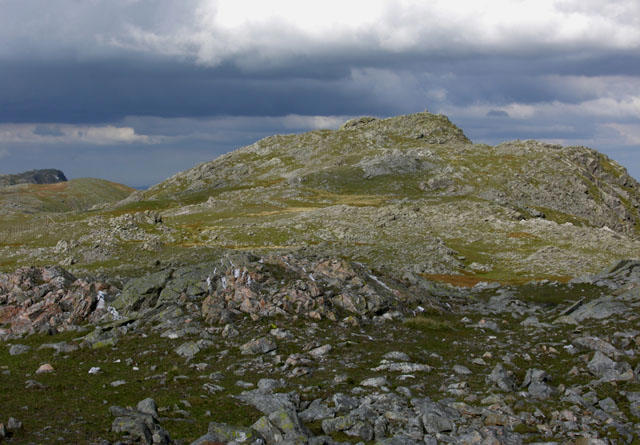 Photo could not load
SH8622 : The summit of Aran Fawddwy
Nigel Brown
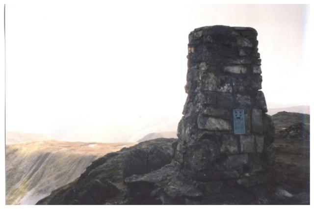 Photo could not load
SH8622 : Aran Fawddwy summit
Peter S
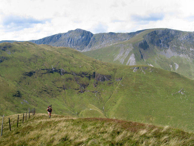 Photo could not load
SH8622 : Aran Fawddwy from the East
Dave Croker
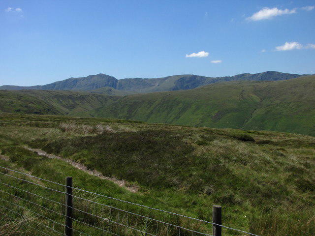 Photo could not load
SH8622 : Aran Fawddwy and Aran Benllyn
John Tustin
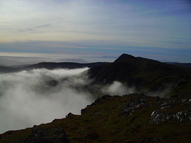 Photo could not load
SH8622 : Aran Fawddwy at dawn
Geraint Smith
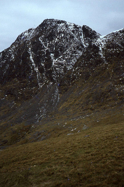 Photo could not load
SH8622 : View to Aran Fawddwy fromabove Creiglyn Dyfi
Colin Park
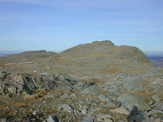 Photo could not load
SH8622 : The Aran summit ridge
Nigel Brown
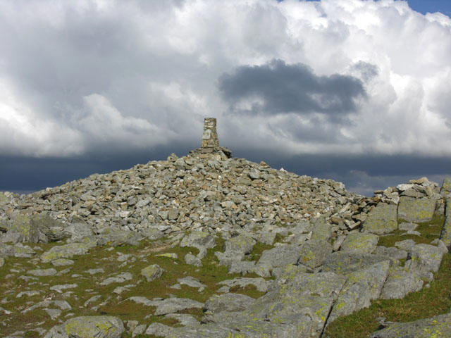 Photo could not load
SH8622 : The summit cairn of Aran Fawddwy
Nigel Brown
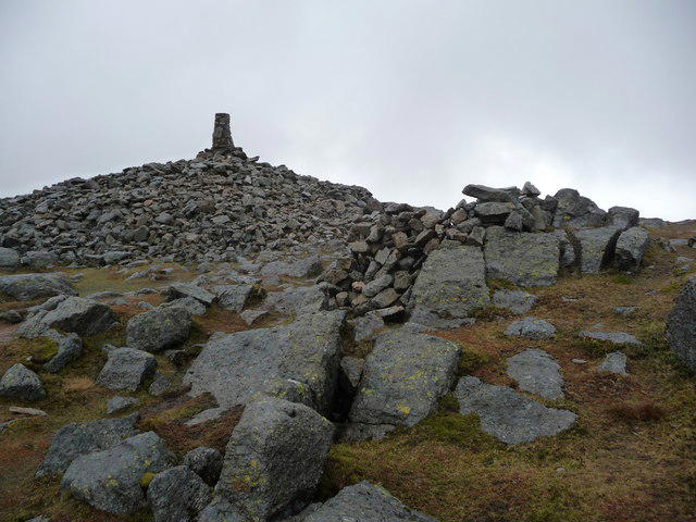
SH8622 : Summit of Aran Fawddwy
Jeremy Bolwell
Hill facts and local notes
Classifications
Elevation
906m
2,971 ft
Prominence
673m
Coordinates
52.7870, -3.6879
SH862223
OS Map
124 125
Explorer: 023E
At the Summit
A trig point stands on a large summit cairn beside the steep eastern edge above Creiglyn Dyfi.
Terrain & Geology
The mountain lies in the Ordovician Aran volcanic succession. BGS identifies welded ash-flow tuffs of the Aran Fawddwy Formation, within a wider sequence of volcanic and sedimentary rocks.
Views & Scenery
In clear weather, views extend along the ridge to Aran Benllyn and Llyn Tegid (Bala Lake), across the Berwyns and Arenigs, and towards Cadair Idris.
History & Heritage
Name Origin
The Welsh name links the mountain to Mawddwy, the historic district to its south; neighbouring Aran Benllyn is associated with Penllyn.
Historical Significance
The summit carries a large ancient cairn. In Cwm Cywarch, remains of metal mining and old peat-transport routes reflect the valley’s industrial history.
Getting There & Facilities
Parking
For southern routes use the small Cwm Cywarch car park at SH852188, reached by the narrow lane from Abercywarch, rather than starting in Dinas Mawddwy. The northern ridge starts at Llanuwchllyn, beside the Afon Twrch at SH879297. Keep farm access clear and use signed paths.
Public Transport
Machynlleth has mainline rail; book fflecsi for connections with Dinas Mawddwy. T3/T3C buses serve Llanuwchllyn. Check current services and return times, and plan the onward journey to Cwm Cywarch: Dinas Mawddwy is not the southern trailhead.
Nearby Facilities
Toilets are listed at Cwm Cywarch car park and in Dinas Mawddwy. Carry food and water for the mountain and check valley facilities before relying on them.
Safety Information
Known Hazards
- Steep eastern crags drop towards Creiglyn Dyfi. Do not treat a direct climb from the lake as an easy summit path or shortcut.
- Boggy ground, wet rock and slippery planking can slow progress; the southern route is not fully waymarked.
- Cloud can obscure the ridge and descent junctions. Carry a map and compass and know how to use them; stay clear of cliff edges in wind or poor visibility.
Seasonal Hazards
Snow and ice can turn the ridge and steep approaches into winter mountaineering terrain. Winter skills and suitable equipment are needed in those conditions; short daylight increases the commitment of the northern ridge walk.
General Safety Tips
- Check weather conditions before setting out
- Carry appropriate clothing and equipment
- Let someone know your planned route
- Take a map, compass, and GPS device
- Carry emergency supplies: food, water, first aid kit, torch
Hills
Some common questions about the hills answered
Are there group walks up Aran Fawddwy?
Many walkers use Walkmates to join or organise walks with others. You can check for group walks around Aran Fawddwy through the maps
Are there other walkers around Aran Fawddwy?
Activity varies by location and time, but Walkmates lets you see whether others have shared walks or shown interest in this area. Find other people through the walking friends search walking friends for Aran Fawddwy search or of course create your own walk for Aran Fawddwy
Can I organise a walk to Aran Fawddwy?
Yes. If there aren’t any walks listed already, you can create a walk and make it available for others to join.
If you're signed up to Walkmates, you can create a walk to Aran Fawddwy.
How do I find a walk up this hill?
There are often multiple ways to walk this hill, depending on experience and route preference. Walkmates helps you explore walks and routes that others have shared.
Can I suggest a new route up Aran Fawddwy?
Yes. You can suggest or create routes to share with others. Walkmates focuses on the social side of walking, so routes are used to help people organise walks and explore areas together, rather than as detailed navigation tools or route libraries.
Other uses really appreciate knowledgeable walkers sharing their routes. Share your favourite route to Aran Fawddwy here
The is an error or something incorrect about this hill. How do I let you know?
We always strive to keep the information on Walkmates as accurate as possible. If you find an error, please let us know through the contact form and we'll aim to correct it as quickly as possible
Community Discussion
Comments
Location
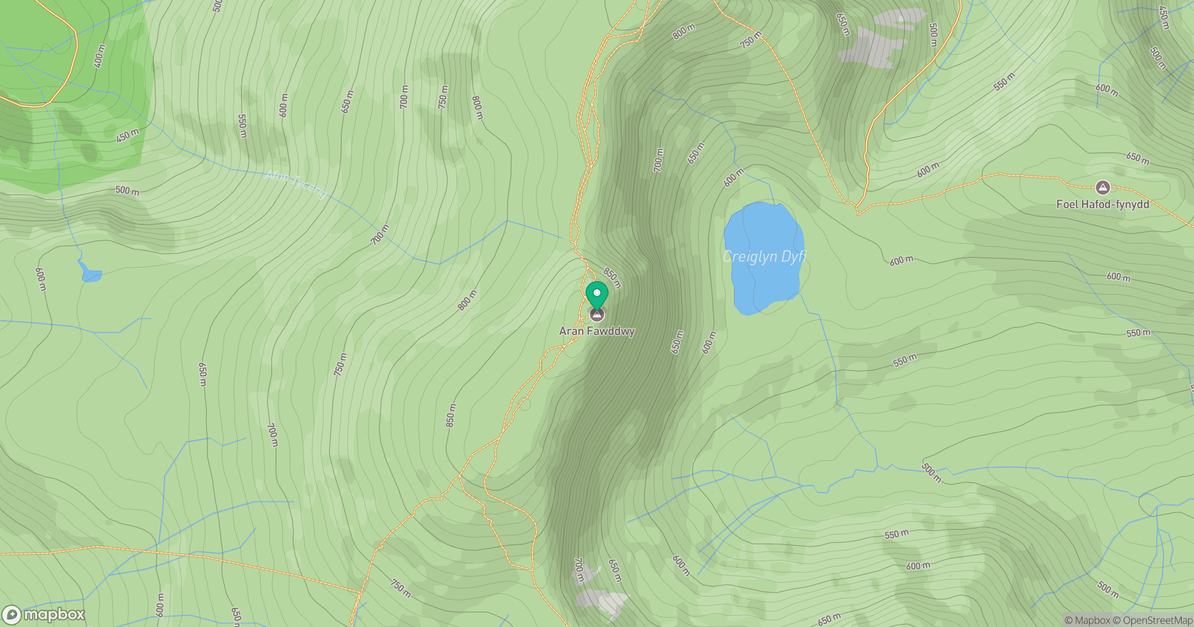
Grid reference: SH862223
View on OpenStreetMapOpens a map in a new tab, centred on the hill.
No comments yet. Be the first.