

Moel y Gydros
Good walks are even better shared.
Overview
Moel y Gydros
Introduction
Nestled beautifully in Snowdonia National Park, Moel y Gydros is a delightful Marilyn that offers both challenges and rewards for hikers of various skill levels. At an elevation of 540 meters, it may not be the highest, but it packs a punch in views and experience.
Geology
Moel y Gydros showcases fascinating volcanic geology with its impressive basalt and andesite formations. If you’re into geology, make sure to stop and marvel at the stones—just don’t forget to look up occasionally to avoid walking into them!
Routes
The most popular route starts from the charming village of Cwm Penmachno. It’s a moderate hike that takes about 2.5 hours and spans roughly 6 km, making it ideal for families, enthusiastic dogs, and anyone who’s ever claimed to be ‘just about fit’.
Summit Features
At the summit, you'll find a vertical stone cairn that serves as a lovely navigation aid (as well as a great backrest for when you decide to take a breather). And the trig point? Let’s just say it’s the cherry on top of this mountain sundae!
Terrain
Expect some grassy slopes, coupled with the occasional rocky outcrop. If you're after a tranquil picnic spot, do keep an eye out for those scenic areas that are slightly less stony underfoot.
Views
From Moel y Gydros, the views are nothing short of spectacular. Spot Snowdon’s majestic peak and the rugged Carneddau nearby—perfect for those Instagram moments! Best time to head up? Spring and autumn, when the scenery looks like it jumped straight out of a postcard.
Hazards
This is not a leisurely stroll in the park—watch for loose stones, especially on steeper sections, and be prepared for sudden weather changes. One moment you’re basking in sunlight, and the next, you might need those hiking trousers with a waterproof lining!
Access
Getting to Moel y Gydros is relatively straightforward. You can park at Cwm Penmachno, but be sure to arrive early to snag a space. If relying on public transport, check local bus schedules from Betws-y-Coed; they might not run as frequently as you hope.
Facilities
Post-hike, your cravings for a hot drink or a slice of cake can be satisfied in nearby Betws-y-Coed, where cafes abound. Public toilets are also available, just in case that last cup of tea caught up with you on the trail.
History
The name Moel y Gydros connects the mountain to the local culture—'Hill of the Gydros' relates to wildlife in the area. Historically, it has been a crucial guidepost for local traders and a serene spot for revitalisation after a long journey.
So, what are you waiting for? Lace up those boots and get ready for an adventure up Moel y Gydros. It’s an experience you won’t soon forget!
Explore routes near Moel y Gydros
Public walks starting within 80 km of this hill. Nearby does not mean a route reaches the summit; check its map and access before setting out.
Arenig Fach guided mountain walk
View route
Aran Benllyn and Aran Fawddwy from LLanuwchllyn
View route
Llyn Crafnant: Lakeside Circuit from the NRW Car Park
View route
Coed y Brenin: Pont Ty'n-y-groes and Mawddach Forest Trail
View route
Route planning notes
These notes describe possible approaches, not verified navigable routes or permission to cross land. Check current paths, local access rules and conditions before setting out.
Via the Southern Ridge
A pleasant walk starting from the village of Cwm Penmachno, following a path that ascends steadily along the southern ridge, offering beautiful views.
Make a day of it, together
Find someone to share the walk with, or organise a day out along a route you like.
Photo Gallery
View all Photo could not load
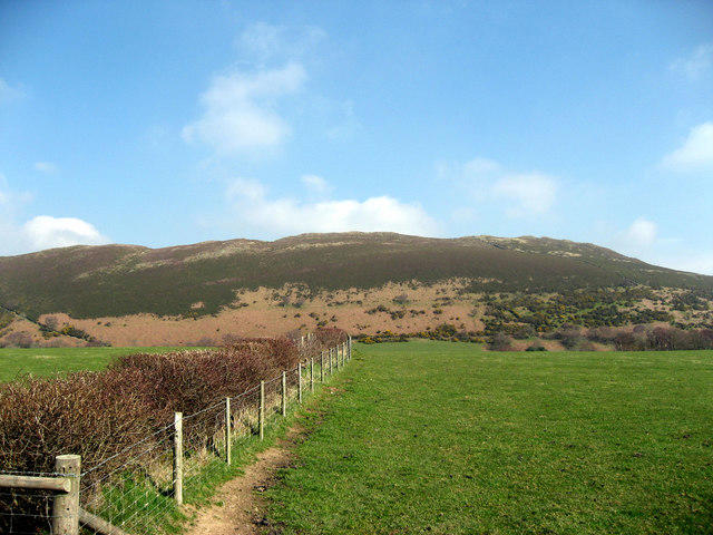
SH9145 : Moel y Gydros from the Cwm Penanner road
Andrew Beasley
 Photo could not load
SH9145 : Moel y Gydros from Rhyduchaf
Andrew Beasley
 Photo could not load
SH9145 : Moel y Gydros summit
Jonathan Wilkins
 Photo could not load
SH9145 : Moel y Gydros summit panorama looking southwest
Andrew Beasley
 Photo could not load
SH9145 : Moel y Gydros summit panorama looking northeast
Andrew Beasley
 Photo could not load
SH9145 : Moel y Gydros summit panorama looking north
Andrew Beasley
 Photo could not load
SH9145 : Moel y Gydros summit panorama looking west
Andrew Beasley
 Photo could not load
SH9145 : Moel y Gydros summit panorama looking east
Andrew Beasley
 Photo could not load
SH9145 : Moel y Gydros summit panorama looking east-northeast
Andrew Beasley
 Photo could not load
SH9145 : Moel y Gydros summit panorama looking north-northeast
Andrew Beasley
Hill facts and local notes
Classifications
Elevation
522m
1,714 ft
Prominence
146m
Coordinates
52.9948, -3.6190
SH914453
OS Map
116
Explorer: OL18E 264S
At the Summit
The summit features a sizeable stone cairn and a trig point with a panoramic view that will make your camera weep with joy.
Terrain & Geology
The mountain is predominantly composed of volcanic rock, featuring a mix of basalt and andesite, providing a unique geological history and stunning cliff formations.
Views & Scenery
On a clear day, enjoy views of Snowdon, the Carneddau range, and the beautiful valleys below. Don't forget to wave at the sheep!
History & Heritage
Name Origin
The name 'Moel y Gydros' translates roughly to 'Hill of the Gydros', with 'Moel' being a term for a hill and 'Gydros' thought to be related to local wildlife.
Historical Significance
The mountain has been a local landmark for centuries, offering routes to ancient traders and sheep drovers.
Getting There & Facilities
Check current local access restrictions, parking rules and transport timetables before travelling. These notes do not confirm public access to the summit.
Parking
Parking is available at Cwm Penmachno; it's a small layby, so get there early to avoid the Friday night rush.
Public Transport
Buses run to Cwm Penmachno from nearby towns, but check the schedule as services can be a bit like British summer weather – unpredictable.
Nearby Facilities
There are no facilities directly on the mountain, but nearby Betws-y-Coed has cafes, shops, and public toilets to cater for your needs before and after your adventure.
Safety Information
Known Hazards
- Watch for loose stones, particularly on steeper sections; weather can change quickly, so be prepared for anything from sunbathing to snowball fights in a matter of minutes!
General Safety Tips
- Check weather conditions before setting out
- Carry appropriate clothing and equipment
- Let someone know your planned route
- Take a map, compass, and GPS device
- Carry emergency supplies: food, water, first aid kit, torch
Hills
Some common questions about the hills answered
Are there group walks up Moel y Gydros?
Many walkers use Walkmates to join or organise walks with others. You can check for group walks around Moel y Gydros through the maps
Are there other walkers around Moel y Gydros?
Activity varies by location and time, but Walkmates lets you see whether others have shared walks or shown interest in this area. Find other people through the walking friends search walking friends for Moel y Gydros search or of course create your own walk for Moel y Gydros
Can I organise a walk to Moel y Gydros?
Yes. If there aren’t any walks listed already, you can create a walk and make it available for others to join.
If you're signed up to Walkmates, you can create a walk to Moel y Gydros.
How do I find a walk up this hill?
There are often multiple ways to walk this hill, depending on experience and route preference. Walkmates helps you explore walks and routes that others have shared.
Can I suggest a new route up Moel y Gydros?
Yes. You can suggest or create routes to share with others. Walkmates focuses on the social side of walking, so routes are used to help people organise walks and explore areas together, rather than as detailed navigation tools or route libraries.
Other uses really appreciate knowledgeable walkers sharing their routes. Share your favourite route to Moel y Gydros here
The is an error or something incorrect about this hill. How do I let you know?
We always strive to keep the information on Walkmates as accurate as possible. If you find an error, please let us know through the contact form and we'll aim to correct it as quickly as possible
Community Discussion
Comments
Location
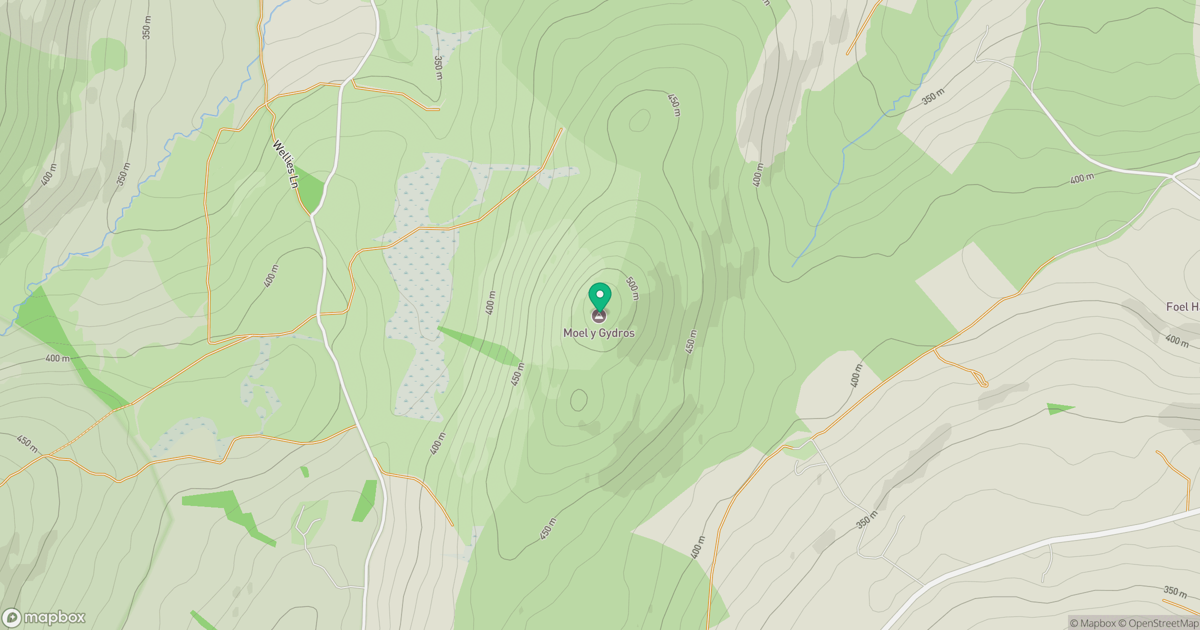
Grid reference: SH914453
View on OpenStreetMapOpens a map in a new tab, centred on the hill.
Hills within 30 km
Straight-line distance, not a walking route or confirmation of access.
No comments yet. Be the first.