
Mwdwl-eithin
Good walks are even better shared.
Overview
Mwdwl-eithin: A Hidden Gem in the Brecon Beacons
Mwdwl-eithin, at an elevation of 588 meters, is a delightful Marilyn nestled in the heart of the Brecon Beacons. While it may not be the highest peak in the area, it offers a splendid hike with stunning views and a variety of terrains to explore.
Geology
Mwdwl-eithin is characterised by its Old Red Sandstone composition. The rugged cliffs and gentle slopes tell tales of millennia past, shaped by glacial activity. This fascinating geology not only provides a rich environment for flora and fauna but also offers numerous photographic opportunities for geology enthusiasts.
Routes
One popular route to explore is the Cwm Eitha Circular. Starting from the foothills of Cwm Eitha, this 7 km trail leads you through lush woodlands before tackling the ascent to the summit. With a moderate difficulty rating, it’s perfect for families and those looking to enjoy a leisurely day out in nature.
Summit Features
Upon reaching the summit, hikers are greeted by a sturdy stone cairn, which stands as a testament to the many adventurers who have trodden here. The panoramic views from the top truly make every step of the ascent worthwhile.
Terrain Type
Expect a mix of grassy slopes and rocky outcrops. Though many parts are stable underfoot, don’t be surprised if a boggy patch sneaks up on you! Proper footwear is advised to tackle the varied terrain skillfully.
Views
From Mwdwl-eithin, the sight of the towering Brecon Beacons and the undulating hills surrounding you will leave you awestruck. The best seasons for these breathtaking views are spring and autumn, where clear skies contrast brilliantly against the rich colours of the landscape.
Hazards
As with any hill walking adventure, be mindful of the rapidly changing weather conditions. Visibility can drop quickly due to mist, so carrying a map and compass is wise. Watch out for rocky areas and bypass any boggy sections, particularly after wet weather.
Nearby Summits
Mwdwl-eithin is close to other notable peaks, such as Fan Fawr (734 meters) and Pen y Fan (886 meters), making it an excellent base for further exploration of the Brecon Beacons.
Access
The nearest parking is a quaint little car park located at the entrance to Cwm Eitha. Facilities in Brecon are plentiful, with shops and cafes ready to cater to your post-hike cravings. Public transport is also available, with regular bus services to Libanus.
History
The meaning of the mountain’s name, 'Mwdwl-eithin', reflects the abundant brambles at the base of the hill. Historically significant as a meeting point for ancient trade routes, the mountain breathes life into local folklore and history.
So, prepare your gear, pack a snack, and embark on a memorable adventure up Mwdwl-eithin - the hill of the bramble awaits!
Explore routes near Mwdwl-eithin
Walks starting near this hill. Open a route to check its map, distance and full itinerary.
Arenig Fach guided mountain walk
View route
Aran Benllyn and Aran Fawddwy from LLanuwchllyn
View route
Llangollen to Horseshoe Falls: Canal Towpath from Market Street
View route
World’s End and back
View route
Route planning notes
These notes describe possible approaches. Check a route's map and access information when planning your walk.
Cwm Eitha Circular
A scenic route starting from Cwm Eitha that takes you through diverse woodland before ascending the gentle slopes towards the summit.
Make a day of it, together
Find someone to share the walk with, or organise a day out along a route you like.
Hill facts and local notes
Classifications
Elevation
470m
1,544 ft
Prominence
131m
Coordinates
53.0106, -3.5076
SH989469
OS Map
116
Explorer: OL18E 255 264S
At the Summit
The summit is adorned with a stone cairn, offering hikers a sense of achievement. The view from here makes every uphill step worthwhile.
Terrain & Geology
Mwdwl-eithin is primarily composed of Old Red Sandstone, featuring rugged cliffs and gentle slopes that have been shaped by glacial erosion. This geological formation provides a fascinating glimpse into the ancient landscapes of the area.
Views & Scenery
From the summit, you can see the majestic peaks of the Brecon Beacons and the rolling hills of the surrounding countryside, perfect for those Instagram shots.
History & Heritage
Name Origin
The name 'Mwdwl-eithin' translates to 'the hill of the bramble', a nod to the dense vegetation that can be found around its base.
Historical Significance
Historically, this area has been a meeting point for ancient trade routes, and tales of folklore are woven into the fabric of its landscape.
Getting There & Facilities
Parking
There is a small car park at the Cwm Eitha entrance, suitable for a handful of vehicles. Arrive early during weekends to secure a spot.
Public Transport
Regular bus services run from Brecon to the nearest village of Libanus, with a short walk to the start of the route.
Nearby Facilities
While there are no facilities directly at Mwdwl-eithin, Brecon offers a variety of cafes, shops, and public toilets to suit your needs.
Safety Information
Known Hazards
- Be wary of changing weather conditions, as it can get misty quickly. Watch your step on rocky areas and avoid boggy sections after heavy rain.
General Safety Tips
- Check weather conditions before setting out
- Carry appropriate clothing and equipment
- Let someone know your planned route
- Take a map, compass, and GPS device
- Carry emergency supplies: food, water, first aid kit, torch
Hills
Some common questions about the hills answered
Are there group walks up Mwdwl-eithin?
Many walkers use Walkmates to join or organise walks with others. You can check for group walks around Mwdwl-eithin through the maps
Are there other walkers around Mwdwl-eithin?
Activity varies by location and time, but Walkmates lets you see whether others have shared walks or shown interest in this area. Find other people through the walking friends search walking friends for Mwdwl-eithin search or of course create your own walk for Mwdwl-eithin
Can I organise a walk to Mwdwl-eithin?
Yes. If there aren’t any walks listed already, you can create a walk and make it available for others to join.
If you're signed up to Walkmates, you can create a walk to Mwdwl-eithin.
How do I find a walk up this hill?
There are often multiple ways to walk this hill, depending on experience and route preference. Walkmates helps you explore walks and routes that others have shared.
Can I suggest a new route up Mwdwl-eithin?
Yes. You can suggest or create routes to share with others. Walkmates focuses on the social side of walking, so routes are used to help people organise walks and explore areas together, rather than as detailed navigation tools or route libraries.
Other uses really appreciate knowledgeable walkers sharing their routes. Share your favourite route to Mwdwl-eithin here
The is an error or something incorrect about this hill. How do I let you know?
We always strive to keep the information on Walkmates as accurate as possible. If you find an error, please let us know through the contact form and we'll aim to correct it as quickly as possible
Community Discussion
Comments
Location
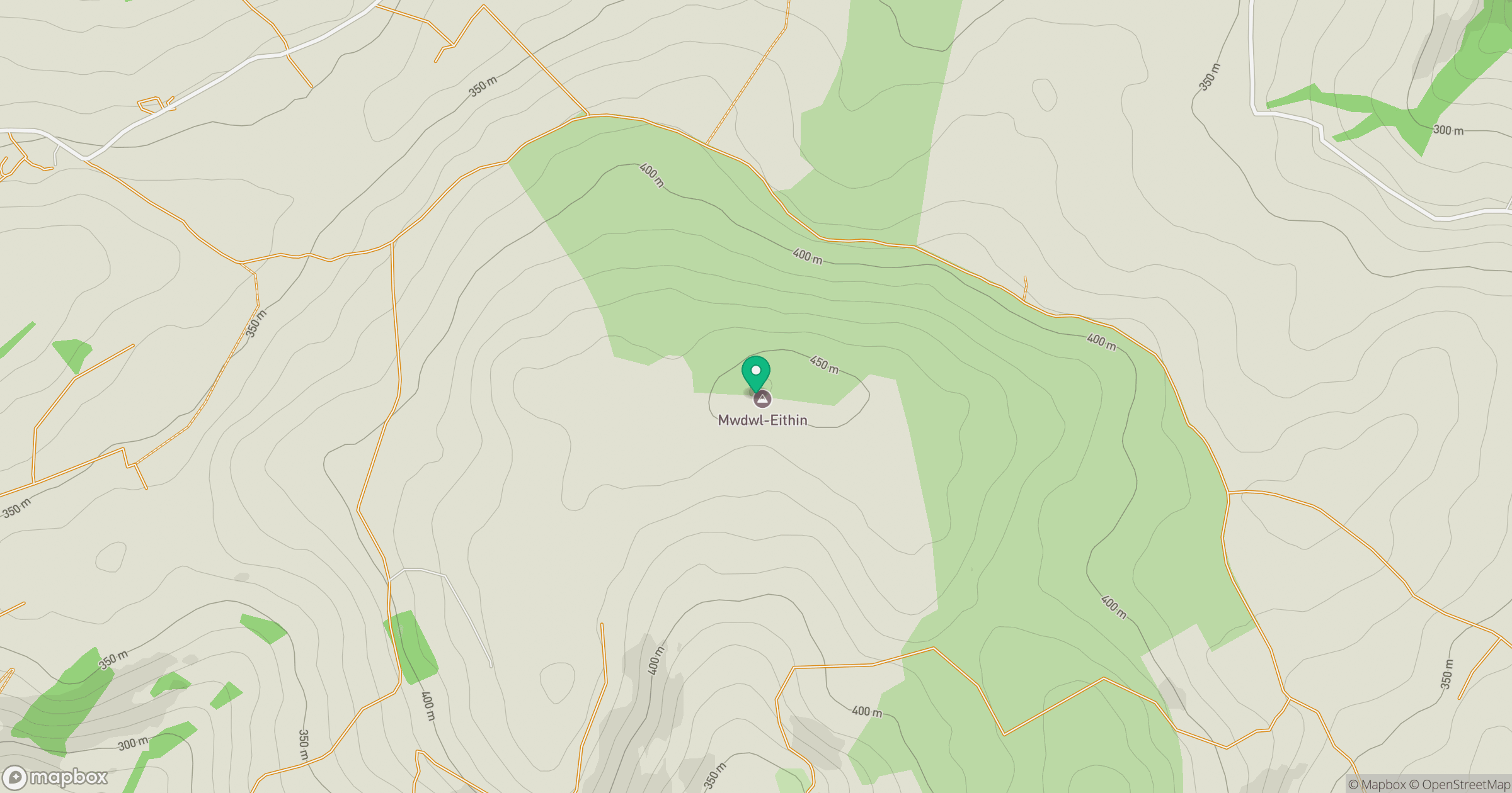
Grid reference: SH989469
View on OpenStreetMapOpens a map in a new tab, centred on the hill.
No comments yet. Be the first.