

Mynydd Mynyllod
Good walks are even better shared.
Overview
Mynydd Mynyllod
Mynydd Mynyllod stands proudly at an elevation of 547 meters in the wilds of Wales. As a Marilyn, it offers both challenge and rewards for those willing to ascend its heights.
Geology
This majestic mountain is primarily constructed from sedimentary rocks like sandstone and mudstone, formed during the Mesozoic era. The unique geological structures can spark the curiosity of both geology enthusiasts and casual walkers alike.
Routes
One of the most favoured routes is the Mynydd Mynyllod Circular Route. It covers approximately 10 kilometers and takes around 3.5 hours to complete. Be prepared for moderate terrain and don’t forget your camera!
Summit Features
At the summit, you will find the iconic trig point, standing resolute against the elements. It’s the perfect spot to take a well-earned break and soak in the panoramic views.
Terrain
The journey features grassy paths interspersed with rocky outcrops, providing variety and a tad of excitement. Just a friendly reminder: mud is a real possibility, especially after rainy weather—don’t wear your Sunday best!
Views
From the top, the vistas are indeed stunning. The Berwyn Mountains can be seen in the distance, and on exceptionally clear days, the majestic Snowdonia range comes into view. Visiting in spring or autumn enhances the visual feast.
Hazards
While exploring, be vigilant of the often slippery paths and be prepared for sudden weather shifts—mountains can be mischievous that way!
Nearby Summits
If you're feeling adventurous, Mynydd Troed (609m) and Mynydd Llangynidr (627m) are close companions worth a visit.
Access
To gear up for your adventure, the nearest parking is in Cwmnantddu. Crickhowell, just a short drive away, offers public transport options.
Facilities
Refreshments are available in Crickhowell with various cafes and pubs to choose from. Perfect for a post-hike pint!
History
The intriguing name 'Mynydd Mynyllod' rolls off the tongue, hinting at the mountain's crooked contours. It’s a site steeped in historical significance, embraced by hikers for generations.
Whether you're chasing sunsets, views, or just a good walk, Mynydd Mynyllod has something for everyone!
Conclusion
In essence, Mynydd Mynyllod is more than just another mountain; it’s a treasure trove for nature lovers, historians, and those seeking a little escapism. Don't miss out on this scenic gem!
Explore routes near Mynydd Mynyllod
Public walks starting within 80 km of this hill. Nearby does not mean a route reaches the summit; check its map and access before setting out.
Arenig Fach guided mountain walk
View route
Aran Benllyn and Aran Fawddwy from LLanuwchllyn
View route
Llangollen to Horseshoe Falls: Canal Towpath from Market Street
View route
World’s End and back
View route
Route planning notes
These notes describe possible approaches, not verified navigable routes or permission to cross land. Check current paths, local access rules and conditions before setting out.
Mynydd Mynyllod Circular Route
A scenic circular walk that offers the opportunity to explore the surrounding heath and wildlife while climbing to the summit.
Make a day of it, together
Find someone to share the walk with, or organise a day out along a route you like.
Photo Gallery
View all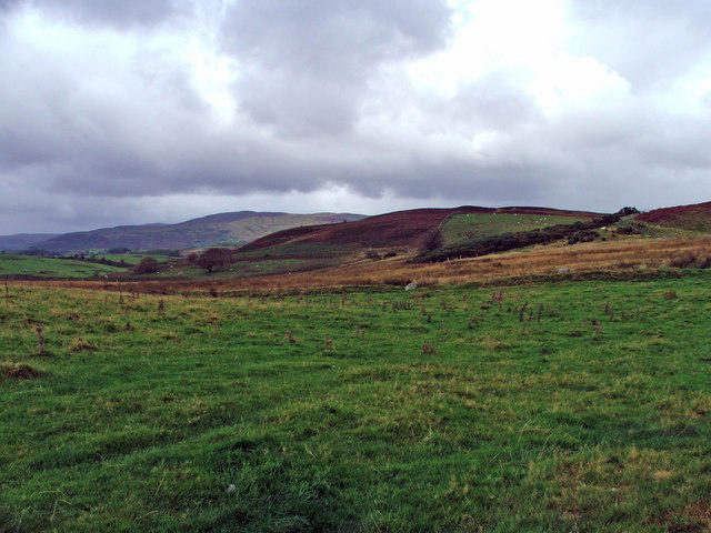 Photo could not load
SJ0039 : Hill near Mynydd Mynyllod.
Edward Williams
Hill facts and local notes
Classifications
Elevation
394m
1,292 ft
Prominence
122m
Coordinates
52.9438, -3.4862
SJ002395
OS Map
125
Explorer: 255
At the Summit
The summit boasts a prominent trig point, which serves as a weathered marker of elevation and is a popular spot for photographs. The views from the summit are simply breathtaking!
Terrain & Geology
The mountain is primarily composed of sedimentary rocks typical of the region, including sandstone and mudstone, which were formed in the Mesozoic era. The exposed rock face provides a glimpse into the earth's geological past.
Views & Scenery
From the summit, you can gaze over the lush countryside and catch a glimpse of the distant Berwyn Mountains. On clear days, the panorama can extend as far as the Snowdonia range.
History & Heritage
Name Origin
The name 'Mynydd Mynyllod' is derived from Welsh, indicating a 'mountain of the bend' or 'crooked mountain', suggesting its unique contours.
Historical Significance
The mountain is part of the historical landscape of the Brecon Beacons and has long been a beloved spot for walkers and nature enthusiasts.
Getting There & Facilities
Check current local access restrictions, parking rules and transport timetables before travelling. These notes do not confirm public access to the summit.
Parking
The nearest parking area is at the village of Cwmnantddu, where space is available for a few cars. Make sure to arrive early during weekends.
Public Transport
The nearest bus stop is in the village of Crickhowell, from where it is a short taxi ride to the parking area.
Nearby Facilities
Nearby, you will find several cafes and pubs in Crickhowell offering refreshments and restrooms for weary hikers.
Safety Information
Known Hazards
- Be cautious of wet and slippery paths, particularly after rain. Also, watch out for sudden weather changes typical of mountainous regions.
General Safety Tips
- Check weather conditions before setting out
- Carry appropriate clothing and equipment
- Let someone know your planned route
- Take a map, compass, and GPS device
- Carry emergency supplies: food, water, first aid kit, torch
Hills
Some common questions about the hills answered
Are there group walks up Mynydd Mynyllod?
Many walkers use Walkmates to join or organise walks with others. You can check for group walks around Mynydd Mynyllod through the maps
Are there other walkers around Mynydd Mynyllod?
Activity varies by location and time, but Walkmates lets you see whether others have shared walks or shown interest in this area. Find other people through the walking friends search walking friends for Mynydd Mynyllod search or of course create your own walk for Mynydd Mynyllod
Can I organise a walk to Mynydd Mynyllod?
Yes. If there aren’t any walks listed already, you can create a walk and make it available for others to join.
If you're signed up to Walkmates, you can create a walk to Mynydd Mynyllod.
How do I find a walk up this hill?
There are often multiple ways to walk this hill, depending on experience and route preference. Walkmates helps you explore walks and routes that others have shared.
Can I suggest a new route up Mynydd Mynyllod?
Yes. You can suggest or create routes to share with others. Walkmates focuses on the social side of walking, so routes are used to help people organise walks and explore areas together, rather than as detailed navigation tools or route libraries.
Other uses really appreciate knowledgeable walkers sharing their routes. Share your favourite route to Mynydd Mynyllod here
The is an error or something incorrect about this hill. How do I let you know?
We always strive to keep the information on Walkmates as accurate as possible. If you find an error, please let us know through the contact form and we'll aim to correct it as quickly as possible
Community Discussion
Comments
Location
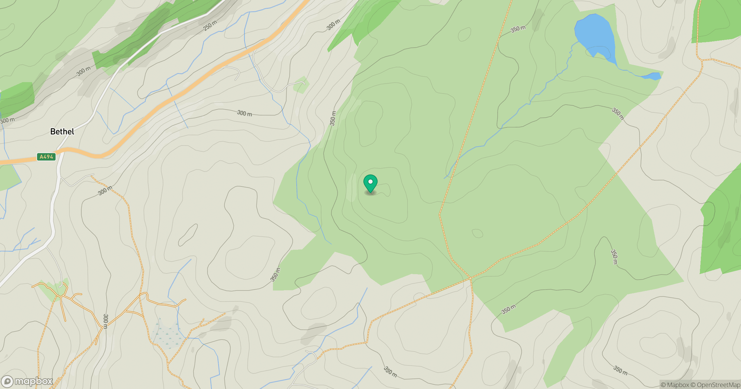
Grid reference: SJ002395
View on OpenStreetMapOpens a map in a new tab, centred on the hill.
Hills within 30 km
Straight-line distance, not a walking route or confirmation of access.
No comments yet. Be the first.