

Mynydd Tryfan
Good walks are even better shared.
SH9765 : Mynydd Tryfan
Alwyn Williams Photo source
Overview
Mynydd Tryfan
Introduction
Mynydd Tryfan is a striking mountain located in Snowdonia, Wales, with an elevation of 918 meters. This Marilyn is famous among climbers and hikers for its challenging scrambles and breathtaking views. Whether you're a seasoned mountaineer or just after a nice walk, this mountain has something to offer for everyone.
Geology
The mountain boasts fascinating geology, primarily composed of granophyre and the older volcanic rocks that constitute the Snowdon Massif. The rocky outcrops and cliffs lend themselves to exploration amid the dramatic landscape. If you're a geology enthusiast or just like examining cool rocks, you’re in for a treat!
Routes
Two well-known routes can take you to the summit:
- North Ridge Route: A short but exhilarating climb featuring rock scrambles and fantastic views, ideal for those seeking a challenge.
- South Ridge Route: This descent is more mellow with easier scrambles, making it safer for newcomers to get their mountain legs!
Summit Features
At the apex, you'll find the famous ‘Adam and Eve’—two prominent stones that climbers like to scramble between for that perfect Instagram moment! Don’t forget to capture evidence of your victory!
Terrain and Hazards
The terrain is rocky and uneven—solid boots are a must! Watch your step: loose stones can be tricky. Always be prepared for rapid weather changes; Mother Nature can be fickle, and you don’t want to be caught off guard.
Views
On a clear day, the views from Mynydd Tryfan are simply magnificent. You'll be treated to sights of the Snowdon range and Llyn Ogwen. The spring and autumn months provide the best visibility, making early morning climbs magical opportunities for witnessing the sunrise over the mountains.
Access and Facilities
Access is straightforward from the Ogwen Cottage Car Park, but do plan for potential crowds on the weekends. Facilities include a café for warming up with tea and cakes—a hiker's delight! Public toilets are available to help make your visit more pleasant.
Conclusion
Mynydd Tryfan is more than just a mountain; it’s an experience steeped in history, breathtaking views, and a dash of adventure. Whether chasing thrills or simply enjoying the scenery, this mountain should certainly be on your bucket list—if you can handle a little rocky charm!
Remember, always check the weather before heading out, and leave no trace. Happy hiking!
Explore routes near Mynydd Tryfan
Walks starting near this hill. Open a route to check its map, distance and full itinerary.
Dyserth to Prestatyn: old railway walkway return
View route
Llyn Crafnant: Lakeside Circuit from the NRW Car Park
View route
Arenig Fach guided mountain walk
View route
Llangollen to Horseshoe Falls: Canal Towpath from Market Street
View route
Route planning notes
These notes describe possible approaches. Check a route's map and access information when planning your walk.
Mynydd Tryfan Circular via Foel Goch
This classic circular route starts from the car park near SH9756665515, heading west towards Foel Goch. The path gradually climbs through grassy terrain before reaching the summit of Mynydd Tryfan, offering panoramic views of the surrounding valleys and peaks. The descent loops back past a small stream and re-joins the starting point.
Direct Ascent from Pont Cyfyng
This direct route begins at the bridge at Pont Cyfyng, following a well-trodden track through heather and rocky outcrops. It involves steady climbing with some steeper sections near the top, rewarding walkers with breathtaking views of Snowdonia. Ideal for those seeking a shorter but more intense climb.
Cwm Gwern Gof Isaf Approach
Starting from the campsite at Cwm Gwern Gof Isaf, this scenic route ascends via a quieter path that weaves through moorland and past a small tarn. It eventually meets the main ridge leading to Mynydd Tryfan’s summit. The return path descends gently along the same route.
Extended Ridge Walk from Capel Curig
This longer route begins in Capel Curig and traverses the ridge heading towards Mynydd Tryfan. The trail passes through varied terrain, including woodlands and open hillside, with opportunities to explore nearby peaks. A more challenging day out for those wanting to extend their adventure.
Mynydd Tryfan via Llyn Crafnant
This picturesque route starts near Llyn Crafnant and takes walkers along a less-frequented trail with views of the lake and surrounding hills. The ascent to Mynydd Tryfan is gradual, making it suitable for those who want a slightly easier gradient while still enjoying the summit views.
Make a day of it, together
Find someone to share the walk with, or organise a day out along a route you like.
Photo Gallery
View all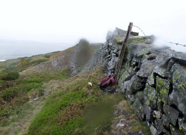 Photo could not load
SH9765 : Mynydd Tryfan
Rude Health
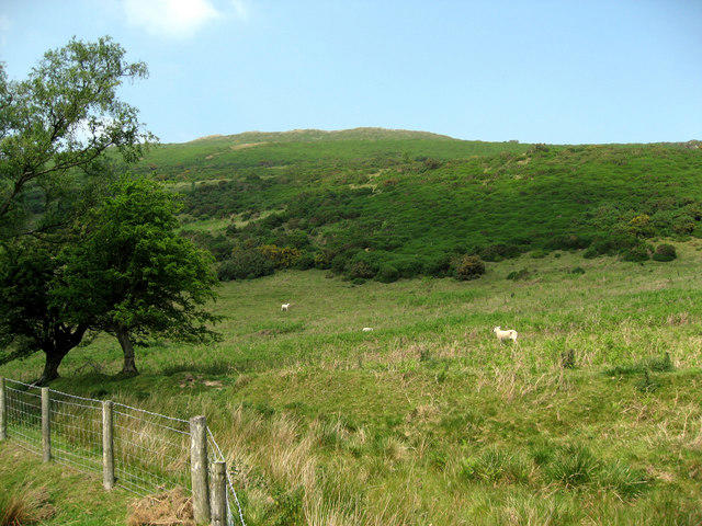 Photo could not load
SH9765 : Mynydd Tryfan 1
Alwyn Williams
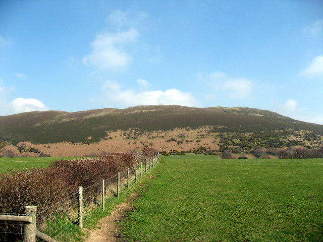 Photo could not load
SH9765 : Mynydd Tryfan
Alwyn Williams
Hill facts and local notes
Classifications
Elevation
402m
1,319 ft
Prominence
109m
Coordinates
53.1769, -3.5341
SH975655
OS Map
116
Explorer: 264N
At the Summit
The summit of Mynydd Tryfan is marked by a distinctive rock formation called Adam and Eve, two iconic boulders that climbers often scramble between for a photograph worthy of bragging rights.
Terrain & Geology
Primarily composed of granophyre and the ancient rocks of the Snowdon Massif. The mountain features interesting geological formations and steep cliffs that showcase the area’s volcanic history.
Views & Scenery
From the summit, you can see the Snowdon range, Llyn Ogwen, and even Cardigan Bay on a clear day. It’s like being on top of the world—if only the world would stop trying to catch you off balance.
History & Heritage
Name Origin
Mynydd Tryfan translates to 'Mountain of Tryfan,' with 'Tryfan' possibly deriving from the Welsh term for 'three peaks,' reflecting the mountain's unique ridgeline.
Historical Significance
Mynydd Tryfan is not only a popular hiking destination but also a site of cultural significance in Welsh folklore, representing bravery and the indomitable spirit of the Welsh people.
Getting There & Facilities
Parking
Ogwen Cottage Car Park, located at SH 654 609. It's often busy on weekends, so arrive early to snag a spot.
Public Transport
Regular bus services run from Bangor and Llandudno to nearby villages, with the closest bus stop at the base of the mountain.
Nearby Facilities
Ogwen Cottage offers a café serving hot drinks and food; there are public toilets available near the car park.
Safety Information
Known Hazards
- Loose rocks and steep drops require careful navigation. Be wary of sudden weather changes; it can be sunny one minute and gloomy the next. Always check the forecast before you head up!
General Safety Tips
- Check weather conditions before setting out
- Carry appropriate clothing and equipment
- Let someone know your planned route
- Take a map, compass, and GPS device
- Carry emergency supplies: food, water, first aid kit, torch
Hills
Some common questions about the hills answered
Are there group walks up Mynydd Tryfan?
Many walkers use Walkmates to join or organise walks with others. You can check for group walks around Mynydd Tryfan through the maps
Are there other walkers around Mynydd Tryfan?
Activity varies by location and time, but Walkmates lets you see whether others have shared walks or shown interest in this area. Find other people through the walking friends search walking friends for Mynydd Tryfan search or of course create your own walk for Mynydd Tryfan
Can I organise a walk to Mynydd Tryfan?
Yes. If there aren’t any walks listed already, you can create a walk and make it available for others to join.
If you're signed up to Walkmates, you can create a walk to Mynydd Tryfan.
How do I find a walk up this hill?
There are often multiple ways to walk this hill, depending on experience and route preference. Walkmates helps you explore walks and routes that others have shared.
Can I suggest a new route up Mynydd Tryfan?
Yes. You can suggest or create routes to share with others. Walkmates focuses on the social side of walking, so routes are used to help people organise walks and explore areas together, rather than as detailed navigation tools or route libraries.
Other uses really appreciate knowledgeable walkers sharing their routes. Share your favourite route to Mynydd Tryfan here
The is an error or something incorrect about this hill. How do I let you know?
We always strive to keep the information on Walkmates as accurate as possible. If you find an error, please let us know through the contact form and we'll aim to correct it as quickly as possible
Community Discussion
Comments
Location
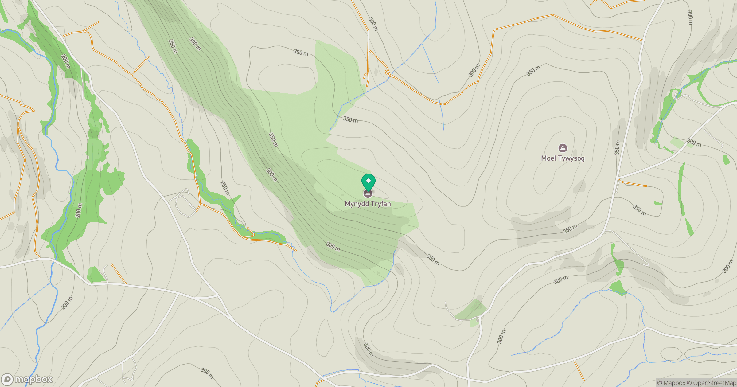
Grid reference: SH975655
View on OpenStreetMapOpens a map in a new tab, centred on the hill.
No comments yet. Be the first.