

Moel Famau
Good walks are even better shared.
SJ1662 : The Jubilee Tower, Moel Famau
Kevin Williams Photo source
Overview
Moel Famau is the 554.9 m high point of the Clwydian Range in north-east Wales. The remains of the Jubilee Tower crown its open, heather-covered summit. Walks start from Bwlch Pen Barras, Coed Moel Famau, Cilcain and Loggerheads, with forest paths giving way to exposed upland terrain.
Moel Famau
Moel Famau rises to 554.9 m, the highest point of the Clwydian Range and the county top of Flintshire. Its heather moorland and conspicuous Jubilee Tower make it a distinctive destination between Mold and Ruthin.
Choosing a walk
The waymarked Jubilee Tower Circular starts at Coed Moel Famau and climbs steeply through the forest before returning by the ridge and Bwlch Pen Barras. Natural Resources Wales currently lists the complete circuit as 5.8 km and 2.5 hours. Starting at the upper Bwlch Pen Barras car park gives a more direct ridge ascent, with a return along the same path.
For a longer day, the Cilcain circuit continues north along the Clwydian ridge before returning through Gronfoel. Flintshire Council's 9.8 km Loggerheads summit circuit returns through Ffrith and the Alyn valley. The separate Foel Fenlli and Moel Famau circuit combines two summits and includes a road section back to Bwlch Pen Barras. Use the route descriptions below to distinguish these different itineraries.
Summit and landscape
The Jubilee Tower is a ruined commemorative monument. Work began in 1810 for George III's Golden Jubilee; its unfinished obelisk fell in 1862. The natural summit is beside the wall at the north corner of the surviving base, rather than on top of the structure.
Silurian mudstone, siltstone and sandstone underlie the hill. Open moorland meets forest on the eastern slopes. In clear weather, views extend across the Vale of Clwyd towards Eryri, and over the north Wales coast and Merseyside.
Planning your visit
Both main car parks charge. Choose Bwlch Pen Barras for the higher start or Coed Moel Famau for toilets, picnic tables and woodland trails. Check the closing time before leaving your car. The T8 bus serves Loggerheads, from which the summit requires a longer walk.
Bring weatherproof clothing, food, water and a map. Wind, low cloud, muddy ground and winter ice can change the difficulty considerably. Stay on signed paths, respect forestry diversions and keep dogs on a lead near livestock.
Sources and record dates
Editorial information checked on 15 October 2026 (UTC) against Natural Resources Wales, Denbighshire County Council, the National Landscape visitor guide, British Geological Survey, Coflein and TrawsCymru.
Route references: Cilcain circuit, Flintshire Council route 20 and the BBC Foel Fenlli and Moel Famau map.
Summit measurements and classifications: Database of British and Irish Hills v18.6, record 2041; source revision 3 June 2024.
Explore routes near Moel Famau
Walks starting near this hill. Open a route to check its map, distance and full itinerary.
Dyserth to Prestatyn: old railway walkway return
View route
Llangollen to Horseshoe Falls: Canal Towpath from Market Street
View route
World’s End and back
View route
Chester Walk with Men Walking & Talking
View route
Route planning notes
These notes describe possible approaches. Check a route's map and access information when planning your walk.
Jubilee Tower Circular from Coed Moel Famau
From Coed Moel Famau car park, climb through the forest to the Jubilee Tower. Follow Offa's Dyke Path south towards Bwlch Pen Barras, then the signed link back to the lower car park. This is NRW's waymarked summit circuit, with a steep, sustained ascent.
Moel Famau and the Clwydian ridge from Cilcain
From Cilcain church, take the lanes and paths towards Tyddyn-y-foel and climb through the Nant Gain valley to Moel Famau. Follow Offa's Dyke Path north-west along the ridge to the road below Moel Arthur, then return east via Gronfoel and the lanes to Cilcain. This circuit does not include the optional ascent of Moel Arthur. Walking Britain suggests about 4 hours 50 minutes.
Loggerheads to Moel Famau circular
Flintshire Council's route 20 starts at Loggerheads Country Park, crosses fields by Brithdir Mawr and climbs steeply through the forest to Moel Famau. Return along the north side of Ffrith Mountain, cross the River Alyn, join the Leete path and pass Alyn Kennels back to the park. Expect many stiles and potentially boggy ground.
Foel Fenlli and Moel Famau from Bwlch Pen Barras
The BBC Weatherman Walking circuit starts with a loop over Foel Fenlli and back to Bwlch Pen Barras, then climbs the main ridge path to Moel Famau. Descend south-east through the forest to the Coed Moel Famau entrance area, then follow the road uphill to the starting car park. The final road section needs care; the published circuit is approximately 4.5 miles.
Moel Famau direct from Bwlch Pen Barras
From the upper car park at Bwlch Pen Barras, follow the main signed path north up the ridge to the Jubilee Tower. Return by the same path to the same car park. The open hillside has steep sections and is exposed to wind and poor visibility; this remains an uphill walk even though the start is higher than Coed Moel Famau.
Make a day of it, together
Find someone to share the walk with, or organise a day out along a route you like.
Photo Gallery
View all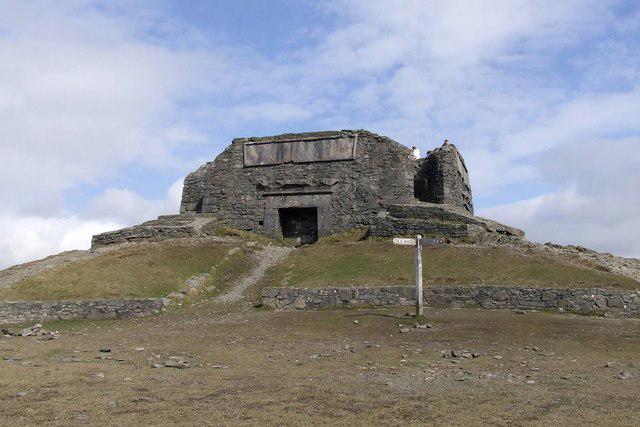 Photo could not load
SJ1662 : The Jubilee Tower, Moel Famau
Kevin Williams
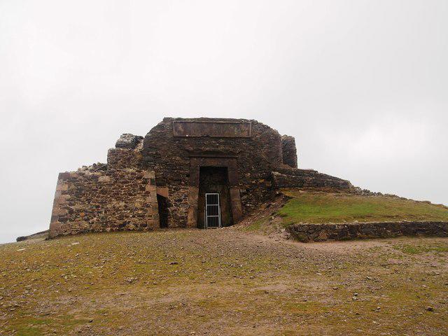 Photo could not load
SJ1662 : Jubilee Tower, Moel Famau
Chris Andrews
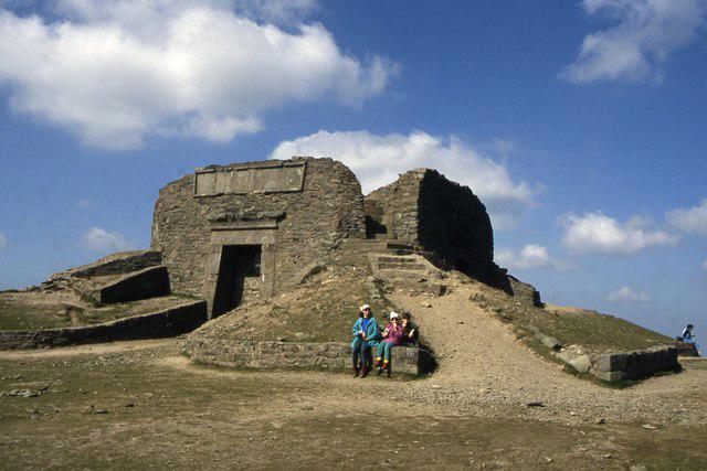 Photo could not load
SJ1662 : Jubilee Tower on Moel Famau
Colin Park
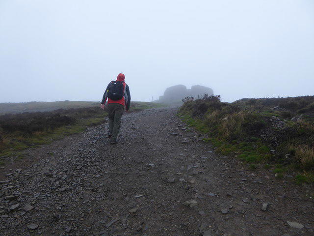 Photo could not load
SJ1662 : Approaching the summit of Moel Famau
Eirian Evans
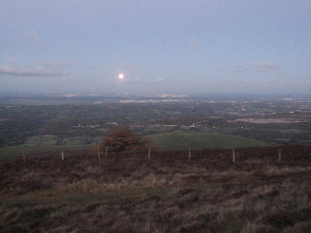 Photo could not load
SJ1662 : Y Tŵr Jubilî 200/Jubilee Tower 200 celebration #15 - The rising moon
John S Turner
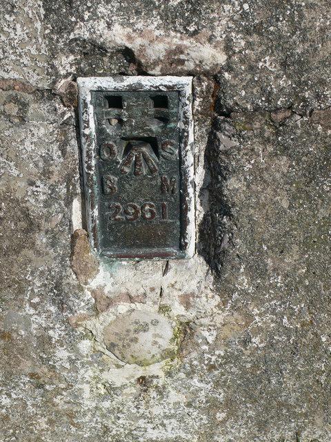 Photo could not load
SJ1662 : Benchmark on the Trig point on Moel Famau
Eirian Evans
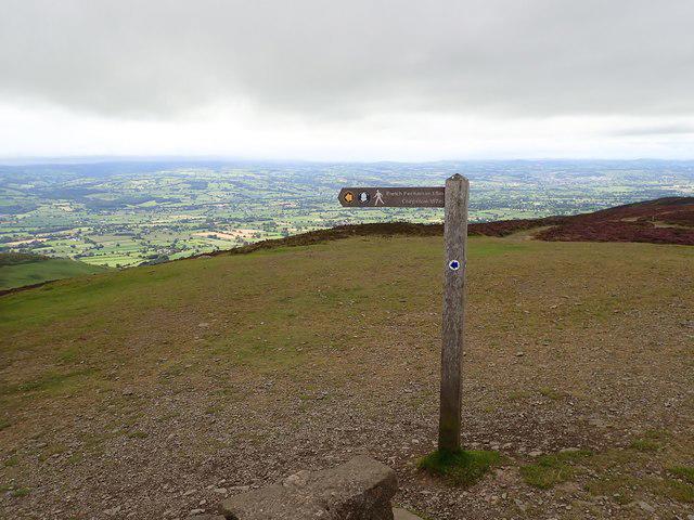 Photo could not load
SJ1662 : Offa's Dyke Path signpost on Moel Famau
Eirian Evans
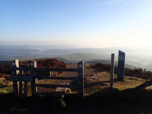 Photo could not load
SJ1662 : Stile at the start of the descent to Loggerheads from Moel Famau
Eirian Evans
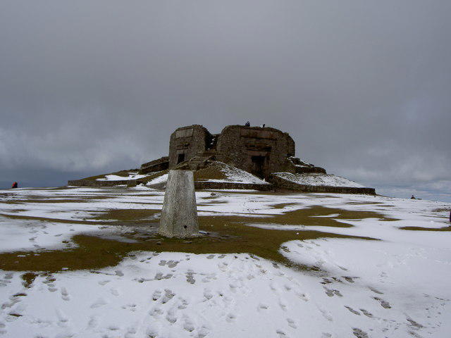 Photo could not load
SJ1662 : Moel Famau Summit
David Quinn
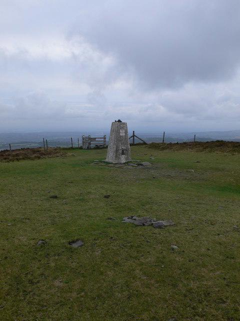
SJ1662 : Trig point on Moel Famau
Eirian Evans
Hill facts and local notes
Classifications
Elevation
555m
1,821 ft
Prominence
282m
Coordinates
53.1546, -3.2558
SJ161626
OS Map
116
Explorer: 265
At the Summit
The surviving stone base of the Jubilee Tower stands on the summit. The natural high point recorded by the Database of British and Irish Hills is ground beside the wall at the tower's north corner, about 45 m west-north-west of the trig point.
Terrain & Geology
Moel Famau is formed from Silurian sedimentary rocks, including mudstone, siltstone and sandstone. The British Geological Survey describes the hill's rocks as turbidites and disturbed beds: sediments deposited by underwater flows and subsequently deformed. Carboniferous limestone occurs elsewhere in the surrounding district.
Views & Scenery
In clear weather the summit overlooks the Vale of Clwyd, with Eryri (Snowdonia) to the west and views towards the north Wales coast, Merseyside and north-west England.
History & Heritage
Name Origin
The Clwydian Range and Dee Valley National Landscape visitor guide renders Moel Famau as 'Mother Mountain'.
Historical Significance
The Egyptian-style Jubilee Tower was begun in 1810 to celebrate George III's Golden Jubilee. Designed by Thomas Harrison of Chester, it had an unfinished obelisk that collapsed in a storm in 1862. The surviving base was restored in 1970.
Getting There & Facilities
Parking
Bwlch Pen Barras upper car park (SJ161605) and Coed Moel Famau lower car park (SJ171610) both charge for parking. Coed Moel Famau uses ANPR with payment by card or contactless. Check the posted tariffs and seasonal gate-closing times before walking; overnight parking is not permitted. The postcode CH7 5SH covers a wide area, so navigate to the chosen car park.
Public Transport
TrawsCymru T8 links Ruthin, Mold and Chester with stops at We Three Loggerheads on the A494. A summit walk from Loggerheads is a longer outing. The National Landscape also lists Maes Hafan Lane End near Llanferres, with about a 30-minute lane walk to Coed Moel Famau. Check the timetable for your date and return journey.
Nearby Facilities
Coed Moel Famau has toilets, including accessible toilets, picnic tables and short woodland trails. Bwlch Pen Barras has benches; a refreshment hut operates on some weekends and holidays, weather permitting. Loggerheads has a visitor centre, toilets and a café. Carry food and water for the summit.
Safety Information
Known Hazards
- The open summit and ridge are exposed to wind and rapidly changing visibility; carry suitable layers and navigation.
- Steep, stony paths and muddy or boggy sections can be slippery, particularly on longer routes from Cilcain or Loggerheads.
- Keep dogs on a lead near livestock and follow forestry closure or diversion signs.
- Longer approaches can include road sections and crossings; do not rely on mobile reception.
Seasonal Hazards
Snow and ice can make the steep paths hazardous in winter. Plan around daylight and the seasonal closing times of the car park gates.
General Safety Tips
- Check weather conditions before setting out
- Carry appropriate clothing and equipment
- Let someone know your planned route
- Take a map, compass, and GPS device
- Carry emergency supplies: food, water, first aid kit, torch
Hills
Some common questions about the hills answered
Are there group walks up Moel Famau?
Many walkers use Walkmates to join or organise walks with others. You can check for group walks around Moel Famau through the maps
Are there other walkers around Moel Famau?
Activity varies by location and time, but Walkmates lets you see whether others have shared walks or shown interest in this area. Find other people through the walking friends search walking friends for Moel Famau search or of course create your own walk for Moel Famau
Can I organise a walk to Moel Famau?
Yes. If there aren’t any walks listed already, you can create a walk and make it available for others to join.
If you're signed up to Walkmates, you can create a walk to Moel Famau.
How do I find a walk up this hill?
There are often multiple ways to walk this hill, depending on experience and route preference. Walkmates helps you explore walks and routes that others have shared.
Can I suggest a new route up Moel Famau?
Yes. You can suggest or create routes to share with others. Walkmates focuses on the social side of walking, so routes are used to help people organise walks and explore areas together, rather than as detailed navigation tools or route libraries.
Other uses really appreciate knowledgeable walkers sharing their routes. Share your favourite route to Moel Famau here
The is an error or something incorrect about this hill. How do I let you know?
We always strive to keep the information on Walkmates as accurate as possible. If you find an error, please let us know through the contact form and we'll aim to correct it as quickly as possible
Community Discussion
Comments
Location
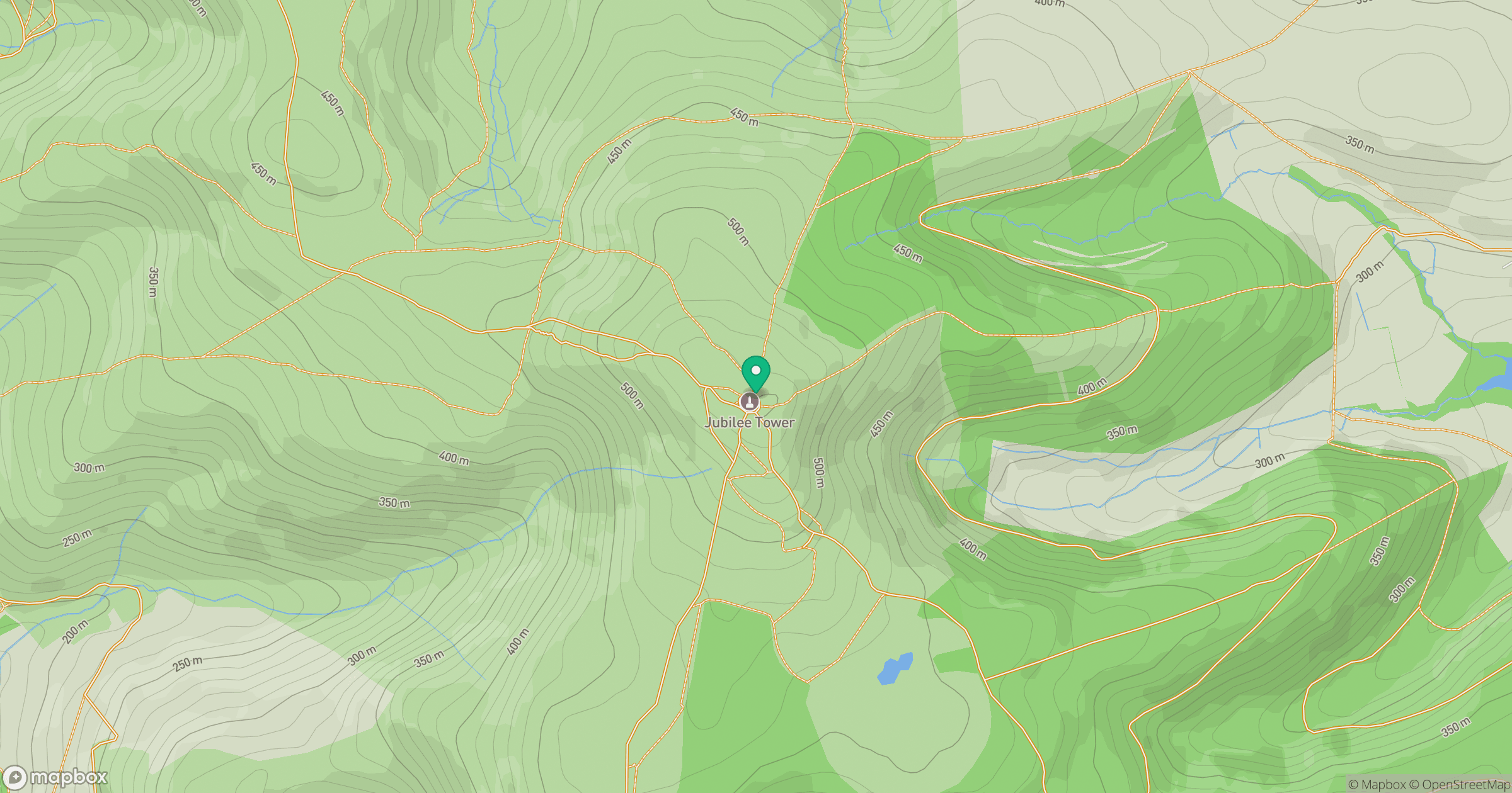
Grid reference: SJ161626
View on OpenStreetMapOpens a map in a new tab, centred on the hill.
Nearby Hills
Mynydd Tryfan
402m
Cadair Berwyn
832m
Arenig Fawr
854m
Aran Fawddwy
906m
Great Orme [Y Gogarth]
207m
No comments yet. Be the first.