

Cadair Berwyn
Good walks are even better shared.
SJ0732 : View towards Llyn Lluncaws
Espresso Addict Photo source
Overview
Cadair Berwyn is the highest mountain in the Berwyn range, with a rocky main summit at 832 m in Powys. Its eastern cliffs overlook Llyn Lluncaws, while broad peat-covered slopes extend west. The trig pillar stands on the separate, lower North Top. The main approaches start at Pistyll Rhaeadr or Llandrillo and require mountain navigation skills.
Cadair Berwyn
Cadair Berwyn is the highest mountain in the Berwyn range, reaching 832 m in Powys. It combines a rocky eastern escarpment with broad, peat-covered western slopes. The highest point and the North Top trig are separate objectives.
Geology
The wider Berwyn landscape is largely Ordovician mudstone and siltstone, with volcanic ash beds in some areas. Glaciers shaped the cwms and valleys, while blanket peat covers much of the upland ground.
Routes
Pistyll Rhaeadr, Cadair Berwyn and Moel Sych circuit
Climb from the waterfall car park by the valley path to Llyn Lluncaws, then take the steep southern rim of the cwm to the main summit. Return over Moel Sych and south along Trum Felen, descending on the established path to the same car park. Mud and Routes lists 8.23 km, 589 m of ascent and 5 hours for this circuit. Visiting the North Top trig adds a detour beyond that itinerary.
Cadair Berwyn circuit from Llandrillo
From the village car park, the council route climbs via Blaen-y-dre and open moorland to the main ridge. Turn south to the trig and continue to the true summit rocks. Retrace to the trig, descend west and follow the mapped stream crossings and lower track back into Llandrillo. The published circuit is 16 km, with a stated 750 m climb and an allowance of six to seven hours. It does not include the summits of Cadair Bronwen or Moel Sych.
Summit Features
The highest point is the rocky outcrop at SJ 07165 32355. North Top is lower at 826.4 m and carries the trig pillar. Between the two is a shelter on the remains of an older burial cairn.
Terrain Type
Steep paths and rocky outcrops give way to heather, grass and peat. Western approaches can be very boggy and their paths indistinct; the Llandrillo return also crosses streams.
Views
Llyn Lluncaws lies beneath the eastern cliffs. Clear weather opens views towards the Aran ridge, Arenig and Eryri, with the Shropshire plain to the east.
Hazards
Stay back from the eastern crags of Craig y Llyn and Craig Berwyn, especially in wind, mist or ice. Do not take a direct shortcut down to Llyn Lluncaws. Boggy ground and weak paths require reliable navigation, and the western stream crossings can become difficult after rain. Keep to the established waterfall paths and away from the edge.
Check mountain weather, carry warm waterproof clothing and navigation equipment, and allow for slower winter travel. Snow or ice may require winter equipment and skills. Follow local notices, keep dogs under close control and leave archaeological stones undisturbed.
Nearby Summits
Moel Sych is 826.7 m, Cadair Berwyn North Top 826.4 m, and Cadair Bronwen 783.4 m. Adding extra summits changes the route distance and effort.
Access
The southern start is the paid car park at Pistyll Rhaeadr / Tan-y-Pistyll, approached from Llanrhaeadr-ym-Mochnant. Its narrow road can be congested; obey local signs and keep passing places and emergency access clear. Check the current parking tariff and closing arrangements. The western circuit starts at Llandrillo village car park.
Tanat Valley Coaches serves Llanrhaeadr-ym-Mochnant, but an onward journey is needed to the waterfall. TrawsCymru T3/T3C lists Llandrillo. Check travel-date timetables and return connections.
Facilities
A cafe and toilets are available at Pistyll Rhaeadr subject to opening arrangements. Llandrillo has community-managed toilets at Y Wern. Bring supplies for the mountain day.
History
Cadair means “chair”, referring to the mountain’s shape. Berwyn probably derives from words for summit/head and white/fair, according to the Welsh Place-name Society. Bronze Age burial cairns remain along the ridge, including beneath the North Top trig and the shelter farther south. A 2014 survey measured the true summit at approximately 832 m.
Explore routes near Cadair Berwyn
Walks starting near this hill. Open a route to check its map, distance and full itinerary.
Llangollen to Horseshoe Falls: Canal Towpath from Market Street
View route
World’s End and back
View route
Aran Benllyn and Aran Fawddwy from LLanuwchllyn
View route
Arenig Fach guided mountain walk
View route
Route planning notes
These notes describe possible approaches. Check a route's map and access information when planning your walk.
Pistyll Rhaeadr, Cadair Berwyn and Moel Sych circuit
From the car park at Pistyll Rhaeadr, follow the valley to Llyn Lluncaws and climb the steep southern rim of the cwm to Cadair Berwyn’s rocky summit. Return over Moel Sych and south along Trum Felen, then descend on the established path to the car park. Mud and Routes gives 8.23 km, 589 m of ascent and 5 hours for this complete circuit. Its optional detour to the North Top trig is excluded from those figures. Faint or boggy paths and the cliff edges demand care.
Cadair Berwyn circuit from Llandrillo
Start at Llandrillo village car park (SJ035372). Follow the council route via Blaen-y-dre and open moorland to the main ridge, then turn south to the North Top trig and continue to the higher summit rocks. Return to the trig, descend west and follow the mapped stream-crossing route to the lower track and lane back into Llandrillo. Denbighshire Countryside describes a 16 km circuit, gives 750 m of climb and allows six to seven hours. It excludes Cadair Bronwen and Moel Sych. Very boggy paths, exposed ground and swollen streams make this a strenuous mountain day.
Make a day of it, together
Find someone to share the walk with, or organise a day out along a route you like.
Photo Gallery
View all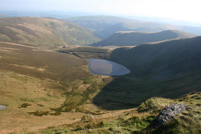 Photo could not load
SJ0732 : View towards Llyn Lluncaws
Espresso Addict
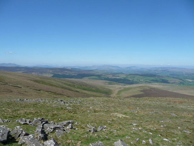 Photo could not load
SJ0732 : View westwards from the Berwyn ridge
Jeremy Bolwell
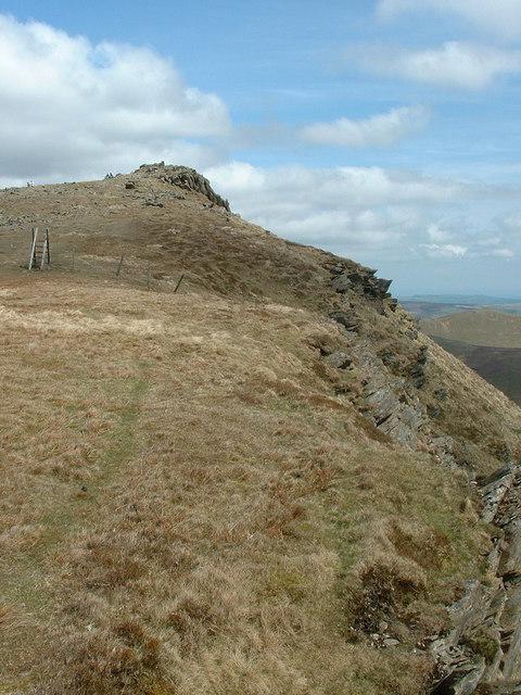 Photo could not load
SJ0732 : Cadair Berwyn New Top
Bill Rowley
 Photo could not load
SJ0732 : Below Cadair Berwyn
Gerald Davison
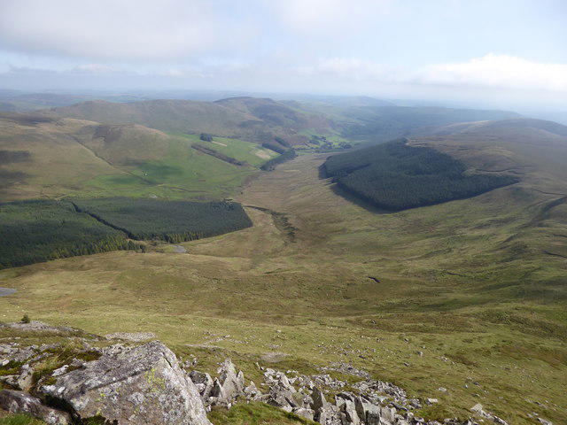 Photo could not load
SJ0732 : Bwlch Maen Gwynedd from the Berwyns
Jeremy Bolwell
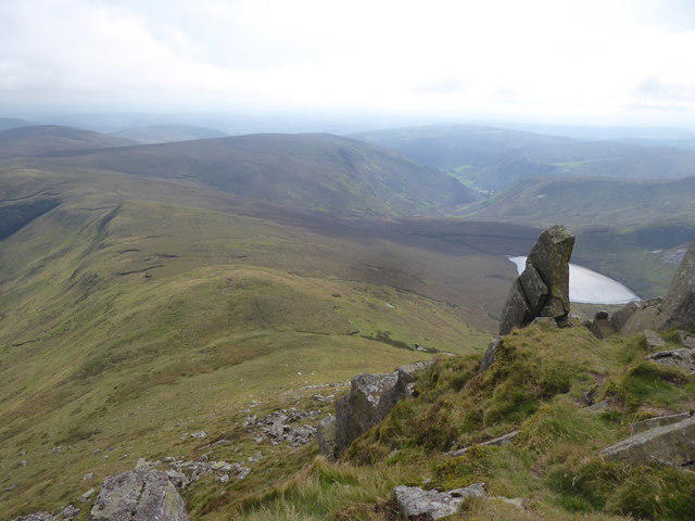 Photo could not load
SJ0732 : On the Berwyn ridge
Jeremy Bolwell
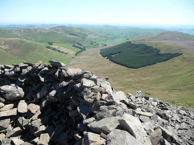 Photo could not load
SJ0732 : Cairn on the Berwyn ridge
Jeremy Bolwell
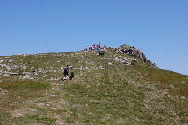 Photo could not load
SJ0732 : Approaching Cadair Berwyn New Top
Trevor Harris
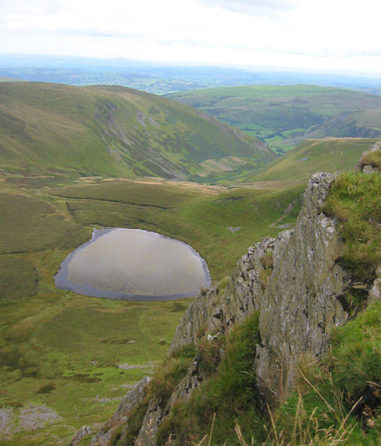 Photo could not load
SJ0732 : View from southern top of Cadair Berwyn
Espresso Addict
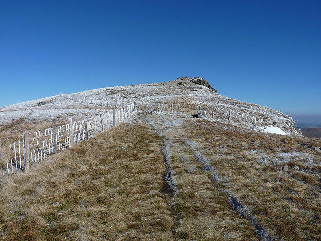
SJ0732 : Fences below the New Top of Cadair Berwyn
Richard Law
Hill facts and local notes
Classifications
Elevation
832m
2,730 ft
Prominence
347m
Coordinates
52.8806, -3.3810
SJ071323
OS Map
125
Explorer: 255
At the Summit
The main summit is a rocky outcrop at SJ 07165 32355, 832 m above sea level. The trig pillar is farther north on Cadair Berwyn North Top, a separate summit at 826.4 m. A stone shelter between the two tops occupies an older burial cairn; neither the trig nor the shelter marks the highest point.
Terrain & Geology
The Berwyn uplands are predominantly underlain by Ordovician mudstone and siltstone. Volcanic ash beds occur in parts of the range, including the resistant layer at Pistyll Rhaeadr. Glacial erosion shaped the cwms and valleys, and blanket peat covers much of the upland ground around Cadair Berwyn.
Views & Scenery
The eastern escarpment overlooks Llyn Lluncaws and the valleys beneath Craig y Llyn and Craig Berwyn. In clear weather, the ridge offers wide views towards the Aran ridge, Arenig and the mountains of Eryri to the west, and towards the Shropshire plain to the east.
History & Heritage
Name Origin
Cadair is Welsh for “chair”, referring to the mountain’s shape. Richard Morgan’s Welsh Place-name Society account suggests Berwyn probably combines words for “head” or “summit” and “white” or “fair”; the derivation is not certain.
Historical Significance
Bronze Age burial cairns survive on the ridge: the North Top trig stands on one, and another between the trig and main summit has been remodelled into a shelter. The higher rocks were recognised as the true summit in the late twentieth century. A June 2014 survey by Myrddyn Phillips measured the main top at approximately 832 m.
Getting There & Facilities
Parking
For the southern circuit use the paid, privately run car park at Pistyll Rhaeadr / Tan-y-Pistyll, SY10 0BZ, reached by the narrow lane from Llanrhaeadr-ym-Mochnant. Check the current tariff and closing arrangements on arrival. The lane has limited passing places and can become congested: keep passing places, gates and emergency access clear and follow local parking signs. For the western circuit use Llandrillo village car park at SJ035372, listed as free in Wrexham Council’s 2026 walking programme; follow current signs.
Public Transport
Tanat Valley Coaches lists services 76 and 79 through Llanrhaeadr-ym-Mochnant, but no direct bus to the waterfall car park was verified; arrange the onward journey separately. TrawsCymru T3/T3C services list a stop at the Dudley Arms in Llandrillo for the western start. Check the timetable for your travel date and the last return before setting out.
Nearby Facilities
Pistyll Rhaeadr has a cafe/tea room and toilets, but check opening arrangements before relying on them. Llandrillo’s community-managed Y Wern toilets are listed by the council as free and open daily from 9am to 5pm. Carry food and drinking water for the mountain routes.
Safety Information
Known Hazards
- Craig y Llyn and Craig Berwyn have steep east-facing crags. Stay back from the edges, especially in wind or poor visibility, and do not improvise a direct descent towards Llyn Lluncaws.
- Peaty ground, boggy hollows and indistinct paths can slow progress and make navigation difficult in mist. Carry a map and compass and know how to use them.
- Streams on the Llandrillo circuit can be difficult to cross after heavy rain. Turn back if a crossing is unsafe.
- Wet rock and steep ground near Pistyll Rhaeadr need care. Keep to the established path and away from the waterfall edge.
- Check a mountain forecast and carry warm waterproof clothing, food, water and a headtorch. Leave your route and expected return with someone.
- Follow local access notices, keep dogs under close control around livestock and ground-nesting birds, and avoid damaging the peat or moving stones from archaeological remains.
Seasonal Hazards
Heavy rain worsens peat bogs and stream crossings. Strong wind and low cloud make the exposed ridge and cliff edges more serious. Snow or ice can make steep paths hazardous and require winter equipment and skills. Allow for shorter daylight and slower progress in winter.
General Safety Tips
- Check weather conditions before setting out
- Carry appropriate clothing and equipment
- Let someone know your planned route
- Take a map, compass, and GPS device
- Carry emergency supplies: food, water, first aid kit, torch
Hills
Some common questions about the hills answered
Are there group walks up Cadair Berwyn?
Many walkers use Walkmates to join or organise walks with others. You can check for group walks around Cadair Berwyn through the maps
Are there other walkers around Cadair Berwyn?
Activity varies by location and time, but Walkmates lets you see whether others have shared walks or shown interest in this area. Find other people through the walking friends search walking friends for Cadair Berwyn search or of course create your own walk for Cadair Berwyn
Can I organise a walk to Cadair Berwyn?
Yes. If there aren’t any walks listed already, you can create a walk and make it available for others to join.
If you're signed up to Walkmates, you can create a walk to Cadair Berwyn.
How do I find a walk up this hill?
There are often multiple ways to walk this hill, depending on experience and route preference. Walkmates helps you explore walks and routes that others have shared.
Can I suggest a new route up Cadair Berwyn?
Yes. You can suggest or create routes to share with others. Walkmates focuses on the social side of walking, so routes are used to help people organise walks and explore areas together, rather than as detailed navigation tools or route libraries.
Other uses really appreciate knowledgeable walkers sharing their routes. Share your favourite route to Cadair Berwyn here
The is an error or something incorrect about this hill. How do I let you know?
We always strive to keep the information on Walkmates as accurate as possible. If you find an error, please let us know through the contact form and we'll aim to correct it as quickly as possible
Community Discussion
Comments
Location
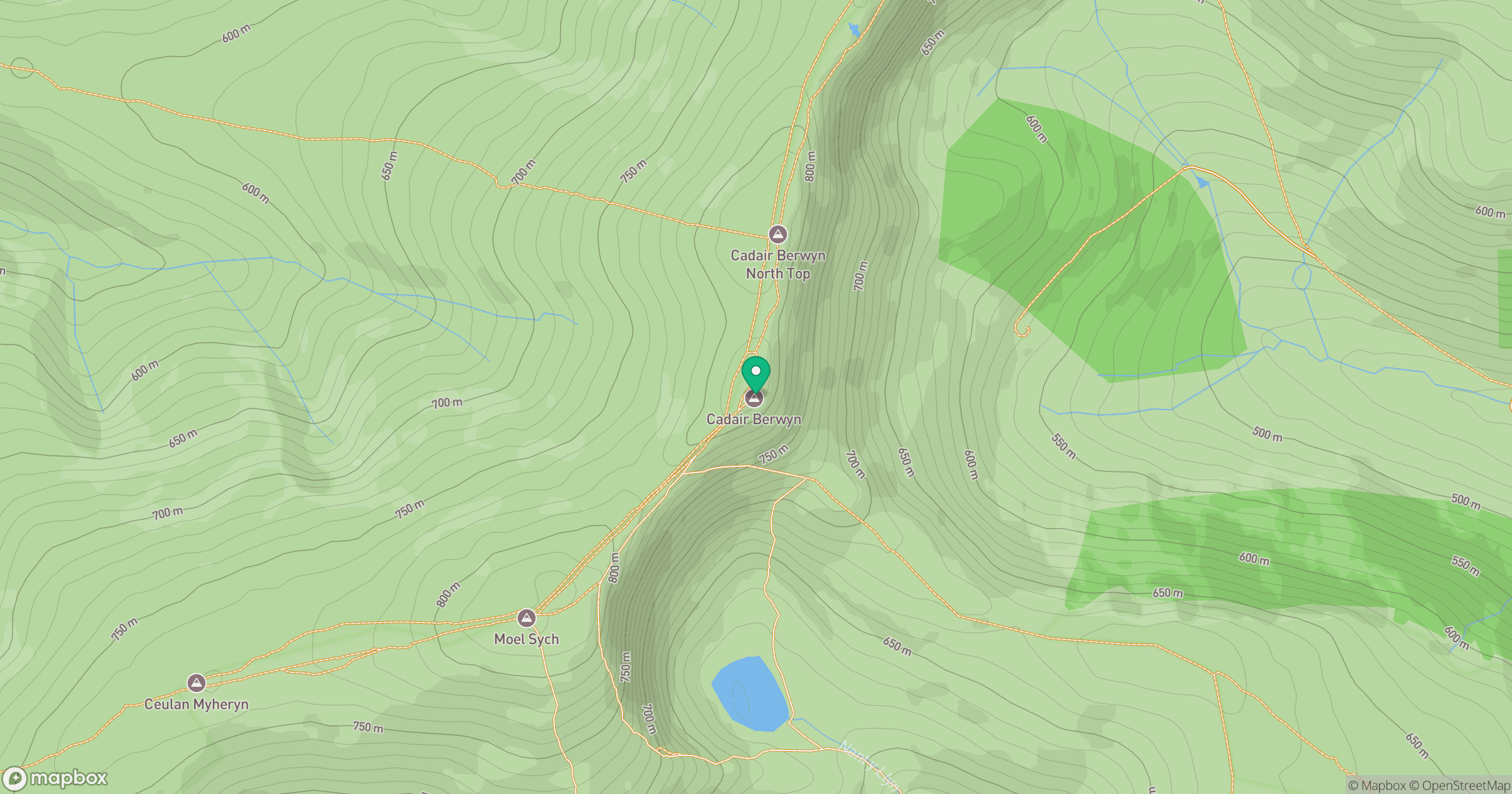
Grid reference: SJ071323
View on OpenStreetMapOpens a map in a new tab, centred on the hill.
No comments yet. Be the first.