

Foel Drygarn
Good walks are even better shared.
SN1533 : Foeldrygarn
Rudi Winter Photo source
Overview
Foel Drygarn is a 365 m hill at the eastern end of the Preseli Hills, west of Crymych in Pembrokeshire. Its rocky summit has a trig point, three Bronze Age burial cairns and the remains of an Iron Age hillfort.
Foel Drygarn
Foel Drygarn is a 365 m hill at the eastern end of the Preseli Hills, west of Crymych in Pembrokeshire. Its recorded summit feature is the trig point. Three large prehistoric burial cairns and the remains of an Iron Age hillfort give the summit its distinctive appearance.
Summit and heritage
The Welsh name means “hill of the three cairns”. The Bronze Age cairns predate the fort built around them. Stone ramparts and numerous house platforms survive. Foel Drygarn Camp is a scheduled monument, reference PE010. Treat the cairns and walls as archaeological remains: do not climb on them, move stones or build new cairns.
Walking routes
Both routes described here start and finish at the limited roadside layby at SN165331, on the minor road west of the A478 south of Crymych.
The longer circuit follows the northern side of the hill to Carn Dafydd-Ias, joins the Golden Road and climbs from the plantation end to the summit. Its southeast descent rejoins the original gate and access track. Walking Britain’s full circuit is 6 km with 155 m ascent and a stated time of 2 hours 10 minutes.
The short circuit climbs the direct grassy summit path, then returns south to the plantation corner and east along the Golden Road to the original gate and layby. Walking Britain gives 2.9 km, 106 m ascent and 1 hour 10 minutes. These are source estimates for the complete circuits; allow extra time for stops and conditions.
The National Park also publishes a separate Foel Drygarn/Carn Menyn circuit of 4 km, 2 hours and 200 m ascent. Its measurements belong to that itinerary and should not be combined with either route above.
Terrain and safety
The hill has open moorland, grassy paths, rocky outcrops and steep summit slopes. Some paths are indistinct, and open-moorland junctions are not comprehensively signposted. Carry a map and compass and know how to use them. Wet ground, slippery rock, wind and low cloud can make the walk harder. Stay back from crag edges and allow enough daylight for the whole return.
Sheep graze here. The National Park asks for dogs to be on a short lead when sheep are present and between 1 March and 31 July to protect ground-nesting birds. Follow current local access notices, leave gates as found and take litter home.
Geology and views
The summit’s tors expose Ordovician volcanic ash and lava. Cold-climate weathering helped shape the outcrops. The National Park’s RIGS 559 assessment gives no conclusive evidence that Foel Drygarn supplied Stonehenge bluestones. In clear weather the summit overlooks the Preseli countryside and the Pembrokeshire coast; visibility depends on conditions.
Getting there
Use the documented roadside start near Blaenbanon, keeping the road, gates and farm entrances clear. Parking capacity is limited and availability is not guaranteed. Crymych is the nearby village and planning base. Toilets, drinking water and refreshments have not been verified at the trailhead, so carry supplies and check facilities before travelling.
Traveline Cymru lists Richards Bros service 430 through Crymych. A direct bus to the layby has not been verified. Plan the onward journey and return separately and check current travel-day timetables.
Explore routes near Foel Drygarn
Walks starting near this hill. Open a route to check its map, distance and full itinerary.
Pembrokeshire Coast Path: Newport Parrog to Fishguard via Dinas Head
View route
Abergwili to Nantgaredig: Tywi Valley Path out and back
View route
Neyland to Johnston: Brunel and Westfield Railway Trail
View route
Llanerchaeron: Lanlas, Aberaeron and Aeron Valley circular
View route
Route planning notes
These notes describe possible approaches. Check a route's map and access information when planning your walk.
Foel Drygarn via Carn Dafydd-Ias circuit
From the roadside layby at SN165331 near Blaenbanon, cross the road and follow the enclosed track to the gate and information board. Keep beside the right-hand wall, passing the direct summit path, and continue around the northern side. From the wall corner at SN157339 follow the wall for about 500 m, then turn left uphill before its end. Pass Carn Dafydd-Ias on your right to reach the ridge at SN148328. Turn left onto the Golden Road; at the plantation end at SN157329 turn left uphill to the summit trig. Descend east then southeast on the steep grassy path to the original gate and follow the enclosed track back to the same layby. Walking Britain gives 6 km, 155 m ascent and 2 hours 10 minutes for this complete circuit. Some connecting paths are indistinct.
Foel Drygarn short summit circuit
Start and finish at the roadside layby at SN165331 near Blaenbanon. Cross the road, take the enclosed track to the gate and information board, then follow the wall briefly before taking the grassy path uphill to the trig point. The final ascent is steep. For the return, take the path south from the trig to the plantation corner, turn left onto the broad Golden Road track and follow it back to the original gate. Return down the enclosed track to the same layby. Walking Britain gives 2.9 km, 106 m ascent and 1 hour 10 minutes for the full circuit; allow extra time to view the archaeology.
Make a day of it, together
Find someone to share the walk with, or organise a day out along a route you like.
Photo Gallery
View all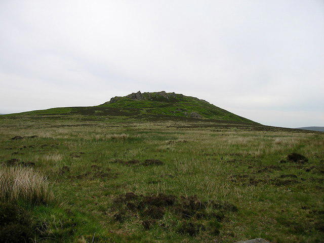 Photo could not load
SN1533 : Foeldrygarn
Rudi Winter
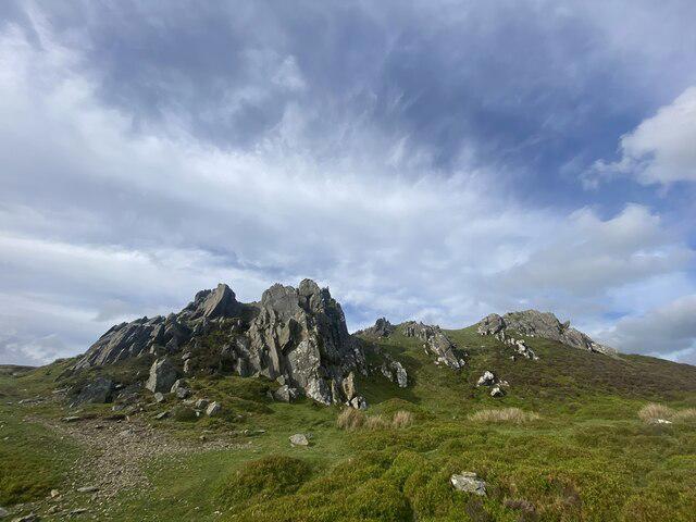 Photo could not load
SN1533 : Approaching Foel Drygarn
Alan Hughes
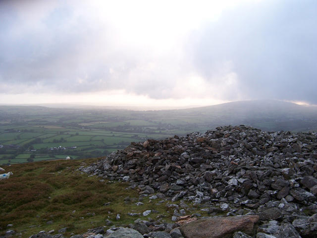 Photo could not load
SN1533 : The ancient hill fort of Foeldrygarn, Preseli Mountains
Andrew Howey
 Photo could not load
SN1533 : Hill fort defensive walls, Foeldrygarn, Preseli Mountains
Andrew Howey
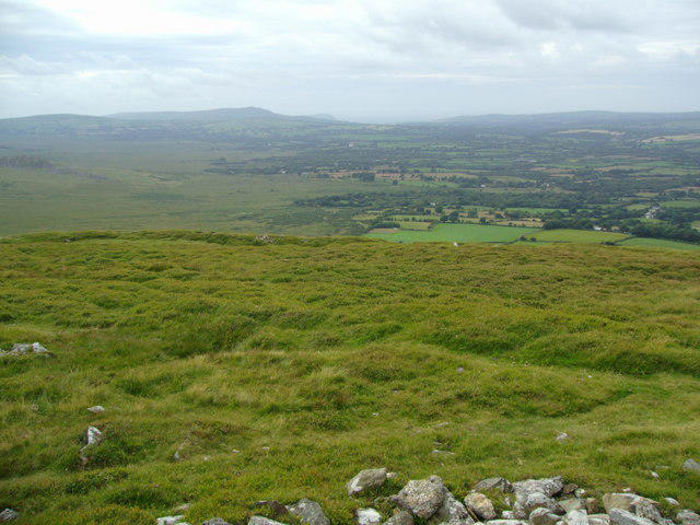 Photo could not load
SN1533 : View from Foel Drygarn towards Dinas Head
S Gill
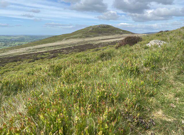 Photo could not load
SN1533 : Approaching Foel Drygarn
Alan Hughes
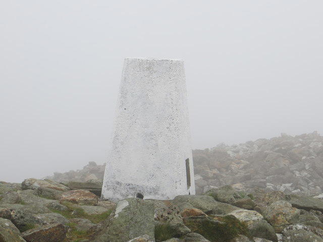 Photo could not load
SN1533 : Ordnance Survey Trig Pillar S5963
Peter Wood
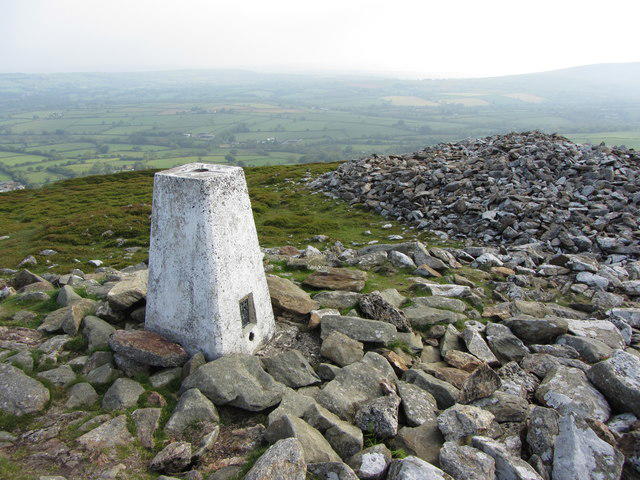 Photo could not load
SN1533 : Trig point on Foel Drygarn, looking east
Gareth James
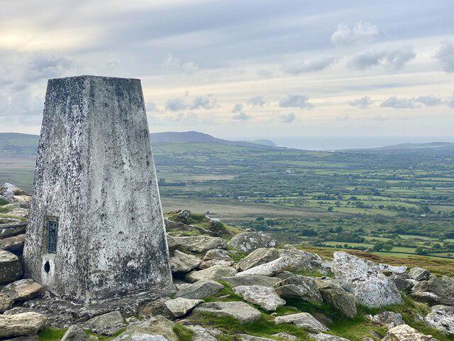 Photo could not load
SN1533 : Trig point on Foel Drygarn
Alan Hughes
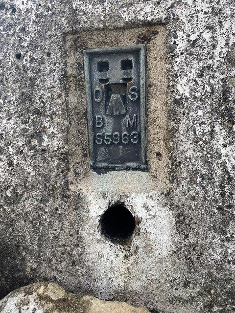
SN1533 : Trig point - Foel Drygarn
Alan Hughes
Hill facts and local notes
Classifications
Elevation
365m
1,198 ft
Prominence
46m
Coordinates
51.9703, -4.6834
SN157335
OS Map
145
Explorer: OL35E
At the Summit
The recorded summit feature is the trig point. Three large Bronze Age burial cairns, rocky outcrops, hillfort ramparts and house platforms occupy the summit area. The cairns are protected archaeology; do not climb on them or move stones.
Terrain & Geology
The summit tors expose Ordovician volcanic ash and lava, shaped in part by cold-climate weathering. The National Park’s RIGS 559 statement identifies these igneous rocks and says there is no conclusive evidence that Foel Drygarn supplied Stonehenge bluestones.
Views & Scenery
In clear weather the summit gives broad views across the Preseli countryside and towards the Pembrokeshire coast. Visibility depends on the weather.
History & Heritage
Name Origin
Foel Drygarn means “hill of the three cairns”, referring to the three prehistoric burial cairns on its summit.
Historical Significance
Three Bronze Age burial cairns predate the Iron Age hillfort built around them. Stone ramparts and numerous house platforms survive. Foel Drygarn Camp is a scheduled monument, reference PE010; the remains should be left undisturbed.
Getting There & Facilities
Parking
The documented start is a small roadside layby at SN165331 near Blaenbanon, on the minor road west of the A478 south of Crymych, towards Mynachlogddu. Parking is limited. Follow current notices and keep roads, gates and farm entrances clear; a route description does not guarantee space or establish parking permission.
Public Transport
Traveline Cymru lists Richards Bros service 430 through Crymych between Cardigan and Narberth. No direct service to the SN165331 layby has been verified. Plan the onward journey and return separately, and check current timetables for your travel day.
Nearby Facilities
Toilets, drinking water and refreshments have not been verified at the roadside trailhead. Carry food and water, and check facilities in nearby Crymych before travelling.
Safety Information
Known Hazards
- The summit approaches are steep and uneven, with rocky outcrops and crag edges. Take particular care on descent and when rocks are wet.
- Paths across open moorland are not comprehensively signposted; some connecting paths are indistinct. Carry a map and compass and use them in poor visibility.
- Sheep graze here. Keep dogs on a short lead around livestock and follow current access notices.
- The cairns and hillfort are protected archaeology. Do not climb on the cairns, move stones or build new cairns.
Seasonal Hazards
Wind, rain, mist, snow or ice can make exposed paths harder and conceal junctions. Check the forecast and allow enough daylight for the return. The National Park asks for dogs to be on a short lead between 1 March and 31 July to protect ground-nesting birds, as well as whenever sheep are grazing.
General Safety Tips
- Check weather conditions before setting out
- Carry appropriate clothing and equipment
- Let someone know your planned route
- Take a map, compass, and GPS device
- Carry emergency supplies: food, water, first aid kit, torch
Hills
Some common questions about the hills answered
Are there group walks up Foel Drygarn?
Many walkers use Walkmates to join or organise walks with others. You can check for group walks around Foel Drygarn through the maps
Are there other walkers around Foel Drygarn?
Activity varies by location and time, but Walkmates lets you see whether others have shared walks or shown interest in this area. Find other people through the walking friends search walking friends for Foel Drygarn search or of course create your own walk for Foel Drygarn
Can I organise a walk to Foel Drygarn?
Yes. If there aren’t any walks listed already, you can create a walk and make it available for others to join.
If you're signed up to Walkmates, you can create a walk to Foel Drygarn.
How do I find a walk up this hill?
There are often multiple ways to walk this hill, depending on experience and route preference. Walkmates helps you explore walks and routes that others have shared.
Can I suggest a new route up Foel Drygarn?
Yes. You can suggest or create routes to share with others. Walkmates focuses on the social side of walking, so routes are used to help people organise walks and explore areas together, rather than as detailed navigation tools or route libraries.
Other uses really appreciate knowledgeable walkers sharing their routes. Share your favourite route to Foel Drygarn here
The is an error or something incorrect about this hill. How do I let you know?
We always strive to keep the information on Walkmates as accurate as possible. If you find an error, please let us know through the contact form and we'll aim to correct it as quickly as possible
Community Discussion
Comments
Location
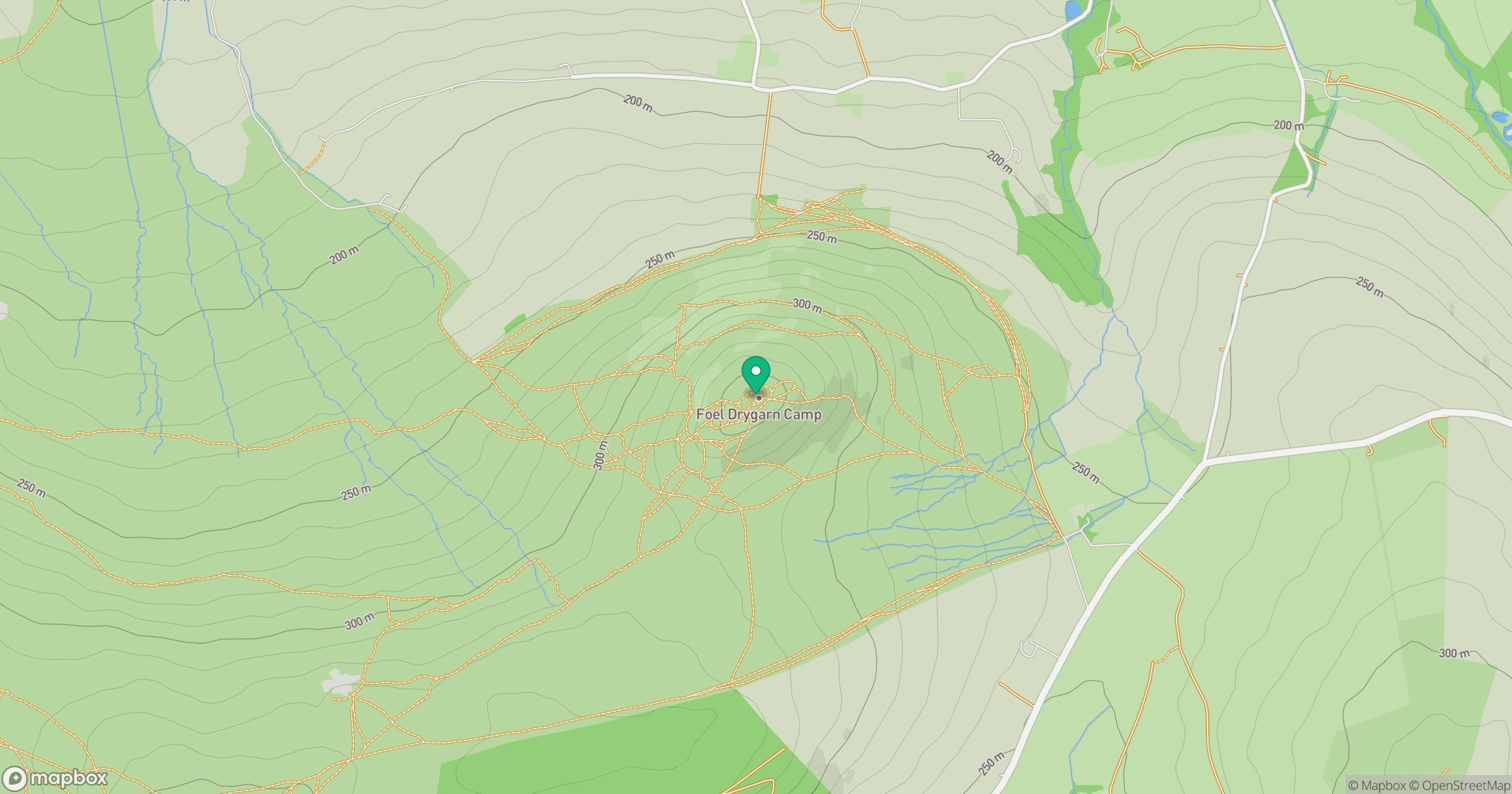
Grid reference: SN157335
View on OpenStreetMapOpens a map in a new tab, centred on the hill.

No comments yet. Be the first.