

Fionn Bheinn
Good walks are even better shared.
NH1462 : Summit of Fionn Bheinn
Russel Wills Photo source
Overview
Fionn Bheinn
Fionn Bheinn, a Munro standing 810 meters tall, is a gem nestled in the heart of the Scottish Highlands. With its striking granite outcrops and expansive vistas, it beckons both seasoned hikers and newcomers seeking a memorable outdoor experience.
Geology
The unique geological composition of Fionn Bheinn is primarily granite and schist. This rugged terrain not only shapes stunning views but also tells tales of ancient geological processes. If you happen upon some unusual rock formations, remember to thank Mother Nature for her peculiar sense of humour!
Routes
There are a couple of popular routes to tackle this fine peak:
- Fionn Bheinn Loop from A832: A moderate loop of about 9.5 km that offers fantastic views. Expect to spend around 3.5 hours on this route, which allows for ample photo opportunities and the occasional snack break.
- Direct Ascent from Loch Fionn: For those up for a challenge, this route leads directly up the mountain. It spans 5.3 km and takes approximately 2.5 hours, but don’t forget to hydrate; it could leave you breathless — in a good way!
Summit Features
Stand at the summit and you'll be greeted by a stone cairn that’s probably seen more weather than most of us! The views are nothing short of spectacular; you might just find your jaw on the ground from the beauty surrounding you.
Terrain Type
The terrain offers a mix of rocky paths, grassy stretches, and a few boggy areas to keep you on your toes — or off them, if you're not careful! Good footwear is a must.
Views
The views from the top of Fionn Bheinn are truly a feast for the eyes. Look towards An Teallach for rugged peaks or gaze down at Loch Fionn, shimmering like a jewel in the sun. The best times to appreciate these views are during spring and autumn, when the air is crisp, and the midges are thankfully MIA!
Access
Access is relatively straightforward. Park at the A832 layby and get ready for your adventure! Public transport options are limited, with Achnasheen station being the closest; plan accordingly.
Facilities
Facilities are sparse, so ensure you bring enough snacks and water. After your climb, Achnasheen offers a delightful cafe to refuel.
History
The name Fionn Bheinn translates to 'White Mountain' in Gaelic, conjuring images of its snow-clad visage. This mountain is steeped in local folklore, known to be a favourite among ancient tribes for both its beauty and strategic viewpoint.
Now that you're equipped with all this fascinating info, it’s time to lace up those boots and hit the trails! Enjoy the climb!
Explore routes near Fionn Bheinn
Walks starting near this hill. Open a route to check its map, distance and full itinerary.
Beinn Eighe Lancaster Wreckage at Coire Mhic Fhearchair
View route
Fairy Lochs Liberator Wreckage Circuit
View route
Glen Affric: Coire Loch Woodland Trail
View route
Fort Augustus to Kytra Lock: Caledonian Canal Towpath
View route
Route planning notes
These notes describe possible approaches. Check a route's map and access information when planning your walk.
Fionn Bheinn Loop from A832
A scenic loop that takes you around the mountain, providing stunning views throughout the hike.
Direct Ascent from Loch Fionn
A direct ascent from the shores of Loch Fionn, leading you steeply to the summit with rewarding views.
Make a day of it, together
Find someone to share the walk with, or organise a day out along a route you like.
Photo Gallery
View all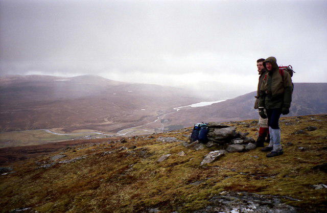 Photo could not load
NH1462 : Summit of Fionn Bheinn
Russel Wills
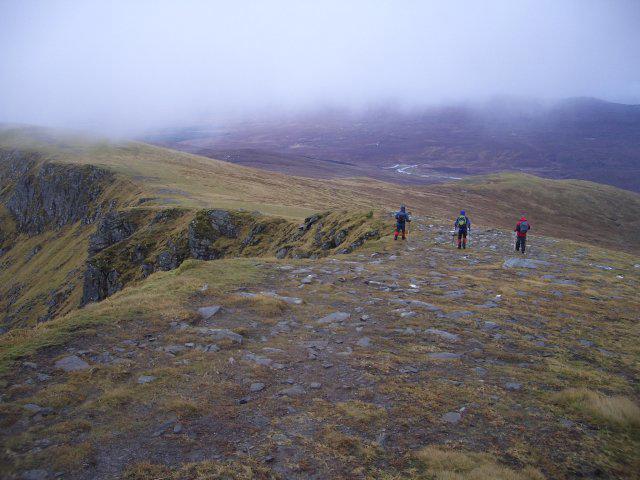 Photo could not load
NH1462 : Fionn Bheinn
Callum Black
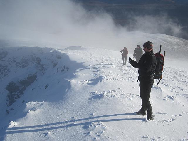 Photo could not load
NH1462 : A hillwalker contemplates his spectre
Richard Webb
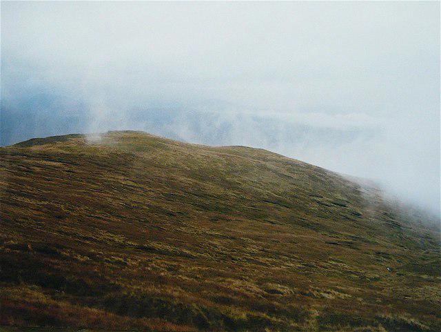 Photo could not load
NH1462 : Fionn Bheinn
AlastairG
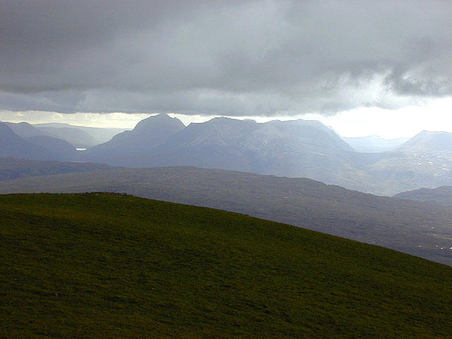 Photo could not load
NH1462 : View west from Fionn Bheinn
Nigel Brown
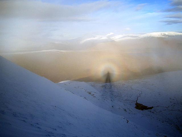 Photo could not load
NH1462 : Brocken spectre on Fionn Bheinn
Richard Webb
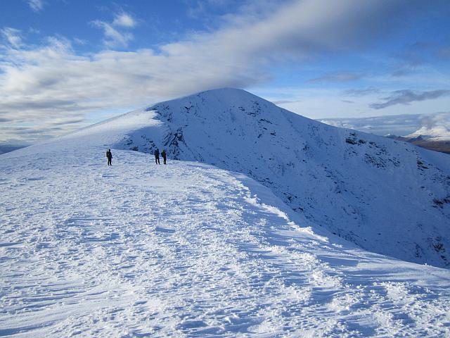 Photo could not load
NH1462 : Fionn Bheinn
Richard Webb
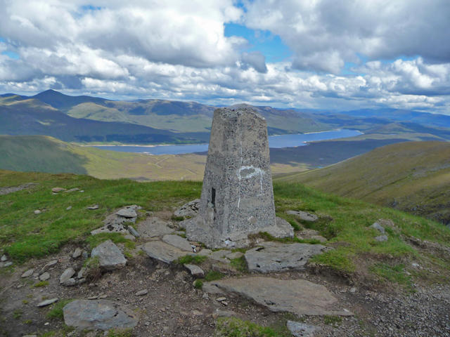 Photo could not load
NH1462 : Fionn Bheinn summit
John Allan
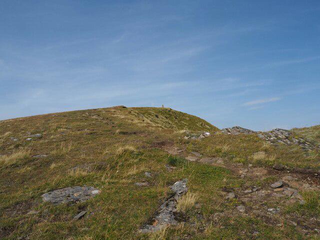 Photo could not load
NH1462 : Nearing Fionn Bheinn's summit
Alec MacKinnon
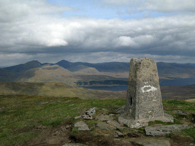
NH1462 : Summit area of Fionn Bheinn with trig point
Trevor Littlewood
Hill facts and local notes
Classifications
Elevation
933m
3,061 ft
Prominence
658m
Coordinates
57.6112, -5.1027
NH147621
OS Map
20
Explorer: 435S
At the Summit
At the summit, you'll find a sizeable stone cairn and magnificent views stretching across the surrounding Highlands. On a clear day, you can spot the towering heights of Ben Wyvis to the east.
Terrain & Geology
Fionn Bheinn is primarily composed of granite and schist, which provide a rugged and fascinating geological landscape. The weathering processes have accentuated its dramatic features, making it a delight for geologists and casual observers alike.
Views & Scenery
From the summit, enjoy panoramic views of the surrounding peaks, including the mighty An Teallach and the beauty of Loch Fionn below.
History & Heritage
Name Origin
Fionn Bheinn translates to 'White Mountain' in Gaelic, a fitting name given its often snow-capped summit.
Historical Significance
The mountain holds cultural significance in local folklore, often associated with ancient tribes and tales of the Scots.
Getting There & Facilities
Parking
The nearest parking is at the A832 layby, where you can find ample space to park without blocking access.
Public Transport
The nearest train station is in Achnasheen, followed by a bus service on certain days; however, it’s advisable to check the current timetable.
Nearby Facilities
There are limited facilities nearby, but Achnasheen offers a cafe and public toilets to refresh yourself post-hike.
Safety Information
Known Hazards
- Beware of potential bogs, especially after heavy rain. The weather can turn on a sixpence, so always be prepared for sudden changes.
General Safety Tips
- Check weather conditions before setting out
- Carry appropriate clothing and equipment
- Let someone know your planned route
- Take a map, compass, and GPS device
- Carry emergency supplies: food, water, first aid kit, torch
Hills
Some common questions about the hills answered
Are there group walks up Fionn Bheinn?
Many walkers use Walkmates to join or organise walks with others. You can check for group walks around Fionn Bheinn through the maps
Are there other walkers around Fionn Bheinn?
Activity varies by location and time, but Walkmates lets you see whether others have shared walks or shown interest in this area. Find other people through the walking friends search walking friends for Fionn Bheinn search or of course create your own walk for Fionn Bheinn
Can I organise a walk to Fionn Bheinn?
Yes. If there aren’t any walks listed already, you can create a walk and make it available for others to join.
If you're signed up to Walkmates, you can create a walk to Fionn Bheinn.
How do I find a walk up this hill?
There are often multiple ways to walk this hill, depending on experience and route preference. Walkmates helps you explore walks and routes that others have shared.
Can I suggest a new route up Fionn Bheinn?
Yes. You can suggest or create routes to share with others. Walkmates focuses on the social side of walking, so routes are used to help people organise walks and explore areas together, rather than as detailed navigation tools or route libraries.
Other uses really appreciate knowledgeable walkers sharing their routes. Share your favourite route to Fionn Bheinn here
The is an error or something incorrect about this hill. How do I let you know?
We always strive to keep the information on Walkmates as accurate as possible. If you find an error, please let us know through the contact form and we'll aim to correct it as quickly as possible
Community Discussion
Comments
Location
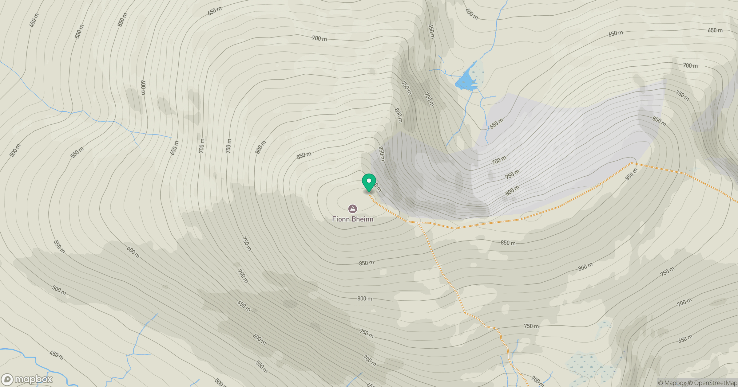
Grid reference: NH147621
View on OpenStreetMapOpens a map in a new tab, centred on the hill.
No comments yet. Be the first.