

Dolebury Warren
Good walks are even better shared.
ST4558 : Small scree slopes?
Neil Owen Photo source
Overview
Dolebury Warren
Dolebury Warren is a 183 m hill above Churchill on the northern edge of the Mendips. DoBIH records 30 m of drop and identifies its summit as a rock on the fort ramparts at ST 45262 59015. The ramparts probably overlie the natural summit; nearby natural ground 50 m east is recorded as 2–3 m lower. It is a Tump, not a Marilyn, and the recorded summit is not a trig pillar.
A complete circuit from Dolebury Bottom
North Somerset Council’s Winter 2023 walk starts and finishes at Dolebury Bottom, at the end of Doleberrow off the A38 south of Churchill. It follows woodland tracks towards Rowberrow Warren, turns into Dolebury Warren through gates, reaches the fort brow and crosses the summit area, then descends the main path and returns past a pink house to the original lane and car park.
The council gives about 2.8 miles, approximately 4.5 km, and about 2 hours for this entire circuit. No ascent total is stated. Its guide does not pinpoint the exact DoBIH rampart rock, so an additional exact-summit diversion cannot automatically inherit the route’s distance or time. Use the full council directions and an OS map rather than this summary alone.
The complete loop is not available to Trampers because of a smaller wooden return gate. The council describes an outward approach through wider gates which can be retraced, but that is a different route with no matching total established here. Check present gate and surface conditions before travelling.
Rock, views and history
The ridge is formed from Carboniferous limestone. Burrington Oolite lies on the northern side of the fort and older Black Rock Limestone to the south. These broad geological units should not be confused with a precise identification of the summit rock. Views reach across North Somerset and the Mendips, with the Bristol Channel and south Welsh coast visible in clear weather.
The Iron Age hillfort has substantial earthworks and a striking western entrance. Later rabbit farming left pillow mounds and other remains, explaining the Warren part of the name. Quarrying and cultivation also shaped the interior. The fort is a scheduled monument; leave stones and earthworks undisturbed.
Access and care
The hillfort is National Trust-owned. The adjacent Dolebury Warren woodland is a separate Woodland Trust property. The council describes only four or five parking spaces at Dolebury Bottom. Its alternative at Churchill Memorial Hall requires a different northern approach and current permission checks; it is not the same measured circuit.
No summit or starting-point toilets or refreshments were verified. Bring supplies and plan public transport, including the final walking connection and return journey, in advance. Expect steep, rocky and muddy ground. Follow signed paths, keep dogs on leads in line with National Trust adder guidance, and give wildlife and livestock space.
Explore routes near Dolebury Warren
Walks starting near this hill. Open a route to check its map, distance and full itinerary.
Cheddar River Yeo and Stubbingham Drove Circuit
View route
Yatton to Sandford Strawberry Line and Cider Orchards
View route
Three Priddy Droves: Pelting, Dursdon and East Water circuit
View route
Weston-super-Mare Walk with Men Walking & Talking
View route
Route planning notes
These notes describe possible approaches. Check a route's map and access information when planning your walk.
Dolebury Bottom, woodland and hillfort circuit
Start and finish at the small Dolebury Bottom car park, at the end of Doleberrow off the A38 south of Churchill. Through the wooden gate, follow the rocky woodland track; take the left fork at the Rowberrow Warren sign, continue ahead at the next junction, then turn left at the wide T-junction. Enter Dolebury Warren through the gate on the left. Follow the grassy path, veer right of the trees after the next gate, then follow the left waymarker through woodland. Continue through the next gate to the fort brow, cross its summit area and descend the main path. Exit the wooden gate, turn left past the pink house and return along the lane to the original car park. The council gives about 2.8 miles (approximately 4.5 km) and about 2 hours for this full circuit; no ascent total. Its fort-summit wording does not pinpoint the DoBIH rampart rock. Additional exact-summit travel is not certified within these figures. The full loop is not suitable for Trampers; a retraced accessible approach is a different route. https://northsomersetlife.co.uk/sites/default/files/2023-11/Elife%20-%20walks.pdf
Make a day of it, together
Find someone to share the walk with, or organise a day out along a route you like.
Photo Gallery
View all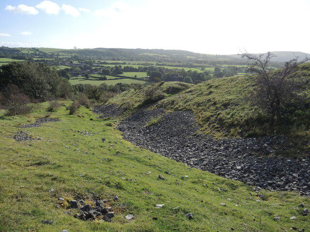 Photo could not load
ST4558 : Small scree slopes?
Neil Owen
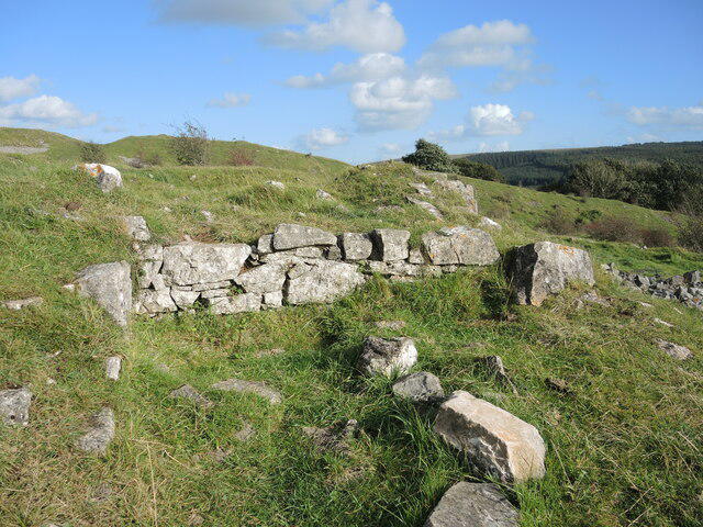 Photo could not load
ST4558 : Set into the hillfort
Neil Owen
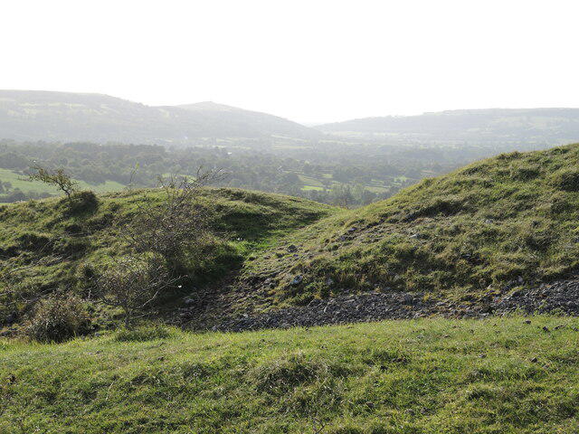 Photo could not load
ST4558 : Eastern ramparts of Dolebury Warren hillfort
Neil Owen
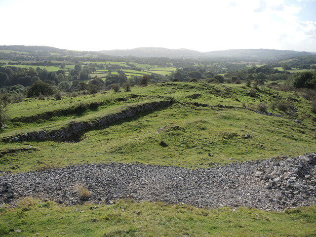 Photo could not load
ST4558 : Ridges, rocks and rabbits
Neil Owen
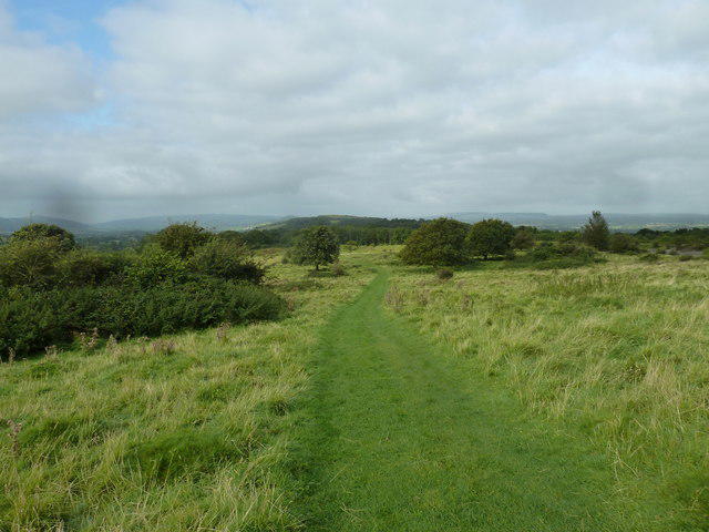 Photo could not load
ST4559 : Three off the leash on the Limestone Link (8)
Basher Eyre
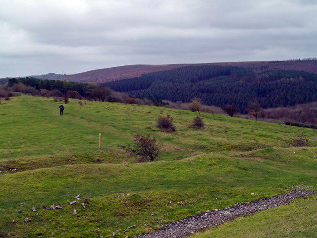 Photo could not load
ST4558 : Limestone Link
Chris McAuley
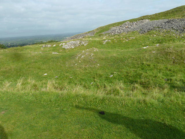 Photo could not load
ST4559 : Three off the leash on the Limestone Link (10)
Basher Eyre
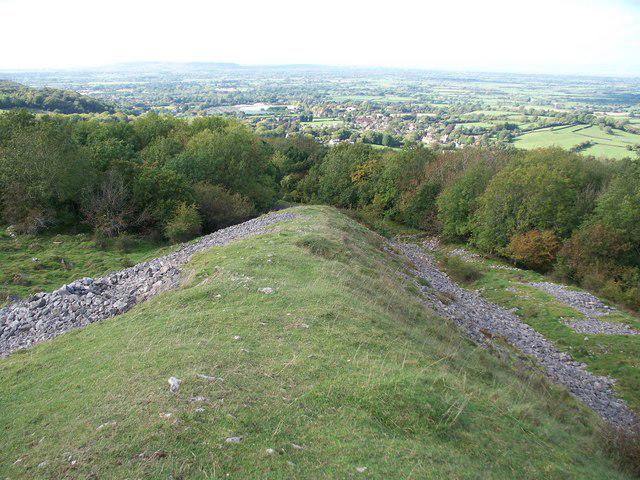 Photo could not load
ST4558 : View from the Iron Age hillfort at Dolebury Warren
Mark Plevin
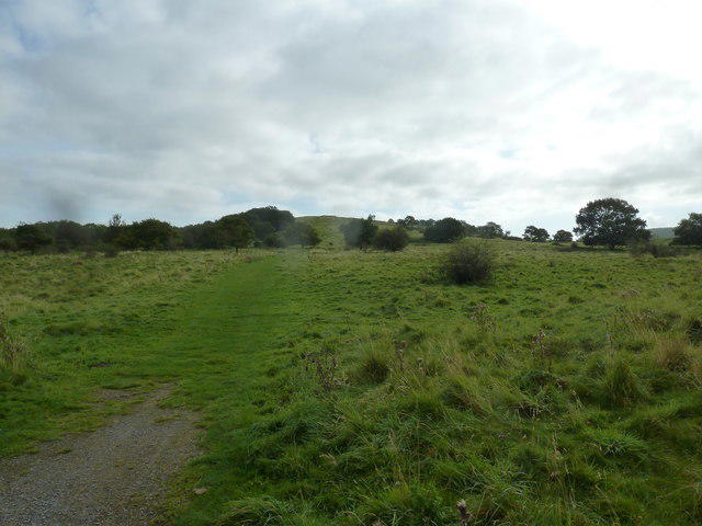 Photo could not load
ST4559 : Three off the leash on the Limestone Link (7)
Basher Eyre
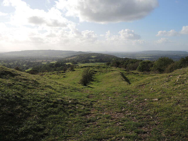
ST4558 : Lines on Dolebury Warren
Neil Owen
Hill facts and local notes
Classifications
Elevation
183m
600 ft
Prominence
30m
Coordinates
51.3275, -2.7870
ST452590
OS Map
172 182
Explorer: 141
At the Summit
DoBIH records the 183 m summit as a rock on the fort ramparts at ST 45262 59015. The ramparts probably cover the natural summit; natural ground 50 m east is recorded as 2–3 m lower. There is no summit trig pillar in the primary description.
Terrain & Geology
Dolebury Warren is a Carboniferous limestone ridge. The archaeological survey identifies Burrington Oolite on the northern side of the fort and older Black Rock Limestone to the south; BGS also records both units and local dolomitisation. This describes the hill’s geology, without assigning a particular bed to the exact summit rock.
Views & Scenery
Views extend across North Somerset and the Mendip Hills; in clear conditions the Bristol Channel and south Welsh coast can be seen.
History & Heritage
Name Origin
“Warren” refers to the later use of the hillfort for keeping rabbits, reflected in surviving pillow mounds and other earthworks. The precise origin of “Dolebury” has not been established by the sources checked.
Historical Significance
Dolebury is an Iron Age hillfort with substantial ramparts, a prominent western entrance and later rabbit-warren remains. Its earthworks include pillow mounds, traces of cultivation and quarrying. It is a scheduled monument, first listed in 1929; the 2009 archaeological survey records both single- and double-rampart sections.
Getting There & Facilities
Parking
The council route starts at Dolebury Bottom, at the end of Doleberrow off the A38 just south of Churchill. Its Winter 2023 guide describes space for only four or five cars. If full, it suggests Churchill Memorial Hall car park in Ladymead Lane; check current permission and restrictions. That alternative needs a different northern approach and does not inherit the published circuit’s distance or time.
Public Transport
Use current First Bus and Traveline information to plan travel to the Churchill/Langford area and the return journey. No exact bus-stop-to-Dolebury Bottom walking connection or current service frequency was verified for this circuit; do not assume a direct bus to the car park. Any additional approach is outside the published walking metrics.
Nearby Facilities
No toilet, drinking-water or refreshment facility at the summit or Dolebury Bottom start was verified in the official sources checked. Bring supplies and arrange stops before the walk. The small parking area and gates should not be treated as a fully accessible visitor facility.
Safety Information
Known Hazards
- Rocky, uneven paths and wet grass can be slippery; some slopes and earthworks are steep. Wear suitable footwear and carry a map.
- Keep to established paths, leave archaeological stones and earthworks undisturbed, and respect wildlife and grazing animals.
- National Trust adder guidance asks visitors to stay on paths, keep dogs on leads and leave snakes undisturbed, particularly during spring basking and breeding.
- The council’s full circuit has a smaller wooden gate on the return and is not suitable for Trampers. Its accessible approach requires retracing the outward route; verify current gates and ground conditions before relying on it.
- Parking at Dolebury Bottom is very limited. Do not block the lane or gateways; take care on the lane return and around the A38 approach.
General Safety Tips
- Check weather conditions before setting out
- Carry appropriate clothing and equipment
- Let someone know your planned route
- Take a map, compass, and GPS device
- Carry emergency supplies: food, water, first aid kit, torch
Hills
Some common questions about the hills answered
Are there group walks up Dolebury Warren?
Many walkers use Walkmates to join or organise walks with others. You can check for group walks around Dolebury Warren through the maps
Are there other walkers around Dolebury Warren?
Activity varies by location and time, but Walkmates lets you see whether others have shared walks or shown interest in this area. Find other people through the walking friends search walking friends for Dolebury Warren search or of course create your own walk for Dolebury Warren
Can I organise a walk to Dolebury Warren?
Yes. If there aren’t any walks listed already, you can create a walk and make it available for others to join.
If you're signed up to Walkmates, you can create a walk to Dolebury Warren.
How do I find a walk up this hill?
There are often multiple ways to walk this hill, depending on experience and route preference. Walkmates helps you explore walks and routes that others have shared.
Can I suggest a new route up Dolebury Warren?
Yes. You can suggest or create routes to share with others. Walkmates focuses on the social side of walking, so routes are used to help people organise walks and explore areas together, rather than as detailed navigation tools or route libraries.
Other uses really appreciate knowledgeable walkers sharing their routes. Share your favourite route to Dolebury Warren here
The is an error or something incorrect about this hill. How do I let you know?
We always strive to keep the information on Walkmates as accurate as possible. If you find an error, please let us know through the contact form and we'll aim to correct it as quickly as possible
Community Discussion
Comments
Location
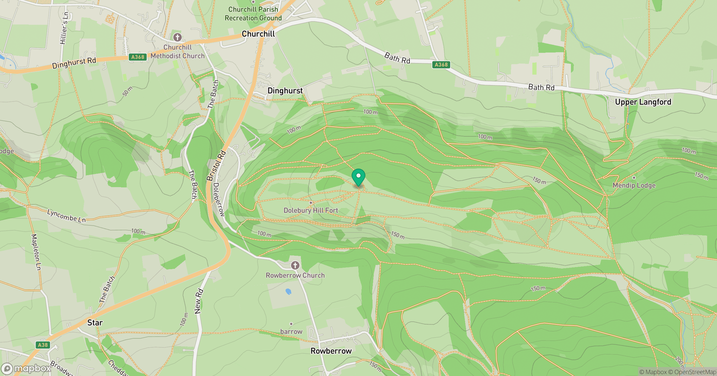
Grid reference: ST452590
View on OpenStreetMapOpens a map in a new tab, centred on the hill.


No comments yet. Be the first.