

Cruach Ardrain SW Top
Good walks are even better shared.
NN4121 : Cruach Ardrain
Richard Webb Photo source
Overview
Cruach Ardrain SW Top
Location: NN408211, Scottish Highlands
Elevation: 892 meters
Nestled in the heart of the Scottish Highlands, Cruach Ardrain SW Top is an often-overlooked gem that presents both challenge and beauty to the intrepid hiker. As a Munro, it stands proudly at 892 meters, offering not just exercise but also stunning views that might just make you forget about the burn in your legs.
Geology
Cruach Ardrain is composed primarily of schists and granite, affording the mountain a rugged texture that has been shaped over millennia. Did you know that these areas were once covered by glaciers? Nature's version of a gigantic ice cream scoop!
Routes
Via Balquhidder Glen
This moderate 11 km route takes you through a picturesque glen, showcasing Scotland's verdant beauty as you ascend. Packed with photo opportunities, be sure to have your camera ready. Allow approximately 4.5 hours.
From Crianlarich
For the more adventurous, this challenging 9 km route is direct and steep, leading to the peak with minimal meandering. Expect to invest around 3.5 hours of your time.
Summit Features
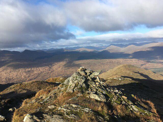
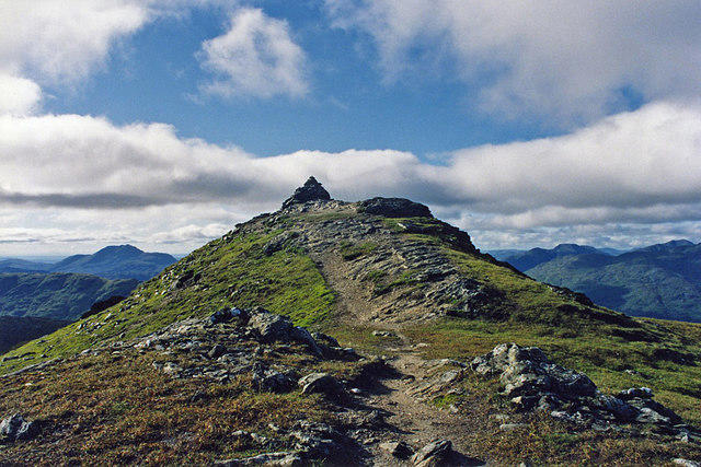
Upon reaching the summit, you are greeted by a sturdy stone cairn that scales the heights of human perseverance. Perfect for a quick breather or a spot of lunch—just watch out for seagulls; they can be cheeky!
Terrain Type
The terrain varies from rocky scrambles to soft, grassy slopes, with the occasional boggy patch to keep you on your toes (or wet socks!).
Views
From the summit, take in the breathtaking vistas of Loch Lomond and the mighty Ben More. The view here is best enjoyed on clear days, particularly in spring and fall when the air is crisp and clear.
Hazards
Be mindful of quickly changing weather conditions—what starts as a sunny day can turn into a downpour before you know it. Steer clear of slippery rocks, especially those with a sheen of moisture.
Nearby Summits
- Ben More (1174m)
- Stob Binnein (1165m)
Both peaks offer fantastic hiking challenges if you're up for a full day's adventure.
Access
Parking is available at the Balquhidder Glen trailhead. It’s crucial to respect local property by not overloading roadside spaces. For public transport, regular bus services connect through Crianlarich, ensuring you can enjoy your outdoors without hassle.
Facilities
Crianlarich is the nearest town, boasting a shop and a popular hotel where weary legs can find rest and refreshments.
History
The name 'Cruach Ardrain' might seem a mouthful, but it amusingly means 'the pile of stones on the high ridge.' It certainly lives up to that title with its rocky summit. This Munro serves not just as a hiking destination but also as a historical landmark in the Scottish Highlands, drawing in both seasoned trekkers and curious newcomers.
So pack your boots, grab your sense of adventure, and set forth! Cruach Ardrain SW Top eagerly awaits, ready to reward you with panache and a few sore muscles along the way.
Happy hiking!
Explore routes near Cruach Ardrain SW Top
Walks starting near this hill. Open a route to check its map, distance and full itinerary.
Loch Katrine: Brenachoile Point Shore Walk from Trossachs Pier
View route
The Cobbler from Succoth Carpark
View route
Beinn Ime from Succoth
View route
Killin: Falls of Dochart, Finlarig and Moirlanich Longhouse
View route
Route planning notes
These notes describe possible approaches. Check a route's map and access information when planning your walk.
Via Balquhidder Glen
A popular route that takes you through stunning glen scenery before ascending to the summit.
From Crianlarich
This route offers a more direct ascent, taking in beautiful moorland before reaching the summit.
Make a day of it, together
Find someone to share the walk with, or organise a day out along a route you like.
Photo Gallery
View all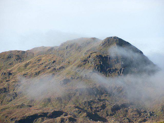 Photo could not load
NN4121 : Cruach Ardrain
Richard Webb
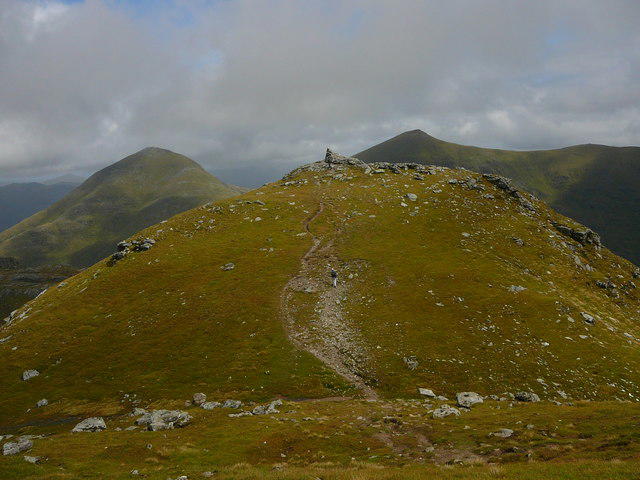 Photo could not load
NN4021 : The summit of Cruach Ardrain looking northeast
Colin Park
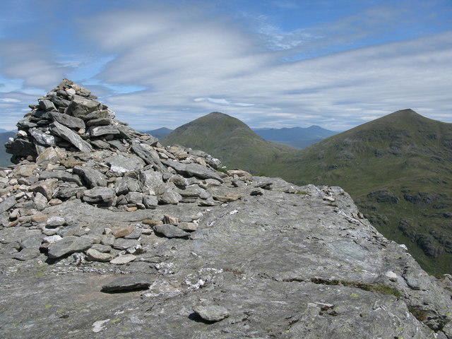 Photo could not load
NN4021 : Cruach Ardrain Summit Cairn
G Laird
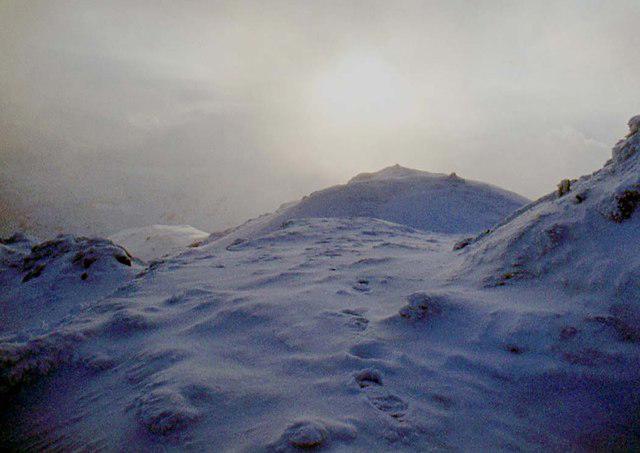 Photo could not load
NN4021 : Top of Cruach Ardrain
Alan Reid
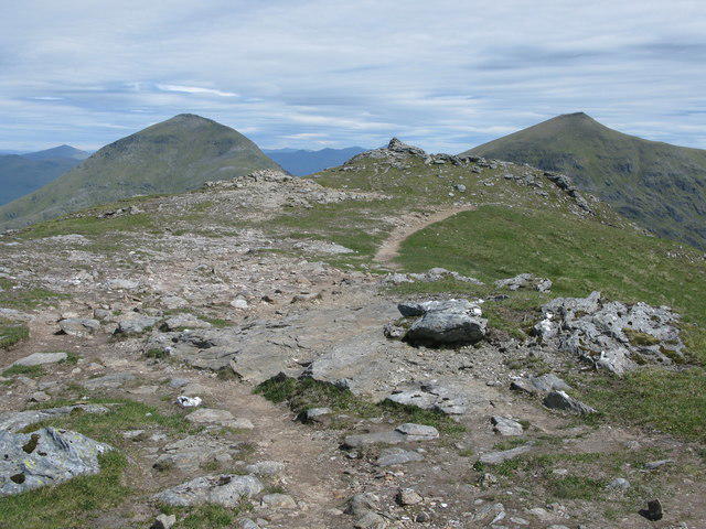 Photo could not load
NN4021 : Summit of Cruach Ardrain
G Laird
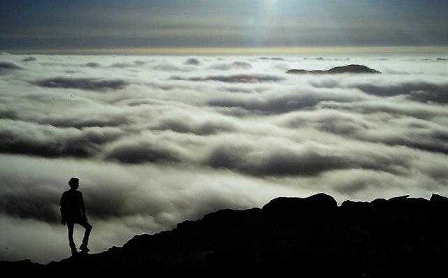 Photo could not load
NN4021 : Temperature inversion on Cruach Ardrain
Colin Kinnear
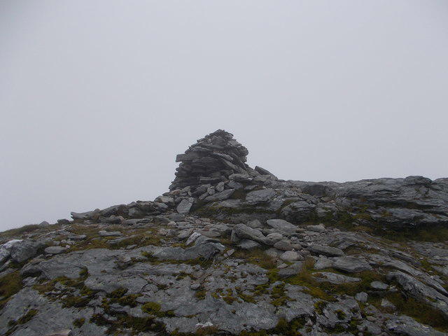 Photo could not load
NN4021 : Summit of Cruach Ardrain
Iain Russell
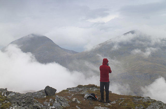 Photo could not load
NN4021 : Summit area, Cruach Ardrain
William Starkey
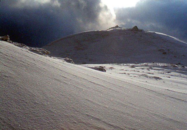 Photo could not load
NN4021 : Cairns on Cruach Ardrain
Alan Reid
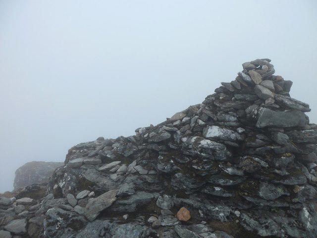
NN4021 : Cruach Ardrain summit
Stephen Sweeney
Hill facts and local notes
Classifications
Elevation
1,045m
3,428 ft
Prominence
14m
Coordinates
56.3555, -4.5779
NN408211
OS Map
51 56
Explorer: OL39N 364N
At the Summit
The summit features a stone cairn, which is perfect for sheltering against the breeze while you enjoy your packed lunch. The views here are worth the hike, especially with a good cuppa in hand!
Terrain & Geology
Cruach Ardrain SW Top comprises schists and granite, creating a rugged landscape that has witnessed the ice ages carve its features. The area is rich in both geological history and diverse minerals.
Views & Scenery
Dramatic views of Loch Lomond, Ben More, and the surrounding rolling hills and valleys.
History & Heritage
Name Origin
The name 'Cruach Ardrain' loosely translates to 'the pile of stones on the high ridge,' giving a nod to its rocky summit and elevated position.
Historical Significance
As a Munro, Cruach Ardrain SW Top attracts hikers keen to complete their list of Munros; it is also part of the scenic landscape that has inspired poets and adventurers alike.
Getting There & Facilities
Parking
There is parking available at the Balquhidder Glen trailhead, which can accommodate several vehicles. Please be considerate of local residents when parking.
Public Transport
Regular buses run from nearby towns such as Callander and Crianlarich to Balquhidder, providing easy access to the starting points.
Nearby Facilities
Crianlarich has a shop and a hotel with toilets available. For a quick bite or a cuppa, try The Crianlarich Hotel.
Safety Information
Known Hazards
- Watch out for changing weather conditions as they can shift quickly. Be wary of slippery rocks, especially when wet.
General Safety Tips
- Check weather conditions before setting out
- Carry appropriate clothing and equipment
- Let someone know your planned route
- Take a map, compass, and GPS device
- Carry emergency supplies: food, water, first aid kit, torch
Hills
Some common questions about the hills answered
Are there group walks up Cruach Ardrain SW Top?
Many walkers use Walkmates to join or organise walks with others. You can check for group walks around Cruach Ardrain SW Top through the maps
Are there other walkers around Cruach Ardrain SW Top?
Activity varies by location and time, but Walkmates lets you see whether others have shared walks or shown interest in this area. Find other people through the walking friends search walking friends for Cruach Ardrain SW Top search or of course create your own walk for Cruach Ardrain SW Top
Can I organise a walk to Cruach Ardrain SW Top?
Yes. If there aren’t any walks listed already, you can create a walk and make it available for others to join.
If you're signed up to Walkmates, you can create a walk to Cruach Ardrain SW Top.
How do I find a walk up this hill?
There are often multiple ways to walk this hill, depending on experience and route preference. Walkmates helps you explore walks and routes that others have shared.
Can I suggest a new route up Cruach Ardrain SW Top?
Yes. You can suggest or create routes to share with others. Walkmates focuses on the social side of walking, so routes are used to help people organise walks and explore areas together, rather than as detailed navigation tools or route libraries.
Other uses really appreciate knowledgeable walkers sharing their routes. Share your favourite route to Cruach Ardrain SW Top here
The is an error or something incorrect about this hill. How do I let you know?
We always strive to keep the information on Walkmates as accurate as possible. If you find an error, please let us know through the contact form and we'll aim to correct it as quickly as possible
Community Discussion
Comments
Location
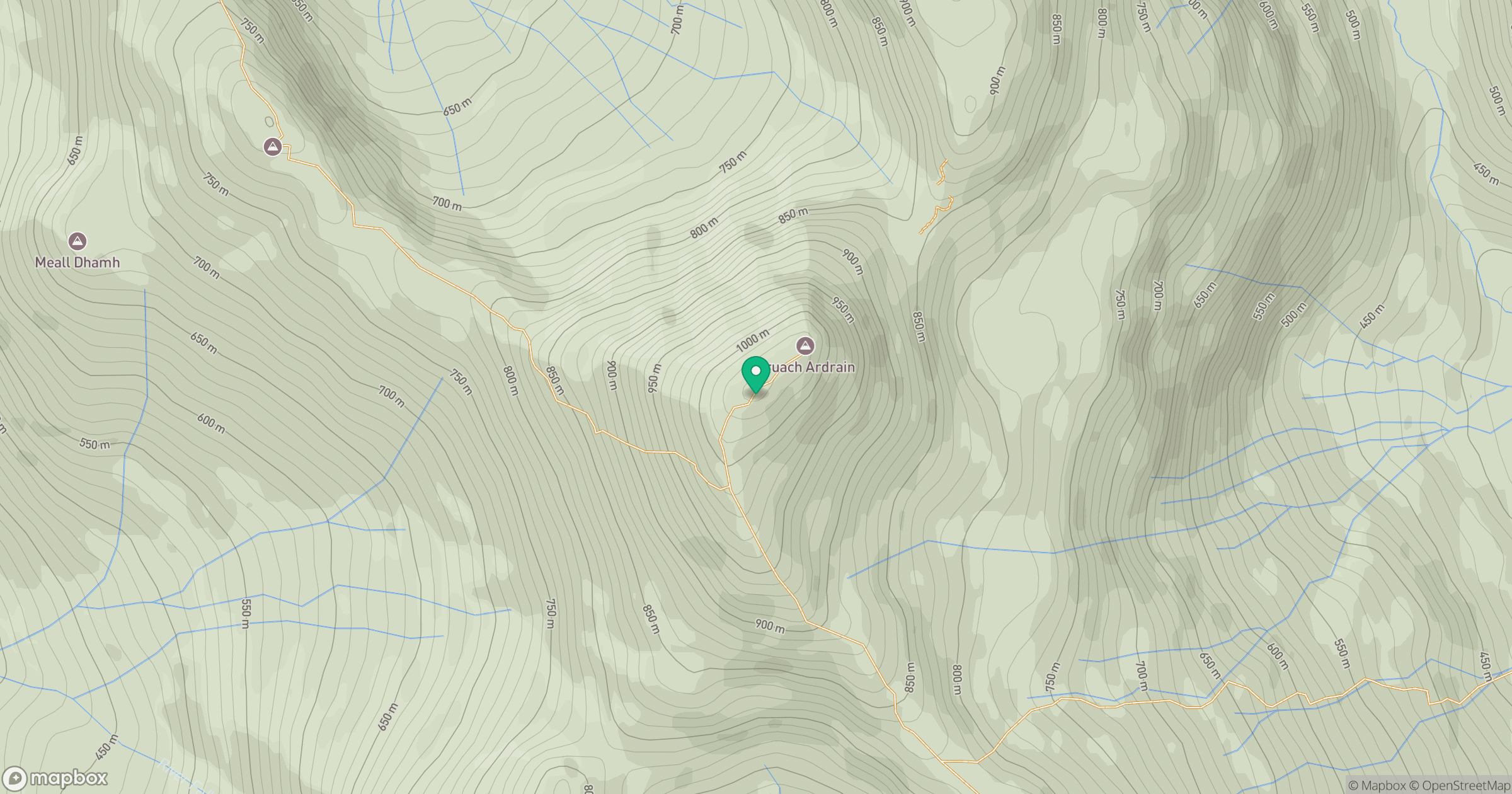
Grid reference: NN408211
View on OpenStreetMapOpens a map in a new tab, centred on the hill.
No comments yet. Be the first.