

Cruach Ardrain
Good walks are even better shared.
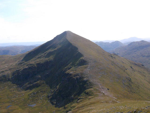
NN4121 : Bealach between Stob Garbh and Cruach Ardrain
Andrew Smith Photo source
Overview
Cruach Ardrain
Cruach Ardrain is a 1045.9 m Munro in the Crianlarich hills. DoBIH records the highest point at a cairn; the separate south-west top is lower. Approaching from Beinn Tulaichean, continue through the short dip to the true summit rather than stopping at the first high point.
Southern two-Munro circuit
Walkhighlands describes a complete circuit from Inverlochlarig, NN445185, at the end of the public road beyond Loch Voil: 12.5 km, 1019 m ascent and 6–7 hours. This is strenuous mountain walking, with boggy, pathless ascent and rough descent, rather than a gradual novice route.
Follow the farm approach, cross the burn bridge, take the right-hand stile and path and join the Glen Inverlochlarig track. Climb Beinn Tulaichean’s rough eastern slopes, passing the gate at NN426188 and avoiding broken crags, until the upper ridge path leads to its summit. Descend north to the bealach and climb Cruach Ardrain.
Return to that same bealach and descend east. The initial path fades; navigate carefully across open slopes around slabby rock and broken crags. On reaching the glen track, turn south and use the signed route around the farmyard to retrace the approach to the car park. The total includes both Munros and the return to Inverlochlarig. Northern A82 or Crianlarich routes have different starts, terrain and distances.
Setting and preparation
NatureScot’s Ben More–Stob Binnein citation places the massif in a Dalradian-schist setting, with limited richer mica-schist outcrops. It does not support the former predominantly volcanic description. The route offers views over Loch Doine and Loch Voil, while Cruach Ardrain looks down Coire Ardrain towards Crianlarich.
There is no public transport to this route’s start according to Walkhighlands. Reaching Balquhidder by bus does not complete the journey to Inverlochlarig. Plan the approach and return, carry navigation equipment and check mountain weather and current access notices. Follow estate and farming signs; no current stalking clearance is implied. Snow, ice, wind and poor visibility can make this a much harder outing.
Sources checked: 18 October 2026.
Explore routes near Cruach Ardrain
Walks starting near this hill. Open a route to check its map, distance and full itinerary.
Loch Katrine: Brenachoile Point Shore Walk from Trossachs Pier
View route
The Cobbler from Succoth Carpark
View route
Beinn Ime from Succoth
View route
Killin: Falls of Dochart, Finlarig and Moirlanich Longhouse
View route
Route planning notes
These notes describe possible approaches. Check a route's map and access information when planning your walk.
Cruach Ardrain and Beinn Tulaichean from Inverlochlarig
Start and finish at the car park at the end of the public road beyond Loch Voil, Inverlochlarig, NN445185. Follow the farm approach, cross the burn bridge, take the stile and path on the right and join the Glen Inverlochlarig track. Climb the rough, pathless eastern slopes of Beinn Tulaichean, passing the gate at NN426188, then follow the upper ridge path to its summit. Descend north to the bealach and climb Cruach Ardrain, continuing beyond the first high point through a short dip to the true summit cairn. Return to the bealach, descend east on a path that fades onto rough open slopes, avoiding slabby rock and broken crags. Turn south on the glen track and follow the signed path around the farmyard to retrace the approach to the car park. Walkhighlands gives 12.5 km, 1019 m ascent and 6–7 hours for this complete two-Munro circuit.
Make a day of it, together
Find someone to share the walk with, or organise a day out along a route you like.
Photo Gallery
View all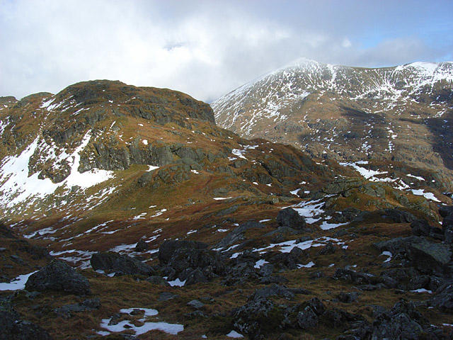 Photo could not load
NN4121 : Bealach between Stob Garbh and Cruach Ardrain
Andrew Smith
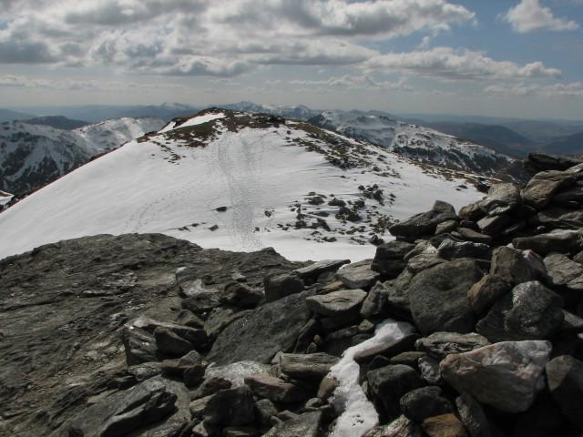 Photo could not load
NN4021 : Cruach Ardrain
Callum Black
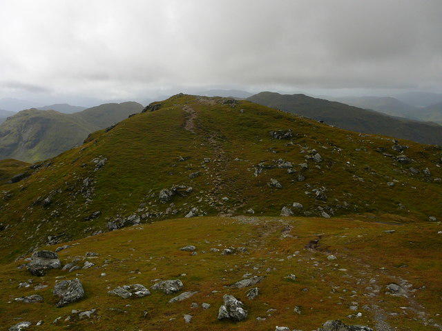 Photo could not load
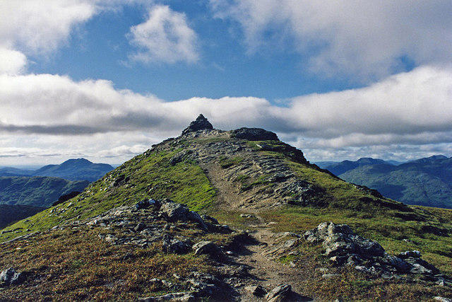
NN4021 : The summit of Cruach Ardrain looking southwest.
Colin Park
 Photo could not load
NN4021 : Temperature inversion on Cruach Ardrain
Colin Kinnear
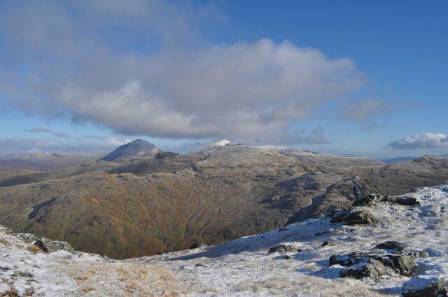 Photo could not load
NN4021 : View from An Caisteal
Robert Struthers
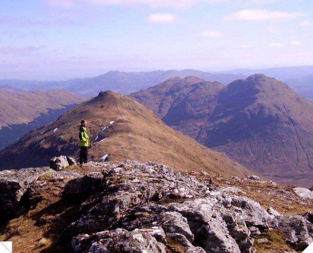 Photo could not load
NN4021 : Cruach Ardrain in sunshine
Graham Cole
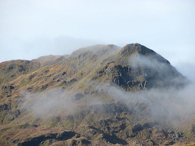 Photo could not load
NN4121 : Cruach Ardrain
Richard Webb
 Photo could not load
NN4121 : Cruach Ardrain, NE Face
Adam Ward
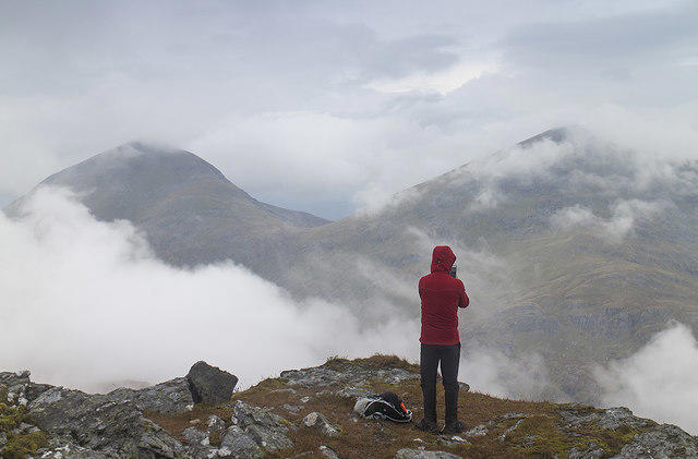 Photo could not load
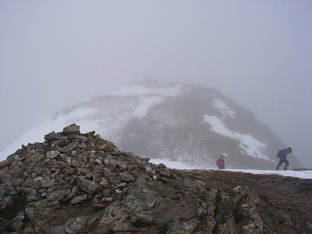
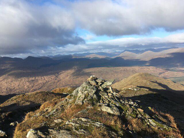
NN4021 : Summit area, Cruach Ardrain
William Starkey
NN4021 : Cruach Ardrain
Andrew Smith
Hill facts and local notes
Classifications
Elevation
1,046m
3,431 ft
Prominence
549m
Coordinates
56.3564, -4.5762
NN409212
OS Map
51 56
Explorer: OL39N 364N
At the Summit
The true summit is the cairn at NN4093021208, recorded at 1045.9 m. Continue through the short dip beyond the south-west top when approaching from Beinn Tulaichean; DoBIH records that separate top as lower.
Terrain & Geology
Cruach Ardrain forms part of the Ben More–Stob Binnein massif. NatureScot’s SSSI citation describes its Dalradian-schist setting, with predominantly nutrient-poor rocks and soils and limited richer mica-schist outcrops. This is a qualified massif-level description of metamorphic rocks; the previous claim that the mountain is mainly basalt and andesite is not supported.
Views & Scenery
From Cruach Ardrain the view looks down Coire Ardrain towards Crianlarich and across the Southern Highlands. The southern circuit also gives views of Loch Doine and Loch Voil on the ascent, with Ben More and Stob Binnein prominent from Beinn Tulaichean.
History & Heritage
Name Origin
Ainmean-Àite na h-Alba records the Gaelic form Cruach Àrdrain. A precise English translation is not asserted here because the current name record’s explanatory text was not established in this audit.
Historical Significance
Historically, this area has been significant for its natural resources and as a settlement for many clans throughout Scottish history.
Getting There & Facilities
Parking
For the described southern circuit, use the Inverlochlarig car park at the end of the public road beyond Loch Voil, NN445185, reached through Balquhidder. Do not block farm or road access; current charges or available spaces have not been verified.
Public Transport
Walkhighlands records no public transport to the Inverlochlarig start of this southern circuit, and the National Park distinguishes it from northern routes based around Crianlarich. A bus to Balquhidder does not reach this roadhead. Arrange the full approach and return separately; Crianlarich or A82 starts are different routes with different totals.
Nearby Facilities
You can find cafes, pubs, and toilets in Callander, which make for a great stop before or after your adventure.
Safety Information
Known Hazards
- The southern route has steep, boggy and pathless slopes. The eastward descent from the bealach becomes rough after the path fades and requires careful route-finding around slabby rocks and broken crags.
- Continue to Cruach Ardrain’s true summit beyond the intervening dip; the south-west top is lower. Poor visibility makes summit and descent navigation harder.
- Strong wind, cold, snow and ice can change the character of this high mountain walk. Carry a map, compass, suitable equipment and a current mountain forecast; allow enough time for the full two-Munro return.
- This is working farm and estate land. Use the signed route around Inverlochlarig farmyard, avoid disturbing livestock and follow current local access and deer-management advice. No blanket all-year access clearance is implied.
General Safety Tips
- Check weather conditions before setting out
- Carry appropriate clothing and equipment
- Let someone know your planned route
- Take a map, compass, and GPS device
- Carry emergency supplies: food, water, first aid kit, torch
Hills
Some common questions about the hills answered
Are there group walks up Cruach Ardrain?
Many walkers use Walkmates to join or organise walks with others. You can check for group walks around Cruach Ardrain through the maps
Are there other walkers around Cruach Ardrain?
Activity varies by location and time, but Walkmates lets you see whether others have shared walks or shown interest in this area. Find other people through the walking friends search walking friends for Cruach Ardrain search or of course create your own walk for Cruach Ardrain
Can I organise a walk to Cruach Ardrain?
Yes. If there aren’t any walks listed already, you can create a walk and make it available for others to join.
If you're signed up to Walkmates, you can create a walk to Cruach Ardrain.
How do I find a walk up this hill?
There are often multiple ways to walk this hill, depending on experience and route preference. Walkmates helps you explore walks and routes that others have shared.
Can I suggest a new route up Cruach Ardrain?
Yes. You can suggest or create routes to share with others. Walkmates focuses on the social side of walking, so routes are used to help people organise walks and explore areas together, rather than as detailed navigation tools or route libraries.
Other uses really appreciate knowledgeable walkers sharing their routes. Share your favourite route to Cruach Ardrain here
The is an error or something incorrect about this hill. How do I let you know?
We always strive to keep the information on Walkmates as accurate as possible. If you find an error, please let us know through the contact form and we'll aim to correct it as quickly as possible
Community Discussion
Comments
Location
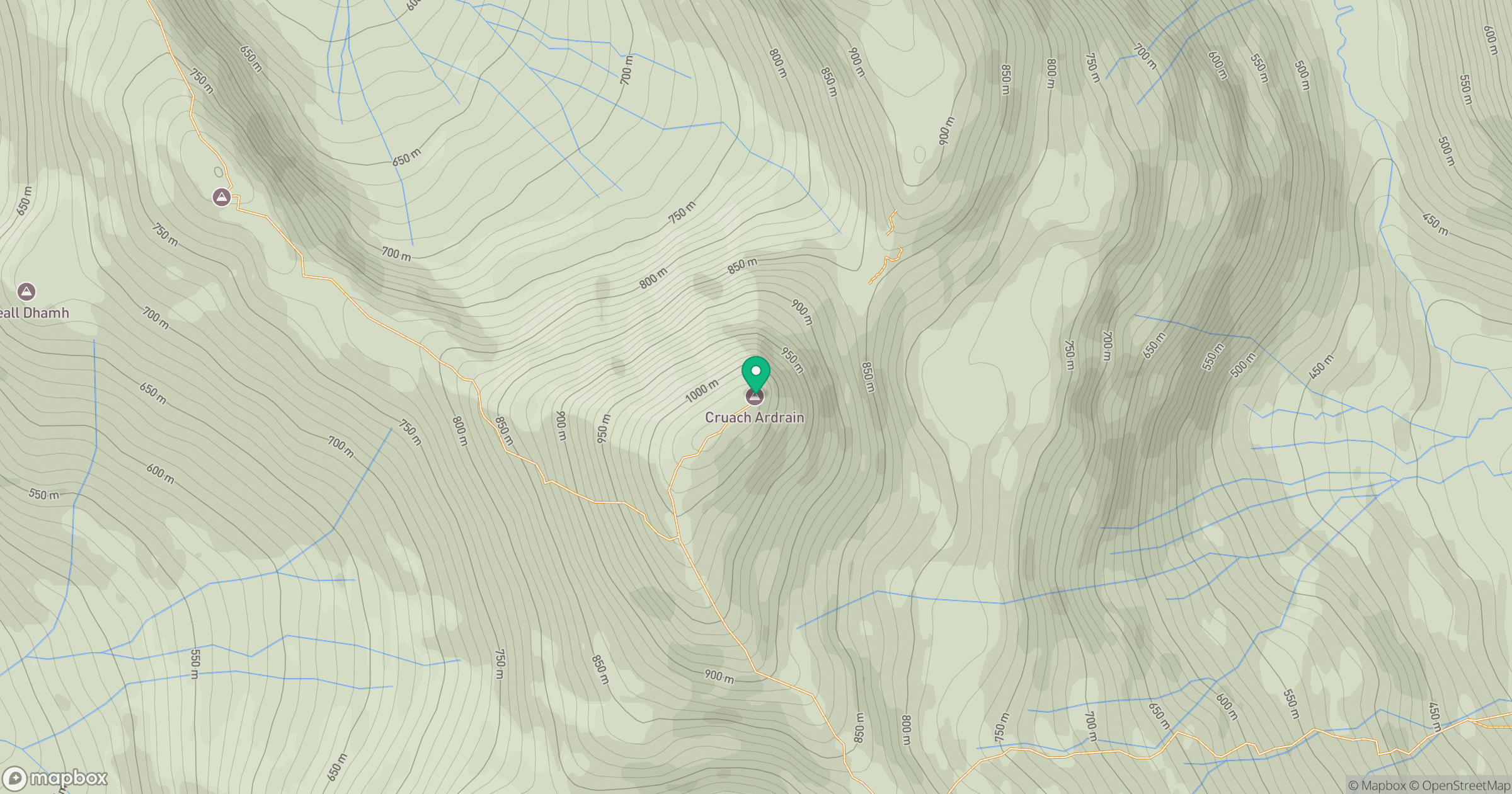
Grid reference: NN409212
View on OpenStreetMapOpens a map in a new tab, centred on the hill.
No comments yet. Be the first.