

Creag nan Damh
Good walks are even better shared.
NG9811 : Creag nan Damh from the SE
Chris Eilbeck Photo source
Overview
Creag nan Damh
Nestled within the majestic Scottish Highlands, Creag nan Damh stands at a proud 744 meters, offering both a challenge and reward for hikers.
Geology
Creag nan Damh is built upon ancient schists and gneisses. These rocks have been shaped over millennia, resulting in a landscape that is as picturesque as it is geologically fascinating. Don’t forget to look closely; you might spot interesting rock formations and even some rare alpine plants!
Routes
The most popular route begins in Inverarish, leading you through lush woodlands and up towards rocky outcrops. The trail is well-marked, making it suitable for those with a sense of adventure but perhaps not an exhaustive hiking resume. With a total distance of 9.5 km and a time estimate of about 4.5 hours, you can certainly say you have earned that well-deserved picnic at the summit!
Summit Features
Upon reaching the summit, you’ll be greeted by a rocky outcrop and a modest cairn, perfect for capturing your triumphant mood with photos. Just be sure not to trip on your own excitement!
Terrain Type
The terrain ranges from grassy slopes to rocky ledges; a bit of everything but you might be wise to pack your best boots. And yes, there are boggy patches – embrace them! It's all part of the Highland experience, right?
Views
The views are nothing short of breathtaking. You’ll see the Glamaig mountains lining the horizon and, if you’re lucky, the shimmering waters of Loch Snizort. Don’t forget; the best time to catch these sights is from late spring to early autumn when the world is in full bloom.
Hazards
As with any Highland adventure, keep an eye on the weather. Conditions can change on a dime, and suitable footwear is essential for navigating the sometimes challenging terrain. Remember: a slipped boot is no way to make friends with the ground!
Nearby Summits
You won’t be alone in your quest for heights! Nearby summits include Bheinn na Caillich and Beinn Ghrideag, each offering their own slice of highland heaven worth exploring.
Access
Accessibility is straightforward. A convenient car park is situated in Inverarish, the humble village at the trailhead. Public transport fans can find their way through buses from Portree, making it an ideal day trip for those without a car.
Facilities
After your hike, delve into the town of Portree for coffee or a delicious slice of cake – you’ve earned it! Facilities here include cafes, shops, and toilets, allowing for a pleasant wind-down.
History
The name Creag nan Damh means 'Rock of the Stags.' This name pays homage to the stunning wildlife and cultural history nestled within these hills. The area is a testament to Highland traditions and embraces the mythical spirit of Scotland.
Final Thoughts
In conclusion, Creag nan Damh is more than just a hill; it’s a journey through nature, history, and breathtaking landscapes. Whether you're a seasoned hiker or a casual rambler with a penchant for picnics, this Munro has something special for everyone. So lace up your hiking boots and set forth on an adventure!
Explore routes near Creag nan Damh
Walks starting near this hill. Open a route to check its map, distance and full itinerary.
Glen Affric: Coire Loch Woodland Trail
View route
Banavie to Glen Loy Aqueduct: Neptune’s Staircase Canal Towpath
View route
Fort Augustus to Kytra Lock: Caledonian Canal Towpath
View route
Ben Nevis via Mountain Path
View route
Route planning notes
These notes describe possible approaches. Check a route's map and access information when planning your walk.
Starting from Inverarish
This route begins in the village of Inverarish and provides a well-marked path through scenic woodlands before leading to the summit.
Make a day of it, together
Find someone to share the walk with, or organise a day out along a route you like.
Photo Gallery
View all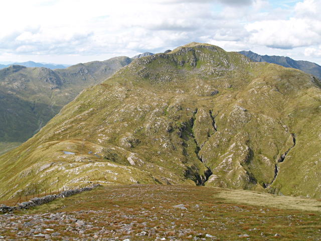 Photo could not load
NG9811 : Creag nan Damh from the SE
Chris Eilbeck
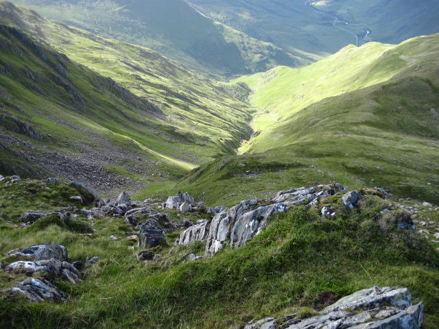 Photo could not load
NG9811 : Towards Am Fàs-allt
Chris Wimbush
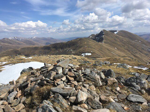 Photo could not load
NG9811 : Small cairn on Creag Nan Damh
Steven Brown
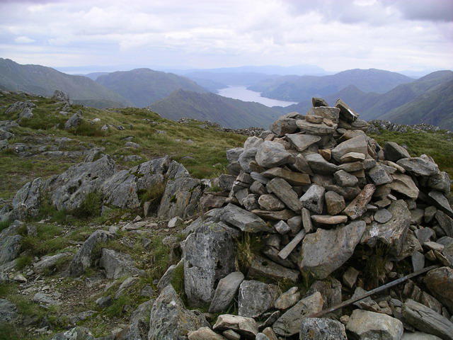 Photo could not load
NG9811 : Creag nan Damh : Munro No 274
Graham Ellis
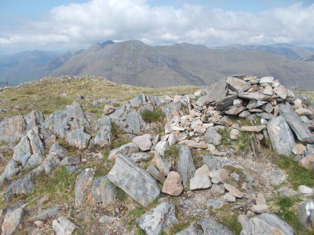 Photo could not load
NG9811 : The summit of Creag nan Damh on the South Cluanie Ridge
Peter S
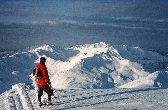 Photo could not load
NG9811 : West from Creag nan Damh
Julian Paren
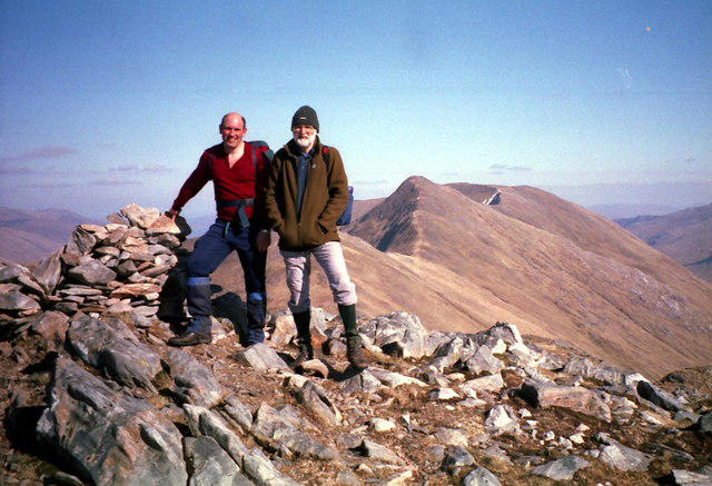 Photo could not load
NG9811 : Summit cairn on Creag nan Damh
Russel Wills
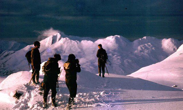 Photo could not load
NG9811 : Summit of Creag nan Damh
Paul Haslam
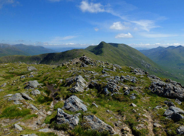 Photo could not load
NG9811 : Summit of Creag nan Damh
John Allan
Hill facts and local notes
Classifications
Elevation
917m
3,009 ft
Prominence
196m
Coordinates
57.1473, -5.3350
NG983112
OS Map
33
Explorer: 414S
At the Summit
The summit features a prominent rocky outcrop with a small cairn, providing an ideal spot for that obligatory selfie with a stunning backdrop.
Terrain & Geology
Creag nan Damh is primarily composed of ancient schists and gneisses, which exhibit fascinating metamorphic properties. The varied geology gives rise to dramatic landscapes and diverse ecosystems.
Views & Scenery
From the summit, enjoy panoramic views of the surrounding mountains, including the spectacular Glamaig and the distant peaks of Skye. On a clear day, you can even spot the serene waters of Loch Snizort.
History & Heritage
Name Origin
The name Creag nan Damh translates to 'Rock of the Stags' in Scots Gaelic, reflecting the area's wildlife and historical agricultural practices.
Historical Significance
This area has been significant in Scottish culture, known for its rich Highland heritage and as a habitat for various wildlife.
Getting There & Facilities
Parking
There is a small car park in Inverarish at the start of the trail. Make sure to arrive early during peak seasons for a space.
Public Transport
Buses run from the nearby town of Portree to Inverarish, although timetables can be erratic, so checking in advance is wise.
Nearby Facilities
The nearest facilities can be found in Portree, where you'll find cafes, shops, and public toilets.
Safety Information
Known Hazards
- Be cautious of sudden weather changes, as conditions can turn quickly in the Highlands. The terrain can also be uneven and challenging; suitable footwear is essential.
General Safety Tips
- Check weather conditions before setting out
- Carry appropriate clothing and equipment
- Let someone know your planned route
- Take a map, compass, and GPS device
- Carry emergency supplies: food, water, first aid kit, torch
Hills
Some common questions about the hills answered
Are there group walks up Creag nan Damh?
Many walkers use Walkmates to join or organise walks with others. You can check for group walks around Creag nan Damh through the maps
Are there other walkers around Creag nan Damh?
Activity varies by location and time, but Walkmates lets you see whether others have shared walks or shown interest in this area. Find other people through the walking friends search walking friends for Creag nan Damh search or of course create your own walk for Creag nan Damh
Can I organise a walk to Creag nan Damh?
Yes. If there aren’t any walks listed already, you can create a walk and make it available for others to join.
If you're signed up to Walkmates, you can create a walk to Creag nan Damh.
How do I find a walk up this hill?
There are often multiple ways to walk this hill, depending on experience and route preference. Walkmates helps you explore walks and routes that others have shared.
Can I suggest a new route up Creag nan Damh?
Yes. You can suggest or create routes to share with others. Walkmates focuses on the social side of walking, so routes are used to help people organise walks and explore areas together, rather than as detailed navigation tools or route libraries.
Other uses really appreciate knowledgeable walkers sharing their routes. Share your favourite route to Creag nan Damh here
The is an error or something incorrect about this hill. How do I let you know?
We always strive to keep the information on Walkmates as accurate as possible. If you find an error, please let us know through the contact form and we'll aim to correct it as quickly as possible
Community Discussion
Comments
Location
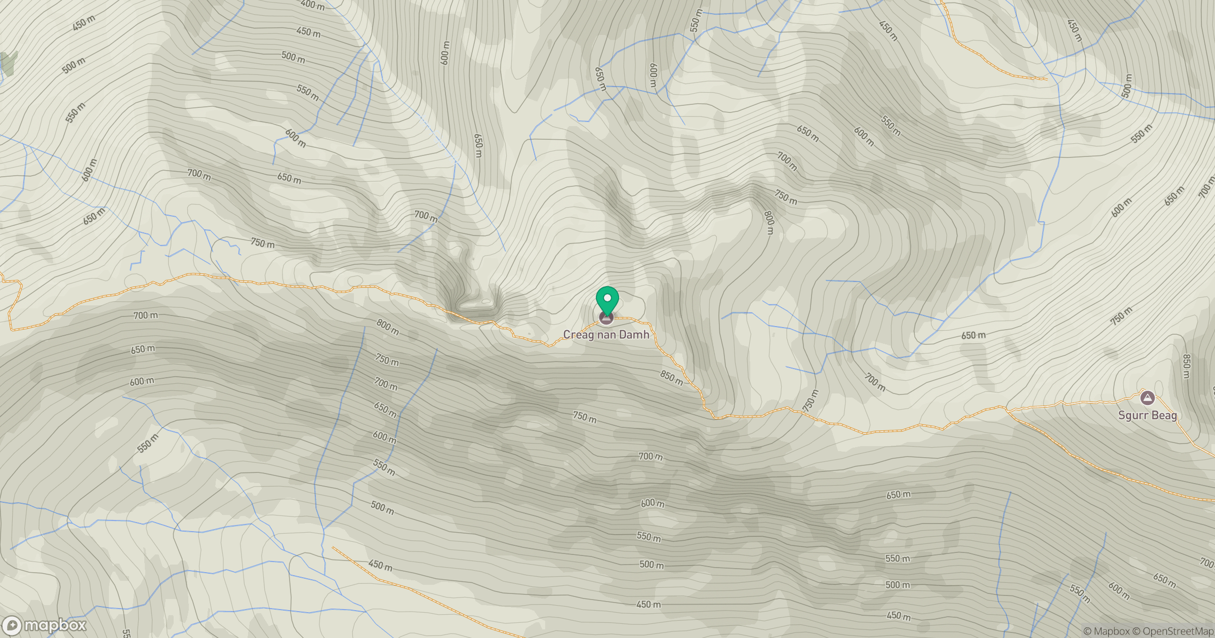
Grid reference: NG983112
View on OpenStreetMapOpens a map in a new tab, centred on the hill.
No comments yet. Be the first.