

Creag a' Chail
Good walks are even better shared.
Overview
Creag a' Chail
Creag a' Chail, soaring at 846 meters, is a classic Scottish crag that beckons hikers and mountain enthusiasts alike. Nestled within the splendid Scottish Highlands, it is classified as a Munro, giving adventurers another tick on their list of peaks to conquer.
Geology
The geological backbone of Creag a' Chail is primarily ancient volcanic rock, which lends itself to the dramatic landscape confronting hikers head-on. One can marvel at the rugged crags and the scattered boulders that testify to a tumultuous past—not too dissimilar to some family gatherings, I might add!
Routes
Two popular routes can be traversed en route to the summit:
North-East Approach - This scenic pathway weaves its way through vibrant woodlands before guiding you towards rocky outcrops. At approximately 10.5 km, and with a moderate difficulty rating, it is a firm favourite for those looking to soak in nature while breaking a sweat.
East Ascent from the A84 - For those seeking a steeper challenge, this route cuts directly up through open moorland. Spanning about 8.2 km, it promises stunning views while rewarding hikers with a fulfilling climb.
Summit Features
Upon reaching the summit, climbers will be greeted by a sturdy cairn, serving as a testament to the many adventurers who have stood upon the peak before. And oh, what a view!
Terrain
Hikers can expect rocky and grassy terrain, although keep an eye out for loose stones that could use glue and some enthusiasm! And yes, there may be boggy spots—leave your high heels at home.
Views
The highlights from the summit include the picturesque Loch Voil and the awe-inspiring sight of Ben More among other surrounding peaks. Best views can be enjoyed in spring or autumn, where the landscape either comes alive with flowers or dons a tapestry of reds and golds.
Hazards
Do keep in mind the loose rocks and those sneaky steep drops! Weather changes can be as swift as a Highland fling, so always be prepared. Those boggy areas love a good ambush, so tread with care.
Nearby Summits
While you’re at it, why not consider tackling nearby peaks like Ben More (1174 m) and Cruach Ardrain (1046 m)—more than enough for the adventurous spirit!
Access
For a hassle-free trip, park at the small car park located off the A84 near Strathyre. Public transport options are available, albeit limited, with a bus stop in the village. Grab a snack from one of the cosy local cafes before you embark.
Facilities
Strathyre is your go-to for essentials, with a selection of cafes and a toilet facility at the village hall for your pre-adventure needs.
History
The name, Creag a' Chail, translates to 'the crag of the hazel'. It hints at the rich diversity of flora that has thrived here over the ages. As a significant Munro, its relevance reaches beyond just elevation, serving as a vital piece of Scottish cultural heritage.
In conclusion, whether you’re a seasoned climber or a casual walker, Creag a' Chail promises an unforgettable journey into the heart of the Scottish wilderness. Bring your boots, your sense of adventure, and maybe a banana or two!
Explore routes near Creag a' Chail
Public walks starting within 80 km of this hill. Nearby does not mean a route reaches the summit; check its map and access before setting out.
Coire Ardair lochan from Aberarder and back
View route
Fort Augustus to Kytra Lock: Caledonian Canal Towpath
View route
Great Glen Way low route: Fort Augustus to Invermoriston Old Bridge
View route
Loch Affric full circuit from River Affric
View route
Route planning notes
These notes describe possible approaches, not verified navigable routes or permission to cross land. Check current paths, local access rules and conditions before setting out.
North-East approach
A scenic route starting from the village of Strathyre, leading through woodland before ascending the more challenging upper slopes.
East ascent from the A84
A more direct route that takes you through open moorland, providing a quicker ascent with breathtaking views as you ascend.
Make a day of it, together
Find someone to share the walk with, or organise a day out along a route you like.
Photo Gallery
View all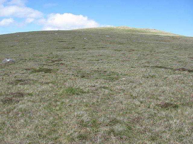 Photo could not load
NN4095 : Creag a' Chail
Richard Webb
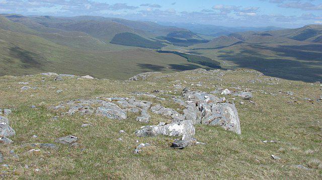 Photo could not load
NN4095 : East ridge of Craig a' Chail
Richard Webb
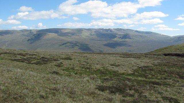 Photo could not load
NN4095 : Summit plateau, Creag a' Chail
Richard Webb
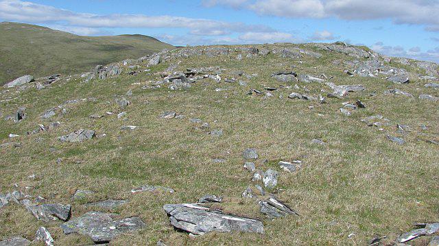 Photo could not load
NN4095 : Creag a' Chail
Richard Webb
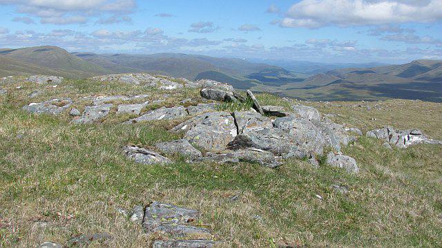 Photo could not load
NN4095 : Summit, Creag a' Chail
Richard Webb
Hill facts and local notes
Classifications
Elevation
761m
2,498 ft
Prominence
100m
Coordinates
57.0261, -4.6324
NN403958
OS Map
34
Explorer: OL55 401
At the Summit
The summit is distinguished by a prominent cairn and expansive views, allowing hikers to bask in a sense of achievement.
Terrain & Geology
Creag a' Chail is primarily composed of ancient volcanic rock, offering a fascinating insight into the geological history of the region. The rugged terrain showcases features typical of the Highland landscape, including crags and scree slopes.
Views & Scenery
From the summit, gaze upon Loch Voil and the towering peaks of the Southern Highlands, with the magnificent Ben More and its neighbouring hills in the distance.
History & Heritage
Name Origin
Creag a' Chail translates to 'the crag of the hazel', suggesting the local flora that once thrived in these parts.
Historical Significance
This mountain is not only a Munro but is also steeped in the cultural heritage of the Scottish Highlands, serving as a reminder of the ancient landscape that has shaped Scottish identity.
Getting There & Facilities
Check current local access restrictions, parking rules and transport timetables before travelling. These notes do not confirm public access to the summit.
Parking
There is a small car park off the A84 at the start of the North-East approach, suitable for several vehicles.
Public Transport
The nearest bus stop is in Strathyre, with limited services connecting to Callander and other towns.
Nearby Facilities
Strathyre offers a few cafes and a pub, perfect for grabbing a bite before or after your adventure. Toilets are available at the village hall.
Safety Information
Known Hazards
- Loose rocks, steep drops, and sudden weather changes are typical hazards. Beware of boggy areas along the lower routes.
General Safety Tips
- Check weather conditions before setting out
- Carry appropriate clothing and equipment
- Let someone know your planned route
- Take a map, compass, and GPS device
- Carry emergency supplies: food, water, first aid kit, torch
Hills
Some common questions about the hills answered
Are there group walks up Creag a' Chail?
Many walkers use Walkmates to join or organise walks with others. You can check for group walks around Creag a' Chail through the maps
Are there other walkers around Creag a' Chail?
Activity varies by location and time, but Walkmates lets you see whether others have shared walks or shown interest in this area. Find other people through the walking friends search walking friends for Creag a' Chail search or of course create your own walk for Creag a' Chail
Can I organise a walk to Creag a' Chail?
Yes. If there aren’t any walks listed already, you can create a walk and make it available for others to join.
If you're signed up to Walkmates, you can create a walk to Creag a' Chail.
How do I find a walk up this hill?
There are often multiple ways to walk this hill, depending on experience and route preference. Walkmates helps you explore walks and routes that others have shared.
Can I suggest a new route up Creag a' Chail?
Yes. You can suggest or create routes to share with others. Walkmates focuses on the social side of walking, so routes are used to help people organise walks and explore areas together, rather than as detailed navigation tools or route libraries.
Other uses really appreciate knowledgeable walkers sharing their routes. Share your favourite route to Creag a' Chail here
The is an error or something incorrect about this hill. How do I let you know?
We always strive to keep the information on Walkmates as accurate as possible. If you find an error, please let us know through the contact form and we'll aim to correct it as quickly as possible
Community Discussion
Comments
Location
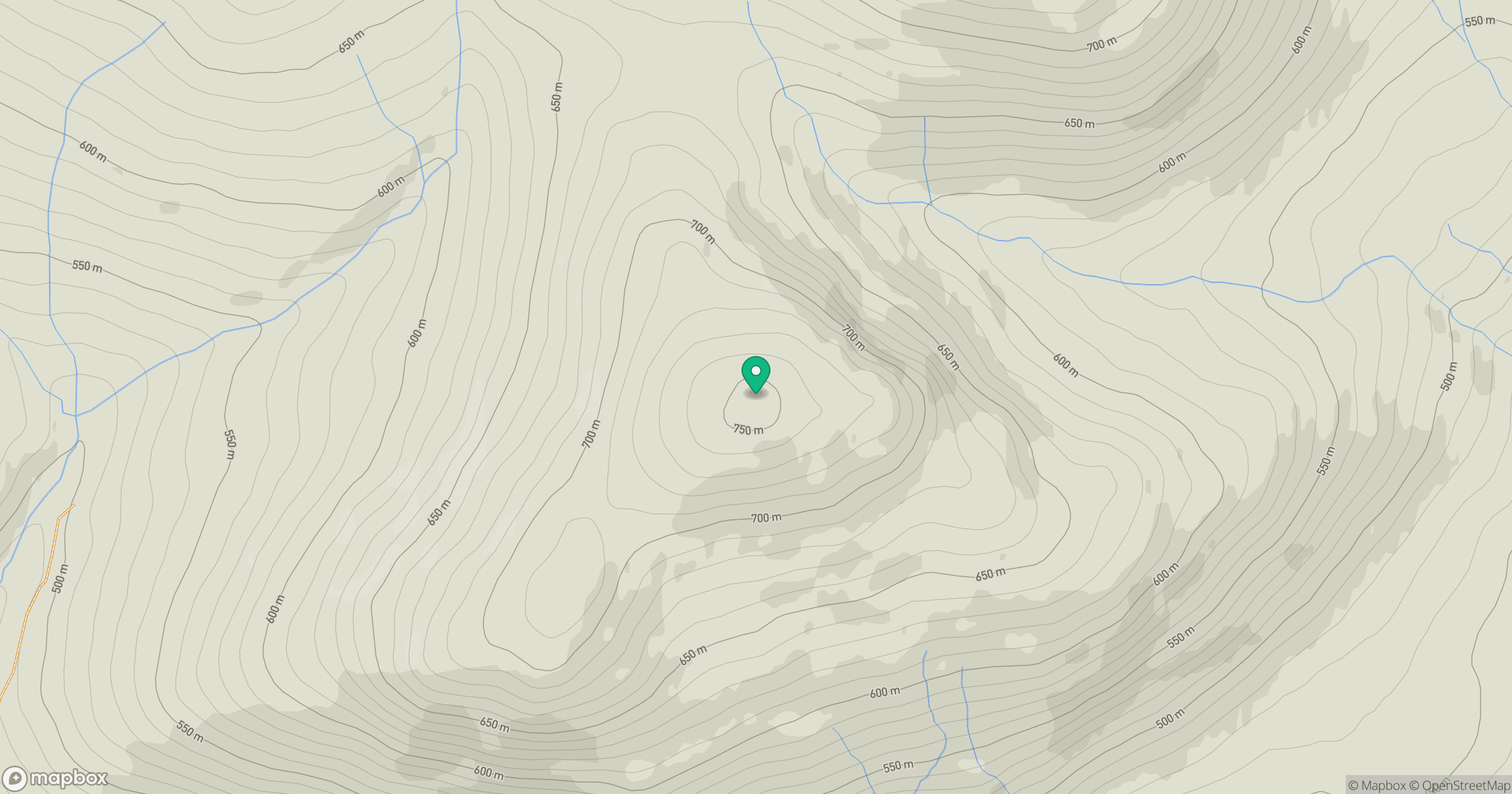
Grid reference: NN403958
View on OpenStreetMapOpens a map in a new tab, centred on the hill.
Hills within 30 km
Straight-line distance, not a walking route or confirmation of access.
Creag Meagaidh
1,128m
Beinn Mheadhoin
541m
Ben Alder
1,148m
Stob Choire Claurigh
1,177m
Stob Ban
977m
No comments yet. Be the first.