
Carn Dearg
Good walks are even better shared.
Overview
Carn Dearg
Overview
Carn Dearg stands proudly in the Scottish Highlands, its towering form a beacon for adventurers and nature lovers alike. At an elevation of 1034 meters, it offers not just a climb but an experience steeped in natural beauty and history.
Geology
The mountain’s granite composition provides a robust terrain. As you trek, keep an eye out for fascinating geological features from glacial activity that has shaped this land since time immemorial. You might even stumble upon a few boulders that seem to have rolled down from an ancient fairy tale!
Routes
There are a couple of popular paths to reach the summit:
- North East Ridge: This moderate route stretches about 10 km and typically takes around four hours. Ideal for those who relish a bit of a challenge while soaking in the views.
- Via Gleann Dhearg: Stretching 12 km and rated as easy, this route meanders through a beautiful glen. Perfect for families or those who prefer a gentler climb.
Summit Features
Reaching the summit is rewarded by a remarkable view, accented by a large rocky outcrop and a sturdy stone cairn, perfect for marking your achievement. Don't forget to snap a pic to share with your mates, they won’t believe you unless they see it!
Terrain Type
The terrain varies from rocky outcrops to heather-clad slopes, with some soft, boggier areas lower down. Keep your wits about you, and perhaps make sure your boots can handle a little Scottish mud!
Views
Once at the top, prepare to be dazzled! The panoramic views encompass the majestic Ben Nevis and nearby peaks, along with the stunning Lochaber landscapes. Autumn and spring provide the best visibility, making them prime times for your ascent.
Hazards
Be cautious! Scottish weather can be as capricious as a cat in a room full of rocking chairs. One minute it’s sunny, and the next it’s a full-blown downpour. Dress in layers and watch your footing—moisture can make paths slippery.
Nearby Summits
In addition to Carn Dearg itself, why not challenge yourself with nearby giants like Ben Nevis and Aonach Beag? The more, the merrier!
Access and Facilities
The nearest parking can be found at NN352946, which is convenient but can get crowded. Fort William, about 10 km away, boasts cafes, shops, and restrooms—just the ticket for refreshments and a comfort break after your adventure.
History
The name 'Carn Dearg' translates to 'red hill' in Gaelic, likely due to the unique colours of the rock formations. Historically, this mountain has been a part of local folklore and culture, holding significance for the communities that have thrived in its shadow.
Conclusion
Whether you’re a seasoned climber or just love a good walk, Carn Dearg has something to offer. With its breathtaking views, accessible routes, and fascinating history, it’s a top pick for outdoor enthusiasts. Just make sure to check the weather and lace up your boots, and you’re good to go!
Happy hiking!
Explore routes near Carn Dearg
Walks starting near this hill. Open a route to check its map, distance and full itinerary.
Fort Augustus to Kytra Lock: Caledonian Canal Towpath
View route
Banavie to Glen Loy Aqueduct: Neptune’s Staircase Canal Towpath
View route
Ben Nevis via Mountain Path
View route
Glen Affric: Coire Loch Woodland Trail
View route
Route planning notes
These notes describe possible approaches. Check a route's map and access information when planning your walk.
North East Ridge
A popular route starting from the parking area at the foot of the ridge, offering stunning views as you ascend.
Via Gleann Dhearg
This route follows a scenic glen and provides a more gentle ascent, making it suitable for families.
Make a day of it, together
Find someone to share the walk with, or organise a day out along a route you like.
Hill facts and local notes
Classifications
Elevation
768m
2,520 ft
Prominence
196m
Coordinates
57.0157, -4.7074
NN357948
OS Map
34
Explorer: 400
At the Summit
The summit features a large rocky outcrop and a traditional stone cairn, perfect for a photo op to prove you were indeed here.
Terrain & Geology
Carn Dearg is primarily composed of granite, lending it a rugged and robust character. The surrounding area showcases ancient rock formations and glacial deposits, which tell tales of the ice age.
Views & Scenery
From the summit, you can witness breathtaking views of Lochaber, Ben Nevis, and the surrounding peaks. On a clear day, the sight is nothing short of spectacular.
History & Heritage
Name Origin
The name 'Carn Dearg' means 'red hill' in Gaelic, potentially referencing the reddish hue of the granite in certain lighting.
Historical Significance
The mountain holds historical significance as part of the landscape that has shaped local communities and folklore.
Getting There & Facilities
Parking
There is a designated parking area at NN352946, which can accommodate several vehicles but may fill quickly during peak season.
Public Transport
The nearest bus service runs from Fort William, with a drop-off at Torlundy, followed by a short walk to the trailhead.
Nearby Facilities
Fort William offers a range of facilities including cafes, restaurants, and public toilets, making it a convenient base for hikers.
Safety Information
Known Hazards
- Variable weather conditions can change rapidly; always carry extra layers and check forecasts.
- Some sections may be slippery, particularly after rain, so tread carefully.
General Safety Tips
- Check weather conditions before setting out
- Carry appropriate clothing and equipment
- Let someone know your planned route
- Take a map, compass, and GPS device
- Carry emergency supplies: food, water, first aid kit, torch
Hills
Some common questions about the hills answered
Are there group walks up Carn Dearg?
Many walkers use Walkmates to join or organise walks with others. You can check for group walks around Carn Dearg through the maps
Are there other walkers around Carn Dearg?
Activity varies by location and time, but Walkmates lets you see whether others have shared walks or shown interest in this area. Find other people through the walking friends search walking friends for Carn Dearg search or of course create your own walk for Carn Dearg
Can I organise a walk to Carn Dearg?
Yes. If there aren’t any walks listed already, you can create a walk and make it available for others to join.
If you're signed up to Walkmates, you can create a walk to Carn Dearg.
How do I find a walk up this hill?
There are often multiple ways to walk this hill, depending on experience and route preference. Walkmates helps you explore walks and routes that others have shared.
Can I suggest a new route up Carn Dearg?
Yes. You can suggest or create routes to share with others. Walkmates focuses on the social side of walking, so routes are used to help people organise walks and explore areas together, rather than as detailed navigation tools or route libraries.
Other uses really appreciate knowledgeable walkers sharing their routes. Share your favourite route to Carn Dearg here
The is an error or something incorrect about this hill. How do I let you know?
We always strive to keep the information on Walkmates as accurate as possible. If you find an error, please let us know through the contact form and we'll aim to correct it as quickly as possible
Community Discussion
Comments
Location
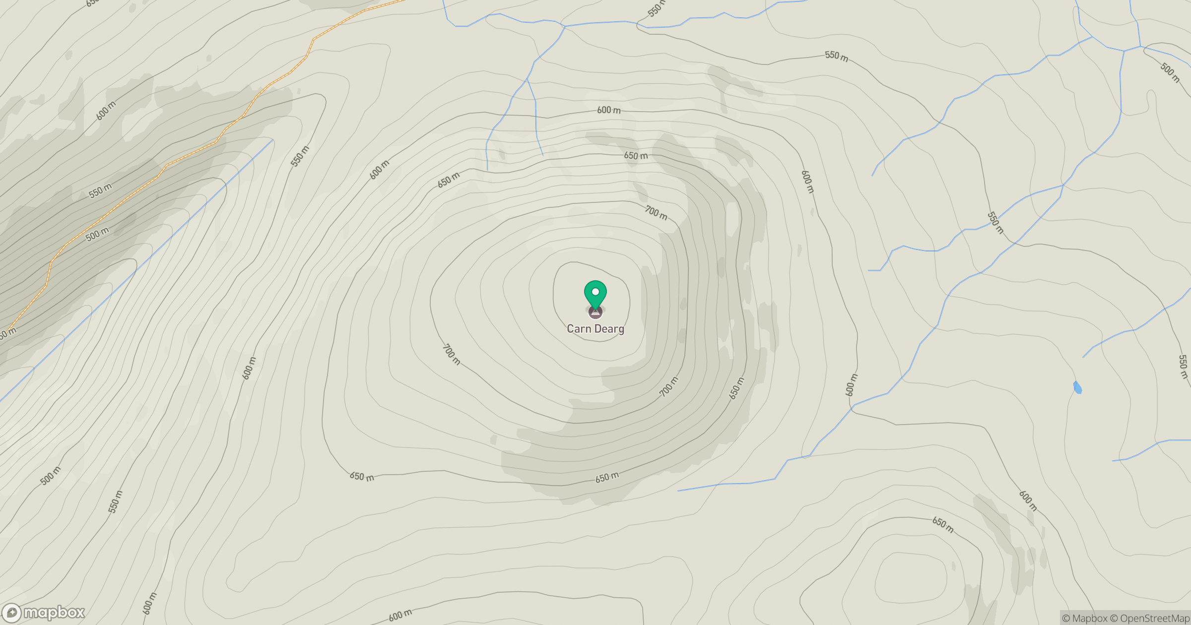
Grid reference: NN357948
View on OpenStreetMapOpens a map in a new tab, centred on the hill.
Nearby Hills
Creag Meagaidh
1,128m
Stob Choire Claurigh
1,177m
Stob Ban
977m
Beinn Mheadhoin
541m
Ben Alder
1,148m
No comments yet. Be the first.